Bedford Place
Settlement in Hampshire
England
Bedford Place

Bedford Place is a vibrant and bustling area located in the heart of Southampton, Hampshire, England. This lively street is known for its eclectic mix of restaurants, bars, cafes, and shops, making it a popular destination for locals and tourists alike.
The street, which stretches between London Road and Carlton Crescent, is lined with beautiful Victorian-era buildings that add to its charm and character. It offers a unique blend of both independent and chain establishments, providing a diverse range of dining, entertainment, and shopping options.
Food enthusiasts will find themselves spoiled for choice with the wide array of cuisines on offer. From traditional English pubs serving hearty meals to international eateries offering flavors from around the world, there is something to satisfy every palate. In addition, the street is home to several trendy bars and pubs, making it a popular spot for socializing and enjoying a night out.
Bedford Place also caters to those seeking retail therapy, with a variety of shops and boutiques selling clothing, accessories, and other goods. Visitors can explore a mix of well-known high street brands and independent retailers, ensuring there is something to suit all tastes and budgets.
The area is well-connected, with excellent transport links, including nearby bus stops and Southampton Central train station within walking distance. It is also conveniently located close to other popular attractions, such as the city center, cultural venues, and Southampton Common, a large park offering recreational activities and green spaces.
Overall, Bedford Place is a vibrant and diverse area that offers a unique blend of dining, entertainment, and retail experiences, making it a must-visit destination in Hampshire.
If you have any feedback on the listing, please let us know in the comments section below.
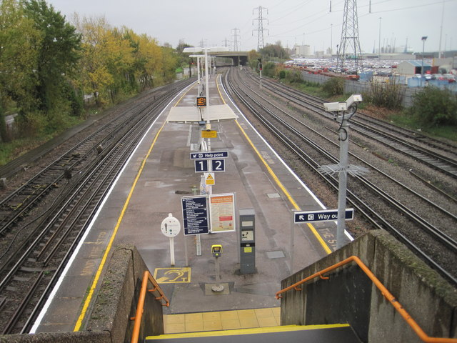
Bedford Place Images
Images are sourced within 2km of 50.913369/-1.407512 or Grid Reference SU4112. Thanks to Geograph Open Source API. All images are credited.


Bedford Place is located at Grid Ref: SU4112 (Lat: 50.913369, Lng: -1.407512)
Unitary Authority: Southampton
Police Authority: Hampshire
What 3 Words
///hears.decreased.rounds. Near Southampton, Hampshire
Nearby Locations
Related Wikis

Carlton Place drill hall, Southampton
The Carlton Place drill hall is a military installation in Southampton, Hampshire. == History == The building is a former Regency era house, built in the...
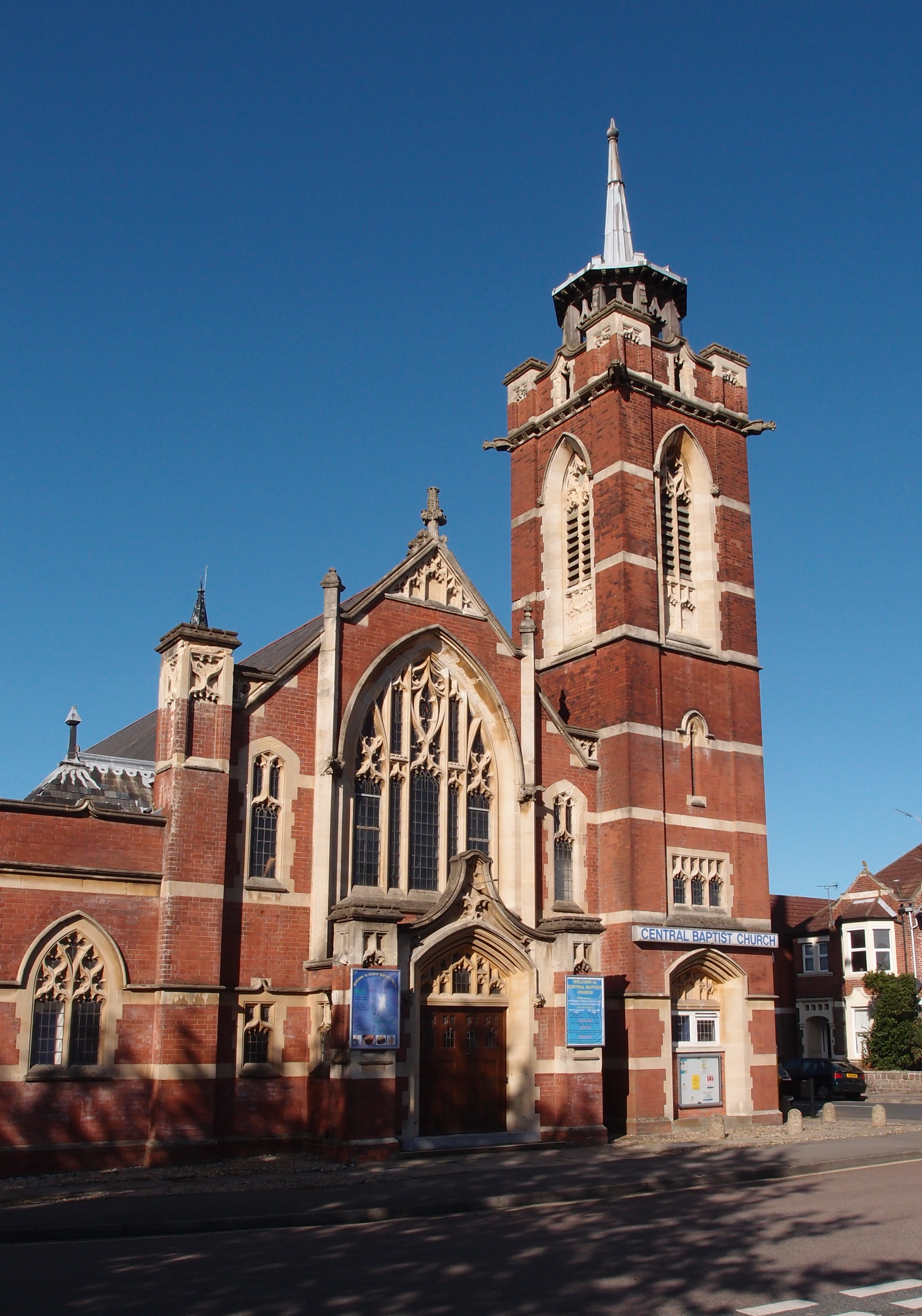
Central Baptist Church, Southampton
Southampton Central Baptist Church is a Baptist church located in the Polygon area of Southampton, Hampshire. The building in which the church meets is...

St Anne's Catholic School, Southampton
St Anne's Catholic School is an 11-18 secondary school in Southampton, England, for girls. The school's sixth form is coeducational. The school is situated...
Simon Flavell Leukaemia Research Laboratory
The Simon Flavell Leukaemia Research Laboratory is based at Southampton General Hospital and named after ten-year-old Simon Flavell who died in 1990 from...

Rockstone Place Park
Rockstone Place Park or Little Mongers Park is a formal park in Southampton, United Kingdom. The park is next to the Southampton and New Forest Magistrates...

Ordnance Survey buildings
The former offices of Ordnance Survey are situated in London Road, Southampton, close to the junction with The Avenue, and are now part of the city's court...

Southampton Courts of Justice
The Southampton Courts of Justice, also known as Southampton Combined Court Centre, is a Crown Court venue, which deals with criminal cases, as well as...
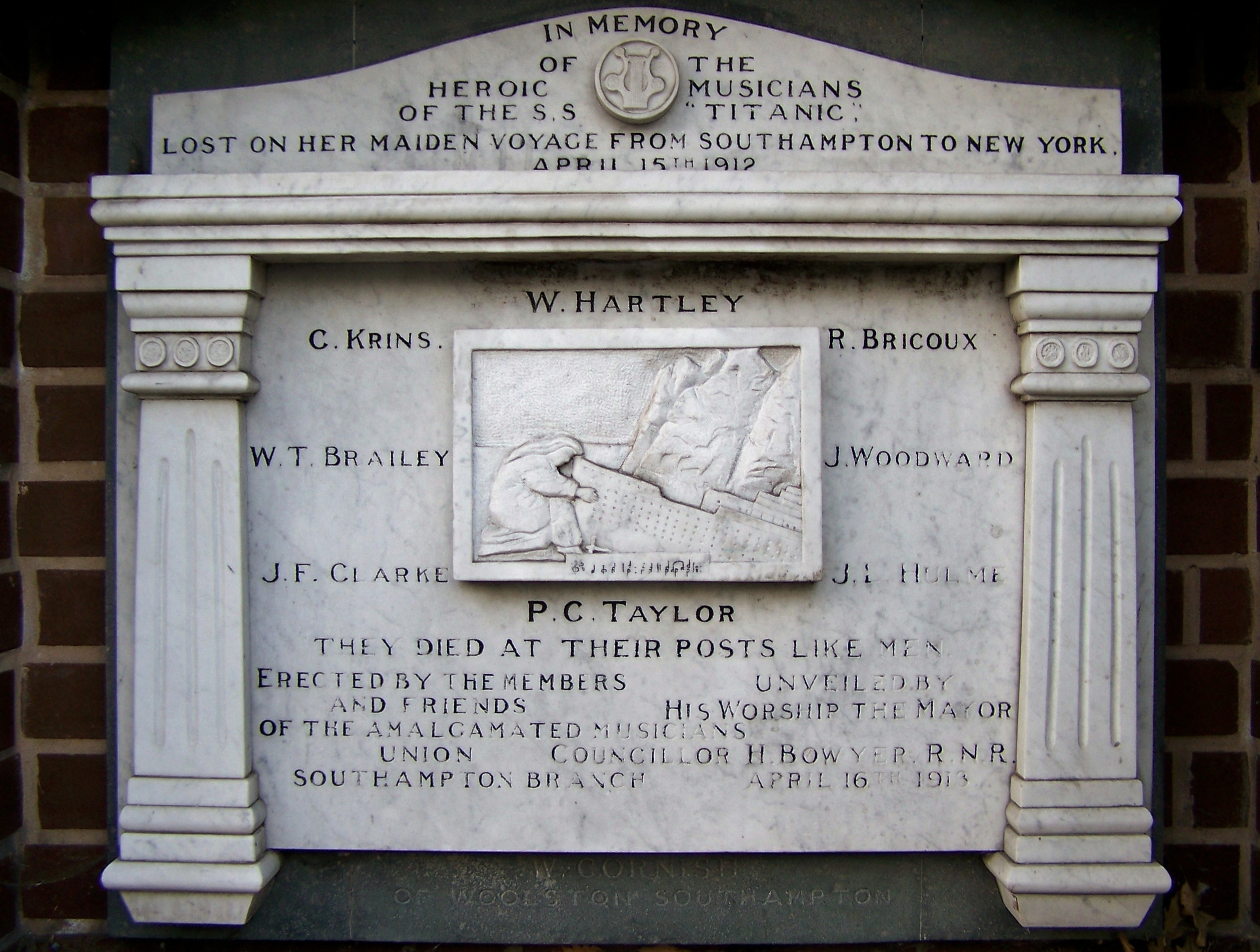
Titanic Musicians' Memorial
The Titanic Musicians' Memorial is a memorial in Southampton, United Kingdom, to the musicians who died in the RMS Titanic disaster on 15 April 1912. The...
Nearby Amenities
Located within 500m of 50.913369,-1.407512Have you been to Bedford Place?
Leave your review of Bedford Place below (or comments, questions and feedback).