Bedford Park

Settlement in Middlesex

England

Bedford Park

Library for Iranian Studies, Acton In The Woodlands Hall, by Woodlands Park.
Library for Iranian Studies, Acton Credit: David Hawgood

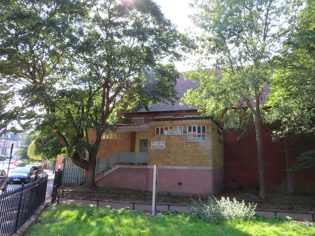
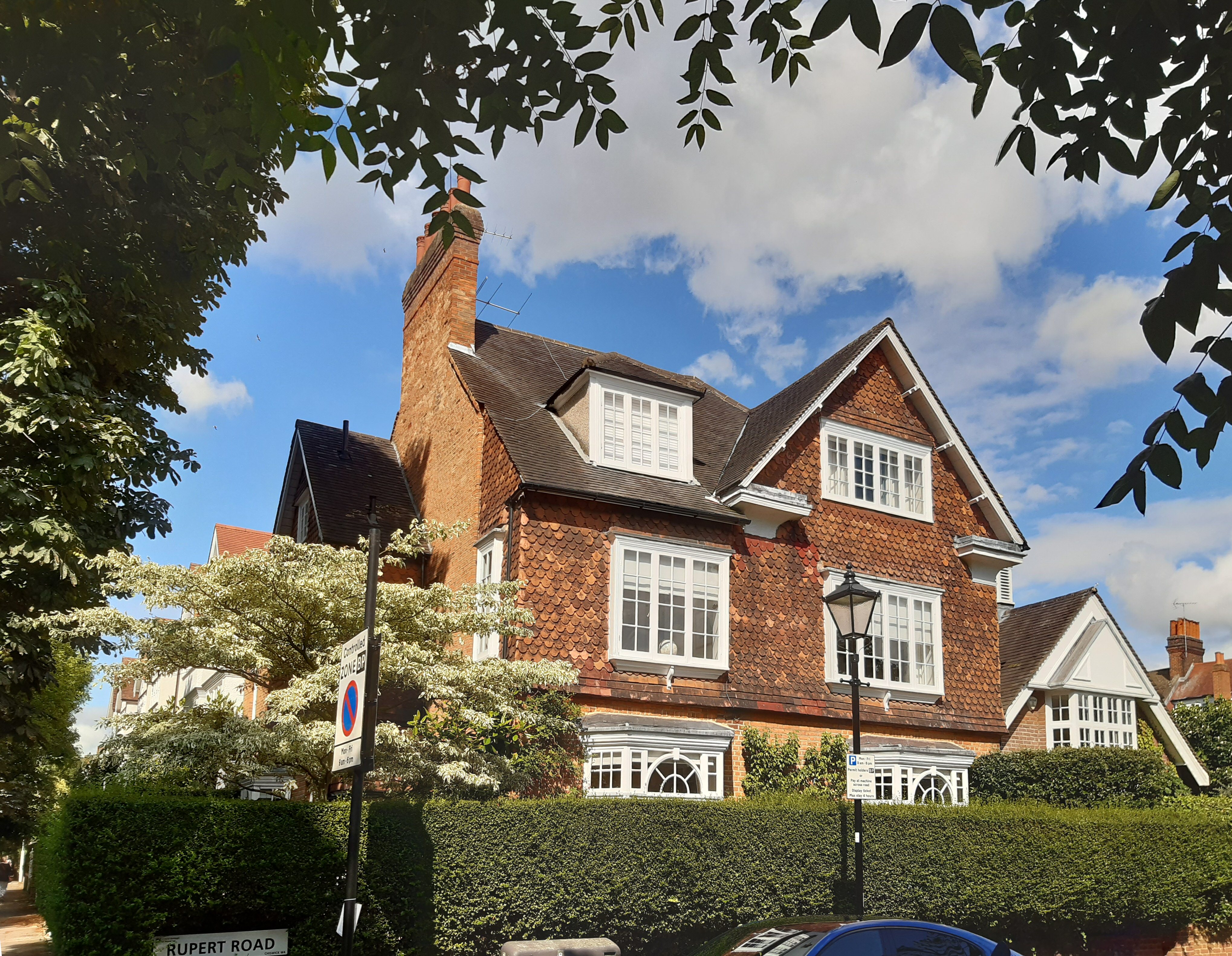
Bedford Park is a picturesque suburban area located in the borough of Ealing, Middlesex, in the western part of London, England. It was one of the earliest examples of a garden suburb and is renowned for its stunning Victorian architecture and well-preserved character.

Developed in the late 19th century by Jonathan Carr, Bedford Park was designed as a middle-class residential area that aimed to provide a peaceful and idyllic environment away from the hustle and bustle of the city. The area features a mix of detached and semi-detached houses, all built in the fashionable Arts and Crafts style, with intricate detailing, red-brick facades, and beautiful gardens.

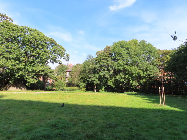
The neighborhood is known for its tree-lined streets, wide pavements, and communal green spaces, which contribute to a sense of tranquility and serenity. This carefully planned layout has ensured that Bedford Park has retained its original charm and architectural integrity over the years.

In addition to its architectural significance, Bedford Park offers a range of amenities to its residents. Chiswick High Road, a bustling commercial thoroughfare, is just a short walk away, providing a variety of shops, cafes, and restaurants. The neighborhood is also well-served by public transport, with several bus routes and a nearby Underground station, offering easy access to central London and other parts of the city.

Overall, Bedford Park is a highly sought-after residential area, attracting those who appreciate its historic architecture, green surroundings, and convenient location. It remains a testament to the enduring appeal of well-designed and carefully planned suburban communities.

If you have any feedback on the listing, please let us know in the comments section below.
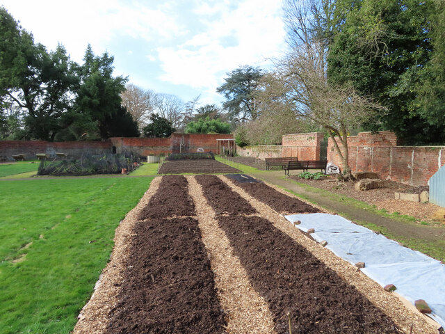
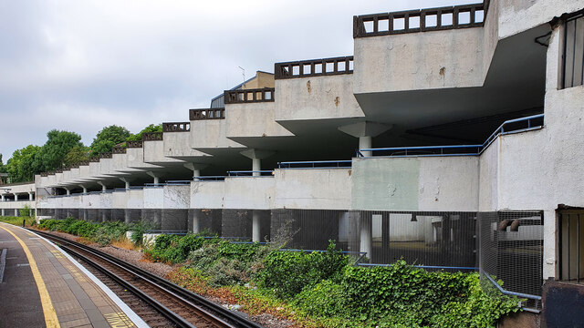
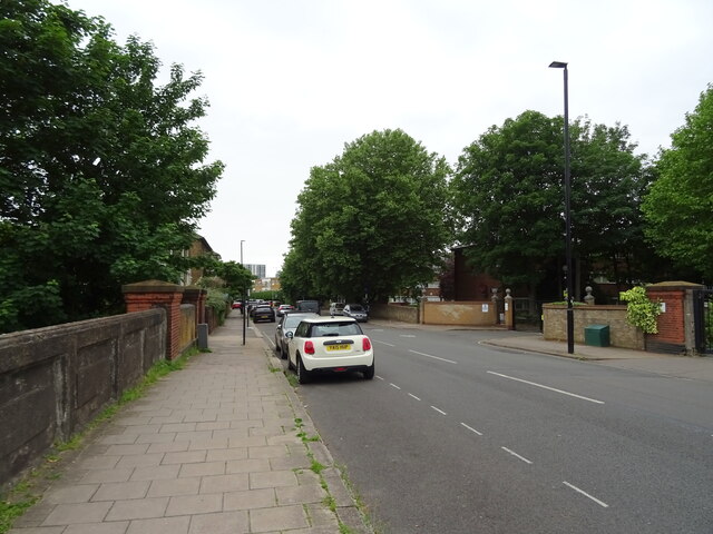
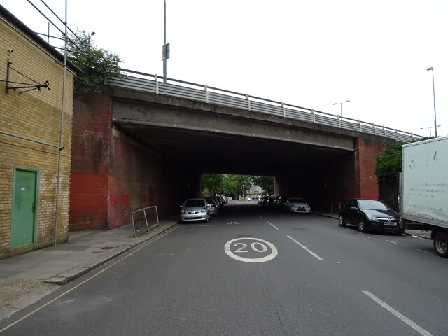
Bedford Park Images

Images are sourced within 2km of 51.500092/-0.258165 or Grid Reference TQ2179. Thanks to Geograph Open Source API. All images are credited.

Library for Iranian Studies, Acton In The Woodlands Hall, by Woodlands Park.
Library for Iranian Studies, Acton
In The Woodlands Hall, by Woodlands Park.
Woodlands Park with ice house, Acton Woodlands is a small park near the centre of Acton.
The domed brick structure visible under the tree on the left is the top of an ice house. It was in the 6-acre garden of a house "Woodlands" demolished in 1903. The ice house and the nearby pond which provided the ice were restored in 2006.
Woodlands Park with ice house, Acton
Woodlands is a small park near the centre of Acton. The domed brick structure visible under the tree on the left is the top of an ice house. It was in the 6-acre garden of a house "Woodlands" demolished in 1903. The ice house and the nearby pond which provided the ice were restored in 2006.
Princess Amelia's bath house with magnolia blossom, Gunnersbury Park Magnolia trees are bearing more blossom than usual this year. The building is Princess Amelia's bath house built originally about 1780 but modified by subsequent owners and restored recently. See <a href="https://www.geograph.org.uk/photo/420128">TQ1979 : Princess Amelia's Bathhouse, Gunnersbury Park</a> for another photo and description, see <span class="nowrap"><a title="https://brentfordandchiswicklhs.org.uk/publications/the-journal/journal-10-2000/princess-amelias-bath-house/" rel="nofollow ugc noopener" href="https://brentfordandchiswicklhs.org.uk/publications/the-journal/journal-10-2000/princess-amelias-bath-house/">Link</a><img style="margin-left:2px;" alt="External link" title="External link - shift click to open in new window" src="https://s1.geograph.org.uk/img/external.png" width="10" height="10"/></span> Brentford and Chiswick Local History Society for detailed account of archaeological investigation.
Princess Amelia's bath house with magnolia blossom, Gunnersbury Park
Magnolia trees are bearing more blossom than usual this year. The building is Princess Amelia's bath house built originally about 1780 but modified by subsequent owners and restored recently. See TQ1979 : Princess Amelia's Bathhouse, Gunnersbury Park for another photo and description, see LinkExternal link Brentford and Chiswick Local History Society for detailed account of archaeological investigation.
Magnolia in blossom by bath house, Gunnersbury Park Magnolia blossom is very good this year. See <a href="https://www.geograph.org.uk/photo/7121746">TQ1979 : Princess Amelia's bath house with magnolia blossom, Gunnersbury Park</a> for details of Princess Amelia's bath house.
Magnolia in blossom by bath house, Gunnersbury Park
Magnolia blossom is very good this year. See TQ1979 : Princess Amelia's bath house with magnolia blossom, Gunnersbury Park for details of Princess Amelia's bath house.
Community garden in Gunnersbury Park The garden is prepared for spring planting.
Community garden in Gunnersbury Park
The garden is prepared for spring planting.
New residential development off Bollo Lane, Acton
Chiswick Tower Chiswick Tower at Gunnersbury.
Chiswick Tower
Chiswick Tower at Gunnersbury.
Gunnersbury Station The car park of Chiswick Tower alongside Gunnersbury Station.
Gunnersbury Station
The car park of Chiswick Tower alongside Gunnersbury Station.
Railway towards Kew Gardens Station From the bridge on Wellesley Road, Chiswick.
Railway towards Kew Gardens Station
From the bridge on Wellesley Road, Chiswick.
Railway towards Kew Gardens Station London Overground Class 378, No.  378203.
From the bridge on Wellesley Road, Chiswick.
Railway towards Kew Gardens Station
London Overground Class 378, No. 378203. From the bridge on Wellesley Road, Chiswick.
Wellesley Road (A3000), Chiswick Towards Brentford.
Wellesley Road (A3000), Chiswick
Towards Brentford.
The Pilot, Chiswick On Wellesley Road, Chiswick.
See <a href="https://www.geograph.org.uk/photo/7278639">TQ1978 : Sign for the Pilot, Chiswick</a> for sign.
The Pilot, Chiswick
On Wellesley Road, Chiswick. See TQ1978 : Sign for the Pilot, Chiswick for sign.
Sign for the Pilot, Chiswick See <a href="https://www.geograph.org.uk/photo/7278638">TQ1978 : The Pilot, Chiswick</a> for public house.
Sign for the Pilot, Chiswick
See TQ1978 : The Pilot, Chiswick for public house.
Chiswick Flyover  A4 bridge over Wellesley Road, Chiswick.
Chiswick Flyover
A4 bridge over Wellesley Road, Chiswick.
Acton Town Station On London Underground, Acton Town is a busy junction on the District and Piccadilly lines.  There are four platforms.

In the foreground an eastbound Piccadilly line train departs for Central London.  In the background is an eastbound District line train.  

On the north side of the station a fifth platform was in use from 1905 to 1959 as a terminus for a District line shuttle service to South Acton.
Acton Town Station
On London Underground, Acton Town is a busy junction on the District and Piccadilly lines. There are four platforms. In the foreground an eastbound Piccadilly line train departs for Central London. In the background is an eastbound District line train. On the north side of the station a fifth platform was in use from 1905 to 1959 as a terminus for a District line shuttle service to South Acton.
Ornamental Pond, Gunnersby Park An ornamental pond in Gunnersby Park in South Ealing or South Acton in London. Across the pond is an orangery.
Ornamental Pond, Gunnersby Park
An ornamental pond in Gunnersby Park in South Ealing or South Acton in London. Across the pond is an orangery.
Nearing the end of the South Circular Road The A205 runs 22 miles from Chiswick roundabout to Woolwich Ferry. It is the inner ring road for London.
Website:  <span class="nowrap"><a title="http://www.sabre-roads.org.uk/wiki/index.php?title=A205" rel="nofollow ugc noopener" href="http://www.sabre-roads.org.uk/wiki/index.php?title=A205">Link</a><img style="margin-left:2px;" alt="External link" title="External link - shift click to open in new window" src="https://s1.geograph.org.uk/img/external.png" width="10" height="10"/></span>
Nearing the end of the South Circular Road
The A205 runs 22 miles from Chiswick roundabout to Woolwich Ferry. It is the inner ring road for London. Website: LinkExternal link
Chiswick flyover The A205 runs 22 miles from Chiswick roundabout to Woolwich Ferry. It is the inner ring road for London.
Website:  <span class="nowrap"><a title="http://www.sabre-roads.org.uk/wiki/index.php?title=A205" rel="nofollow ugc noopener" href="http://www.sabre-roads.org.uk/wiki/index.php?title=A205">Link</a><img style="margin-left:2px;" alt="External link" title="External link - shift click to open in new window" src="https://s1.geograph.org.uk/img/external.png" width="10" height="10"/></span>
Chiswick flyover
The A205 runs 22 miles from Chiswick roundabout to Woolwich Ferry. It is the inner ring road for London. Website: LinkExternal link
Show me another place!

Bedford Park is located at Grid Ref: TQ2179 (Lat: 51.500092, Lng: -0.258165)

Unitary Authority: Ealing

Police Authority: Metropolitan

What 3 Words

///sticky.finds.after. Near Acton, London

Related Wikis

Bedford Park, London

Bedford Park is a suburban development in Chiswick, London, begun in 1875 under the direction of Jonathan Carr, with many large houses in British Queen...

Rugby Road Halt railway station

Rugby Road Halt was a short lived railway station in London on the Hammersmith & Chiswick branch line from South Acton to Hammersmith & Chiswick. The station...

Woodstock Road railway station

Woodstock Road was a short-lived railway station in London on the Hammersmith & Chiswick branch line from South Acton to Hammersmith & Chiswick. The station...

London Buddhist Vihara

The London Buddhist Vihara (Sinhala:ලන්ඩන් බෞද්ධ විහාරය Landan Bauddha Viharaya) is one of the main Theravada Buddhist temples in the United Kingdom. The...

Acton Green, London

Acton Green is a residential neighbourhood in Chiswick and the London Borough of Ealing, in West London, England. It is named for the nearby Acton Green...
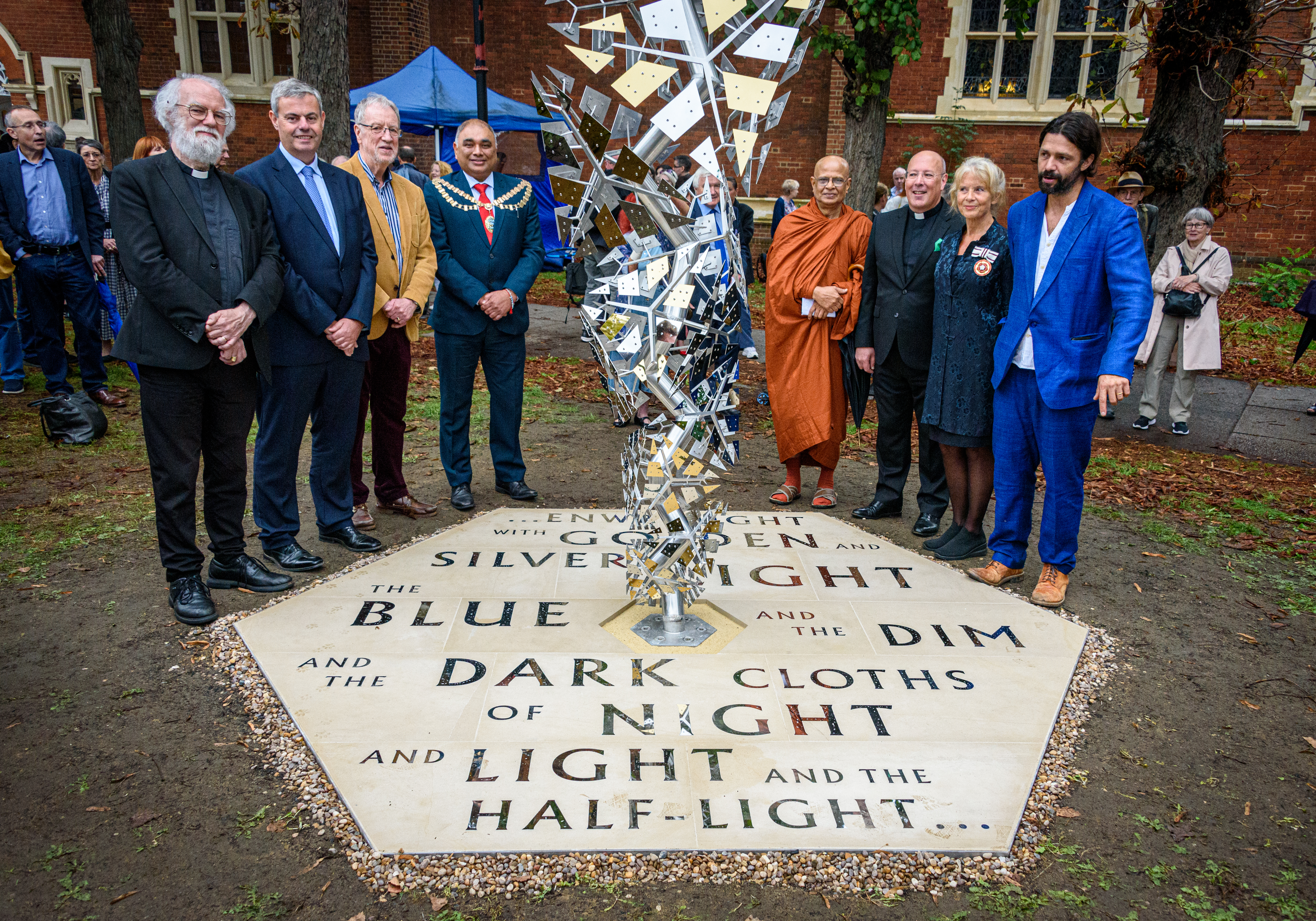
Enwrought Light

Enwrought Light is a sculpture in Bedford Park, London. It was sculpted by Conrad Shawcross and commemorates the poet W. B. Yeats who was a resident of...

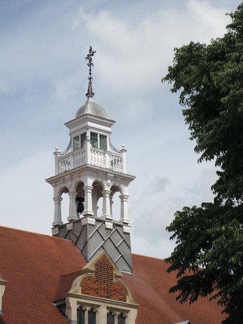
St Michael and All Angels, Bedford Park

St Michael and All Angels is a Grade II* listed Church of England parish church in Bedford Park, Chiswick. It was designed by the architect Norman Shaw...

Tabard Theatre

The Tabard Theatre is a small 96-seat theatre in Chiswick in the London Borough of Hounslow. Close to Turnham Green Underground station, it is situated...

Nearby Amenities

Located within 500m of 51.500092,-0.258165
Mini Roundabout
Direction: clockwise
Lat/Long: 51.4961503/-0.2555476
Traffic Calming: table
Lat/Long: 51.4992365/-0.2563869
Traffic Calming: table
Lat/Long: 51.502548/-0.2628017
Ref GB Tflcid: RWG229641
Traffic Calming: hump
Lat/Long: 51.4984665/-0.2644237
Traffic Calming: table
Lat/Long: 51.5026105/-0.25982
Post Box
Brand: Royal Mail
Brand Wikidata: Q638098
Collection Times: Mo-Fr 09:00, Sa 07:00
Operator: Royal Mail
Operator Wikidata: Q638098
Post Box Type: pillar
Ref: W4 27D
Royal Cypher: VR
Royal Cypher Wikidata: Q33102356
Lat/Long: 51.4991553/-0.2532228
Ref GB Tflcid: RWG230571
Traffic Calming: hump
Lat/Long: 51.5012397/-0.2537789
Post Box
Brand: Royal Mail
Brand Wikidata: Q638098
Collection Times: Mo-Fr 09:00; Sa 07:00
Operator: Royal Mail
Operator Wikidata: Q638098
Post Box Type: pillar
Ref: W4 1D
Royal Cypher: EVIIR
Royal Cypher Wikidata: Q33102324
Lat/Long: 51.4991514/-0.2565356
Post Box
Listed Status: Grade II
Note: plate missing
Post Box Design: penfold
Post Box Type: pillar
Royal Cypher: VR
Royal Cypher Wikidata: Q33102356
Wikidata: Q26641109
Lat/Long: 51.4972493/-0.2580379
Telephone
Booth: K6
Check Date: 2021-06-25
Covered: booth
Listed Status: Grade II
Lat/Long: 51.4960219/-0.2553395
Post Box
Collection Times: Mo-Fr 17:30; Sa 12:00
Operator: Royal Mail
Operator Wikidata: Q638098
Post Box Type: pillar
Ref: W4 49
Royal Cypher: EVIIR
Royal Cypher Wikidata: Q33102324
Lat/Long: 51.500601/-0.2602913
Post Box
Brand: Royal Mail
Brand Wikidata: Q638098
Collection Times: Mo-Fr 17:30; Sa 12:00
Operator: Royal Mail
Operator Wikidata: Q638098
Post Box Type: pillar
Ref: W4 38
Royal Cypher: GR
Royal Cypher Wikidata: Q33102273
Lat/Long: 51.4979324/-0.2623626
School
Carlton Day Centre (disused)
School: nursery
Lat/Long: 51.5010146/-0.2633948
Bicycle Parking
Bicycle Parking: stands
Capacity: 2
Check Date: 2022-06-25
Covered: no
Lat/Long: 51.5002656/-0.2649931
RPC Cleaning Supplies
Shop: yes
Lat/Long: 51.5001941/-0.2648414
Pretty Wo-Man
Phone: +44 20 8994 5466
Shop: hairdresser
Lat/Long: 51.4998138/-0.264671
Fast Food
Radiant
Cuisine: chinese
Phone: +44 20 8742 0880
Lat/Long: 51.4997093/-0.2645688
Restaurant
Thai Thai Café
Cuisine: thai
Phone: +44 20 8994 1093
Lat/Long: 51.4995651/-0.2645088
Cafe
Peter's Cafe
Lat/Long: 51.4994799/-0.264467
Crossing
Crossing: marked
Crossing Island: no
Tactile Paving: no
Lat/Long: 51.499365/-0.2645811
Pub
The Stag
Lat/Long: 51.4992672/-0.2644126
Taxi
A Cars
Phone: +44 20 8995 2244
Lat/Long: 51.4988089/-0.2643382
2000 Dry Cleaners
Shop: dry_cleaning
Lat/Long: 51.4983916/-0.264266
Bus Stop
Bedford Road
Bench: yes
Bin: yes
Bus: yes
Local Ref: J
Naptan AtcoCode: 490003797N
Naptan Bearing: N
Naptan CommonName: Bedford Road The Avenue
Naptan Street: THE AVENUE
Naptan Verified: no
Public Transport: platform
Ref: 59138
Shelter: yes
Lat/Long: 51.4966556/-0.2558401
Bus Stop
Bedford Road
Bench: yes
Local Ref: K
Naptan AtcoCode: 490003797S
Naptan Bearing: N
Naptan CommonName: Bedford Road The Avenue
Naptan Street: THE AVENUE
Naptan Verified: no
Public Transport: platform
Ref: 52182
Shelter: yes
Lat/Long: 51.4970393/-0.2558653
Bus Stop
Blandford Road
Bench: yes
Bin: yes
Bus: yes
Local Ref: D
Naptan AtcoCode: 490004095S
Naptan Bearing: N
Naptan CommonName: Blandford Road (W4)
Naptan Street: THE AVENUE
Naptan Verified: no
Public Transport: platform
Ref: 57331
Shelter: yes
Lat/Long: 51.5000063/-0.2564788
Bus Stop
Marlborough Crescent
Bench: no
Bus: yes
Covered: no
Local Ref: E
Naptan AtcoCode: 490009673N
Naptan Bearing: N
Naptan CommonName: Marlborough Crescent
Naptan Street: THE AVENUE
Naptan Verified: no
Public Transport: platform
Ref: 51876
Shelter: no
Lat/Long: 51.4994857/-0.2565149
Bus Stop
Rugby Road
Bench: no
Bus: yes
Covered: no
Local Ref: F
Naptan AtcoCode: 490011777N
Naptan Bearing: N
Naptan CommonName: Rugby Road Southfield Road
Naptan Street: SOUTHFIELD ROAD
Naptan Verified: no
Public Transport: platform
Ref: 72018
Shelter: no
Lat/Long: 51.5017982/-0.2575386
Bus Stop
Rugby Road
Bus: yes
Local Ref: C
Naptan AtcoCode: 490011777S
Naptan Bearing: N
Naptan CommonName: Rugby Road Southfield Road
Naptan Street: SOUTHFIELD ROAD
Naptan Verified: no
Public Transport: platform
Ref: 55383
Lat/Long: 51.5023398/-0.2576938
Bus Stop
St Peter's Church
Bench: yes
Bin: yes
Bus: yes
Local Ref: B
Naptan AtcoCode: 490012889E
Naptan Bearing: E
Naptan CommonName: St.Peters Church Southfield Rd
Naptan Verified: no
Public Transport: platform
Ref: 76650
Shelter: yes
Lat/Long: 51.5026315/-0.2607241
Bus Stop
St Peter's Church
Bench: yes
Bin: yes
Bus: yes
Local Ref: G
Naptan AtcoCode: 490012889W
Naptan Bearing: W
Naptan CommonName: St.Peters Church Southfield Rd
Naptan Verified: no
Public Transport: platform
Ref: 53930
Shelter: yes
Lat/Long: 51.5025352/-0.261595
Bus Stop
The Orchard
Bench: no
Bin: no
Local Ref: L
Naptan AtcoCode: 490013487E
Naptan Bearing: E
Naptan CommonName: The Orchard South Parade
Naptan Street: SOUTH PARADE
Naptan Verified: no
Public Transport: platform
Shelter: no
Tactile Paving: no
Lat/Long: 51.4957645/-0.2581635
Post Box
Collection Times: Mo-Fr 09:00
Post Box Type: pillar
Ref: W4 69
Lat/Long: 51.496247/-0.2561294
Barrier: cycle_barrier
Bicycle: yes
Foot: yes
Motor Vehicle: no
Lat/Long: 51.5015614/-0.253152
Crossing
Crossing: unmarked
Crossing Island: yes
Kerb: lowered
Tactile Paving: yes
Lat/Long: 51.5010236/-0.2567676
Crossing
Crossing: uncontrolled
Crossing Island: yes
Crossing Ref: zebra
Kerb: flush
Tactile Paving: yes
Traffic Calming: table
Lat/Long: 51.5013677/-0.2572157
Addr City: London
Addr Postcode: W4 1AT
Addr Street: Rugby Road
Lat/Long: 51.5029156/-0.2576555
Crossing
Lat/Long: 51.5036147/-0.2537218
Crossing
Crossing: marked
Crossing Island: yes
Crossing Markings: yes
Tactile Paving: yes
Lat/Long: 51.496141/-0.2557554
Crossing
Crossing: unmarked
Crossing Island: yes
Crossing Markings: no
Kerb: lowered
Tactile Paving: yes
Lat/Long: 51.4962628/-0.2555758
Crossing
Crossing: uncontrolled
Crossing Ref: zebra
Kerb: flush
Tactile Paving: yes
Traffic Calming: table
Lat/Long: 51.4973597/-0.2559981
Post Box
Post Box Type: wall
Ref: W4 53D
Royal Cypher: EVIIR
Royal Cypher Wikidata: Q33102324
Lat/Long: 51.4963689/-0.2542333
Bicycle Parking
Access: private
Bicycle Parking: shed
Capacity: 6
Covered: yes
Operator: cyclehoop
Ref: Bikehangar 1028
Lat/Long: 51.5013509/-0.2641579
Crossing
Crossing: unmarked
Lat/Long: 51.5025638/-0.2617091
Barrier: bollard
Lat/Long: 51.498129/-0.2630918
Barrier: lift_gate
Lat/Long: 51.5010812/-0.2515891
Crossing
Crossing: marked
Crossing Island: yes
Crossing Markings: yes
Tactile Paving: yes
Lat/Long: 51.4961362/-0.2557955
Bench
Lat/Long: 51.4957571/-0.2564882
John Lindley
Historic: memorial
Inscription: John Lindley (1799-1865) Botanist and Pioneer Orchidologist lived here from 1836 and died here
Memorial: blue_plaque
Openplaques Id: 652
Subject Wikidata: Q378629
Lat/Long: 51.4967322/-0.2559252
Man Made: street_cabinet
Operator: BT
Street Cabinet: telecom
Lat/Long: 51.5015961/-0.2627881
Bicycle Parking
Access: private
Bicycle Parking: shed
Capacity: 6
Covered: yes
Fee: yes
Lit: yes
Operator: cyclehoop
Ref: Bikehangar 1364
Lat/Long: 51.5006552/-0.2619606
Man Made: street_cabinet
Operator: Openreach
Operator Wikidata: Q7096543
Street Cabinet: telecom
Lat/Long: 51.5024793/-0.2620585
Bicycle Parking
Access: private
Bicycle Parking: shed
Capacity: 6
Covered: yes
Fee: yes
Lit: yes
Operator: cyclehoop
Ref: Bikehangar 684
Lat/Long: 51.50358/-0.2584892
Traffic Calming: bump
Lat/Long: 51.5014053/-0.25146
Barrier: cycle_barrier
Bicycle: yes
Foot: yes
Lat/Long: 51.5014802/-0.2531569
Barrier: lift_gate
Bicycle: yes
Foot: yes
Lat/Long: 51.5016707/-0.2520685
Leisure: playground
Lat/Long: 51.5010101/-0.2524557
Addr City: London
Addr Housenumber: 115
Addr Postcode: W12 9TG
Addr Street: Emlyn Road
Lat/Long: 51.5008211/-0.2512125
Addr City: London
Addr Housenumber: 113
Addr Postcode: W12 9TG
Addr Street: Emlyn Road
Lat/Long: 51.5007728/-0.251175
Addr City: London
Addr Housenumber: 111
Addr Postcode: W12 9TG
Addr Street: Emlyn Road
Lat/Long: 51.5007235/-0.251132
Addr City: London
Addr Housenumber: 109
Addr Postcode: W12 9TG
Addr Street: Emlyn Road
Lat/Long: 51.5006703/-0.251092
Addr City: London
Addr Housenumber: 107
Addr Postcode: W12 9TG
Addr Street: Emlyn Road
Lat/Long: 51.5005809/-0.2510032
Addr City: London
Addr Housenumber: 118-120
Addr Postcode: W12 9TA
Addr Street: Emlyn Road
Lat/Long: 51.5015457/-0.2513372
Addr City: London
Addr Housenumber: 122-124
Addr Postcode: W12 9TA
Addr Street: Emlyn Road
Lat/Long: 51.5015983/-0.2513817
Addr City: London
Addr Housenumber: 126-128
Addr Postcode: W12 9TA
Addr Street: Emlyn Road
Lat/Long: 51.5016429/-0.2514195
Addr City: London
Addr Housenumber: 130-132
Addr Postcode: W12 9TA
Addr Street: Emlyn Road
Lat/Long: 51.5016949/-0.2514635
Addr City: London
Addr Housenumber: 134-136
Addr Postcode: W12 9TA
Addr Street: Emlyn Road
Lat/Long: 51.50174/-0.2515016
Addr City: London
Addr Housenumber: 138-140
Addr Postcode: W12 9TB
Addr Street: Emlyn Road
Lat/Long: 51.5018075/-0.2515613
Addr City: London
Addr Housenumber: 142-144
Addr Postcode: W12 9TB
Addr Street: Emlyn Road
Lat/Long: 51.5018552/-0.251584
Addr City: London
Addr Housenumber: 146-148
Addr Postcode: W12 9TB
Addr Street: Emlyn Road
Lat/Long: 51.5019046/-0.2516075
Addr City: London
Addr Housenumber: 150-152
Addr Postcode: W12 9TB
Addr Street: Emlyn Road
Lat/Long: 51.5019555/-0.2516318
Addr City: London
Addr Housenumber: 154-156
Addr Postcode: W12 9TB
Addr Street: Emlyn Road
Lat/Long: 51.5020269/-0.2516566
Noexit: yes
Lat/Long: 51.4980096/-0.259282
Post Box
Collection Times: Mo-Fr 17:30; Sa 12:00
Operator: Royal Mail
Operator Wikidata: Q638098
Post Box Type: pillar
Ref: W4 31
Royal Cypher: VR
Royal Cypher Wikidata: Q33102356
Lat/Long: 51.5008692/-0.2652497
Post Box
Brand: Royal Mail
Brand Wikidata: Q638098
Collection Times: Mo-Fr 09:00; Sa 07:00
Operator: Royal Mail
Operator Wikidata: Q638098
Post Box Type: pillar
Ref: W4 45D
Royal Cypher: EVIIR
Royal Cypher Wikidata: Q33102324
Lat/Long: 51.5025806/-0.2596974
Post Box
Brand: Royal Mail
Brand Wikidata: Q638098
Collection Times: Mo-Fr 17:30; Sa 12:00
Operator: Royal Mail
Operator Wikidata: Q638098
Post Box Type: pillar
Ref: W4 59
Royal Cypher: EIIR
Royal Cypher Wikidata: Q33102113
Lat/Long: 51.5015644/-0.2574618
The Chiswick Fireplace Company
Shop: fireplace
Lat/Long: 51.5013782/-0.2569932
Bicycle Parking
Bicycle Parking: stands
Capacity: 2
Covered: no
Lat/Long: 51.5015418/-0.2575082
Bicycle Parking
Bicycle Parking: stands
Capacity: 4
Covered: no
Lat/Long: 51.5013097/-0.2570777
Fresh as a Daisy Dry Cleaners
Addr City: London
Addr Housenumber: 70
Addr Postcode: W4 1BD
Addr Street: Southfield Road
Shop: dry_cleaning
Lat/Long: 51.5014324/-0.2570575
Escooter Rental
Lat/Long: 51.5004907/-0.256729
Traffic Calming: hump
Lat/Long: 51.5003597/-0.2561349
Traffic Calming: hump
Lat/Long: 51.5003555/-0.2551183
Traffic Calming: hump
Lat/Long: 51.4992452/-0.2539717
Traffic Calming: hump
Lat/Long: 51.49924/-0.2550405
Bicycle Parking
Bicycle Parking: stands
Capacity: 16
Covered: no
Lat/Long: 51.502609/-0.2531932
Charging Station
Capacity: 3
Operator: source London
Lat/Long: 51.5026348/-0.2522302
Bicycle Parking
Access: private
Bicycle Parking: shed
Capacity: 6
Operator: cyclehoop
Ref: Bikehangar 1367
Lat/Long: 51.5021181/-0.2574032
Rugby Road
Historic Railway: halt
Railway: site
Wikidata: Q27825963
Wikipedia: en:Rugby Road Halt railway station
Lat/Long: 51.5033301/-0.2566748
Woodstock Road
Historic Railway: station
Railway: site
Wikidata: Q27825969
Wikipedia: en:Woodstock Road railway station
Lat/Long: 51.5011702/-0.2527204
Traffic Calming: table
Lat/Long: 51.5012481/-0.2531857
Addr City: London
Addr Housenumber: 127
Addr Postcode: W4 5LB
Addr Street: Southfield Road
Lat/Long: 51.5024306/-0.2629435
Addr City: London
Addr Housenumber: 40
Addr Postcode: W4 1HR
Addr Street: The Avenue
Lat/Long: 51.4999186/-0.2563502
Addr City: London
Addr Housenumber: 56
Addr Postcode: W4 1HR
Addr Street: The Avenue
Lat/Long: 51.5002631/-0.2563967
Bicycle Parking
Bicycle Parking: stands
Capacity: 4
Covered: no
Lat/Long: 51.501206/-0.2568228
Bicycle Parking
Bicycle Parking: stands
Capacity: 2
Covered: no
Lat/Long: 51.5011597/-0.2573192
Bicycle Parking
Bicycle Parking: stands
Capacity: 2
Covered: no
Lat/Long: 51.5011771/-0.2572582
Bicycle Parking
Bicycle Parking: stands
Capacity: 4
Covered: no
Lat/Long: 51.501239/-0.2572648
Recycling
Recycling Type: container
Lat/Long: 51.501534/-0.2574772
Waste Basket
Waste: trash
Lat/Long: 51.5015332/-0.2574626
Shop: convenience
Lat/Long: 51.5016183/-0.2575568
Addr City: London
Addr Housenumber: 178
Addr Postcode: W4 5LD
Addr Street: Southfield Road
Lat/Long: 51.5027049/-0.2615338
Addr City: London
Addr Housenumber: 172
Addr Postcode: W4 5LD
Addr Street: Southfield Road
Lat/Long: 51.5027074/-0.2612152
Bicycle Parking
Bicycle Parking: stands
Capacity: 2
Ref GB Tflcid: RWG232039
Lat/Long: 51.4963727/-0.255715
Bicycle Parking
Bicycle Parking: post_hoop
Capacity: 2
Ref GB Tflcid: RWG232037
Lat/Long: 51.4974124/-0.2562288
Bicycle Parking
Bicycle Parking: stands
Capacity: 2
Ref GB Tflcid: RWG232040
Lat/Long: 51.4964189/-0.2557385
Ref GB Tflcid: RWG230586
Traffic Calming: hump
Lat/Long: 51.4997866/-0.2542548
Ref GB Tflcid: RWG230582
Traffic Calming: hump
Lat/Long: 51.5003364/-0.2532187
Ref GB Tflcid: RWG230555
Traffic Calming: hump
Lat/Long: 51.4998139/-0.2551406
Ref GB Tflcid: RWG230574
Traffic Calming: hump
Lat/Long: 51.500902/-0.2536219
Ref GB Tflcid: RWG230583
Traffic Calming: hump
Lat/Long: 51.4997781/-0.253392
Ref GB Tflcid: RWG230578
Traffic Calming: hump
Lat/Long: 51.5011873/-0.2560843
Ref GB Tflcid: RWG229651
Traffic Calming: hump
Lat/Long: 51.495858/-0.2573691
Ref GB Tflcid: RWG042967
Traffic Calming: hump
Lat/Long: 51.5010348/-0.2511373
Ref GB Tflcid: RWG230576
Traffic Calming: hump
Lat/Long: 51.5008976/-0.2561688
Ref GB Tflcid: RWG230581
Traffic Calming: hump
Lat/Long: 51.5003426/-0.2541814
Ref GB Tflcid: RWG230575
Traffic Calming: hump
Lat/Long: 51.5009/-0.2548214
Ref GB Tflcid: RWG230552
Traffic Calming: hump
Lat/Long: 51.4998163/-0.2561705
Ref GB Tflcid: RWG230577
Traffic Calming: hump
Lat/Long: 51.5011786/-0.2564523
Bicycle Parking
Bicycle Parking: stands
Capacity: 2
Ref GB Tflcid: RWG232795
Lat/Long: 51.4993733/-0.264727
Bicycle Parking
Bicycle Parking: stands
Capacity: 2
Ref GB Tflcid: RWG232794
Lat/Long: 51.4998162/-0.2648161
Bicycle Parking
Bicycle Parking: stands
Capacity: 2
Ref GB Tflcid: RWG232792
Lat/Long: 51.4998844/-0.2648686
Bicycle Parking
Bicycle Parking: stands
Capacity: 2
Ref GB Tflcid: RWG232789
Lat/Long: 51.4999171/-0.2647094
Bicycle Parking
Bicycle Parking: stands
Capacity: 2
Ref GB Tflcid: RWG232791
Lat/Long: 51.499894/-0.2647396
Bicycle Parking
Bicycle Parking: stands
Capacity: 2
Ref GB Tflcid: RWG232788
Lat/Long: 51.49999/-0.2647317
Noexit: yes
Lat/Long: 51.5000541/-0.2577522
Noexit: yes
Lat/Long: 51.5001994/-0.2593213
Noexit: yes
Lat/Long: 51.5007086/-0.2584912
Noexit: yes
Lat/Long: 51.5007195/-0.2571756
Noexit: yes
Lat/Long: 51.5013681/-0.2584402
Noexit: yes
Lat/Long: 51.5013999/-0.258628
Noexit: yes
Lat/Long: 51.5018523/-0.261097
Noexit: yes
Lat/Long: 51.502314/-0.2603929
Noexit: yes
Lat/Long: 51.5023382/-0.2594729
Noexit: yes
Lat/Long: 51.5020869/-0.2593736
Noexit: yes
Lat/Long: 51.5022238/-0.2584456
Noexit: yes
Lat/Long: 51.502198/-0.2593844
Noexit: yes
Lat/Long: 51.5019216/-0.2581264
Noexit: yes
Lat/Long: 51.5019191/-0.2583101
Noexit: yes
Lat/Long: 51.5021136/-0.2584483
Bench
Lat/Long: 51.4959841/-0.2553322
Addr City: London
Addr Housenumber: 63
Addr Postcode: W4 5DU
Addr Street: Clovelly Road
Lat/Long: 51.5020928/-0.2629249
Addr City: London
Addr Housenumber: 25
Addr Postcode: W4 5DU
Addr Street: Clovelly Road
Lat/Long: 51.5020494/-0.2643223
Addr City: London
Addr Housenumber: 23
Addr Postcode: W4 5DU
Addr Street: Clovelly Road
Lat/Long: 51.5020435/-0.2644363
Addr City: London
Addr Housenumber: 1
Addr Postcode: W4 5DY
Addr Street: Carlton Road
Lat/Long: 51.5011027/-0.2627076
Addr City: London
Addr Housenumber: 6
Addr Postcode: W4 5DY
Addr Street: Carlton Road
Lat/Long: 51.5012008/-0.2627365
Addr City: London
Addr Housenumber: 33
Addr Postcode: W4 5DY
Addr Street: Carlton Road
Lat/Long: 51.50145/-0.2624019
Addr City: London
Addr Housenumber: 35
Addr Postcode: W4 5DY
Addr Street: Carlton Road
Lat/Long: 51.5015051/-0.2624729
Addr City: London
Addr Housenumber: 37
Addr Postcode: W4 5DY
Addr Street: Carlton Road
Lat/Long: 51.5015385/-0.2625453
Addr City: London
Addr Housenumber: 43
Addr Postcode: W4 5DY
Addr Street: Carlton Road
Lat/Long: 51.5016862/-0.2625614
Addr City: London
Addr Housenumber: 64
Addr Postcode: W4 5DS
Addr Street: Clovelly Road
Lat/Long: 51.5018565/-0.2629061
Addr City: London
Addr Housenumber: 54
Addr Postcode: W4 5DS
Addr Street: Clovelly Road
Lat/Long: 51.5018457/-0.2633017
Addr City: London
Addr Housenumber: 52
Addr Postcode: W4 5DS
Addr Street: Clovelly Road
Lat/Long: 51.5018473/-0.2634198
Addr City: London
Addr Housenumber: 43
Addr Postcode: W4 5JS
Addr Street: St. Albans Avenue
Lat/Long: 51.4980771/-0.2625588
Addr City: London
Addr Housenumber: 53
Addr Postcode: W4 5JS
Addr Street: St. Albans Avenue
Lat/Long: 51.4982925/-0.2624448
Addr City: London
Addr Housenumber: 57
Addr Postcode: W4 5JS
Addr Street: St. Albans Avenue
Lat/Long: 51.4983877/-0.2624314
Addr City: London
Addr Housenumber: 59
Addr Postcode: W4 5JS
Addr Street: St. Albans Avenue
Lat/Long: 51.4984503/-0.2624314
Addr City: London
Addr Housenumber: 67
Addr Postcode: W4 5JS
Addr Street: St. Albans Avenue
Lat/Long: 51.498654/-0.2623978
Addr City: London
Addr Housenumber: 69
Addr Postcode: W4 5JS
Addr Street: St. Albans Avenue
Lat/Long: 51.498705/-0.2623911
Addr City: London
Addr Housenumber: 79
Addr Postcode: W4 5JS
Addr Street: St. Albans Avenue
Lat/Long: 51.4989237/-0.2623133
Addr City: London
Addr Housenumber: 81
Addr Postcode: W4 5JS
Addr Street: St. Albans Avenue
Lat/Long: 51.4989771/-0.2622798
Addr City: London
Addr Housenumber: 91
Addr Postcode: W4 5JS
Addr Street: St. Albans Avenue
Lat/Long: 51.4991808/-0.2621055
Addr City: London
Addr Housenumber: 93
Addr Postcode: W4 5JS
Addr Street: St. Albans Avenue
Lat/Long: 51.4992217/-0.2620746
Addr City: London
Addr Housenumber: 99
Addr Postcode: W4 5JS
Addr Street: St. Albans Avenue
Lat/Long: 51.499352/-0.2619915
Addr City: London
Addr Housenumber: 101
Addr Postcode: W4 5JS
Addr Street: St. Albans Avenue
Lat/Long: 51.4994037/-0.2619687
Addr City: London
Addr Housenumber: 119
Addr Postcode: W4 5JS
Addr Street: St. Albans Avenue
Lat/Long: 51.4997986/-0.2618667
Addr City: London
Addr Housenumber: 121
Addr Postcode: W4 5JS
Addr Street: St. Albans Avenue
Lat/Long: 51.4998437/-0.2618667
Addr City: London
Addr Housenumber: 133
Addr Postcode: W4 5JS
Addr Street: St. Albans Avenue
Lat/Long: 51.5001635/-0.2618386
Addr City: London
Addr Housenumber: 30
Addr Postcode: W4 5JR
Addr Street: St. Albans Avenue
Lat/Long: 51.4971489/-0.2622953
Addr City: London
Addr Housenumber: 10
Addr Postcode: W4 5JR
Addr Street: St. Albans Avenue
Lat/Long: 51.4964875/-0.2622557
Addr City: London
Addr Housenumber: 50
Addr Postcode: W4 5JR
Addr Street: St. Albans Avenue
Lat/Long: 51.4977849/-0.2623335
Addr City: London
Addr Housenumber: 52
Addr Postcode: W4 5JR
Addr Street: St. Albans Avenue
Lat/Long: 51.4979786/-0.2622342
Addr City: London
Addr Housenumber: 88
Addr Postcode: W4 5JR
Addr Street: St. Albans Avenue
Lat/Long: 51.4988285/-0.261966
Addr City: London
Addr Housenumber: 82
Addr Postcode: W4 5JR
Addr Street: St. Albans Avenue
Lat/Long: 51.4986933/-0.2620277
Addr City: London
Addr Housenumber: 66
Addr Postcode: W4 5JR
Addr Street: St. Albans Avenue
Lat/Long: 51.4983009/-0.2620813
Addr City: London
Addr Housenumber: 90
Addr Postcode: W4 5JR
Addr Street: St. Albans Avenue
Lat/Long: 51.4988769/-0.2619499
Addr City: London
Addr Housenumber: 104
Addr Postcode: W4 5JR
Addr Street: St. Albans Avenue
Lat/Long: 51.4991691/-0.2617058
Addr City: London
Addr Housenumber: 106
Addr Postcode: W4 5JR
Addr Street: St. Albans Avenue
Lat/Long: 51.4992343/-0.261679
Addr City: London
Addr Housenumber: 118
Addr Postcode: W4 5JR
Addr Street: St. Albans Avenue
Lat/Long: 51.4995198/-0.2615637
Addr City: London
Addr Housenumber: 120
Addr Postcode: W4 5JR
Addr Street: St. Albans Avenue
Lat/Long: 51.4995716/-0.2615503
Addr City: London
Addr Housenumber: 186
Addr Postcode: W4 5JU
Addr Street: St. Albans Avenue
Lat/Long: 51.5015752/-0.2615663
Addr City: London
Addr Housenumber: 178
Addr Postcode: W4 5JU
Addr Street: St. Albans Avenue
Lat/Long: 51.5013949/-0.2614966
Addr City: London
Addr Housenumber: 176
Addr Postcode: W4 5JU
Addr Street: St. Albans Avenue
Lat/Long: 51.5011895/-0.2614135
Addr City: London
Addr Housenumber: 158
Addr Postcode: W4 5JU
Addr Street: St. Albans Avenue
Lat/Long: 51.5007838/-0.2614215
Addr City: London
Addr Housenumber: 156
Addr Postcode: W4 5JU
Addr Street: St. Albans Avenue
Lat/Long: 51.5005817/-0.261443
Addr City: London
Addr Housenumber: 138
Addr Postcode: W4 5JU
Addr Street: St. Albans Avenue
Lat/Long: 51.5001843/-0.2614751
Addr City: London
Addr Housenumber: 136
Addr Postcode: W4 5JR
Addr Street: St. Albans Avenue
Lat/Long: 51.4999664/-0.2615087
Addr City: London
Addr Housenumber: 37
Addr Postcode: W4 5LL
Addr Street: St. Albans Avenue
Lat/Long: 51.4977398/-0.2627479
Addr City: London
Addr Housenumber: 41
Addr Postcode: W4 5LL
Addr Street: St. Albans Avenue
Lat/Long: 51.4978793/-0.2626888
Addr City: London
Addr Housenumber: 46a;46b;48a;48b;50a;50b
Addr Postcode: W4 1JN
Addr Street: Ramillies Road
Building: apartments
Lat/Long: 51.49741/-0.260759
Addr City: London
Addr Housenumber: 32a;32b;34a;34b;36a;36b;38a;38b;40a;40b;42a;42b
Addr Postcode: W4 1JN
Addr Street: Ramillies Road
Building: apartments
Lat/Long: 51.4970535/-0.2607402
Addr City: London
Addr Housenumber: 30
Addr Postcode: W4 1JN
Addr Street: Ramillies Road
Lat/Long: 51.4968256/-0.2607375
Addr City: London
Addr Housenumber: 4
Addr Postcode: W4 1JJ
Addr Street: Bedford Road
Lat/Long: 51.4974459/-0.2578984
Addr City: London
Addr Housenumber: 13
Addr Postcode: W4 1JD
Addr Street: Bedford Road
Building: apartments
Lat/Long: 51.4975737/-0.2594434
Addr City: London
Addr Housenumber: 16
Addr Postcode: W4 1JD
Addr Street: Bedford Road
Building: house
Lat/Long: 51.4978325/-0.2601703
Addr City: London
Addr Housenumber: 15
Addr Postcode: W4 1JD
Addr Street: Bedford Road
Building: house
Lat/Long: 51.497764/-0.2597652
Addr City: London
Addr Housenumber: 17
Addr Postcode: W4 1JD
Addr Street: Bedford Road
Building: house
Lat/Long: 51.4979093/-0.2607
Addr Housenumber: 49
Addr Street: The Avenue
Lat/Long: 51.4999281/-0.2567879
Addr Housenumber: 118
Addr Street: Southfield Road
Lat/Long: 51.5023127/-0.2576148
Addr Housenumber: 47
Addr Street: Southfield Road
Lat/Long: 51.4997492/-0.2567057
Addr Housenumber: 72
Addr Street: Southfield Road
Lat/Long: 51.5016249/-0.2571821
Bench
Lat/Long: 51.5030458/-0.2614566
Bench
Lat/Long: 51.5038711/-0.2603212
Waste Basket
Lat/Long: 51.5040903/-0.2613354
Waste Basket
Lat/Long: 51.5032779/-0.2613589
Bench
Lat/Long: 51.5036596/-0.2612809
Waste Basket
Lat/Long: 51.5036187/-0.2613512
Bench
Lat/Long: 51.5034329/-0.2613556
Waste Basket
Lat/Long: 51.5026573/-0.2604096
Advertising: board
Lat/Long: 51.5026884/-0.2604164
Waste Basket
Lat/Long: 51.5043098/-0.2601065
Bench
Lat/Long: 51.5042902/-0.2600505
Bench
Lat/Long: 51.5038665/-0.2607153
Waste Basket
Lat/Long: 51.5038754/-0.2605181
Information: board
Tourism: information
Lat/Long: 51.5040162/-0.259908
Waste Basket
Lat/Long: 51.5039537/-0.2599227
Waste Basket
Lat/Long: 51.5029376/-0.2617442
Waste Basket
Lat/Long: 51.5029769/-0.2628247
Leisure: picnic_table
Lat/Long: 51.5041127/-0.2611126
Leisure: picnic_table
Lat/Long: 51.5040557/-0.2611573
Bicycle Parking
Access: private
Bicycle Parking: shed
Capacity: 6
Covered: yes
Operator: cyclehoop
Ref: Bikehangar 4446
Lat/Long: 51.5008255/-0.2563816
Bench
Lat/Long: 51.4961441/-0.255276
Waste Basket
Lat/Long: 51.4958054/-0.2568145
Bench
Lat/Long: 51.4959581/-0.2556538
Waste Basket
Lat/Long: 51.4959252/-0.2555751
Parcel Locker
ceresa
Brand: Amazon Hub
Brand Wikidata: Q100274430
Opening Hours: 24/7
Operator: Amazon
Parcel Mail In: yes
Parcel Pickup: yes
Wheelchair: yes
Lat/Long: 51.5027027/-0.2524533
Parcel Locker
Brand: InPost
Brand Wikidata: Q3182097
Opening Hours: 24/7
Operator: InPost
Parcel Mail In: yes
Parcel Pickup: yes
Wheelchair: yes
Lat/Long: 51.5026981/-0.2524941
Waste Basket
Lat/Long: 51.4960126/-0.2553257
Bench
Lat/Long: 51.4962324/-0.2552779
Crossing
Lat/Long: 51.4974657/-0.2559466
Crossing
Lat/Long: 51.496156/-0.2560363
Crossing
Lat/Long: 51.4963104/-0.2557045
Entrance: yes
Lat/Long: 51.5034012/-0.2612764
The data included in this document is from www.openstreetmap.org. The data is made available under ODbL.

Have you been to Bedford Park?

Leave your review of Bedford Park below (or comments, questions and feedback).