Bodach

Island in Ross-shire

Scotland

Bodach

Shiant Islands - Garbh Eilean from Eilean an Taighe The spit of land connecting the two (the usual landing place) is known as Mol Mor. Even in these fairly benign conditions the direction of the weather is clear.

Garbh Eilean is a Marilyn (summit Mullach Buidhe, 162m), though the actual summit is concealed by the nearby ground.
Shiant Islands - Garbh Eilean from Eilean an Taighe Credit: Michael Earnshaw

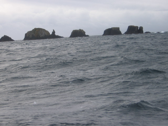
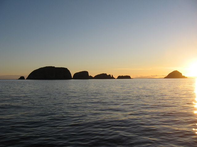
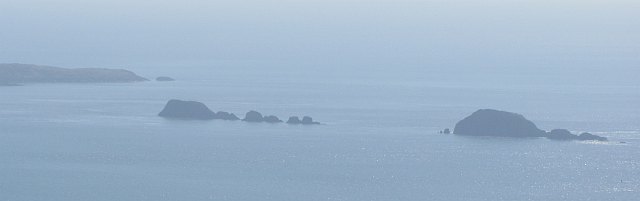
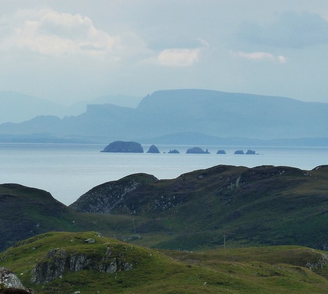
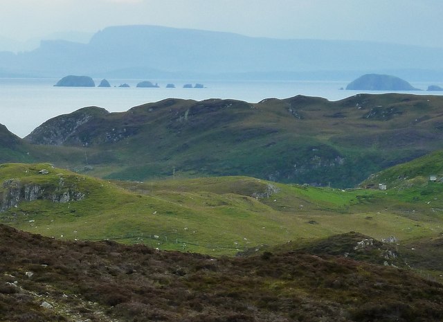
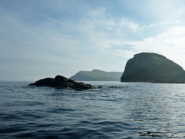
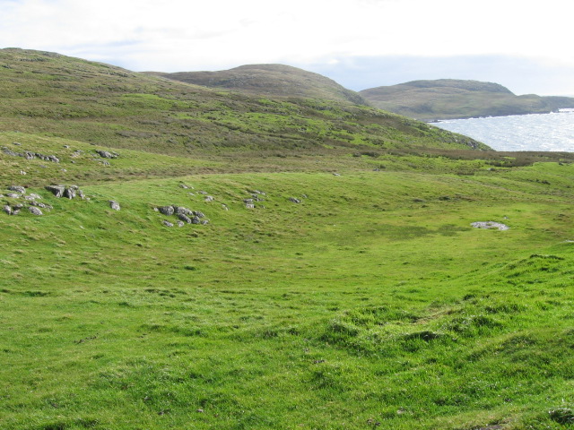
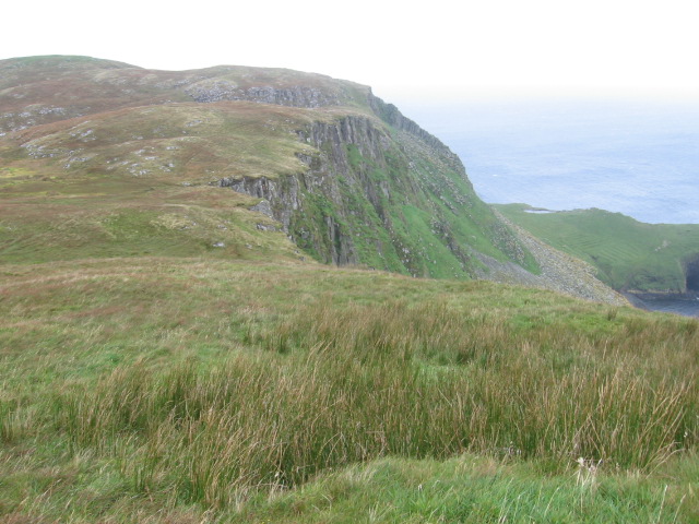
Bodach is a small island located off the coast of Ross-shire in the Highlands of Scotland. It is situated in the Inner Hebrides, specifically in the Inner Sound between the mainland and the Isle of Skye. The island covers an area of approximately 2 square kilometers and has a rugged and dramatic coastline, characterized by cliffs, rocky outcrops, and small sandy coves.

Bodach is uninhabited and boasts a diverse range of flora and fauna. The island is home to a variety of bird species, including puffins, guillemots, and razorbills, making it a popular destination for birdwatching enthusiasts. Seals can often be spotted basking on the rocks, and if lucky, visitors might catch a glimpse of dolphins or whales in the surrounding waters.

The island offers stunning panoramic views of the nearby Skye Bridge and the Cuillin Mountains. It is a haven for hikers and nature lovers, attracting those seeking solitude and tranquility amidst the unspoiled wilderness. The challenging terrain provides opportunities for adventurous exploration, as well as opportunities for photography and painting.

Access to Bodach is limited, with no regular ferry services available. However, visitors can hire private boats or join guided tours to reach the island. It is important to note that visitors should respect the fragile ecosystem and adhere to any conservation guidelines in place to preserve the island's natural beauty for future generations.

If you have any feedback on the listing, please let us know in the comments section below.

Bodach Images

Images are sourced within 2km of 57.897687/-6.3919979 or Grid Reference NG3998. Thanks to Geograph Open Source API. All images are credited.

Shiant Islands - Garbh Eilean from Eilean an Taighe The spit of land connecting the two (the usual landing place) is known as Mol Mor. Even in these fairly benign conditions the direction of the weather is clear.

Garbh Eilean is a Marilyn (summit Mullach Buidhe, 162m), though the actual summit is concealed by the nearby ground.
Shiant Islands - Garbh Eilean from Eilean an Taighe
The spit of land connecting the two (the usual landing place) is known as Mol Mor. Even in these fairly benign conditions the direction of the weather is clear. Garbh Eilean is a Marilyn (summit Mullach Buidhe, 162m), though the actual summit is concealed by the nearby ground.
Galtachan
Galtachan
Galtachan After a trip from Lochmaddy to the Shiant Isles, we are heading towards Stornoway.
Galtachan
After a trip from Lochmaddy to the Shiant Isles, we are heading towards Stornoway.
Galtachan A line of skerries running west from the Shiant Islands. View from Uisinis, Pairc.
Galtachan
A line of skerries running west from the Shiant Islands. View from Uisinis, Pairc.
Eastern Galtachan from southeastern Lewis A zoomed view from the same position as <a href="https://www.geograph.org.uk/photo/2621888">NB3714 : The view across the Minch from south of Grabhair</a> focusing on the row of little islets to the west of the Shiant Islands that make up the eastern section of Galtachan - In order from left to right, the islets that comprise Galtachan are:
Galta Beag, Bodach and Staca Làidir with various rocks dotted about round them. The other two main islets of Galtachan - Galta Mòr and Sgeir Mhic a' Ghobha - can be seen in <a href="https://www.geograph.org.uk/photo/2621995">NG3998 : Galtachan from southeastern Lewis</a>
The mountains looming in the background are those of northern Skye.
Eastern Galtachan from southeastern Lewis
A zoomed view from the same position as NB3714 : The view across the Minch from south of Grabhair focusing on the row of little islets to the west of the Shiant Islands that make up the eastern section of Galtachan - In order from left to right, the islets that comprise Galtachan are: Galta Beag, Bodach and Staca Làidir with various rocks dotted about round them. The other two main islets of Galtachan - Galta Mòr and Sgeir Mhic a' Ghobha - can be seen in NG3998 : Galtachan from southeastern Lewis The mountains looming in the background are those of northern Skye.
Galtachan from southeastern Lewis This is rather a grainy view of the Galtachan archipelago to the west of the Shiant Isles, but it does show all the main islets of the chain rather than just the eastern ones seen in <a href="https://www.geograph.org.uk/photo/2621947">NG3998 : Eastern Galtachan from southeastern Lewis</a>.
Galtachan from southeastern Lewis
This is rather a grainy view of the Galtachan archipelago to the west of the Shiant Isles, but it does show all the main islets of the chain rather than just the eastern ones seen in NG3998 : Eastern Galtachan from southeastern Lewis.
Western end of the Galtachan Galta Mòr and a few tidal skerries to the west.  A theory for the etymology is that it derives from a Norse word that is the root of 'gable' in English.

There is another tidal rock further to the west, Damhag, but it was still underwater at this stage of the tide.
Western end of the Galtachan
Galta Mòr and a few tidal skerries to the west. A theory for the etymology is that it derives from a Norse word that is the root of 'gable' in English. There is another tidal rock further to the west, Damhag, but it was still underwater at this stage of the tide.
Near Rubha Stocanis
Near Rubha Stocanis
Towards Carnach Mhòr
Old field wall at Glaic na Crotha
Ship passing the Shiant Islands (Na h-Eileanan Mora) Taken from the ferry from Uig to Tarbert.
Ship passing the Shiant Islands (Na h-Eileanan Mora)
Taken from the ferry from Uig to Tarbert.
The Shiants from Scalpay Bridge Taken early one August morning looking out to the Shiant Isles as the sun rises over eastern Harris. Two fishing boats make their way out to sea.
I have taken an arbitrary square on Garbh Eilean (one of the Shiants) as the subject position for this shot.
The Shiants from Scalpay Bridge
Taken early one August morning looking out to the Shiant Isles as the sun rises over eastern Harris. Two fishing boats make their way out to sea. I have taken an arbitrary square on Garbh Eilean (one of the Shiants) as the subject position for this shot.
Cliffs of Garbh Eilean Viewed from the cairn above 'The House'
Cliffs of Garbh Eilean
Viewed from the cairn above 'The House'
The Shiant Isles A panoramic view of this rocky archipelago from The Minch
The Shiant Isles
A panoramic view of this rocky archipelago from The Minch
Mullach Buidhe This is the highest point in the Shiant Islands, Mullach Buidhe at 160 metres.  This is a Marilyn hill with a prominence of 160 metres.
Mullach Buidhe
This is the highest point in the Shiant Islands, Mullach Buidhe at 160 metres. This is a Marilyn hill with a prominence of 160 metres.
On The Edge Of Garbh Eilean On the upper eastern edge of Garbh Eilean.
On The Edge Of Garbh Eilean
On the upper eastern edge of Garbh Eilean.
Shiant Islands Grassy Rake A great day climbing Seaforth Island again then the Shiants Island high point via this steep grassy rake which is viewed in descent. Bagged the Marilyn and the HuMP on the Shiants then walked for 6 hours through the Pairc to bag a further two Marilyns, Uisinis and Gormol with Martin Richardson, Bob Taylor, Tony Smith and Richard Tibbetts.
Shiant Islands Grassy Rake
A great day climbing Seaforth Island again then the Shiants Island high point via this steep grassy rake which is viewed in descent. Bagged the Marilyn and the HuMP on the Shiants then walked for 6 hours through the Pairc to bag a further two Marilyns, Uisinis and Gormol with Martin Richardson, Bob Taylor, Tony Smith and Richard Tibbetts.
North coast of Garbh Eilean From Mullach Buidhe the columnar basalt that makes up the Shiants is clearly visible. In the distance are the skerries of the Galtachan and the coast of Pairc in Lewis.
North coast of Garbh Eilean
From Mullach Buidhe the columnar basalt that makes up the Shiants is clearly visible. In the distance are the skerries of the Galtachan and the coast of Pairc in Lewis.
Show me another place!

Bodach is located at Grid Ref: NG3998 (Lat: 57.897687, Lng: -6.3919979)

Unitary Authority: Na h-Eileanan an Iar

Police Authority: Highlands and Islands

What 3 Words

///reverted.ruffle.escapes. Near Tarbert, Na h-Eileanan Siar

Related Wikis

Garbh Eilean, Shiant Islands

Garbh Eilean (Scottish Gaelic Rough Isle) is one of the Shiant Islands at the south end of the Minch on the west coast of Scotland. == Geology == In geological...

Shiant Islands

The Shiant Islands (; Scottish Gaelic: Na h-Eileanan Mòra [nə ˈhelanən ˈmoːɾə] or Na h-Eileanan Seunta [nə ˈhelanən ˈʃiant̪ə] ) or Shiant Isles are a privately...

Eilean an Taighe

"Eilean an Taighe", or "Eilean Taigh" is a fairly common island nameEilean an T(a)ighe, meaning "House Island" (lit. "Island of the House"), is one of...

Eilean Mhuire

Eilean Mhuire (meaning "Virgin Mary's island") is the most easterly of the Shiant Islands in the Outer Hebrides. Once populated, Eilean Mhuire is now used...

Have you been to Bodach?

Leave your review of Bodach below (or comments, questions and feedback).