Staca Làidir

Island in Ross-shire

Scotland

Staca Làidir

Galtachan
Galtachan Credit: Chris Wimbush

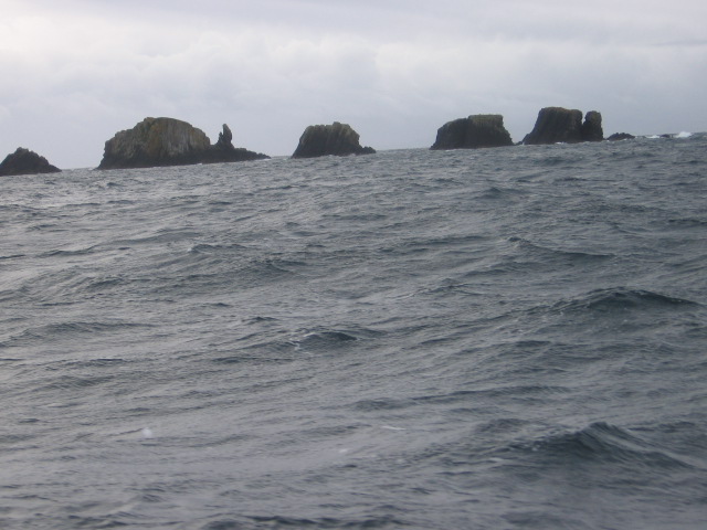
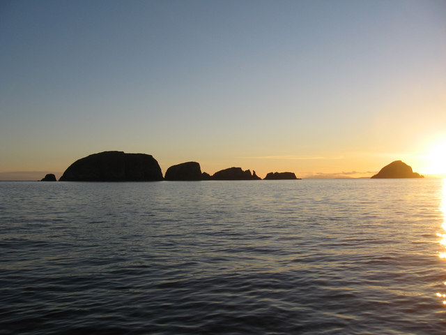
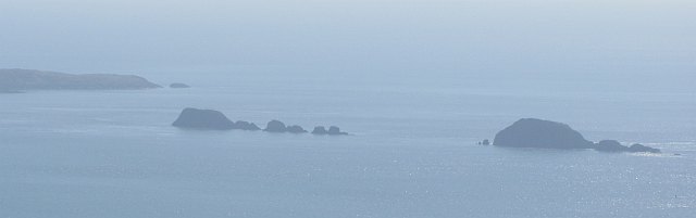
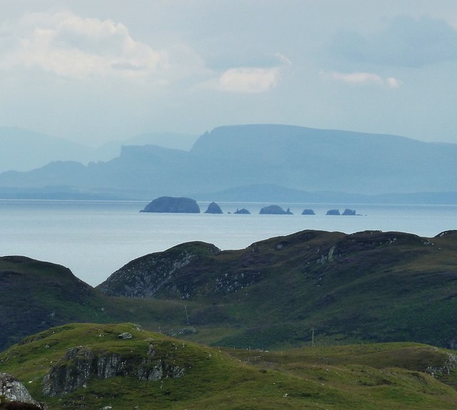
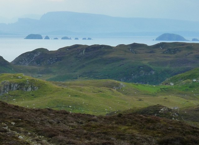
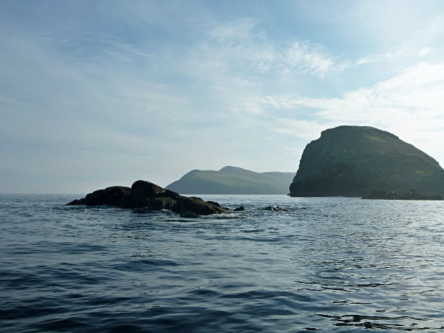
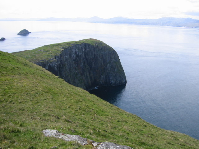
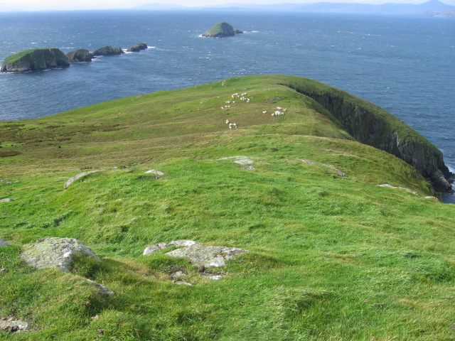
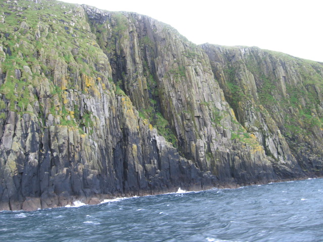
Staca Làidir is a small island located off the coast of Ross-shire, in the Highlands region of Scotland. The island is situated in the picturesque Loch Carron, surrounded by stunning landscapes and breathtaking views. Staca Làidir is part of the Inner Hebrides archipelago, known for its rugged beauty and rich history.

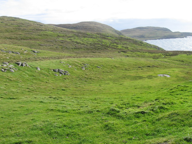
Measuring approximately 0.2 square miles, Staca Làidir is a rocky island with a diverse ecosystem. The island is home to a variety of seabirds, including gulls, puffins, and cormorants. Its shores are dotted with small caves and crevices, providing nesting sites for these majestic creatures.

Staca Làidir is also known for its historical significance. The island is believed to have been inhabited since ancient times, with evidence of human presence dating back to the Bronze Age. In more recent history, the island played a role during the Norse invasions and the medieval period.

Access to Staca Làidir is limited, as the island is only accessible by boat. Visitors can hire a local boat or join organized tours to explore its natural beauty and historical landmarks. The small size of the island makes it an ideal destination for hikers and nature enthusiasts looking to experience the tranquility and isolation of the Scottish Highlands.

Overall, Staca Làidir offers a unique and idyllic getaway for those seeking a remote and untouched destination. Its stunning landscapes, diverse wildlife, and rich history make it a hidden gem in the Ross-shire region of Scotland.

If you have any feedback on the listing, please let us know in the comments section below.

Staca Làidir Images

Images are sourced within 2km of 57.897805/-6.3948163 or Grid Reference NG3998. Thanks to Geograph Open Source API. All images are credited.

Galtachan
Galtachan
Galtachan After a trip from Lochmaddy to the Shiant Isles, we are heading towards Stornoway.
Galtachan
After a trip from Lochmaddy to the Shiant Isles, we are heading towards Stornoway.
Galtachan A line of skerries running west from the Shiant Islands. View from Uisinis, Pairc.
Galtachan
A line of skerries running west from the Shiant Islands. View from Uisinis, Pairc.
Eastern Galtachan from southeastern Lewis A zoomed view from the same position as <a href="https://www.geograph.org.uk/photo/2621888">NB3714 : The view across the Minch from south of Grabhair</a> focusing on the row of little islets to the west of the Shiant Islands that make up the eastern section of Galtachan - In order from left to right, the islets that comprise Galtachan are:
Galta Beag, Bodach and Staca Làidir with various rocks dotted about round them. The other two main islets of Galtachan - Galta Mòr and Sgeir Mhic a' Ghobha - can be seen in <a href="https://www.geograph.org.uk/photo/2621995">NG3998 : Galtachan from southeastern Lewis</a>
The mountains looming in the background are those of northern Skye.
Eastern Galtachan from southeastern Lewis
A zoomed view from the same position as NB3714 : The view across the Minch from south of Grabhair focusing on the row of little islets to the west of the Shiant Islands that make up the eastern section of Galtachan - In order from left to right, the islets that comprise Galtachan are: Galta Beag, Bodach and Staca Làidir with various rocks dotted about round them. The other two main islets of Galtachan - Galta Mòr and Sgeir Mhic a' Ghobha - can be seen in NG3998 : Galtachan from southeastern Lewis The mountains looming in the background are those of northern Skye.
Galtachan from southeastern Lewis This is rather a grainy view of the Galtachan archipelago to the west of the Shiant Isles, but it does show all the main islets of the chain rather than just the eastern ones seen in <a href="https://www.geograph.org.uk/photo/2621947">NG3998 : Eastern Galtachan from southeastern Lewis</a>.
Galtachan from southeastern Lewis
This is rather a grainy view of the Galtachan archipelago to the west of the Shiant Isles, but it does show all the main islets of the chain rather than just the eastern ones seen in NG3998 : Eastern Galtachan from southeastern Lewis.
Western end of the Galtachan Galta Mòr and a few tidal skerries to the west.  A theory for the etymology is that it derives from a Norse word that is the root of 'gable' in English.

There is another tidal rock further to the west, Damhag, but it was still underwater at this stage of the tide.
Western end of the Galtachan
Galta Mòr and a few tidal skerries to the west. A theory for the etymology is that it derives from a Norse word that is the root of 'gable' in English. There is another tidal rock further to the west, Damhag, but it was still underwater at this stage of the tide.
Near Rubha Stocanis
Near Rubha Stocanis
Old field wall at Glaic na Crotha
The Shiants from Scalpay Bridge Taken early one August morning looking out to the Shiant Isles as the sun rises over eastern Harris. Two fishing boats make their way out to sea.
I have taken an arbitrary square on Garbh Eilean (one of the Shiants) as the subject position for this shot.
The Shiants from Scalpay Bridge
Taken early one August morning looking out to the Shiant Isles as the sun rises over eastern Harris. Two fishing boats make their way out to sea. I have taken an arbitrary square on Garbh Eilean (one of the Shiants) as the subject position for this shot.
Mullach Buidhe This is the highest point in the Shiant Islands, Mullach Buidhe at 160 metres.  This is a Marilyn hill with a prominence of 160 metres.
Mullach Buidhe
This is the highest point in the Shiant Islands, Mullach Buidhe at 160 metres. This is a Marilyn hill with a prominence of 160 metres.
North coast of Garbh Eilean From Mullach Buidhe the columnar basalt that makes up the Shiants is clearly visible. In the distance are the skerries of the Galtachan and the coast of Pairc in Lewis.
North coast of Garbh Eilean
From Mullach Buidhe the columnar basalt that makes up the Shiants is clearly visible. In the distance are the skerries of the Galtachan and the coast of Pairc in Lewis.
NW point of Garbh Eilean, Shiant Isles In the distance is Harris and, to the left, the islet of Galta Mor
NW point of Garbh Eilean, Shiant Isles
In the distance is Harris and, to the left, the islet of Galta Mor
Galta Beag from Garbh Eileann
Tobhaichean Caola basalt cliffs on Garbh Eilean
Mullach Buidhe on Garbh Eilean, the Shiants
Airighean na h-Annaid on Garbh Eilean, the Shiants
An Sulaire visiting the Shiant Isles
The Anchorage End of another wonderful day on The Shiants.
The Anchorage
End of another wonderful day on The Shiants.
Show me another place!

Staca Làidir is located at Grid Ref: NG3998 (Lat: 57.897805, Lng: -6.3948163)

Unitary Authority: Na h-Eileanan an Iar

Police Authority: Highlands and Islands

What 3 Words

///webcams.influence.flaking. Near Tarbert, Na h-Eileanan Siar

Related Wikis

Garbh Eilean, Shiant Islands

Garbh Eilean (Scottish Gaelic Rough Isle) is one of the Shiant Islands at the south end of the Minch on the west coast of Scotland. == Geology == In geological...

Shiant Islands

The Shiant Islands (; Scottish Gaelic: Na h-Eileanan Mòra [nə ˈhelanən ˈmoːɾə] or Na h-Eileanan Seunta [nə ˈhelanən ˈʃiant̪ə] ) or Shiant Isles are a privately...

Eilean an Taighe

"Eilean an Taighe", or "Eilean Taigh" is a fairly common island nameEilean an T(a)ighe, meaning "House Island" (lit. "Island of the House"), is one of...

Eilean Mhuire

Eilean Mhuire (meaning "Virgin Mary's island") is the most easterly of the Shiant Islands in the Outer Hebrides. Once populated, Eilean Mhuire is now used...

Have you been to Staca Làidir?

Leave your review of Staca Làidir below (or comments, questions and feedback).