Sgeirean Mòra

Island in Argyllshire

Scotland

Sgeirean Mòra

View across Cliad Bay
View across Cliad Bay Credit: sparkione

Sgeirean Mòra is a small island located in Argyllshire, on the west coast of Scotland. It is part of the Inner Hebrides, a group of islands known for their rugged landscapes and rich history. Sgeirean Mòra is situated in the Sound of Islay, between the larger islands of Islay and Jura.

The island is characterized by its dramatic cliffs and rocky terrain, with no significant vegetation covering its surface. Its name, Sgeirean Mòra, translates to "big skerries" in Gaelic, which accurately describes the numerous rocky outcrops surrounding the island. These skerries are an important habitat for various seabird species, including puffins, guillemots, and razorbills, making Sgeirean Mòra a popular destination for birdwatchers.

Access to Sgeirean Mòra is limited, as there are no regular ferry services to the island. However, it is possible to arrange private boat trips from nearby ports such as Port Ellen on Islay or Craighouse on Jura. Visitors to the island can explore its rugged coastline, observe the diverse birdlife, and enjoy the stunning views of the surrounding sea.

Despite its remote location, Sgeirean Mòra has historical significance. It is believed to have been used as a navigational aid for sailors, with its distinctive skerries serving as markers along the treacherous waters of the Sound of Islay. Today, the island stands as a testament to the raw beauty of the Scottish coastline and provides a unique glimpse into the natural wonders of the Inner Hebrides.

If you have any feedback on the listing, please let us know in the comments section below.

Sgeirean Mòra Images

Images are sourced within 2km of 56.65608/-6.5791366 or Grid Reference NM1960. Thanks to Geograph Open Source API. All images are credited.
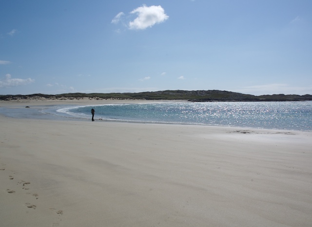
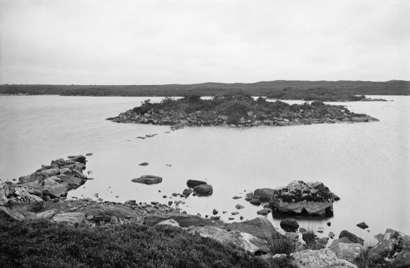
View across Cliad Bay
Cliad Bay, Coll
Cliad Bay, Coll
West end of Cliad Bay, Isle of Coll
Beach, Cliad Bay A big white sand beach beyond the golf course.
Beach, Cliad Bay
A big white sand beach beyond the golf course.
Arnabost This is possibly the former schoolhouse.
Arnabost
This is possibly the former schoolhouse.
Clachard Summit Sixth TuMP of an eight TuMP day with Iain Brown and Martin Richardson.      Name: Clachard
Hill number: 10517
Height: 48m / 157ft
Parent (Ma/M): none
Area: 17F: Coll and Tiree
Class: 0
Grid ref: NM 21063 60509
Summit feature: outcrop
Drop: 35m
Col: 13m  NM213598
Clachard Summit
Sixth TuMP of an eight TuMP day with Iain Brown and Martin Richardson. Name: Clachard Hill number: 10517 Height: 48m / 157ft Parent (Ma/M): none Area: 17F: Coll and Tiree Class: 0 Grid ref: NM 21063 60509 Summit feature: outcrop Drop: 35m Col: 13m NM213598
Cottage At Arnabost
Cottage At Arnabost
Isle of Coll: the B8072 and a Rùm view The outline of the isle of Rùm is visible beyond the large dunes of this northern stretch of the Coll coast. The B8072, like the rest of the island's roads, is single-track with passing places and often, as here, has grass growing down the middle and looking like little more than a farm track.
Isle of Coll: the B8072 and a Rùm view
The outline of the isle of Rùm is visible beyond the large dunes of this northern stretch of the Coll coast. The B8072, like the rest of the island's roads, is single-track with passing places and often, as here, has grass growing down the middle and looking like little more than a farm track.
Cliad Household Waste & Recycling Centre, Coll
The road to Gallanach
B8072, Arnabost The road to the north end of Coll.
B8072, Arnabost
The road to the north end of Coll.
B8072, Cranaig View towards Rùm.
B8072, Cranaig
View towards Rùm.
Summit, Clachard Small hill on Coll with the Gallanach wind turbine beyond.
Summit, Clachard
Small hill on Coll with the Gallanach wind turbine beyond.
North side of Coll View from Clachard above Gallanach towards Rùm.
North side of Coll
View from Clachard above Gallanach towards Rùm.
Arnabost Small dwelling by the B8071/B8072 junction.
Arnabost
Small dwelling by the B8071/B8072 junction.
Gallanach Large house on Coll's west coast.
Gallanach
Large house on Coll's west coast.
Shore north-east of Cliad Bay, Coll Looking north-east at one of the rockier stretches of Coll's north coast. The high ground to the right in the distance - and out of map square - is A Chroic.
[scanned photo]
Shore north-east of Cliad Bay, Coll
Looking north-east at one of the rockier stretches of Coll's north coast. The high ground to the right in the distance - and out of map square - is A Chroic. [scanned photo]
Bagh an Trailleich, Coll Looking south west across this broad bay on Coll's north coast.
Bagh an Trailleich, Coll
Looking south west across this broad bay on Coll's north coast.
Show me another place!

Sgeirean Mòra is located at Grid Ref: NM1960 (Lat: 56.65608, Lng: -6.5791366)

Unitary Authority: Argyll and Bute

Police Authority: Argyll and West Dunbartonshire

What 3 Words

///adults.person.seeing. Near Arinagour, Argyll & Bute

Related Wikis

Dùn Dubh

Dùn Dubh is a hillfort, located on the Inner Hebridean island of Coll. The fort is one of three associated with a local tradition which states that they...

Coll

Coll (; Scottish Gaelic: Cola; Scots: Coll) is an island located west of the Isle of Mull in the Inner Hebrides of Scotland. Coll is known for its sandy...

An Caisteal (Coll)

An Caisteal (English: The Castle) is a hill fort located on the island of Coll. This island is one of the islands which make up the Inner Hebrides located...

Dùn Anlaimh

Dùn Anlaimh, also known as Dùn Amhlaidh, and Eilean nan Cinneachan, is a crannog (an artificial island), located within Loch nan Cinneachan on the Inner...

Nearby Amenities

Located within 500m of 56.65608,-6.5791366
Natural: rock
Source: OS7
Tidal: yes
Lat/Long: 56.6562643/-6.5774849
Natural: rock
Source: OS7
Tidal: yes
Lat/Long: 56.655809/-6.578693
Natural: rock
Source: OS7
Tidal: yes
Lat/Long: 56.6551787/-6.5777392
Natural: rock
Source: OS7
Tidal: yes
Lat/Long: 56.6547234/-6.5808547
Natural: rock
Source: OS7
Tidal: yes
Lat/Long: 56.6543031/-6.5783114
Natural: rock
Source: OS7
Tidal: yes
Lat/Long: 56.6538478/-6.5790744
Natural: rock
Source: OS7
Tidal: yes
Lat/Long: 56.6537602/-6.5744572
Natural: rock
Source: OS7
Tidal: yes
Lat/Long: 56.6530221/-6.5748193
Natural: rock
Source: OS7
Tidal: yes
Lat/Long: 56.6524635/-6.5747468
Natural: rock
Source: OS7
Tidal: yes
Lat/Long: 56.6529423/-6.5774993
Natural: rock
Source: OS7
Tidal: yes
Lat/Long: 56.6523039/-6.5769561
Natural: rock
Source: OS7
Tidal: yes
Lat/Long: 56.6519448/-6.5768836
Natural: rock
Source: OS7
Tidal: yes
Lat/Long: 56.6519448/-6.5776079
Natural: rock
Source: OS7
Tidal: yes
Lat/Long: 56.6522839/-6.5779701
Natural: rock
Source: OS7
Tidal: yes
Lat/Long: 56.6519249/-6.5785133
Natural: rock
Source: OS7
Tidal: yes
Lat/Long: 56.6536259/-6.5831032
The data included in this document is from www.openstreetmap.org. The data is made available under ODbL.

Have you been to Sgeirean Mòra?

Leave your review of Sgeirean Mòra below (or comments, questions and feedback).