Eilean an Arbhair

Island in Inverness-shire

Scotland

Eilean an Arbhair

Loch nan Uidhean Typical 'Cnoc and Lochan' topography, with a small loch hemmed in by steeply dipping hummocky Lewisian gneiss.
Loch nan Uidhean Credit: Anne Burgess

Eilean an Arbhair, also known as Island of the Corn, is a small island located in Inverness-shire, Scotland. Situated in the middle of Loch Maree, it is surrounded by stunning mountainous landscapes and lush vegetation.

Covering an area of approximately 9 hectares, Eilean an Arbhair is accessible only by boat. The island is known for its rich history and cultural significance. It is believed to have been a sacred site for the ancient Picts, who inhabited the area centuries ago. Remnants of ancient structures and burial sites can still be found on the island, adding to its historical appeal.

The island's name, Island of the Corn, is derived from the Gaelic words "eilean" meaning island and "arbhair" meaning corn. This name is a testament to the island's fertile soil, which was once used for cultivating crops.

Eilean an Arbhair is also home to a variety of wildlife, including red deer, otters, and various bird species. The surrounding waters of Loch Maree are known for their rich biodiversity, attracting anglers and nature enthusiasts.

Visitors to the island can enjoy breathtaking views of the surrounding mountains and explore the ancient ruins. With its tranquil ambiance and natural beauty, Eilean an Arbhair offers a unique and memorable experience for those seeking a peaceful retreat in the heart of the Scottish Highlands.

If you have any feedback on the listing, please let us know in the comments section below.

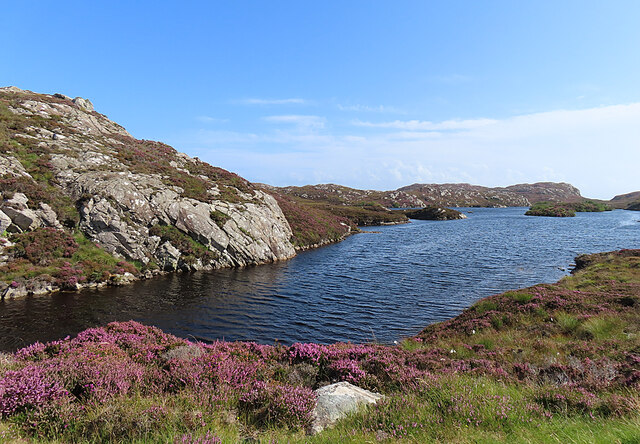
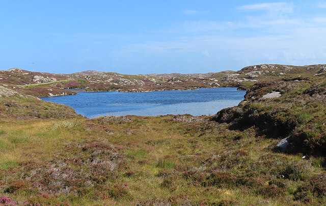
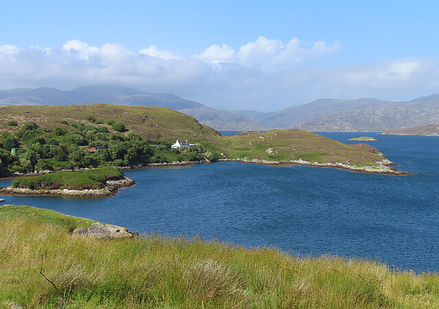
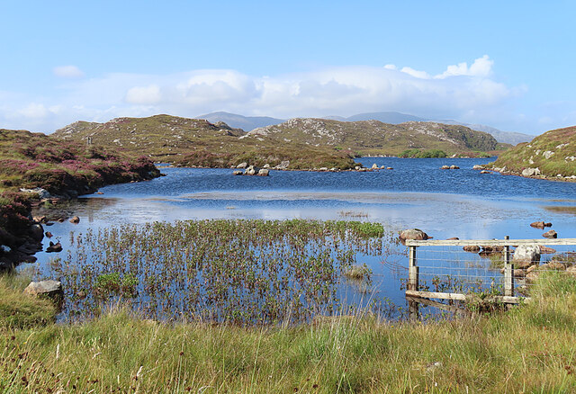
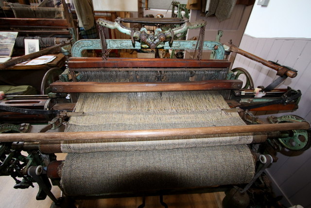
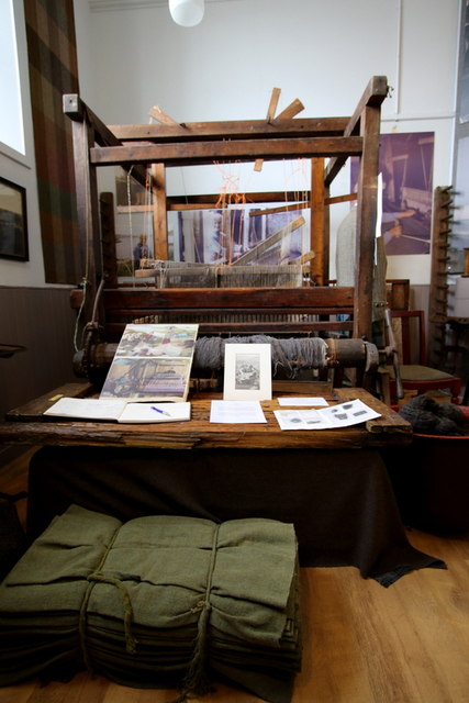
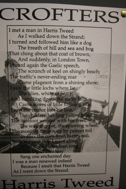
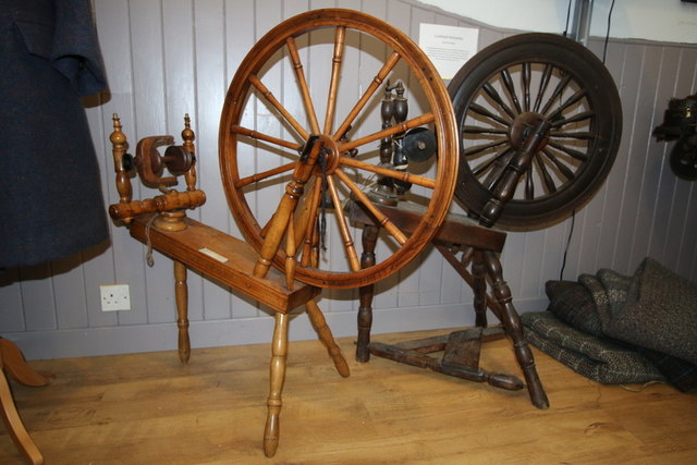
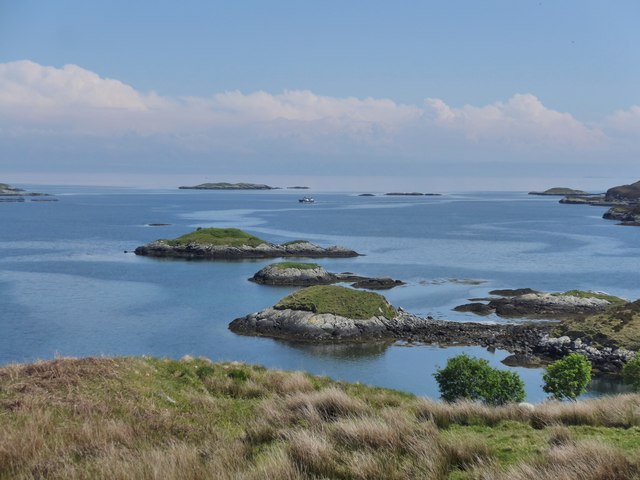
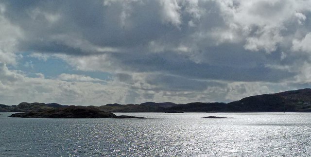
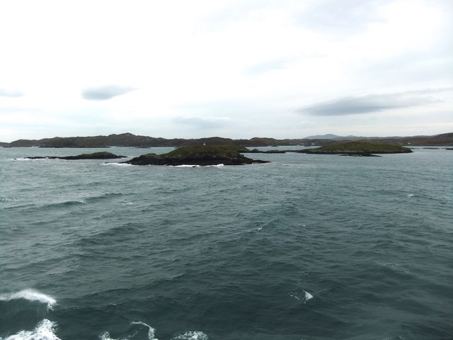
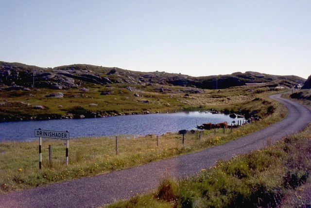
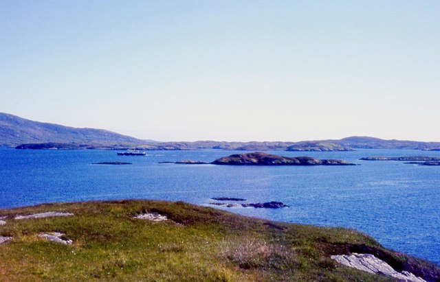
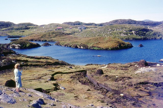
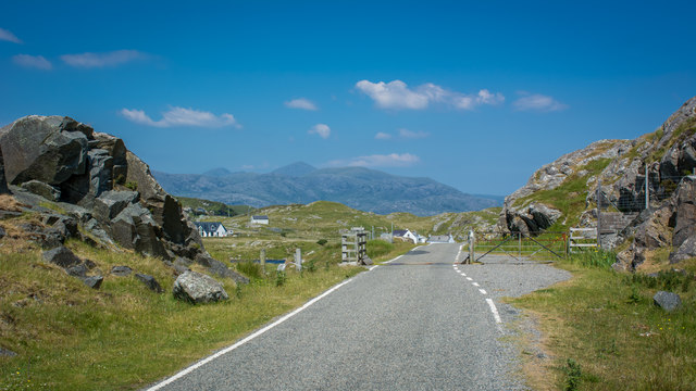
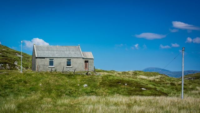
Eilean an Arbhair Images

Images are sourced within 2km of 57.849239/-6.7561121 or Grid Reference NG1794. Thanks to Geograph Open Source API. All images are credited.

Loch nan Uidhean Typical 'Cnoc and Lochan' topography, with a small loch hemmed in by steeply dipping hummocky Lewisian gneiss.
Loch nan Uidhean
Typical 'Cnoc and Lochan' topography, with a small loch hemmed in by steeply dipping hummocky Lewisian gneiss.
Nameless Lochan That is to say, the map doesn't name it.
Nameless Lochan
That is to say, the map doesn't name it.
Loch Phlocrapoil This is one of the larger lochs on the route of the Golden Road.
Loch Phlocrapoil
This is one of the larger lochs on the route of the Golden Road.
Drinishader A bay on the west side of islet-studded Loch Tairbeart, the largest of the sea-lochs on the east side of Harris.
Drinishader
A bay on the west side of islet-studded Loch Tairbeart, the largest of the sea-lochs on the east side of Harris.
Loch Drinisiadair This is just the southern tip of one of the larger lochs in eastern Harris.
Loch Drinisiadair
This is just the southern tip of one of the larger lochs in eastern Harris.
In the driving seat of the Hattersley Mk1 at Drinisiadar Built in Keighley, West Yorkshire and one time Luddite bait the loom was designed by George Hattersley and from 1919 to the present has proved a godsend to the people of Harris.
In the driving seat of the Hattersley Mk1 at Drinisiadar
Built in Keighley, West Yorkshire and one time Luddite bait the loom was designed by George Hattersley and from 1919 to the present has proved a godsend to the people of Harris.
All trades their gear, tackle, and trim.. The loom and some of the products at the exhibition at Drinisiadar.
All trades their gear, tackle, and trim..
The loom and some of the products at the exhibition at Drinisiadar.
Original Harris Tweed Introduced to Harris in 1919 the Hattersley cottage loom which was manufactured by George Hattersley of Keighley, West Yorkshire and proved a godsend for the people of Harris.
Original Harris Tweed
Introduced to Harris in 1919 the Hattersley cottage loom which was manufactured by George Hattersley of Keighley, West Yorkshire and proved a godsend for the people of Harris.
Nostalgia's not what it used to be! If ever a poem ran in parallel with Yeats' Lake Isle of Innisfree then this is the one.
Nostalgia's not what it used to be!
If ever a poem ran in parallel with Yeats' Lake Isle of Innisfree then this is the one.
The Spinning Wheels of Harris Before you weave, first spin the wool.
The Spinning Wheels of Harris
Before you weave, first spin the wool.
Islands and skerries off Drinishader Not quite a painted ship on a painted ocean, but close;  there is a fishing boat dead-centre in this image.
Islands and skerries off Drinishader
Not quite a painted ship on a painted ocean, but close; there is a fishing boat dead-centre in this image.
Gloraig Dhubh, Loch an Tairbeairt, Harris The northern (right hand) tip of Gloraig Dhubh, the larger skerry, and the whole of the smaller skerry lie within the grid square.
Gloraig Dhubh, Loch an Tairbeairt, Harris
The northern (right hand) tip of Gloraig Dhubh, the larger skerry, and the whole of the smaller skerry lie within the grid square.
Dun Corr Mor
Dun Corr Mor
South end of Loch Drinisiadair
Rubha na Mòine The ferry heading in to Tarbert past the Gloraigs.
Rubha na Mòine
The ferry heading in to Tarbert past the Gloraigs.
Loch Plocrapol at Scadabay
Cattle grid on the Golden Road
Abandoned Kirk at Scadabay
Show me another place!

Eilean an Arbhair is located at Grid Ref: NG1794 (Lat: 57.849239, Lng: -6.7561121)

Unitary Authority: Na h-Eileanan an Iar

Police Authority: Highlands and Islands

What 3 Words

///driven.imperious.bills. Near Tarbert, Na h-Eileanan Siar

Related Wikis

East Loch Tarbert

East Loch Tarbert (Scottish Gaelic: Loch an Tairbeairt) is a sea loch that lies to the east of Harris in the Outer Hebrides of Scotland. The loch contains...

Sgeotasaigh

Scotasay (Scottish Gaelic: Sgeotasaigh) is small island in the Outer Hebrides of Scotland. It lies 1 kilometre (0.6 miles) off the east coast of Harris...

Scalpay, Outer Hebrides

Scalpay (; Scottish Gaelic: Sgalpaigh or Sgalpaigh na Hearadh; i.e. "Scalpay of Harris" to distinguish it from Scalpay off Skye) is an island in the Outer...

Stockinish Island

Stockinish Island (Scottish Gaelic: Eilean Stocainis) is an uninhabited island off Harris, in the Outer Hebrides. == Geography and geology == Stockinish...

Nearby Amenities

Located within 500m of 57.849239,-6.7561121
Passing Place
Lat/Long: 57.850577/-6.7638466
Post Box
Operator: Royal Mail
Operator Wikidata: Q638098
Post Box Mounting: pier
Post Box Type: lamp
Ref: HS3 165
Royal Cypher: scottish_crown
Source: survey
Lat/Long: 57.8458385/-6.760663
Tourism: camp_site
Lat/Long: 57.8457953/-6.7595016
Passing Place
Lat/Long: 57.8499223/-6.7630237
Passing Place
Lat/Long: 57.8477675/-6.7616228
Passing Place
Lat/Long: 57.8465822/-6.7612338
Material: wood
Power: pole
Lat/Long: 57.8505086/-6.7626922
Material: wood
Power: pole
Lat/Long: 57.8496244/-6.7618942
Material: wood
Power: pole
Lat/Long: 57.8457425/-6.7589103
Material: wood
Power: pole
Lat/Long: 57.8460509/-6.7582317
Material: wood
Power: pole
Lat/Long: 57.845587/-6.7585831
Material: wood
Power: pole
Lat/Long: 57.8461679/-6.7598893
Material: wood
Power: pole
Lat/Long: 57.8465769/-6.7598893
Material: wood
Power: pole
Lat/Long: 57.8471264/-6.759959
Material: wood
Power: pole
Lat/Long: 57.8477938/-6.7602702
Material: wood
Power: pole
Lat/Long: 57.8468424/-6.7615692
Material: wood
Power: pole
Lat/Long: 57.8471104/-6.7617743
Material: wood
Power: pole
Lat/Long: 57.8475033/-6.7620896
Material: wood
Power: pole
Lat/Long: 57.84981/-6.7635729
Material: wood
Power: pole
Lat/Long: 57.849947/-6.7637928
Material: wood
Power: pole
Lat/Long: 57.8500968/-6.7637767
Material: wood
Power: pole
Lat/Long: 57.8502688/-6.7642595
Material: wood
Power: pole
Lat/Long: 57.8511742/-6.7633418
Passing Place
Lat/Long: 57.8486078/-6.7617253
Passing Place
Lat/Long: 57.8491628/-6.7621278
Material: wood
Power: pole
Lat/Long: 57.8502737/-6.7633554
Material: wood
Power: pole
Lat/Long: 57.8488927/-6.7608234
Power: pole
Lat/Long: 57.8454668/-6.7598182
Telephone
Booth: K6
Covered: booth
Operator: BT
Operator Wikidata: Q593786
Phone: +44 1859 511212
Lat/Long: 57.8477129/-6.7617605
Rubha na Moine
Natural: cape
Lat/Long: 57.8521219/-6.7624971
Bun na Leige
Natural: bay
Lat/Long: 57.8466523/-6.7568859
Power: pole
Lat/Long: 57.8477342/-6.7614618
Power: pole
Lat/Long: 57.8476229/-6.7617736
Passing Place
Lat/Long: 57.8502115/-6.7633677
Street Lamp
Lamp Type: electric
Lat/Long: 57.8503016/-6.7638303
Passing Place
Lat/Long: 57.8499223/-6.7630237
The data included in this document is from www.openstreetmap.org. The data is made available under ODbL.

Have you been to Eilean an Arbhair?

Leave your review of Eilean an Arbhair below (or comments, questions and feedback).