Beinn Drinisiadair

Hill, Mountain in Inverness-shire

Scotland

Beinn Drinisiadair

Lochan near Greosabhagh A lochan liberally sprinkled with water-lily leaves.
Lochan near Greosabhagh Credit: Anne Burgess

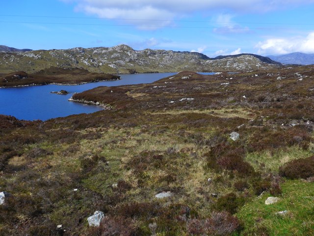
Beinn Drinisiadair is a prominent hill located in Inverness-shire, Scotland. With an elevation of 918 meters (3,012 feet), it is considered a Corbett, which is a Scottish hill between 2,500 and 3,000 feet in height.

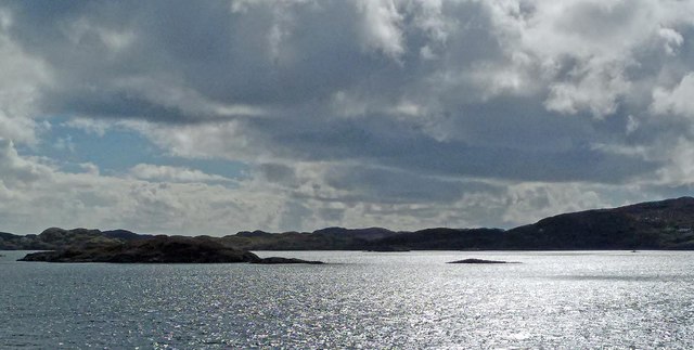
Situated in the Northwest Highlands, Beinn Drinisiadair offers breathtaking panoramic views of the surrounding mountains and glens. It is part of the Beinn Dearg group of hills, which includes several other Corbetts and Munros (Scottish mountains over 3,000 feet).

The ascent of Beinn Drinisiadair is achievable through various routes, each offering unique challenges and landscapes. The most popular approach is from the north, starting at the village of Strathcarron. This route takes hikers through heather-covered slopes and rocky terrain, leading to a narrow ridge that requires some scrambling skills. The final push to the summit rewards climbers with magnificent vistas across the Torridon and Fisherfield mountains.

The hill is known for its rugged and wild beauty, featuring steep slopes and rocky outcrops that attract experienced mountaineers and hillwalkers seeking a challenging adventure. The surrounding area is home to a diverse range of wildlife, including deer, mountain hares, and golden eagles, making it a popular spot for nature enthusiasts and birdwatchers.

Beinn Drinisiadair is a must-visit destination for those seeking a true Highland experience. Its remote location and untouched wilderness offer a sense of solitude and tranquility, away from the hustle and bustle of everyday life. Whether it is conquering the summit or simply immersing oneself in the stunning natural surroundings, Beinn Drinisiadair is a captivating destination for outdoor enthusiasts.

If you have any feedback on the listing, please let us know in the comments section below.

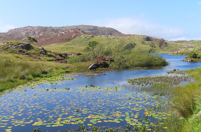
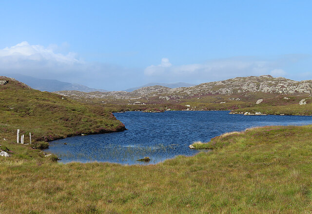
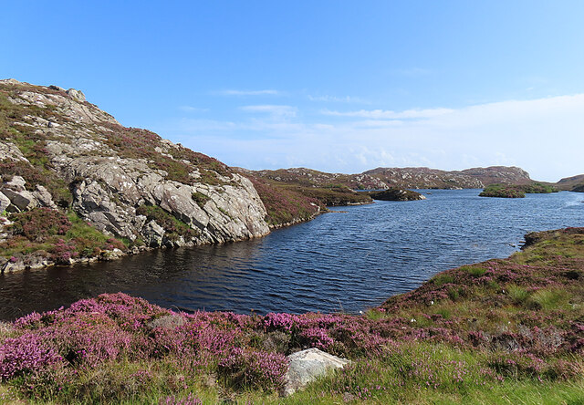
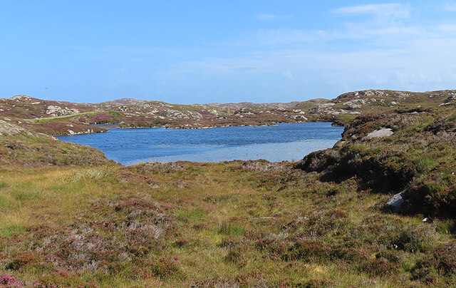
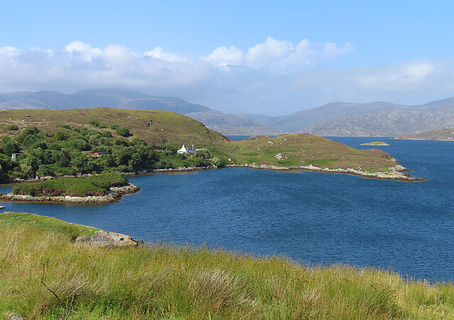
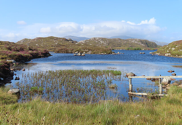
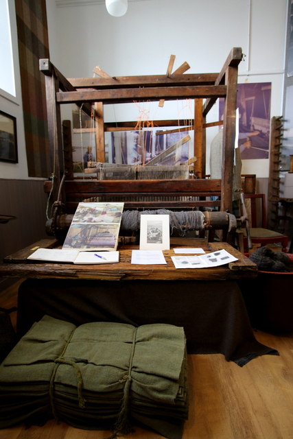
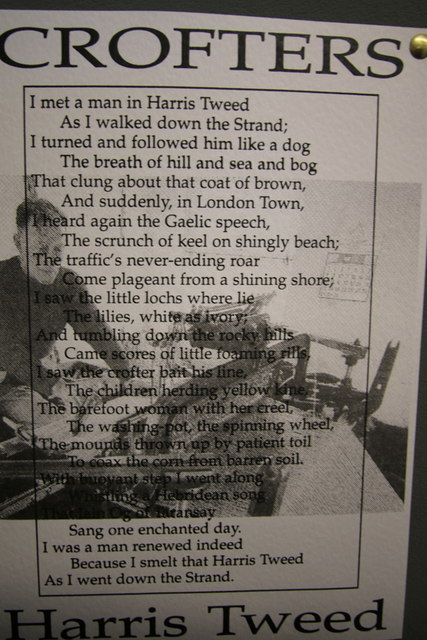
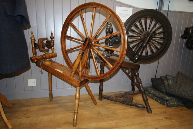
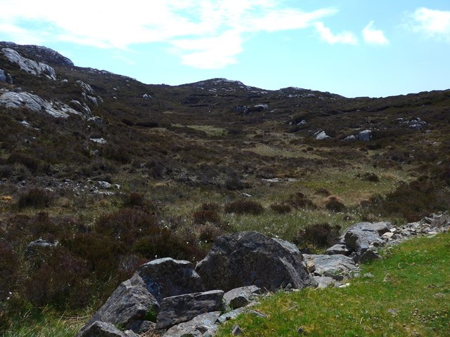
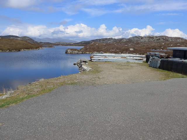
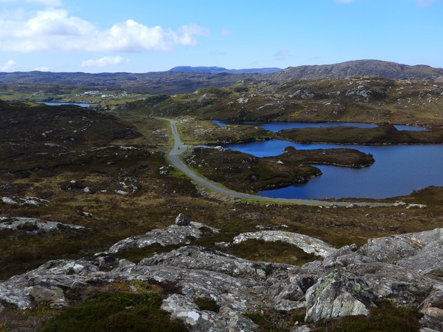
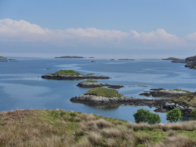
Beinn Drinisiadair Images

Images are sourced within 2km of 57.849045/-6.7696346 or Grid Reference NG1794. Thanks to Geograph Open Source API. All images are credited.

Lochan near Greosabhagh A lochan liberally sprinkled with water-lily leaves.
Lochan near Greosabhagh
A lochan liberally sprinkled with water-lily leaves.
Loch Harmasaig Most of this loch is hidden behind the knoll on the left.
Loch Harmasaig
Most of this loch is hidden behind the knoll on the left.
Loch nan Uidhean Typical 'Cnoc and Lochan' topography, with a small loch hemmed in by steeply dipping hummocky Lewisian gneiss.
Loch nan Uidhean
Typical 'Cnoc and Lochan' topography, with a small loch hemmed in by steeply dipping hummocky Lewisian gneiss.
Nameless Lochan That is to say, the map doesn't name it.
Nameless Lochan
That is to say, the map doesn't name it.
Loch Phlocrapoil This is one of the larger lochs on the route of the Golden Road.
Loch Phlocrapoil
This is one of the larger lochs on the route of the Golden Road.
Drinishader A bay on the west side of islet-studded Loch Tairbeart, the largest of the sea-lochs on the east side of Harris.
Drinishader
A bay on the west side of islet-studded Loch Tairbeart, the largest of the sea-lochs on the east side of Harris.
Loch Drinisiadair This is just the southern tip of one of the larger lochs in eastern Harris.
Loch Drinisiadair
This is just the southern tip of one of the larger lochs in eastern Harris.
In the driving seat of the Hattersley Mk1 at Drinisiadar Built in Keighley, West Yorkshire and one time Luddite bait the loom was designed by George Hattersley and from 1919 to the present has proved a godsend to the people of Harris.
In the driving seat of the Hattersley Mk1 at Drinisiadar
Built in Keighley, West Yorkshire and one time Luddite bait the loom was designed by George Hattersley and from 1919 to the present has proved a godsend to the people of Harris.
All trades their gear, tackle, and trim.. The loom and some of the products at the exhibition at Drinisiadar.
All trades their gear, tackle, and trim..
The loom and some of the products at the exhibition at Drinisiadar.
Original Harris Tweed Introduced to Harris in 1919 the Hattersley cottage loom which was manufactured by George Hattersley of Keighley, West Yorkshire and proved a godsend for the people of Harris.
Original Harris Tweed
Introduced to Harris in 1919 the Hattersley cottage loom which was manufactured by George Hattersley of Keighley, West Yorkshire and proved a godsend for the people of Harris.
Nostalgia's not what it used to be! If ever a poem ran in parallel with Yeats' Lake Isle of Innisfree then this is the one.
Nostalgia's not what it used to be!
If ever a poem ran in parallel with Yeats' Lake Isle of Innisfree then this is the one.
The Spinning Wheels of Harris Before you weave, first spin the wool.
The Spinning Wheels of Harris
Before you weave, first spin the wool.
Loch Harmasaig
Loch Harmasaig
Rough ground at Druim nan-Uidhean
Old pontoon equipment at Loch Harmasaig
The road to Greosabhagh A typical East Harris view - water and rock, rock and water.

Shots of parts of the island were used by Stanley Kubrick as the surface of Jupiter in the film 2001: A Space Odyssey.
The road to Greosabhagh
A typical East Harris view - water and rock, rock and water. Shots of parts of the island were used by Stanley Kubrick as the surface of Jupiter in the film 2001: A Space Odyssey.
Islands and skerries off Drinishader Not quite a painted ship on a painted ocean, but close;  there is a fishing boat dead-centre in this image.
Islands and skerries off Drinishader
Not quite a painted ship on a painted ocean, but close; there is a fishing boat dead-centre in this image.
Gloraig Dhubh, Loch an Tairbeairt, Harris The northern (right hand) tip of Gloraig Dhubh, the larger skerry, and the whole of the smaller skerry lie within the grid square.
Gloraig Dhubh, Loch an Tairbeairt, Harris
The northern (right hand) tip of Gloraig Dhubh, the larger skerry, and the whole of the smaller skerry lie within the grid square.
Show me another place!

Beinn Drinisiadair is located at Grid Ref: NG1794 (Lat: 57.849045, Lng: -6.7696346)

Unitary Authority: Na h-Eileanan an Iar

Police Authority: Highlands and Islands

What 3 Words

///frantic.fidget.norms. Near Tarbert, Na h-Eileanan Siar

Related Wikis

East Loch Tarbert

East Loch Tarbert (Scottish Gaelic: Loch an Tairbeairt) is a sea loch that lies to the east of Harris in the Outer Hebrides of Scotland. The loch contains...

Sgeotasaigh

Scotasay (Scottish Gaelic: Sgeotasaigh) is small island in the Outer Hebrides of Scotland. It lies 1 kilometre (0.6 miles) off the east coast of Harris...

Stockinish Island

Stockinish Island (Scottish Gaelic: Eilean Stocainis) is an uninhabited island off Harris, in the Outer Hebrides. == Geography and geology == Stockinish...

Scalpay, Outer Hebrides

Scalpay (; Scottish Gaelic: Sgalpaigh or Sgalpaigh na Hearadh; i.e. "Scalpay of Harris" to distinguish it from Scalpay off Skye) is an island in the Outer...

Harris distillery

Harris distillery is a Scotch whisky and Gin distillery in Tarbert on the Isle of Harris, Scotland. The distillery was the first legal distillery ever...

Tarbert, Harris

Tarbert (Scottish Gaelic: An Tairbeart [ən̪ˠ ˈt̪ɛrʲɛbərˠʃt̪]) is the main community on Harris in the Western Isles of Scotland. The name means "isthmus...

Eilean Glas, Scalpay

Eilean Glas is a peninsula of Scalpay in the Outer Hebrides, Scotland. Eilean Glas is home to a historic lighthouse. Eilean Glas means Grey/Green Island...

Eilean Glas Lighthouse

Eilean Glas Lighthouse is situated on the east coast of the island of Scalpay in the Outer Hebrides of Scotland. It was one of the original four lights...

Nearby Amenities

Located within 500m of 57.849045,-6.7696346
Passing Place
Lat/Long: 57.850577/-6.7638466
Bus Stop
Drinishader
Bus: yes
Naptan AtcoCode: 6010731635
Naptan Bearing: N
Naptan CommonName: Drinishader
Naptan Indicator: Village
Naptan Landmark: Village
Naptan NaptanCode: 94723649
Naptan Street: Village
Naptan Verified: no
Public Transport: platform
Source: naptan_import
Lat/Long: 57.8528104/-6.76859
No. 5 Drinishader
Addr City: Na Hearadh
Addr City En: Isle of Harris
Addr Country: GB
Addr Postcode: HS3 3DX
Guest House: hostel
Tourism: hostel
Website: https://www.number5.biz/
Lat/Long: 57.8530006/-6.7701488
Clò-Mòr
Fee: no
Name En: Museum of Harris Tweed
Name Gd: Clò-Mòr
Opening Hours: Mo-Sa 09:00-17:30
Tourism: museum
Website: http://www.harristweedandknitwear.co.uk/clo-mor-harris-tweed-exhibition/
Wheelchair: yes
Lat/Long: 57.8520949/-6.7667006
Drinisiadar
Alt Name: Drinesheader
Name En: Drinishader
Name Gd: Drinisiadar
Place: village
Lat/Long: 57.8533539/-6.7694155
Entrance: yes
Lat/Long: 57.852107/-6.7666545
Access: customers
Entrance: yes
Lat/Long: 57.8522137/-6.7667297
Barrier: cattle_grid
Lat/Long: 57.8522028/-6.768338
Barrier: cattle_grid
Lat/Long: 57.8507386/-6.7649751
Passing Place
Lat/Long: 57.8499223/-6.7630237
Passing Place
Lat/Long: 57.8477675/-6.7616228
Material: wood
Power: pole
Lat/Long: 57.8534718/-6.7691938
Material: wood
Power: pole
Lat/Long: 57.8532938/-6.7694353
Material: wood
Power: pole
Lat/Long: 57.8526519/-6.7689471
Material: wood
Power: pole
Lat/Long: 57.8528545/-6.7691121
Material: wood
Power: pole
Lat/Long: 57.852202/-6.7686574
Material: wood
Power: pole
Lat/Long: 57.8517974/-6.7683409
Material: wood
Power: pole
Lat/Long: 57.8520586/-6.7675256
Material: wood
Power: pole
Lat/Long: 57.8516546/-6.7677294
Material: wood
Power: pole
Lat/Long: 57.8515925/-6.7684228
Material: wood
Power: pole
Lat/Long: 57.8505086/-6.7626922
Material: wood
Power: pole
Lat/Long: 57.8496244/-6.7618942
Material: wood
Power: pole
Lat/Long: 57.8475033/-6.7620896
Material: wood
Power: pole
Lat/Long: 57.84981/-6.7635729
Material: wood
Power: pole
Lat/Long: 57.849947/-6.7637928
Material: wood
Power: pole
Lat/Long: 57.8500968/-6.7637767
Material: wood
Power: pole
Lat/Long: 57.8502688/-6.7642595
Generator Method: photovoltaic
Generator Output Electricity: small_installation
Generator Source: solar
Generator Type: solar_photovoltaic_panel
Power: generator
Lat/Long: 57.8507733/-6.765728
Passing Place
Lat/Long: 57.8511818/-6.7658896
Harris Tweed and Knitwear
Addr City: Na Hearadh
Addr City En: Isle of Harris
Addr Country: GB
Addr Housename: Old School
Addr Postcode: HS3 3DX
Addr Street: Drinishader
Opening Hours: Mo-Sa 09:00-17:30
Shop: clothes
Website: https://www.harristweedandknitwear.co.uk
Wheelchair: yes
Lat/Long: 57.8521963/-6.766781
Material: wood
Power: pole
Lat/Long: 57.8532919/-6.7701532
Beinn Dhrinisiadair
Natural: peak
Lat/Long: 57.8486511/-6.7687458
Material: wood
Power: pole
Lat/Long: 57.8511742/-6.7633418
Material: wood
Power: pole
Lat/Long: 57.8514885/-6.7645501
Material: wood
Power: pole
Lat/Long: 57.8515746/-6.7660185
Passing Place
Lat/Long: 57.8486078/-6.7617253
Passing Place
Lat/Long: 57.8491628/-6.7621278
Material: wood
Power: pole
Lat/Long: 57.8502737/-6.7633554
Telephone
Booth: K6
Covered: booth
Operator: BT
Operator Wikidata: Q593786
Phone: +44 1859 511212
Lat/Long: 57.8477129/-6.7617605
Power: pole
Lat/Long: 57.8476229/-6.7617736
Bench: yes
Leisure: picnic_table
Material: wood
Lat/Long: 57.8534096/-6.7690966
Bench: yes
Leisure: picnic_table
Material: wood
Lat/Long: 57.8533572/-6.7690537
Material: wood
Power: pole
Lat/Long: 57.8530368/-6.7684495
Power: pole
Lat/Long: 57.8526832/-6.7671701
Power: pole
Lat/Long: 57.8523342/-6.7666283
Passing Place
Lat/Long: 57.8502115/-6.7633677
Street Lamp
Lamp Type: electric
Lat/Long: 57.8509453/-6.7651661
Street Lamp
Lamp Type: electric
Lat/Long: 57.8503016/-6.7638303
Passing Place
Lat/Long: 57.8499223/-6.7630237
The data included in this document is from www.openstreetmap.org. The data is made available under ODbL.

Have you been to Beinn Drinisiadair?

Leave your review of Beinn Drinisiadair below (or comments, questions and feedback).