Eileanan Glasa
Island in Ross-shire
Scotland
Eileanan Glasa

Eileanan Glasa, also known as the Green Isles, is a group of small islands located in Ross-shire, Scotland. Situated off the northwest coast of the mainland, the islands are part of the Inner Hebrides archipelago. Eileanan Glasa consists of several uninhabited islands, with the largest one being Eilean Fladday.
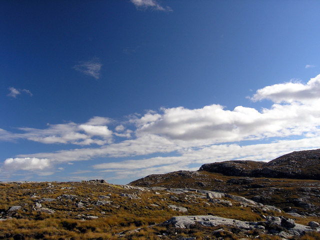
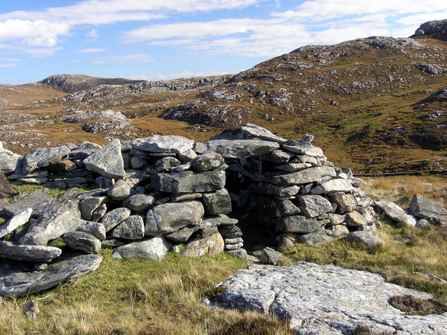
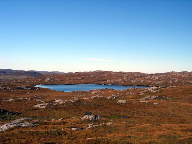
The islands are renowned for their breathtaking natural beauty, with picturesque landscapes and stunning coastlines. The lush greenery that covers the islands gives them their name and adds to their charm. Eileanan Glasa offers a haven for nature enthusiasts, who can explore the diverse flora and fauna present on the islands.
Eilean Fladday is the main attraction of Eileanan Glasa, featuring a rocky terrain and towering cliffs that offer mesmerizing panoramic views. The island is a popular spot for birdwatching, as it serves as a nesting site for various seabirds, including puffins, guillemots, and razorbills. Visitors can also spot seals and dolphins swimming in the surrounding waters.
Although there are no permanent residents on the islands, Eileanan Glasa attracts tourists who are looking for a peaceful retreat away from the bustling cities. Outdoor activities such as hiking, fishing, and kayaking are popular among visitors, who can enjoy the tranquility and solitude that the islands provide.
Eileanan Glasa is accessible by boat from the nearby town of Ullapool, where visitors can arrange trips to explore the islands. The untouched beauty and serene atmosphere of Eileanan Glasa make it a hidden gem and a must-visit destination for nature lovers and those seeking a unique Scottish island experience.
If you have any feedback on the listing, please let us know in the comments section below.
Eileanan Glasa Images
Images are sourced within 2km of 58.159343/-6.884724 or Grid Reference NB1229. Thanks to Geograph Open Source API. All images are credited.


Eileanan Glasa is located at Grid Ref: NB1229 (Lat: 58.159343, Lng: -6.884724)
Unitary Authority: Na h-Eileanan an Iar
Police Authority: Highlands and Islands
What 3 Words
///abandons.reserve.posting. Near Carloway, Na h-Eileanan Siar
Related Wikis

Gisla Hydro-Electric Scheme
Gisla Hydro-Electric Scheme was a small scheme promoted by the North of Scotland Hydro-Electric Board on the Isle of Lewis, Outer Hebrides, Scotland. It...

Fuaigh Beag
Fuaigh Beag or Vuia Be(a)g is an island in the Outer Hebrides. It is off the west coast of Lewis near Great Bernera in Loch Roag. Its name means "little...
Flodaigh, Lewis
Flodaigh is a small island in Loch Roag on the west coast of Lewis in the Outer Hebrides of Scotland. It is about 33 hectares (82 acres) in extent and...
Loch Ròg
Loch Ròg or Loch Roag is a large sea loch on the west coast of Lewis, Outer Hebrides. It is broadly divided into East Loch Roag and West Loch Roag with...
Nearby Amenities
Located within 500m of 58.159343,-6.884724Have you been to Eileanan Glasa?
Leave your review of Eileanan Glasa below (or comments, questions and feedback).