Sgeir Araichean

Island in Argyllshire

Scotland

Sgeir Araichean

Trig point at Calgary Point
Trig point at Calgary Point Credit: Peter Edwards

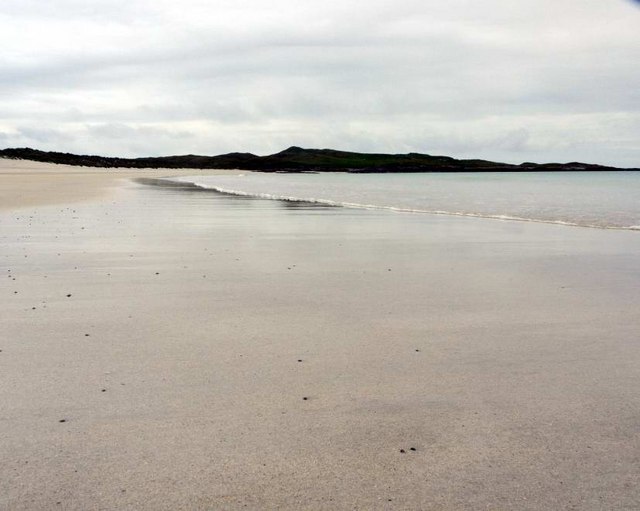
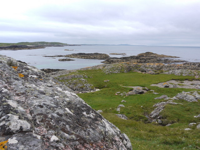
Sgeir Araichean is a small island located off the west coast of Scotland in Argyllshire. It is a rocky and uninhabited islet that forms part of the Garvellachs archipelago in the Inner Hebrides. The island is situated approximately 10 miles southwest of Oban and covers an area of around 0.1 square kilometers.

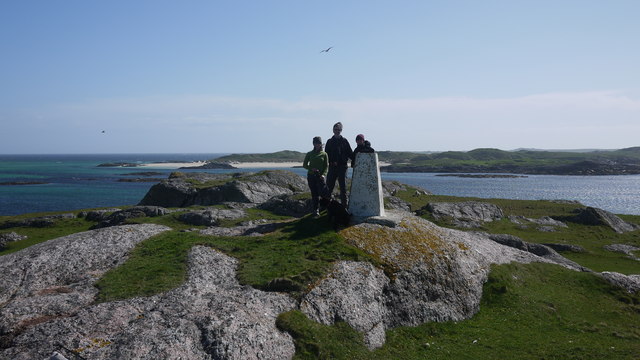
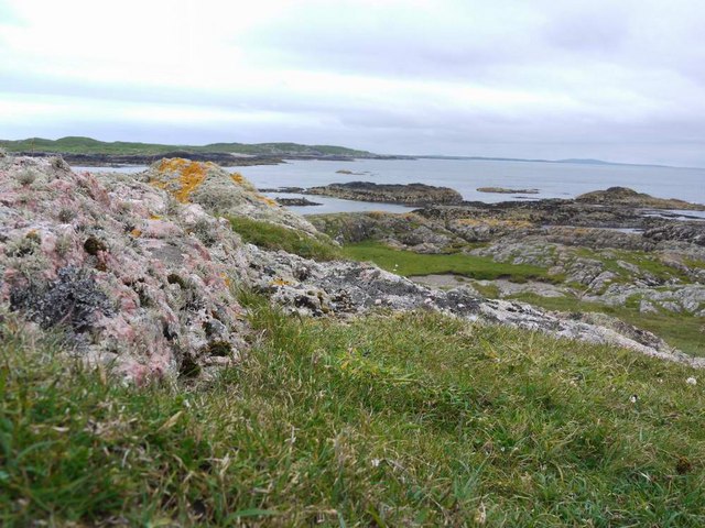
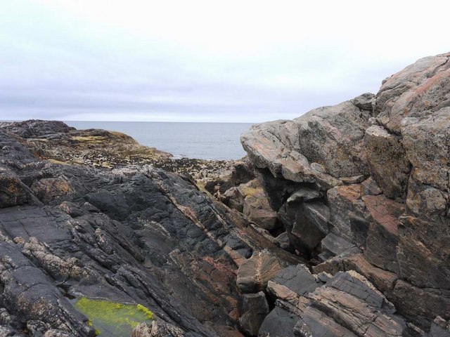
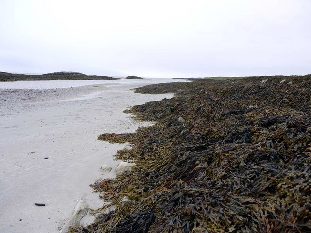
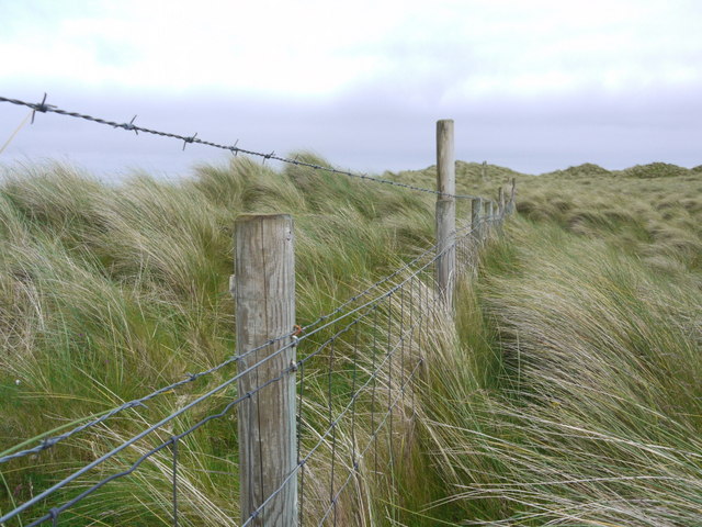
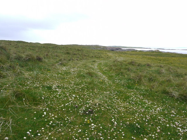
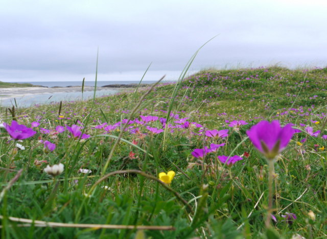
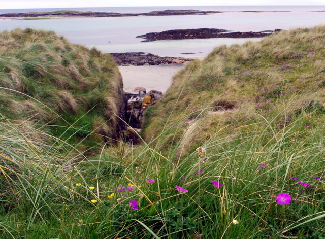
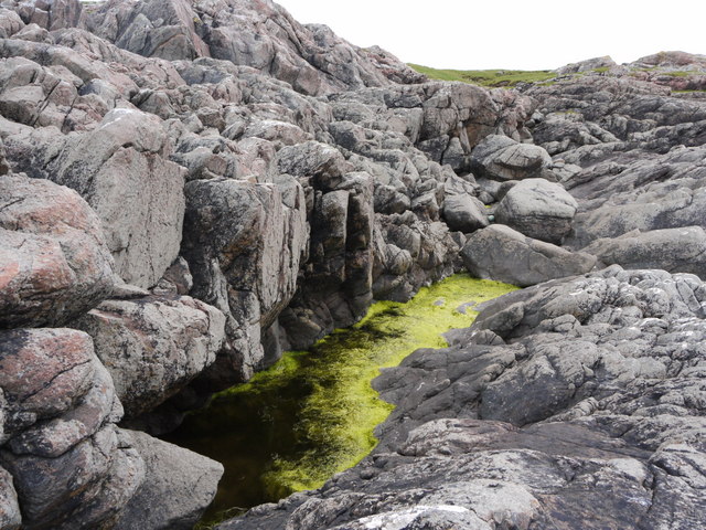
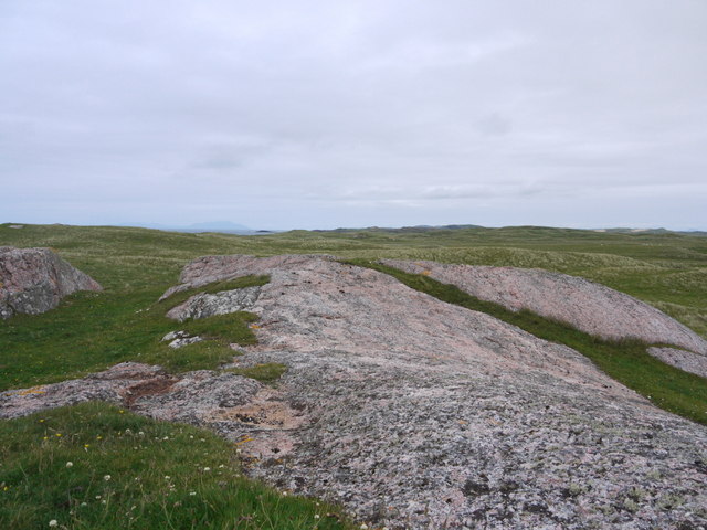
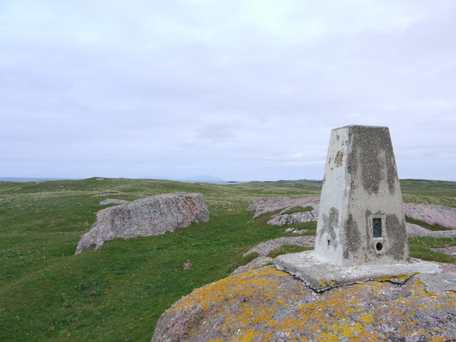
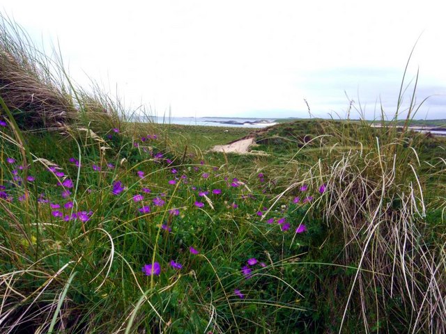
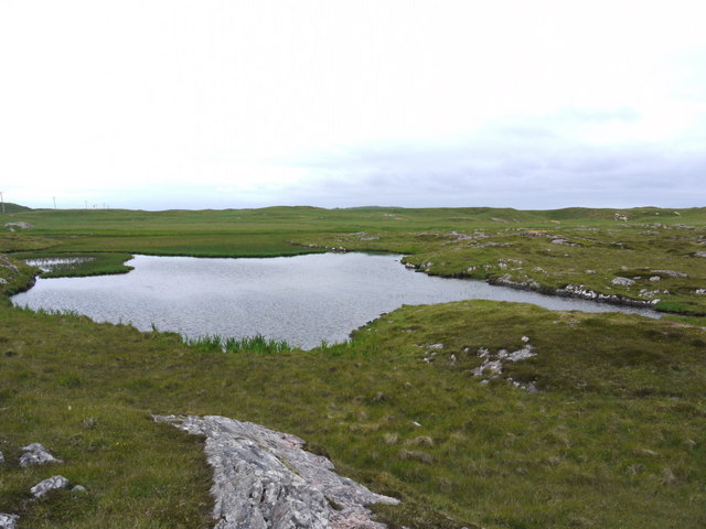
Sgeir Araichean is characterized by its rugged and jagged coastline, with steep cliffs rising from the surrounding waters. The terrain is predominantly rocky, with very limited vegetation. The island's highest point reaches only a few meters above sea level.

Due to its remote location and challenging access, Sgeir Araichean is rarely visited by humans. However, it serves as an important habitat for various bird species. The island is known to be a breeding ground for seabirds, including puffins, guillemots, and razorbills. These birds take advantage of the rocky cliffs and inaccessible ledges for nesting and rearing their young.

The surrounding waters of Sgeir Araichean are also home to a diverse marine ecosystem. They offer an abundance of food sources for the resident bird population, as well as providing a habitat for seals and other marine mammals.

Overall, Sgeir Araichean is an isolated and untouched island, rich in wildlife and natural beauty. Its pristine environment and untouched landscapes make it an intriguing destination for nature enthusiasts and wildlife lovers seeking a unique and undisturbed experience in the Scottish wilderness.

If you have any feedback on the listing, please let us know in the comments section below.

Sgeir Araichean Images

Images are sourced within 2km of 56.578015/-6.6786461 or Grid Reference NM1252. Thanks to Geograph Open Source API. All images are credited.

Trig point at Calgary Point
Calgary Point Looking over to Gunna
Calgary Point
Looking over to Gunna
Rock outcrops near Calgary Point
Low tide at the west end of Crossapol Bay Crossapol Bay is yet another of Coll's lovely sandy bays - about 2Km wide and there will probably only be you on it!
Low tide at the west end of Crossapol Bay
Crossapol Bay is yet another of Coll's lovely sandy bays - about 2Km wide and there will probably only be you on it!
Traigh Feall
Traigh Feall
Unfriendly fence We had walked from Calgary Point round to Feall Bay but got on the wrong side of this fence - not simple to cross with its wire-netting and two strands of barbed wire!
Unfriendly fence
We had walked from Calgary Point round to Feall Bay but got on the wrong side of this fence - not simple to cross with its wire-netting and two strands of barbed wire!
Trio of orchids All part of the joy of the Coll machairs.
Trio of orchids
All part of the joy of the Coll machairs.
Machair blossoms near Port Mine
The path to Calgary Point There is a faint waymarked (occasionally!) path all the way from the car park at Crossapol, via Feall Bay, to Calgary Point.
The path to Calgary Point
There is a faint waymarked (occasionally!) path all the way from the car park at Crossapol, via Feall Bay, to Calgary Point.
Footpath sign on Coll Left to Crossapol Beach, right to Calgary Point and behind the photographer to Feall Beach.  There is waymarking on the path to Calgary Point but it is a little spasmodic (June 2011).
Footpath sign on Coll
Left to Crossapol Beach, right to Calgary Point and behind the photographer to Feall Beach. There is waymarking on the path to Calgary Point but it is a little spasmodic (June 2011).
The machair in bloom at Traigh Halum
Rocky inlet at Traigh Halum Bloody cranesbill, daisies and buttercups in bloom in the machair.
Rocky inlet at Traigh Halum
Bloody cranesbill, daisies and buttercups in bloom in the machair.
Weedy tide-pool near Calgary Point
Exposed rock at Calgary Point The hills of Rum just visible in the distance.
Exposed rock at Calgary Point
The hills of Rum just visible in the distance.
The trig at Calgary Point The hills of Rum visible in the distance.
The trig at Calgary Point
The hills of Rum visible in the distance.
Calgary Point Looking over to the island of Gunna and, beyond that, Tiree.
Calgary Point
Looking over to the island of Gunna and, beyond that, Tiree.
Bloody cranesbill and dunes at Traigh nan Siolag Tiree in the distance.
Bloody cranesbill and dunes at Traigh nan Siolag
Tiree in the distance.
Lochan a' Chuirn
Lochan a' Chuirn
Show me another place!

Sgeir Araichean is located at Grid Ref: NM1252 (Lat: 56.578015, Lng: -6.6786461)

Unitary Authority: Argyll and Bute

Police Authority: Argyll and West Dunbartonshire

What 3 Words

///deeper.shorthand.ventures. Near Arinagour, Argyll & Bute
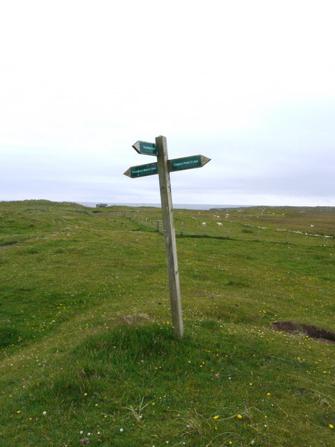
Related Wikis

Gunna, Scotland

Gunna (Gaelic: Gunnaigh) is an island in the Inner Hebrides of Scotland. == Geography and geology == Gunna lies between Coll and Tiree, closer to Coll...

Breachacha crannog

The Breachacha crannog is a crannog located near Loch Breachacha, on the Inner Hebridean island of Coll. The crannog is recognised in the United Kingdom...

Breachacha Castle

Breachacha Castle (also spelled Breacachadh) is either of two structures on the shore of Loch Breachacha, on the Inner Hebridean island of Coll, Scotland...

Coll Airport

Coll Island Airport (IATA: COL, ICAO: EGEL) (Scottish Gaelic: Port-adhair Cholla) is located 5 NM (9.3 km; 5.8 mi) west southwest of Arinagour on the island...

Nearby Amenities

Located within 500m of 56.578015,-6.6786461
Natural: rock
Source: OS7
Tidal: yes
Lat/Long: 56.5752223/-6.6728543
Natural: rock
Source: OS7
Tidal: yes
Lat/Long: 56.5752223/-6.673551
Natural: rock
Source: OS7
Tidal: yes
Lat/Long: 56.5749996/-6.6741011
Natural: rock
Source: OS7
Tidal: yes
Lat/Long: 56.5754247/-6.6745779
Natural: rock
Source: OS7
Tidal: yes
Lat/Long: 56.5750199/-6.6748713
Natural: rock
Source: OS7
Tidal: yes
Lat/Long: 56.5756878/-6.6751646
Natural: rock
Source: OS7
Tidal: yes
Lat/Long: 56.5754854/-6.675898
Natural: rock
Source: OS7
Tidal: yes
Lat/Long: 56.5760927/-6.6738445
Natural: rock
Source: OS7
Tidal: yes
Lat/Long: 56.5771655/-6.6709106
Natural: rock
Source: OS7
Tidal: yes
Lat/Long: 56.5776715/-6.6711674
Natural: rock
Source: OS7
Tidal: yes
Lat/Long: 56.5771452/-6.6790152
Natural: rock
Source: OS7
Tidal: yes
Lat/Long: 56.5776917/-6.6789052
Natural: rock
Source: OS7
Tidal: yes
Lat/Long: 56.5782787/-6.6789052
Natural: rock
Source: OS7
Tidal: yes
Lat/Long: 56.5786228/-6.6767415
Natural: rock
Source: OS7
Tidal: yes
Lat/Long: 56.5779143/-6.6770716
Natural: rock
Source: OS7
Tidal: yes
Lat/Long: 56.5784608/-6.675678
Generator Method: wind_turbine
Generator Source: wind
Generator Type: horizontal_axis
Power: generator
Lat/Long: 56.5772729/-6.6838424
Crossapol
Name Gd: Crosabol
Place: isolated_dwelling
Lat/Long: 56.5820552/-6.6799861
Power: pole
Lat/Long: 56.5768279/-6.686004
Power: pole
Lat/Long: 56.5774425/-6.6850491
Power: pole
Lat/Long: 56.5780349/-6.6841103
Power: pole
Lat/Long: 56.5788165/-6.6834264
Power: pole
Lat/Long: 56.5795108/-6.6828256
Power: pole
Lat/Long: 56.5803026/-6.6821389
Power: pole
Lat/Long: 56.5823287/-6.6797222
Power: pole
Lat/Long: 56.5818545/-6.6808032
Power: pole
Lat/Long: 56.581073/-6.6814657
Generator Method: wind_turbine
Generator Source: wind
Generator Type: horizontal_axis
Power: generator
Lat/Long: 56.5763526/-6.6842365
Caolas
Name Gd: An Caolas Collach
Place: isolated_dwelling
Lat/Long: 56.5781961/-6.6827826
Barrier: cattle_grid
Lat/Long: 56.5794104/-6.6821209
The data included in this document is from www.openstreetmap.org. The data is made available under ODbL.

Have you been to Sgeir Araichean?

Leave your review of Sgeir Araichean below (or comments, questions and feedback).