Aird an t-Srutha

Coastal Feature, Headland, Point in Ross-shire

Scotland

Aird an t-Srutha

Old tractor I'm no expert but I think this is a Ferguson TEA20 of about 1950 vintage with Loch Ròg Beag as a backdrop.
Old tractor Credit: Jo and Steve Turner

Aird an t-Srutha is a prominent coastal feature located in Ross-shire, Scotland. It is a headland or point that juts out into the sea, offering breathtaking views and a diverse range of natural features.

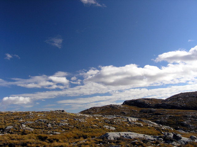
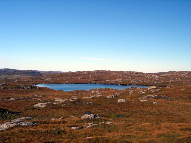
Situated on the northern coast of the country, Aird an t-Srutha is known for its rugged and dramatic cliffs that rise sharply from the sea. The headland is composed of sedimentary rocks, which have been shaped and eroded by the relentless waves and wind over centuries. This geological formation adds to the area's unique charm and beauty.

The headland provides a habitat for a variety of plant and animal species. The exposed cliffs are home to seabird colonies, including kittiwakes, guillemots, and razorbills. These birds nest on the precarious ledges, making it a popular spot for birdwatching enthusiasts. Additionally, the surrounding waters host a diverse marine ecosystem that includes seals, dolphins, and even occasional sightings of whales.

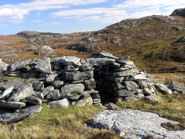
Aird an t-Srutha is a popular destination for outdoor enthusiasts, offering numerous walking trails along the cliffs and coastal paths. The views from the headland are awe-inspiring, with panoramic vistas of the North Sea and the surrounding countryside. On a clear day, it is possible to see as far as the Inner Hebrides.

Overall, Aird an t-Srutha is a remarkable coastal feature that showcases Scotland's natural beauty. With its striking cliffs, diverse wildlife, and stunning views, it is a must-visit location for anyone exploring the Ross-shire region.

If you have any feedback on the listing, please let us know in the comments section below.

Aird an t-Srutha Images

Images are sourced within 2km of 58.163286/-6.8848912 or Grid Reference NB1229. Thanks to Geograph Open Source API. All images are credited.

Old tractor I'm no expert but I think this is a Ferguson TEA20 of about 1950 vintage with Loch Ròg Beag as a backdrop.
Old tractor
I'm no expert but I think this is a Ferguson TEA20 of about 1950 vintage with Loch Ròg Beag as a backdrop.
Loch Ròg Beag Viewed from Einacleite.
Loch Ròg Beag
Viewed from Einacleite.
Inlet to Loch Croistean and ford
Looking down Loch Croistean. Good brown trout fishing and a few finnock
Looking down Loch Croistean.
Good brown trout fishing and a few finnock
Ruined blackhouse, Ungaisidar
Looking towards Loch Croistean from the B8011
Cairn, Druim Sandavig, Isle of Lewis This is one of several similarly shaped cairns in the area.  See also <a href="https://www.geograph.org.uk/photo/6205869">NB1229 : Cairn, Druim Sandavig, Isle of Lewis</a>.
Cairn, Druim Sandavig, Isle of Lewis
This is one of several similarly shaped cairns in the area. See also NB1229 : Cairn, Druim Sandavig, Isle of Lewis.
Cairn, Druim Sandavig, Isle of Lewis This is one of several similarly shaped cairns in the area.  See also <a href="https://www.geograph.org.uk/photo/6205867">NB1129 : Cairn, Druim Sandavig, Isle of Lewis</a>.
Cairn, Druim Sandavig, Isle of Lewis
This is one of several similarly shaped cairns in the area. See also NB1129 : Cairn, Druim Sandavig, Isle of Lewis.
Sharp bend in the road near Loch Sanndabhat
Phonebox and Loch Rog Beag
Loch Croistean, West Lewis. Loch with boathouse at the side of the B8011.
Loch Croistean, West Lewis.
Loch with boathouse at the side of the B8011.
Loch Sanndabhat Southwest of the settlement of Ungisiadar.
Loch Sanndabhat
Southwest of the settlement of Ungisiadar.
Crofthouse at Ungisiadar Overlooking Loch Ròg Beag.
Crofthouse at Ungisiadar
Overlooking Loch Ròg Beag.
Disused Croft Buildings Ungisiadar.
Disused Croft Buildings
Ungisiadar.
Shieling above Strome Ruined shieling on high ground above Strome and Drovinish.
Shieling above Strome
Ruined shieling on high ground above Strome and Drovinish.
Shieling above Strome Ruined shieling above Strome and Drovinish.  The hill behind is Creag na h-Iolaire, the rock of the eagle.
Shieling above Strome
Ruined shieling above Strome and Drovinish. The hill behind is Creag na h-Iolaire, the rock of the eagle.
Enaclete, Uig From across Little Loch Roag.  The red-roofed house belongs to Croft No.1.
Enaclete, Uig
From across Little Loch Roag. The red-roofed house belongs to Croft No.1.
Loch Uamasbroc
Loch Uamasbroc
Show me another place!

Aird an t-Srutha is located at Grid Ref: NB1229 (Lat: 58.163286, Lng: -6.8848912)

Unitary Authority: Na h-Eileanan an Iar

Police Authority: Highlands and Islands

What 3 Words

///stated.dearest.cried. Near Carloway, Na h-Eileanan Siar

Related Wikis

Fuaigh Beag

Fuaigh Beag or Vuia Be(a)g is an island in the Outer Hebrides. It is off the west coast of Lewis near Great Bernera in Loch Roag. Its name means "little...

Gisla Hydro-Electric Scheme

Gisla Hydro-Electric Scheme was a small scheme promoted by the North of Scotland Hydro-Electric Board on the Isle of Lewis, Outer Hebrides, Scotland. It...

Flodaigh, Lewis

Flodaigh is a small island in Loch Roag on the west coast of Lewis in the Outer Hebrides of Scotland. It is about 33 hectares (82 acres) in extent and...

Loch Ròg

Loch Ròg or Loch Roag is a large sea loch on the west coast of Lewis, Outer Hebrides. It is broadly divided into East Loch Roag and West Loch Roag with...

Nearby Amenities

Located within 500m of 58.163286,-6.8848912
Power: pole
Lat/Long: 58.1617754/-6.892592
Power: pole
Lat/Long: 58.1624428/-6.8919668
Power: pole
Lat/Long: 58.162577/-6.8913154
Power: pole
Lat/Long: 58.162754/-6.8906189
The data included in this document is from www.openstreetmap.org. The data is made available under ODbL.

Have you been to Aird an t-Srutha?

Leave your review of Aird an t-Srutha below (or comments, questions and feedback).