Eilean an Fheoir

Island in Argyllshire

Scotland

Eilean an Fheoir

Gunna The 36m highpoint of the island at the west end.
Gunna Credit: Richard Webb

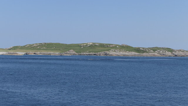
Eilean an Fheoir, also known as Eilean Fheoir or the Island of Grass, is a small uninhabited island located off the west coast of Argyllshire in Scotland. Situated in the Sound of Islay, it lies approximately 2 kilometers northeast of the Isle of Islay.

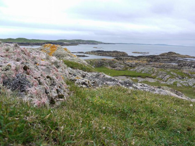
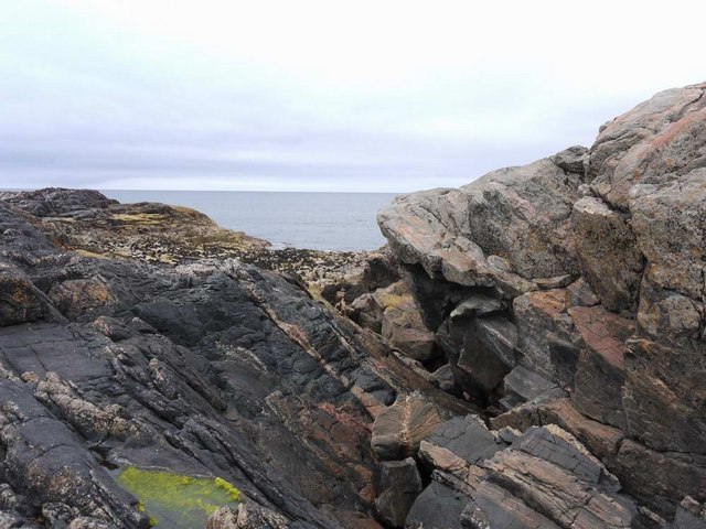
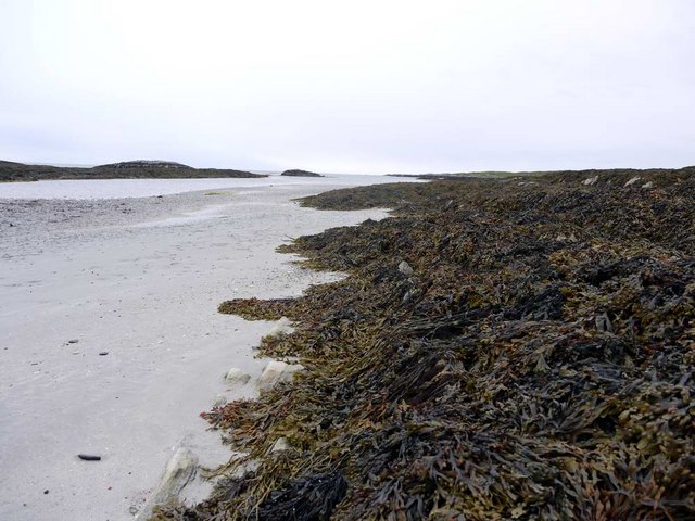
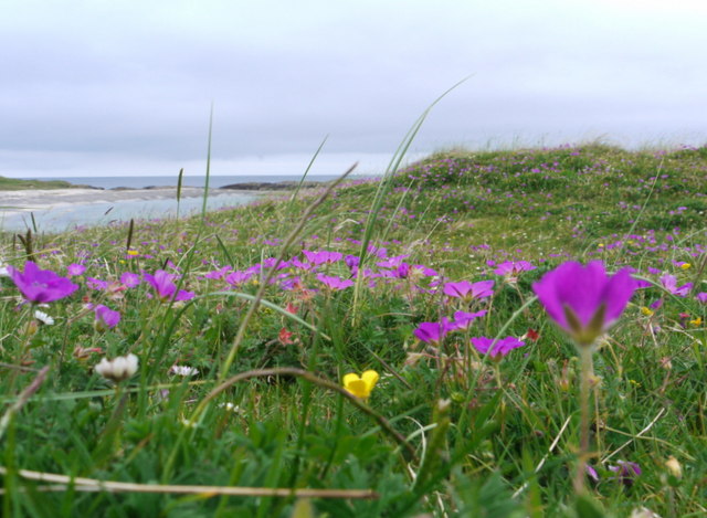
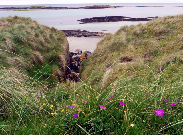
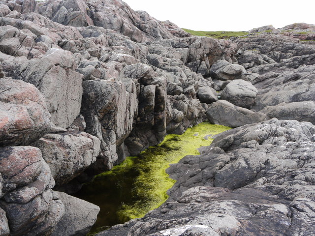
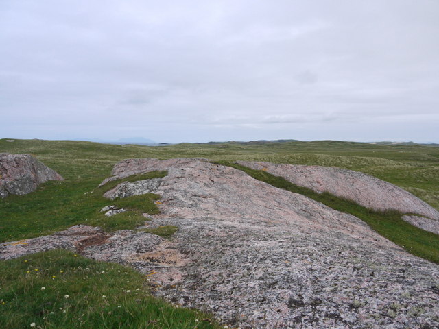
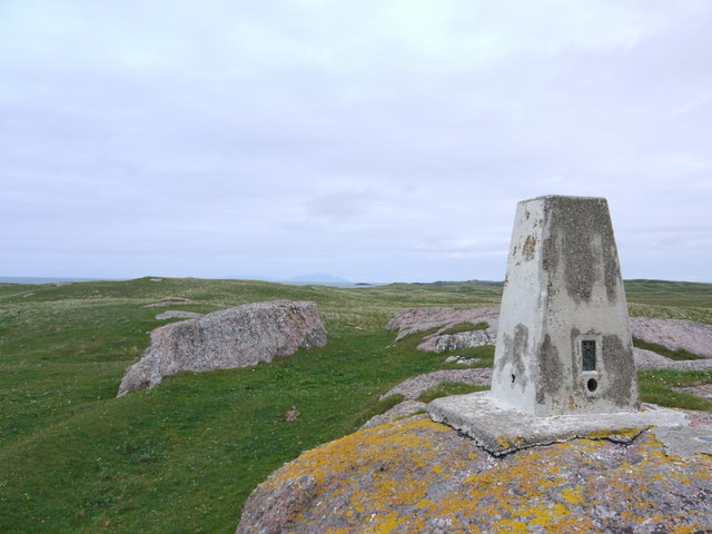
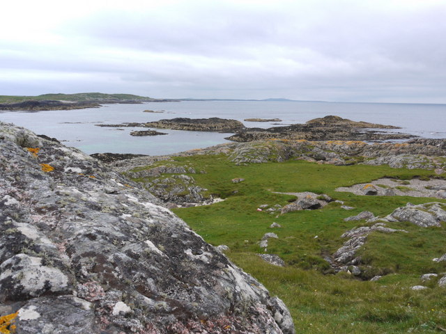
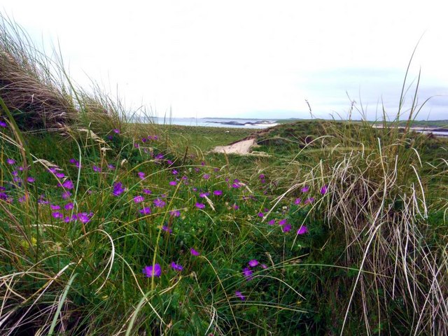
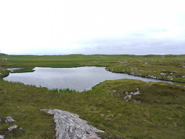
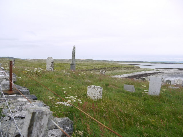
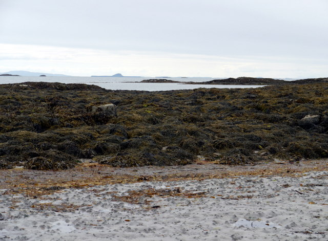
Eilean an Fheoir covers an area of about 20 hectares and is characterized by its rugged and rocky terrain, with low-lying grassy areas that give the island its name. The island is surrounded by steep cliffs, reaching heights of around 30 meters, and is mostly inaccessible from the sea due to these treacherous shores.

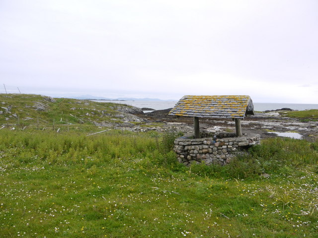
Despite being uninhabited, Eilean an Fheoir has historically played a significant role in the region. The island was once utilized as a grazing ground for sheep from neighboring islands, and evidence of old stone walls can still be seen, marking the boundaries of these pastures.

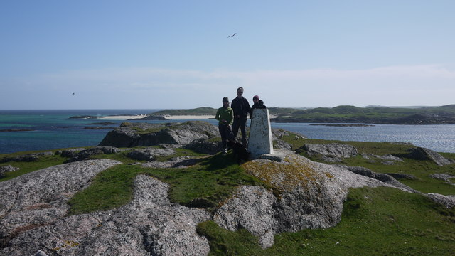
Today, Eilean an Fheoir is mainly frequented by wildlife enthusiasts and birdwatchers, as it serves as a breeding ground for various seabird species, including gulls, fulmars, and guillemots. The island's remote location and lack of human presence provide a sanctuary for these birds, making it an important site for conservation efforts.

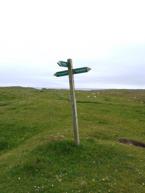
Visitors to Eilean an Fheoir can enjoy breathtaking views of the surrounding seascape and wildlife, but should exercise caution when approaching the island due to its challenging terrain and limited accessibility.

If you have any feedback on the listing, please let us know in the comments section below.

Eilean an Fheoir Images

Images are sourced within 2km of 56.574556/-6.7044566 or Grid Reference NM1152. Thanks to Geograph Open Source API. All images are credited.

Gunna The 36m highpoint of the island at the west end.
Gunna
The 36m highpoint of the island at the west end.
Trig point at Calgary Point
Calgary Point Looking over to Gunna
Calgary Point
Looking over to Gunna
Rock outcrops near Calgary Point
Low tide at the west end of Crossapol Bay Crossapol Bay is yet another of Coll's lovely sandy bays - about 2Km wide and there will probably only be you on it!
Low tide at the west end of Crossapol Bay
Crossapol Bay is yet another of Coll's lovely sandy bays - about 2Km wide and there will probably only be you on it!
Footpath sign on Coll Left to Crossapol Beach, right to Calgary Point and behind the photographer to Feall Beach.  There is waymarking on the path to Calgary Point but it is a little spasmodic (June 2011).
Footpath sign on Coll
Left to Crossapol Beach, right to Calgary Point and behind the photographer to Feall Beach. There is waymarking on the path to Calgary Point but it is a little spasmodic (June 2011).
The machair in bloom at Traigh Halum
Rocky inlet at Traigh Halum Bloody cranesbill, daisies and buttercups in bloom in the machair.
Rocky inlet at Traigh Halum
Bloody cranesbill, daisies and buttercups in bloom in the machair.
Weedy tide-pool near Calgary Point
Exposed rock at Calgary Point The hills of Rum just visible in the distance.
Exposed rock at Calgary Point
The hills of Rum just visible in the distance.
The trig at Calgary Point The hills of Rum visible in the distance.
The trig at Calgary Point
The hills of Rum visible in the distance.
Calgary Point Looking over to the island of Gunna and, beyond that, Tiree.
Calgary Point
Looking over to the island of Gunna and, beyond that, Tiree.
Bloody cranesbill and dunes at Traigh nan Siolag Tiree in the distance.
Bloody cranesbill and dunes at Traigh nan Siolag
Tiree in the distance.
Lochan a' Chuirn
Lochan a' Chuirn
Well at Coales House Known by this name on the OS 50,000 mapping, but named "Walkers Cottage" on the 25,000 version.  This well has what appears to be a pump and waterpipe emerging so is not merely decorative.  Caoles House appears to be derelict.
Well at Coales House
Known by this name on the OS 50,000 mapping, but named "Walkers Cottage" on the 25,000 version. This well has what appears to be a pump and waterpipe emerging so is not merely decorative. Caoles House appears to be derelict.
Caoles House (aka Walkers Cottage) Seen over the machair in full bloom.
Caoles House (aka Walkers Cottage)
Seen over the machair in full bloom.
Burial ground at Crossapol According to "Guide to Coll" by Betty MacDougall, high tides wrought such havoc on this graveyard that it could no longer be used.
Burial ground at Crossapol
According to "Guide to Coll" by Betty MacDougall, high tides wrought such havoc on this graveyard that it could no longer be used.
Low tide at the west end of Crossapol Bay The central island in the distance is Bac Mor, better known as Dutchman's Cap.
Low tide at the west end of Crossapol Bay
The central island in the distance is Bac Mor, better known as Dutchman's Cap.
Show me another place!

Eilean an Fheoir is located at Grid Ref: NM1152 (Lat: 56.574556, Lng: -6.7044566)

Unitary Authority: Argyll and Bute

Police Authority: Argyll and West Dunbartonshire

What 3 Words

///laminated.served.skater. Near Scarinish, Argyll & Bute

Related Wikis

Gunna, Scotland

Gunna (Gaelic: Gunnaigh) is an island in the Inner Hebrides of Scotland. == Geography and geology == Gunna lies between Coll and Tiree, closer to Coll...

Breachacha crannog

The Breachacha crannog is a crannog located near Loch Breachacha, on the Inner Hebridean island of Coll. The crannog is recognised in the United Kingdom...

Breachacha Castle

Breachacha Castle (also spelled Breacachadh) is either of two structures on the shore of Loch Breachacha, on the Inner Hebridean island of Coll, Scotland...

Dùn Beic

Dùn Beic is a dun located on the Inner Hebridean island of Coll. It is located at grid reference NM15495644 and is thought to date to between 1000 BCE...

Coll Airport

Coll Island Airport (IATA: COL, ICAO: EGEL) (Scottish Gaelic: Port-adhair Cholla) is located 5 NM (9.3 km; 5.8 mi) west southwest of Arinagour on the island...

Dùn an Achaidh

Dùn an Achaidh, sometimes Anglicised as Dun Acha, is a dun located near the village of Acha on the Inner Hebridean island of Coll. It is considered the...

Acha, Coll

Acha (Gaelic: An t-Achadh, tranlsating to "The Field") is a small hamlet on the Scottish island of Coll. == References == == See also == Dùn an Achaidh...

Dun Mor Vaul

Dun Mor Vaul (or simply Dun Mor; Scottish Gaelic: Dùn Mòr) is an iron-age broch located on the north coast of the island of Tiree, in Scotland. ��2�...

Nearby Amenities

Located within 500m of 56.574556,-6.7044566
Natural: rock
Source: OS7
Tidal: yes
Lat/Long: 56.5746134/-6.7103019
Natural: rock
Source: OS7
Tidal: yes
Lat/Long: 56.5741478/-6.7104965
Natural: rock
Source: OS7
Tidal: yes
Lat/Long: 56.5739688/-6.7115993
Natural: rock
Source: OS7
Tidal: yes
Lat/Long: 56.5735749/-6.7104317
Natural: rock
Source: OS7
Tidal: yes
Lat/Long: 56.573754/-6.7088099
Natural: rock
Source: OS7
Tidal: yes
Lat/Long: 56.5715697/-6.7081613
Natural: rock
Source: OS7
Tidal: yes
Lat/Long: 56.571319/-6.7068638
Natural: rock
Source: OS7
Tidal: yes
Lat/Long: 56.5716413/-6.7049827
Natural: rock
Source: OS7
Tidal: yes
Lat/Long: 56.5717129/-6.703815
Natural: rock
Source: OS7
Tidal: yes
Lat/Long: 56.5711758/-6.7036852
Natural: rock
Source: OS7
Tidal: yes
Lat/Long: 56.5707103/-6.7038799
Natural: rock
Source: OS7
Tidal: yes
Lat/Long: 56.5714623/-6.7017392
Natural: rock
Source: OS7
Tidal: yes
Lat/Long: 56.570746/-6.7078369
Natural: rock
Source: OS7
Tidal: yes
Lat/Long: 56.5706028/-6.7067341
The data included in this document is from www.openstreetmap.org. The data is made available under ODbL.

Have you been to Eilean an Fheoir?

Leave your review of Eilean an Fheoir below (or comments, questions and feedback).