Sgeir Tarcall

Island in Inverness-shire

Scotland

Sgeir Tarcall

Moorland on Beinn Dhubh, Harris
Moorland on Beinn Dhubh, Harris Credit: wrobison

Sgeir Tarcall is a small island located off the west coast of Inverness-shire, Scotland. It is situated in the Inner Hebrides, specifically in the Sound of Mull. The island is part of the larger group of islands known as the Small Isles, which also includes Eigg, Muck, and Rum.

Sgeir Tarcall is relatively small, measuring approximately 1.5 hectares in size. It is characterized by its rugged and rocky terrain, with steep cliffs surrounding its coastlines. The island is uninhabited and lacks any significant vegetation, making it a challenging place for human settlement.

Despite its inhospitable nature, Sgeir Tarcall is known for its diverse wildlife. The surrounding waters are home to various species of marine mammals, including seals and dolphins. The island itself serves as a nesting site for seabirds such as puffins, guillemots, and razorbills.

The island's remote location and natural beauty make it a popular destination for wildlife enthusiasts and birdwatchers. Visitors can reach Sgeir Tarcall by boat, with ferry services available from nearby ports such as Mallaig and Tobermory. However, it is essential to note that access to the island may be limited due to its protected status and conservation efforts.

Sgeir Tarcall offers a unique opportunity to experience the untamed beauty of the Scottish coast and observe its diverse marine and avian life. It is a place where nature's raw power and tranquility converge, providing a truly awe-inspiring experience for those who venture to its shores.

If you have any feedback on the listing, please let us know in the comments section below.

Sgeir Tarcall Images

Images are sourced within 2km of 57.909318/-6.927821 or Grid Reference NB0801. Thanks to Geograph Open Source API. All images are credited.
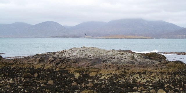
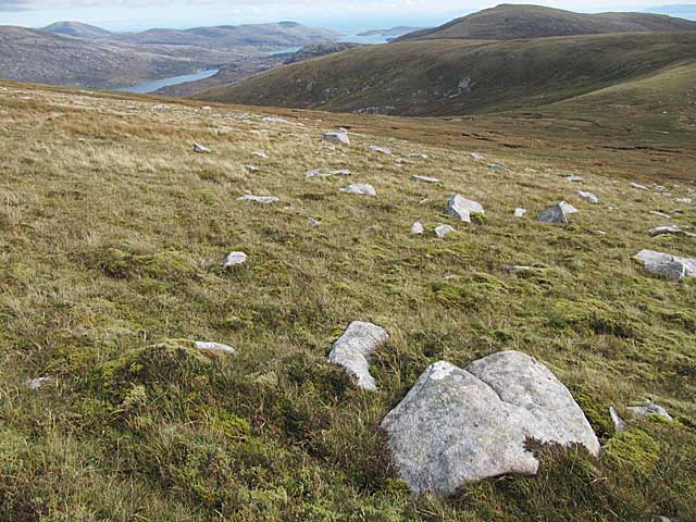
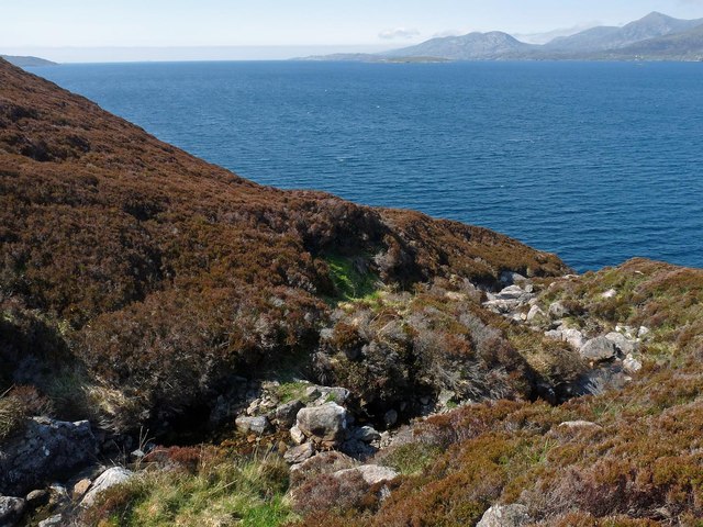
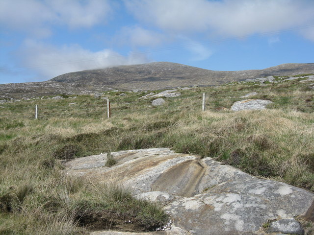
Moorland on Beinn Dhubh, Harris
View west from Beinn Dhubh, Harris Looking towards the island of Taransay.
View west from Beinn Dhubh, Harris
Looking towards the island of Taransay.
Driftwood on the shore One wonders how far these worm ridden tree trunks might have travelled to be washed up on the rocky shores of Harris.
Driftwood on the shore
One wonders how far these worm ridden tree trunks might have travelled to be washed up on the rocky shores of Harris.
Rocks and sand near Losgaintir Looking south along the rocky shoreline towards the big beach of Traigh Rosamol.
Rocks and sand near Losgaintir
Looking south along the rocky shoreline towards the big beach of Traigh Rosamol.
Mol nan Stop The rocky headland at Mol nan Stop, looking across the waters to the hills of North Harris.
Mol nan Stop
The rocky headland at Mol nan Stop, looking across the waters to the hills of North Harris.
A very curious rock A large boulder perched on smaller rocks near to the point at Mol nan Stop.  How did it get here? It is too heavy to be manhandled, except maybe by the giant MacAskill <a href="https://www.geograph.org.uk/gridref/NF8980">NF8980</a> or Donald Mor Maclellan <a href="https://www.geograph.org.uk/gridref/NF7475">NF7475</a>. To be thrown up here by the waves seems very unlikely, so one is left with the theory that it is a perched block left here as a result of glacial action, as with the well known Norber Erratics in the Yorkshire Dales <a href="https://www.geograph.org.uk/gridref/SD7669">SD7669</a>.
A very curious rock
A large boulder perched on smaller rocks near to the point at Mol nan Stop. How did it get here? It is too heavy to be manhandled, except maybe by the giant MacAskill NF8980 or Donald Mor Maclellan NF7475. To be thrown up here by the waves seems very unlikely, so one is left with the theory that it is a perched block left here as a result of glacial action, as with the well known Norber Erratics in the Yorkshire Dales SD7669.
Mol an Tighe Rocky shoreline at Mol an Tighe. Many colours and varieties of Lewisian Gneiss are on display here.
Mol an Tighe
Rocky shoreline at Mol an Tighe. Many colours and varieties of Lewisian Gneiss are on display here.
Rocky coastline at Mol an Tighe Looking across the rocky shoreline at Mol an Tighe towards the shapely peak of Sgaoth Iosal [531m] which is to the north of Tarbert.
Rocky coastline at Mol an Tighe
Looking across the rocky shoreline at Mol an Tighe towards the shapely peak of Sgaoth Iosal [531m] which is to the north of Tarbert.
Tartur Geo, Tarcall, Harris Looking towards the skerry, Sgeir Tarcall, and beyond to the mountains of North Harris.
Tartur Geo, Tarcall, Harris
Looking towards the skerry, Sgeir Tarcall, and beyond to the mountains of North Harris.
The Uisg a' Ri, Tarcall, Harris Looking across Loch a' Sair towards the mountains of North Harris.
The Uisg a' Ri, Tarcall, Harris
Looking across Loch a' Sair towards the mountains of North Harris.
Cattle above the Sound of Taransay/Caolas Tharasaigh, Harris Looking towards Tràigh Rosamol and Toe Head/Gob an Tobha beyond.
Cattle above the Sound of Taransay/Caolas Tharasaigh, Harris
Looking towards Tràigh Rosamol and Toe Head/Gob an Tobha beyond.
Ruined building, Àird Grothadnais, Harris The building lies adjacent to the field bounded by the wall shown at <a href="https://www.geograph.org.uk/photo/1518354">NB0601 : Ancient wall and Beinn Dubh</a>.
Ruined building, Àird Grothadnais, Harris
The building lies adjacent to the field bounded by the wall shown at NB0601 : Ancient wall and Beinn Dubh.
Lazy beds above Mol nan Stòp, Harris Looking across Loch a Siar towards the peaks of North Harris.  The highest peak is Tiorga Mòr.
Lazy beds above Mol nan Stòp, Harris
Looking across Loch a Siar towards the peaks of North Harris. The highest peak is Tiorga Mòr.
Beinn Dhubh, from the road to Luskentyre Rocky moorland/grassland of the Frith Losgaintir
Beinn Dhubh, from the road to Luskentyre
Rocky moorland/grassland of the Frith Losgaintir
Mol nan Stòp
Mol nan Stòp
Old dry stone wall, Mol an Tighe
Beinn Dhubh trig point
Sgeir Tarcall
Sgeir Tarcall
Show me another place!

Sgeir Tarcall is located at Grid Ref: NB0801 (Lat: 57.909318, Lng: -6.927821)

Unitary Authority: Na h-Eileanan an Iar

Police Authority: Highlands and Islands

What 3 Words

///organisms.seaweed.brief. Near Tarbert, Na h-Eileanan Siar

Related Wikis

West Loch Tarbert

West Loch Tarbert (Scottish Gaelic: Loch A Siar) is a sea loch that separates the northern and southern parts of Harris in the Outer Hebrides of Scotland...

Luskentyre

Luskentyre (Scottish Gaelic: Losgaintir) is a sparse settlement on the west coast of Harris, in the Outer Hebrides, Scotland. Luskentyre is situated within...

Soay Mòr

Soay Mòr (Scottish Gaelic: Sòdhaigh Mòr) is an island in West Loch Tarbert, between the northern and southern parts of Harris. The uninhabited island is...

Soay Sound

Soay Sound (Scottish Gaelic: Caolas Shòdhaigh) is a strait separating the islands of Soay Mòr and Soay Beag from the northern part of Harris. The sound...

Nearby Amenities

Located within 500m of 57.909318,-6.927821
Created By: dmgroom_coastlines
Lat/Long: 57.9054379/-6.9312728
Created By: dmgroom_coastlines
Lat/Long: 57.9056879/-6.9307828
Created By: dmgroom_coastlines
Lat/Long: 57.9063079/-6.9295428
Created By: dmgroom_coastlines
Lat/Long: 57.9068179/-6.9292728
Created By: dmgroom_coastlines
Lat/Long: 57.9080679/-6.9272828
Created By: dmgroom_coastlines
Lat/Long: 57.9106279/-6.9203928
The data included in this document is from www.openstreetmap.org. The data is made available under ODbL.

Have you been to Sgeir Tarcall?

Leave your review of Sgeir Tarcall below (or comments, questions and feedback).