Sgeir an Tairbh

Island in Inverness-shire

Scotland

Sgeir an Tairbh

Houses on Boreray/Boraraigh
Houses on Boreray/Boraraigh Credit: Sandy Gerrard

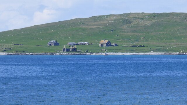
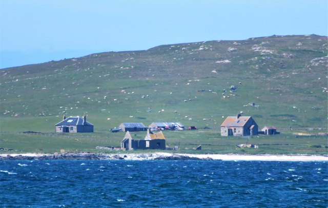
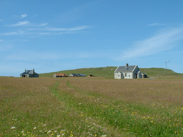
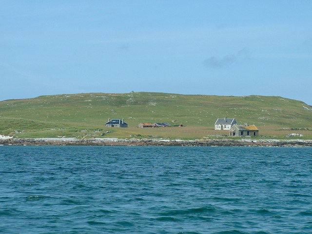
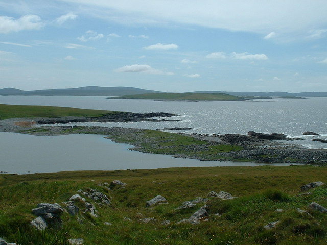
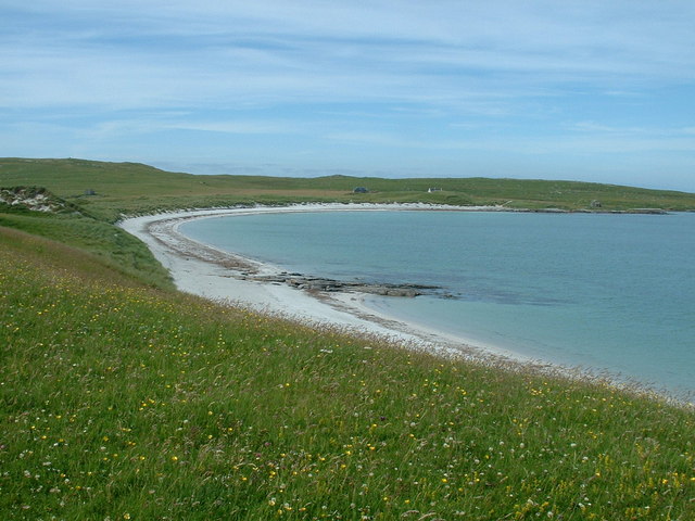
Sgeir an Tairbh is a small uninhabited island located off the coast of Inverness-shire, Scotland. Situated in the Moray Firth, it is part of a group of islands known as the Inner Hebrides. Sgeir an Tairbh translates to "rock of the bull" in Scottish Gaelic, reflecting its rugged and rocky landscape.

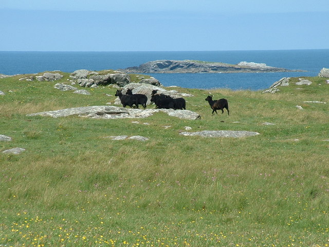
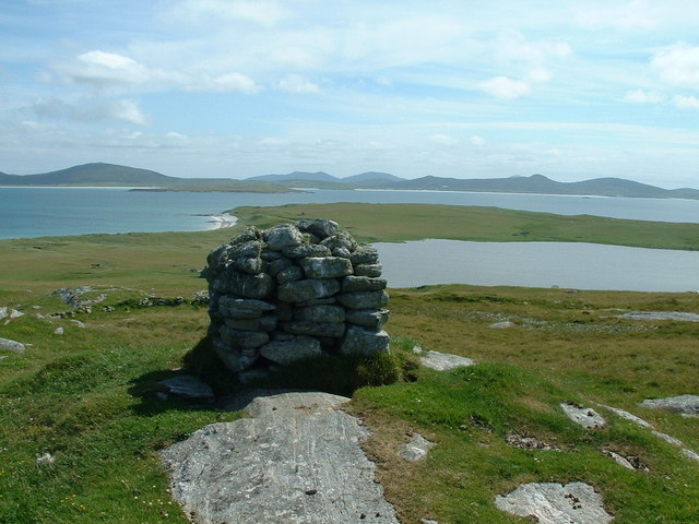
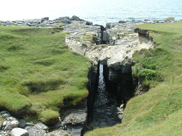
The island covers an area of approximately 0.1 square kilometers and is characterized by its steep cliffs, rocky outcrops, and lush vegetation. It is a haven for various species of seabirds, including puffins, gulls, and razorbills, making it an important site for birdwatching and wildlife enthusiasts.

Access to Sgeir an Tairbh is limited due to its remote location and lack of infrastructure. The island is only accessible by boat, and visitors should be cautious of the strong tides and unpredictable weather conditions in the area.

Historically, Sgeir an Tairbh was used for grazing sheep and cattle, but it has been uninhabited for many years. Today, it remains a largely untouched and pristine natural environment, offering a peaceful retreat away from the bustling mainland.

The island's rugged beauty and abundant wildlife make it a popular destination for photographers, nature lovers, and those seeking solitude in the midst of nature. Sgeir an Tairbh is a hidden gem in Inverness-shire, providing a unique opportunity to experience the untamed beauty of the Scottish coast.

If you have any feedback on the listing, please let us know in the comments section below.

Sgeir an Tairbh Images

Images are sourced within 2km of 57.706228/-7.27966 or Grid Reference NF8580. Thanks to Geograph Open Source API. All images are credited.

Houses on Boreray/Boraraigh
Boreray from Rubha Bhoisnis Looking across to the buildings on Boreray from Rubha Bhoisnis on Berneray. Signs of habitation on the island with two houses that look weatherproof, plus a red tractor and dinghy with outboard motor, neither of which are likely to be of much use to the dozens of small white specs which are grazing sheep.
Boreray from Rubha Bhoisnis
Looking across to the buildings on Boreray from Rubha Bhoisnis on Berneray. Signs of habitation on the island with two houses that look weatherproof, plus a red tractor and dinghy with outboard motor, neither of which are likely to be of much use to the dozens of small white specs which are grazing sheep.
Houses on Boreray (North Uist) Boreray has a population of 1. I visited it on a boat trip organised from Berneray in July 2006. I believe the photo shows the residents house and another house which is let to viitors.
Houses on Boreray (North Uist)
Boreray has a population of 1. I visited it on a boat trip organised from Berneray in July 2006. I believe the photo shows the residents house and another house which is let to viitors.
Boreray (North Uist) from the sea Picture was taken from a boat at anchor off the beach, before boarding a dinghy to land on the beach.
Boreray (North Uist) from the sea
Picture was taken from a boat at anchor off the beach, before boarding a dinghy to land on the beach.
Boreray Sheep Some of the many blcak sheep grazing on Boreray (North Uist).
Boreray Sheep
Some of the many blcak sheep grazing on Boreray (North Uist).
View from Mullach Mor, Boreray, North Uist Looking SSE from Mullach Mor, over Loch Mor and towards North Uist.
View from Mullach Mor, Boreray, North Uist
Looking SSE from Mullach Mor, over Loch Mor and towards North Uist.
Mol Mor, Boreray, North Uist Looking over the narrow strip of land which separates Loch Mor from the sea.
Mol Mor, Boreray, North Uist
Looking over the narrow strip of land which separates Loch Mor from the sea.
Coastal Crevasse on Boreray North Uist A trap for the unwary walking along the Southwest coast of Boreray. As this feature does not appear on the map, the location may be slightly incorrect, but it is to the South of Loch Mor.
Coastal Crevasse on Boreray North Uist
A trap for the unwary walking along the Southwest coast of Boreray. As this feature does not appear on the map, the location may be slightly incorrect, but it is to the South of Loch Mor.
Beach on Boreray North Uist Looking at the beach from the machair.
Beach on Boreray North Uist
Looking at the beach from the machair.
Blackhouse ruins on Boreray North Uist Ruins of blackhouse near the South end of the beach on Boreray, North Uist. These ruins may date from the nineteenth century.
Blackhouse ruins on Boreray North Uist
Ruins of blackhouse near the South end of the beach on Boreray, North Uist. These ruins may date from the nineteenth century.
Show me another place!

Sgeir an Tairbh is located at Grid Ref: NF8580 (Lat: 57.706228, Lng: -7.27966)

Unitary Authority: Na h-Eileanan an Iar

Police Authority: Highlands and Islands

What 3 Words

///lance.entitle.directors. Near Lochmaddy, Na h-Eileanan Siar

Related Wikis

Boreray, North Uist

Boreray (Scottish Gaelic: Boraraigh) is an island with a single croft, lying 2 kilometres (1.2 mi) north of North Uist in the Outer Hebrides of Scotland...

Lingeigh, North Uist

Lingeigh is an uninhabited island off North Uist, south east of Boreray. It is separated from North Uist by Traigh Lingeigh. == Footnotes ==

North Uist Machair and Islands

The North Uist Machair and Islands is a protected wetland area in the Outer Hebrides of Scotland. A total of 4,705 hectares comprises seven separate areas...

Newtonferry

Newtonferry (Scottish Gaelic: Port nan Long, "the harbour of the ships") is a small crofting community on the island of North Uist in the Western Isles...

Oronsay, Outer Hebrides

Oronsay (Gaelic Orasaigh) is a tidal island off North Uist in the Outer Hebrides. Lying to the north of Vallaquie Strand, the island has been uninhabited...

Dun an Sticir

Dun an Sticir (Scottish Gaelic: Dùn an Sticir [ˈt̪un əɲ ˈʃtʲiçkʲɪɾʲ]) is an Iron Age broch situated approximately 9.5 kilometers north of Lochmaddy in...

Otternish

Otternish is the former North Uist terminal for the ferry to Berneray, in the Outer Hebrides, Scotland. The slipway lies 6 miles (10 km) north of Lochmaddy...

Berneray (North Uist)

Berneray (Scottish Gaelic: Beàrnaraigh na Hearadh) is an island and community in the Sound of Harris, Scotland. It is one of fifteen inhabited islands...

Nearby Amenities

Located within 500m of 57.706228,-7.27966
Source: PGS
Lat/Long: 57.7106678/-7.2795739
Source: PGS
Lat/Long: 57.7106355/-7.2799492
Source: PGS
Lat/Long: 57.7105553/-7.2803921
Source: PGS
Lat/Long: 57.7102365/-7.2810837
Source: PGS
Lat/Long: 57.7098505/-7.2815817
Source: PGS
Lat/Long: 57.708506/-7.2819142
Source: PGS
Lat/Long: 57.7078542/-7.2816206
Source: PGS
Lat/Long: 57.7072605/-7.2809752
Source: PGS
Lat/Long: 57.7062405/-7.2795221
Source: PGS
Lat/Long: 57.7061142/-7.2795009
Source: PGS
Lat/Long: 57.705607/-7.2786663
Source: PGS
Lat/Long: 57.7052152/-7.2780963
Source: PGS
Lat/Long: 57.7044658/-7.2778047
Source: PGS
Lat/Long: 57.70345/-7.2772858
Source: PGS
Lat/Long: 57.7033809/-7.276751
Source: PGS
Lat/Long: 57.7028347/-7.2766786
The data included in this document is from www.openstreetmap.org. The data is made available under ODbL.

Have you been to Sgeir an Tairbh?

Leave your review of Sgeir an Tairbh below (or comments, questions and feedback).