Eilean nan Gall

Island in Inverness-shire

Scotland

Eilean nan Gall

Loch Glen Na Feannag shieling and chambered cairn The shieling is built on the edge of a much earlier chambered cairn. <span class="nowrap"><a title="https://canmore.org.uk/site/10251/north-uist-loch-glen-na-feannag" rel="nofollow ugc noopener" href="https://canmore.org.uk/site/10251/north-uist-loch-glen-na-feannag">Link</a><img style="margin-left:2px;" alt="External link" title="External link - shift click to open in new window" src="https://s1.geograph.org.uk/img/external.png" width="10" height="10"/></span>
Loch Glen Na Feannag shieling and chambered cairn Credit: Sandy Gerrard

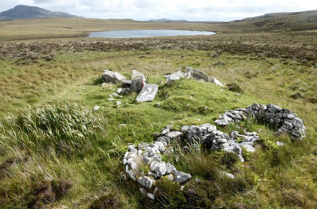
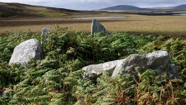
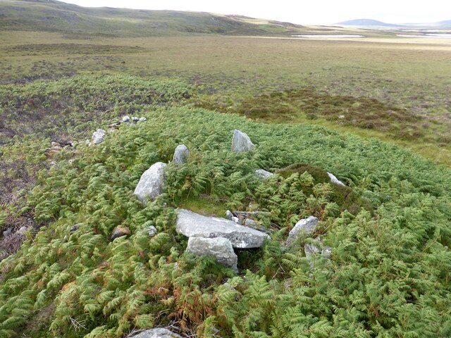
Eilean nan Gall, also known as the Island of Strangers, is a small uninhabited island located off the west coast of Inverness-shire, Scotland. Situated in the picturesque Loch Alsh, the island measures approximately 3.6 hectares in size and is accessible only by boat.

The island's name, Eilean nan Gall, translates to "island of the strangers" in Gaelic, referring to the Vikings who once inhabited the area centuries ago. The Vikings used the island as a base for their raids on the mainland, taking advantage of its strategic location.

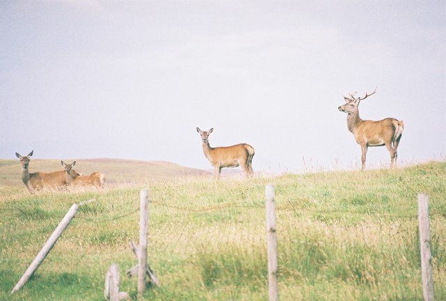
Eilean nan Gall is characterized by its rugged and rocky terrain, with steep cliffs surrounding most of its perimeter. The island is home to a variety of bird species, including gannets, puffins, and guillemots, making it a popular destination for birdwatchers.

Visitors to the island can explore its natural beauty, taking in breathtaking views of the surrounding loch and nearby mountains. The island's remote location and lack of human habitation provide a sense of tranquility and solitude, making it an ideal spot for those seeking a peaceful retreat.

While there are no facilities or amenities on the island, nearby towns such as Kyle of Lochalsh and Plockton offer accommodation options and boat tours for visitors interested in exploring Eilean nan Gall. Overall, the island's rich history, stunning scenery, and abundant wildlife make it a hidden gem in the Scottish Highlands.

If you have any feedback on the listing, please let us know in the comments section below.

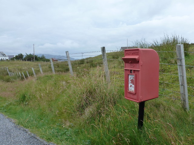
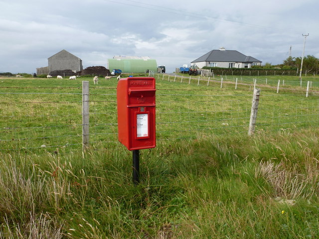
Eilean nan Gall Images

Images are sourced within 2km of 57.552151/-7.2568871 or Grid Reference NF8563. Thanks to Geograph Open Source API. All images are credited.

Loch Glen Na Feannag shieling and chambered cairn The shieling is built on the edge of a much earlier chambered cairn. <span class="nowrap"><a title="https://canmore.org.uk/site/10251/north-uist-loch-glen-na-feannag" rel="nofollow ugc noopener" href="https://canmore.org.uk/site/10251/north-uist-loch-glen-na-feannag">Link</a><img style="margin-left:2px;" alt="External link" title="External link - shift click to open in new window" src="https://s1.geograph.org.uk/img/external.png" width="10" height="10"/></span>
Loch Glen Na Feannag shieling and chambered cairn
The shieling is built on the edge of a much earlier chambered cairn. LinkExternal link
Loch Glen Na Feannag chambered cairn A close up view of the large slabs forming the chamber. <span class="nowrap"><a title="https://canmore.org.uk/site/10251/north-uist-loch-glen-na-feannag" rel="nofollow ugc noopener" href="https://canmore.org.uk/site/10251/north-uist-loch-glen-na-feannag">Link</a><img style="margin-left:2px;" alt="External link" title="External link - shift click to open in new window" src="https://s1.geograph.org.uk/img/external.png" width="10" height="10"/></span>
Loch Glen Na Feannag chambered cairn
A close up view of the large slabs forming the chamber. LinkExternal link
Oban Nam Fiadh chambered cairn Large stones forming part of the chamber. <span class="nowrap"><a title="https://canmore.org.uk/site/10252/north-uist-oban-nam-fiadh" rel="nofollow ugc noopener" href="https://canmore.org.uk/site/10252/north-uist-oban-nam-fiadh">Link</a><img style="margin-left:2px;" alt="External link" title="External link - shift click to open in new window" src="https://s1.geograph.org.uk/img/external.png" width="10" height="10"/></span>
Oban Nam Fiadh chambered cairn
Large stones forming part of the chamber. LinkExternal link
Oban Nam Fiadh chambered cairn View from above showing the character of the chamber. <span class="nowrap"><a title="https://canmore.org.uk/site/10252/north-uist-oban-nam-fiadh" rel="nofollow ugc noopener" href="https://canmore.org.uk/site/10252/north-uist-oban-nam-fiadh">Link</a><img style="margin-left:2px;" alt="External link" title="External link - shift click to open in new window" src="https://s1.geograph.org.uk/img/external.png" width="10" height="10"/></span>
Oban Nam Fiadh chambered cairn
View from above showing the character of the chamber. LinkExternal link
The community of Locheport on the shore of Loch Eport Seen from the circular way-marked path on Beinn Langais as it leaves the summit and descends to the Pobull Fhinn stone circle.
The community of Locheport on the shore of Loch Eport
Seen from the circular way-marked path on Beinn Langais as it leaves the summit and descends to the Pobull Fhinn stone circle.
Field, Loch Euphort It looks rough, but these fields show up as a green area against the moors when seen from the hills.
Field, Loch Euphort
It looks rough, but these fields show up as a green area against the moors when seen from the hills.
End of the B894 The road continues with a sharp bend to Saighdinis, only now coloured yellow on the maps.
End of the B894
The road continues with a sharp bend to Saighdinis, only now coloured yellow on the maps.
Small cove near the head of Loch Langais
Locheport: postbox № HS6 8 A small postbox serving this small community, it is emptied at 9 o'clock on weekday mornings and half an hour earlier on Saturdays.
Locheport: postbox № HS6 8
A small postbox serving this small community, it is emptied at 9 o'clock on weekday mornings and half an hour earlier on Saturdays.
Sidinish: postbox № HS6 20 and the old post office This postbox stands outside the old post office, which was in the building to the right. See <a href="https://www.geograph.org.uk/photo/854445">NF8763 : Sidinish Post Office</a> for a picture of the post office when it was operational.

The post office had opened in the early part of 1930 but fell victim to the Network Change programme - in which 2,500 branches nationwide were axed - and its last day of business was 21 July 2008.
Sidinish: postbox № HS6 20 and the old post office
This postbox stands outside the old post office, which was in the building to the right. See NF8763 : Sidinish Post Office for a picture of the post office when it was operational. The post office had opened in the early part of 1930 but fell victim to the Network Change programme - in which 2,500 branches nationwide were axed - and its last day of business was 21 July 2008.
Otter watching at Beinn Langais
Improved land, Loch Euphort Some of the strip of improved land running along the south side of a sea loch which almost crosses North Uist.
Improved land, Loch Euphort
Some of the strip of improved land running along the south side of a sea loch which almost crosses North Uist.
Oban nam Fiadh A branch of Loch Euphort and there is probably more water than land between here and Eabhal.
Oban nam Fiadh
A branch of Loch Euphort and there is probably more water than land between here and Eabhal.
Locheport: view north across the loch Looking north from the B894, across Loch Euphort, over the western peninsula of the island of Steisaigh and into the mouth of Loch Langais.
Locheport: view north across the loch
Looking north from the B894, across Loch Euphort, over the western peninsula of the island of Steisaigh and into the mouth of Loch Langais.
Locheport: a deer behind a ruin This rather magnificent creature was as surprised to see me as I was to see him when I stopped the car to take a quick photo looking across the loch. He was with several others.
Locheport: a deer behind a ruin
This rather magnificent creature was as surprised to see me as I was to see him when I stopped the car to take a quick photo looking across the loch. He was with several others.
Locheport: four deer look at me These deer were roused by my stopping the car to take a picture, at which point I had no idea they were there.
Locheport: four deer look at me
These deer were roused by my stopping the car to take a picture, at which point I had no idea they were there.
Locheport: two deer dart across the B894 Having roused a group of deer as I got out of the car to take a photo across the loch, unaware of their presence, after a bit of mutual bluffing these two deer darted across the road, leaping rather noisily over the fences on each side of the road.

I was a little too slow with the camera so the one on the right is not quite fully in shot.
Locheport: two deer dart across the B894
Having roused a group of deer as I got out of the car to take a photo across the loch, unaware of their presence, after a bit of mutual bluffing these two deer darted across the road, leaping rather noisily over the fences on each side of the road. I was a little too slow with the camera so the one on the right is not quite fully in shot.
Minor road, Saighdinis The road along the southern shore of Loch Euphort.
Minor road, Saighdinis
The road along the southern shore of Loch Euphort.
Show me another place!

Eilean nan Gall is located at Grid Ref: NF8563 (Lat: 57.552151, Lng: -7.2568871)

Unitary Authority: Na h-Eileanan an Iar

Police Authority: Highlands and Islands

What 3 Words

///estate.portfolio.mercy. Near Lochmaddy, Na h-Eileanan Siar

Related Wikis

Carinish

Carinish (Scottish Gaelic: Càirinis), is a hamlet on North Uist, in the Outer Hebrides, Scotland. It is in the south of the island, about two miles (three...

Battle of Carinish

The Battle of Carinish was a Scottish clan battle fought in North Uist in 1601. It was part of a year of feuding between Clan MacLeod of Dunvegan and the...

Loch Sgadabhagh

Loch Sgadabhagh or Loch Scadavay is a body of water on the island of North Uist, Scotland. The name may be of Old Norse derivation meaning "lake of tax...

Teampull na Trionaid

Teampull na Trionaid ("trinity church") is a ruined 13th-century Augustinian nunnery at Carinish, on North Uist, in the Outer Hebrides of Scotland. �...

Fraoch-Eilean

Fraoch-eilean is a small island with an uncertain population north of Benbecula in the Outer Hebrides of Scotland. It is about 55 hectares (140 acres...

Bail' Iochdrach

Bail' Iochdrach or Baliochrach (Scottish Gaelic: Am Baile Ìochdrach) is a village on Benbecula in the Outer Hebrides, Scotland. Baliochrach is within the...

Baile Glas

Baile Glas or Ballaglasa (Scottish Gaelic: Am Baile Glas) is a settlement on Grimsay in the Outer Hebrides, Scotland. Ballaglasa is within the parish of...

Grimsay

Grimsay (Scottish Gaelic: Griomasaigh) is a tidal island in the Outer Hebrides of Scotland. == Geography == Grimsay is the largest of the low-lying stepping...

Nearby Amenities

Located within 500m of 57.552151,-7.2568871
Passing Place
Lat/Long: 57.5508121/-7.2608892
Passing Place
Lat/Long: 57.551024/-7.2614083
Passing Place
Lat/Long: 57.550298/-7.260116
Passing Place
Lat/Long: 57.5501219/-7.2522399
Loch Euphort
Alt Name: Loch Euphoirt
Name En: Locheport
Name Gd: Loch Euphort
Place: village
Wikidata: Q15057498
Wikipedia: de:Locheport
Lat/Long: 57.5501028/-7.2570706
Power: pole
Lat/Long: 57.5498812/-7.2496962
Power: pole
Lat/Long: 57.5499553/-7.2512506
Power: pole
Lat/Long: 57.5500114/-7.2525152
Power: pole
Lat/Long: 57.5500733/-7.2538148
Power: pole
Lat/Long: 57.5501352/-7.2551022
Power: pole
Lat/Long: 57.5501337/-7.2563253
Power: pole
Lat/Long: 57.5501877/-7.257358
Power: pole
Lat/Long: 57.5502798/-7.2591215
Power: pole
Lat/Long: 57.5503496/-7.260704
Power: pole
Lat/Long: 57.5504165/-7.2618842
Power: pole
Lat/Long: 57.5504698/-7.2629759
Power: pole
Lat/Long: 57.5505583/-7.2646965
Power: pole
Lat/Long: 57.5505144/-7.2638221
Passing Place
Lat/Long: 57.5499576/-7.2497548
Passing Place
Lat/Long: 57.5503947/-7.258653
Passing Place
Lat/Long: 57.5513408/-7.2626847
Power: pole
Lat/Long: 57.5510489/-7.2607677
Power: pole
Lat/Long: 57.5514398/-7.2607867
Power: pole
Lat/Long: 57.5517469/-7.2607867
Power: pole
Lat/Long: 57.5509924/-7.2605596
Power: pole
Lat/Long: 57.5510024/-7.260734
Power: pole
Lat/Long: 57.5511766/-7.2613643
Power: pole
Lat/Long: 57.5515673/-7.2614287
Power: pole
Lat/Long: 57.5517609/-7.2613066
Barrier: cattle_grid
Lat/Long: 57.5520199/-7.2607056
Post Box
Collection Times: Mo-Fr 09:30; Sa 08:30
Operator: Royal Mail
Post Box Mounting: pole
Post Box Type: lamp
Ref: HS6 8
Royal Cypher: scottish_crown
Lat/Long: 57.5513145/-7.2626616
The data included in this document is from www.openstreetmap.org. The data is made available under ODbL.

Have you been to Eilean nan Gall?

Leave your review of Eilean nan Gall below (or comments, questions and feedback).