Crò-Dubhaig

Coastal Feature, Headland, Point in Inverness-shire

Scotland

Crò-Dubhaig

Houses on Boreray/Boraraigh
Houses on Boreray/Boraraigh Credit: Sandy Gerrard

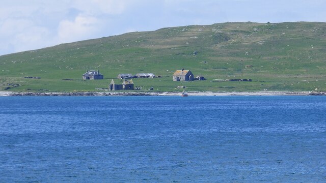
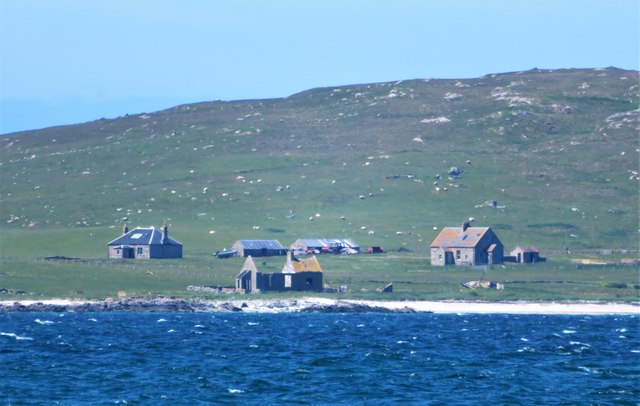
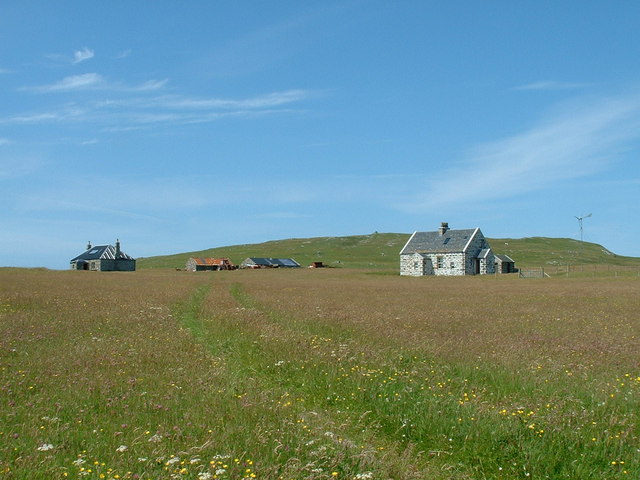
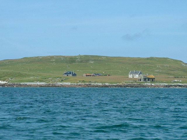
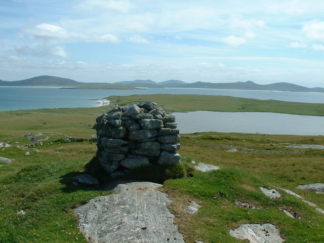
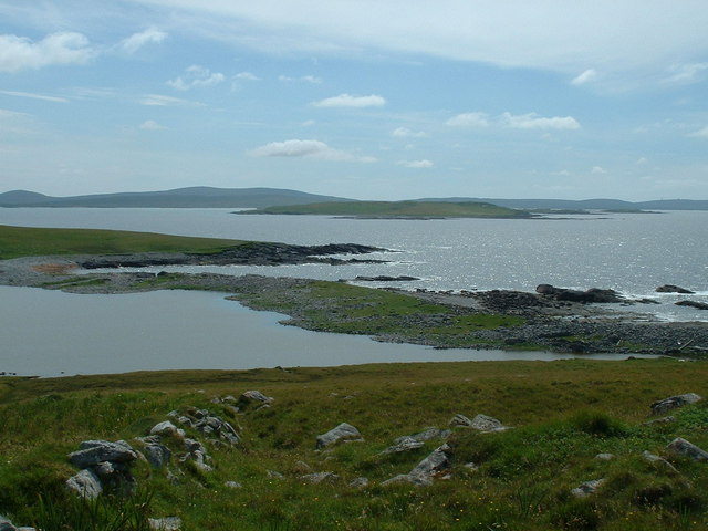
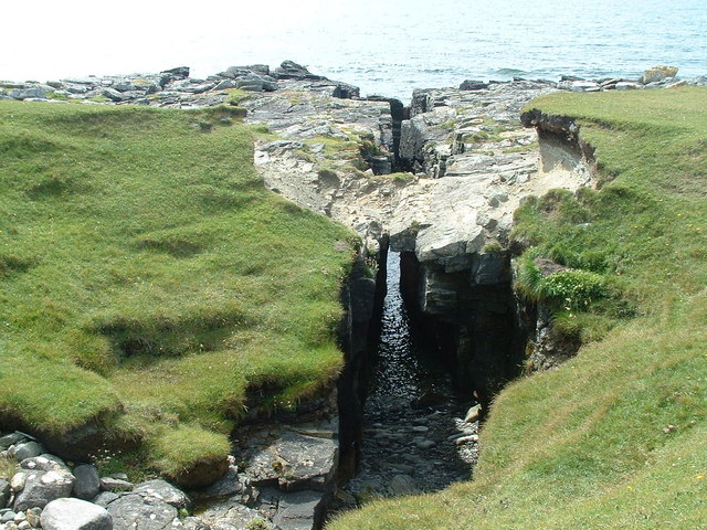
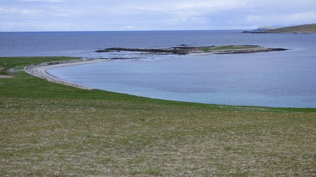
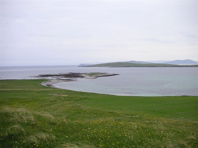
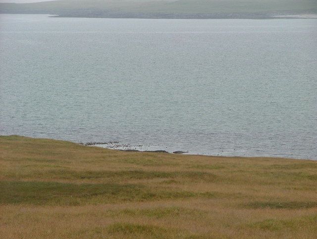
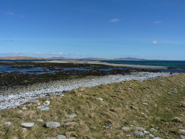
Crò-Dubhaig is a prominent coastal feature located in Inverness-shire, Scotland. It is a headland that juts out into the North Atlantic Ocean, forming a distinctive point along the rugged coastline. The name "Crò-Dubhaig" is derived from the Gaelic language and translates to "black sheepfold."

This headland is characterized by its steep cliffs, which rise dramatically from the sea, providing stunning panoramic views of the surrounding area. The cliffs are composed of ancient rock formations, layered with sedimentary deposits and fossilized remains, offering a glimpse into the geological history of the region.

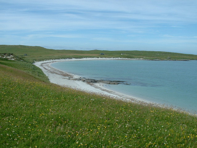
The headland is also known for its diverse wildlife and natural beauty. Seabirds such as gannets, puffins, and fulmars can be spotted nesting on the cliffs, while seals and dolphins can often be seen swimming in the waters below. The area is also rich in marine life, with a variety of fish species inhabiting the nearby coastal waters.

Crò-Dubhaig is a popular destination for nature enthusiasts and hikers, who can explore the headland via a network of walking trails. These trails provide access to breathtaking viewpoints, secluded coves, and hidden beaches, making it an ideal spot for photography and relaxation.

In addition to its natural attractions, Crò-Dubhaig is steeped in history and folklore. It is believed to have been a significant site for ancient Celtic rituals and ceremonies, adding an air of mystery and intrigue to the area.

Overall, Crò-Dubhaig is a captivating coastal feature that offers a unique blend of natural beauty, wildlife, and cultural significance. It is a must-visit destination for those seeking an authentic Scottish coastal experience.

If you have any feedback on the listing, please let us know in the comments section below.

Crò-Dubhaig Images

Images are sourced within 2km of 57.700431/-7.2784107 or Grid Reference NF8580. Thanks to Geograph Open Source API. All images are credited.

Houses on Boreray/Boraraigh
Boreray from Rubha Bhoisnis Looking across to the buildings on Boreray from Rubha Bhoisnis on Berneray. Signs of habitation on the island with two houses that look weatherproof, plus a red tractor and dinghy with outboard motor, neither of which are likely to be of much use to the dozens of small white specs which are grazing sheep.
Boreray from Rubha Bhoisnis
Looking across to the buildings on Boreray from Rubha Bhoisnis on Berneray. Signs of habitation on the island with two houses that look weatherproof, plus a red tractor and dinghy with outboard motor, neither of which are likely to be of much use to the dozens of small white specs which are grazing sheep.
Houses on Boreray (North Uist) Boreray has a population of 1. I visited it on a boat trip organised from Berneray in July 2006. I believe the photo shows the residents house and another house which is let to viitors.
Houses on Boreray (North Uist)
Boreray has a population of 1. I visited it on a boat trip organised from Berneray in July 2006. I believe the photo shows the residents house and another house which is let to viitors.
Boreray (North Uist) from the sea Picture was taken from a boat at anchor off the beach, before boarding a dinghy to land on the beach.
Boreray (North Uist) from the sea
Picture was taken from a boat at anchor off the beach, before boarding a dinghy to land on the beach.
View from Mullach Mor, Boreray, North Uist Looking SSE from Mullach Mor, over Loch Mor and towards North Uist.
View from Mullach Mor, Boreray, North Uist
Looking SSE from Mullach Mor, over Loch Mor and towards North Uist.
Mol Mor, Boreray, North Uist Looking over the narrow strip of land which separates Loch Mor from the sea.
Mol Mor, Boreray, North Uist
Looking over the narrow strip of land which separates Loch Mor from the sea.
Coastal Crevasse on Boreray North Uist A trap for the unwary walking along the Southwest coast of Boreray. As this feature does not appear on the map, the location may be slightly incorrect, but it is to the South of Loch Mor.
Coastal Crevasse on Boreray North Uist
A trap for the unwary walking along the Southwest coast of Boreray. As this feature does not appear on the map, the location may be slightly incorrect, but it is to the South of Loch Mor.
Beach on Boreray North Uist Looking at the beach from the machair.
Beach on Boreray North Uist
Looking at the beach from the machair.
Blackhouse ruins on Boreray North Uist Ruins of blackhouse near the South end of the beach on Boreray, North Uist. These ruins may date from the nineteenth century.
Blackhouse ruins on Boreray North Uist
Ruins of blackhouse near the South end of the beach on Boreray, North Uist. These ruins may date from the nineteenth century.
Eilean a' Mhòrain
Eilean a' Mhòrain
Eilean a Mhorain Eilean a Mhorain is in the foreground; Boreray and Pabbay in the distance
Eilean a Mhorain
Eilean a Mhorain is in the foreground; Boreray and Pabbay in the distance
Towards Boreray from Lingeigh The rocky shoreline of Lingeigh is mirrored across the water on Boreray.
Towards Boreray from Lingeigh
The rocky shoreline of Lingeigh is mirrored across the water on Boreray.
Lòn Hulabhaig The wave-cut rocks at the northern end of the Greinetobht peninsula, with the small islets of Eilean a'Mhòrain amongst them.
Lòn Hulabhaig
The wave-cut rocks at the northern end of the Greinetobht peninsula, with the small islets of Eilean a'Mhòrain amongst them.
Show me another place!

Crò-Dubhaig is located at Grid Ref: NF8580 (Lat: 57.700431, Lng: -7.2784107)

Unitary Authority: Na h-Eileanan an Iar

Police Authority: Highlands and Islands

What 3 Words

///eyelash.otters.alerting. Near Lochmaddy, Na h-Eileanan Siar

Related Wikis

Boreray, North Uist

Boreray (Scottish Gaelic: Boraraigh) is an island with a single croft, lying 2 kilometres (1.2 mi) north of North Uist in the Outer Hebrides of Scotland...

Lingeigh, North Uist

Lingeigh is an uninhabited island off North Uist, south east of Boreray. It is separated from North Uist by Traigh Lingeigh. == Footnotes ==

North Uist Machair and Islands

The North Uist Machair and Islands is a protected wetland area in the Outer Hebrides of Scotland. A total of 4,705 hectares comprises seven separate areas...

Oronsay, Outer Hebrides

Oronsay (Gaelic Orasaigh) is a tidal island off North Uist in the Outer Hebrides. Lying to the north of Vallaquie Strand, the island has been uninhabited...

Nearby Amenities

Located within 500m of 57.700431,-7.2784107
Source: PGS
Lat/Long: 57.7044658/-7.2778047
Source: PGS
Lat/Long: 57.70345/-7.2772858
Source: PGS
Lat/Long: 57.7033809/-7.276751
Source: PGS
Lat/Long: 57.7028347/-7.2766786
The data included in this document is from www.openstreetmap.org. The data is made available under ODbL.

Have you been to Crò-Dubhaig?

Leave your review of Crò-Dubhaig below (or comments, questions and feedback).