Dubh-eilean Leathann

Island in Inverness-shire

Scotland

Dubh-eilean Leathann

Pony and ruin, Carinish
Pony and ruin, Carinish Credit: Hugh Venables

Dubh-eilean Leathann is a small island located in Inverness-shire, Scotland. Also known as the Black Isle, it is situated in the Moray Firth, just north of Inverness. Despite its name, the island is not actually an isle but a peninsula, connected to the mainland by a narrow strip of land.

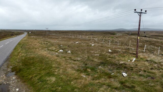
Covering an area of approximately 75 square miles, Dubh-eilean Leathann boasts picturesque landscapes and stunning natural beauty. The island is characterized by rolling hills, fertile farmlands, and rugged coastline, offering breathtaking views of the surrounding sea and nearby mountains.

The Black Isle is rich in history, with evidence of human settlement dating back to the Mesolithic era. Visitors can explore ancient sites such as the Fairy Glen, a prehistoric burial mound, and the Rosemarkie Pictish Stones, which showcase intricate carvings from the early medieval period.

The island is also renowned for its diverse wildlife. The Moray Firth is a haven for bottlenose dolphins, and visitors often have the opportunity to spot these majestic creatures from the coastline. The Black Isle is also home to a wide array of bird species, including ospreys, red kites, and various seabirds.

In terms of amenities, the island offers a range of facilities for visitors, including charming bed and breakfasts, hotels, and holiday cottages. There are also several quaint villages scattered across the peninsula, where visitors can enjoy local cuisine and traditional Scottish hospitality.

Overall, Dubh-eilean Leathann, or the Black Isle, is a captivating destination that combines stunning natural landscapes, rich history, and abundant wildlife, making it a must-visit location for nature enthusiasts and history buffs alike.

If you have any feedback on the listing, please let us know in the comments section below.

Dubh-eilean Leathann Images

Images are sourced within 2km of 57.524385/-7.321276 or Grid Reference NF8160. Thanks to Geograph Open Source API. All images are credited.

Pony and ruin, Carinish
End of the road at Àird Mhòr
House at Carinish
House at Carinish
Marshy area at Carinish Seemingly a naturally infilled loch.
Marshy area at Carinish
Seemingly a naturally infilled loch.
Outside Talla Chairinis, North Uist Outside a community hall
Outside Talla Chairinis, North Uist
Outside a community hall
Blar Chairinis Site of battle in 1601.
Blar Chairinis
Site of battle in 1601.
Stone barn at Carinish
The ruins of Trinity Temple (Teampull na Trianaid) According to the plaque "Medieval monastery and college of European significance, founded by Beathag, daughter of Somhairle (Somerled).  Enlarged about 1350 to 1390 by Amie Mic Ruarie, first wife of John, Lord of the Isles.  Reconstructed in the 16th century.  Destroyed after the reformation.  Later restored in the 19th century by Dotair Ban."
The ruins of Trinity Temple (Teampull na Trianaid)
According to the plaque "Medieval monastery and college of European significance, founded by Beathag, daughter of Somhairle (Somerled). Enlarged about 1350 to 1390 by Amie Mic Ruarie, first wife of John, Lord of the Isles. Reconstructed in the 16th century. Destroyed after the reformation. Later restored in the 19th century by Dotair Ban."
Field and houses at Carinish And also the site of Feith na Fala (The ditch of blood) - a battle waged in 1601 between the MacLeods and the MacDonalds.
Field and houses at Carinish
And also the site of Feith na Fala (The ditch of blood) - a battle waged in 1601 between the MacLeods and the MacDonalds.
Bagh a’ Ghriasaiche
Bagh a’ Ghriasaiche
Fèithe na Fala - The ditch of blood
View from Temple View Hotel Teampull na Trionaid is a ruined 13th-century church and seminary at Carinish, North Uist, Scotland. Amie mac Ruari is said to have rebuilt the church in the 14th century after her divorce from John of Islay, Lord of the Isles. The ruins are protected as a scheduled monument.
View from Temple View Hotel
Teampull na Trionaid is a ruined 13th-century church and seminary at Carinish, North Uist, Scotland. Amie mac Ruari is said to have rebuilt the church in the 14th century after her divorce from John of Islay, Lord of the Isles. The ruins are protected as a scheduled monument.
Closer to the temple The ruins of Trinity Temple (Teampull na Trianaid)
Closer to the temple
The ruins of Trinity Temple (Teampull na Trianaid)
Free Church, Cairinis Current OS maps show this as a church, but older versions show it as a pub, which was its original purpose. Enough said.
Free Church, Cairinis
Current OS maps show this as a church, but older versions show it as a pub, which was its original purpose. Enough said.
A not very useful gate A rusty old metal gate at the point where a fence once crossed the track.
A not very useful gate
A rusty old metal gate at the point where a fence once crossed the track.
Track above Loch Creag nan Speireag This track, which is indistinct in places, forms part of the Hebridean Way, a relatively new walking route through the Western Isles.
Track above Loch Creag nan Speireag
This track, which is indistinct in places, forms part of the Hebridean Way, a relatively new walking route through the Western Isles.
Cotton grass, Creag nan Speireag Looking over cotton grass towards Loch nan Speireag and the houses at Gearraidh Cladach.
Cotton grass, Creag nan Speireag
Looking over cotton grass towards Loch nan Speireag and the houses at Gearraidh Cladach.
Carinish stone circle Sadly the road cuts through this stone circle. <span class="nowrap"><a title="https://canmore.org.uk/site/10249/north-uist-carinish" rel="nofollow ugc noopener" href="https://canmore.org.uk/site/10249/north-uist-carinish">Link</a><img style="margin-left:2px;" alt="External link" title="External link - shift click to open in new window" src="https://s1.geograph.org.uk/img/external.png" width="10" height="10"/></span>
Carinish stone circle
Sadly the road cuts through this stone circle. LinkExternal link
Show me another place!

Dubh-eilean Leathann is located at Grid Ref: NF8160 (Lat: 57.524385, Lng: -7.321276)

Unitary Authority: Na h-Eileanan an Iar

Police Authority: Highlands and Islands

What 3 Words

///encoded.disengage.actual. Near Balivanich, Na h-Eileanan Siar

Related Wikis

Battle of Carinish

The Battle of Carinish was a Scottish clan battle fought in North Uist in 1601. It was part of a year of feuding between Clan MacLeod of Dunvegan and the...

Teampull na Trionaid

Teampull na Trionaid ("trinity church") is a ruined 13th-century Augustinian nunnery at Carinish, on North Uist, in the Outer Hebrides of Scotland. �...

Carinish

Carinish (Scottish Gaelic: Càirinis), is a hamlet on North Uist, in the Outer Hebrides, Scotland. It is in the south of the island, about two miles (three...

Bail' Iochdrach

Bail' Iochdrach or Baliochrach (Scottish Gaelic: Am Baile Ìochdrach) is a village on Benbecula in the Outer Hebrides, Scotland. Baliochrach is within the...

Nearby Amenities

Located within 500m of 57.524385,-7.321276
Bus Stop
Carinish
Bus: yes
Naptan AtcoCode: 6010731585
Naptan Bearing: S
Naptan BusStopType: CUS
Naptan CommonName: Carinish
Naptan Indicator: School
Naptan Landmark: School car park
Naptan NaptanCode: 94723535
Naptan Street: School
Naptan Verified: no
Public Transport: platform
Source: naptan_import
Lat/Long: 57.5265676/-7.3155802
Post Box
Collection Times: Mo-Fr 14:00; Sa 09:30
Post Box Type: lamp
Royal Cypher: scottish_crown
Lat/Long: 57.5238889/-7.3144068
Telephone
Booth: KX100
Covered: booth
Payment Coins: yes
Lat/Long: 57.524198/-7.3145919
Bus Stop
Bench: yes
Bus: yes
Naptan AtcoCode: 6010774
Naptan NaptanCode: 94726572
Public Transport: platform
Shelter: yes
Lat/Long: 57.5225833/-7.3139173
Turning Circle
Lat/Long: 57.5215608/-7.3162026
Bagh a' Ghriasaiche
Natural: bay
Lat/Long: 57.5235778/-7.3193622
Board Type: history
Information: board
Tourism: information
Lat/Long: 57.5210633/-7.317012
Entrance: yes
Lat/Long: 57.5265036/-7.3164424
Power: pole
Lat/Long: 57.5244465/-7.3131966
Power: pole
Lat/Long: 57.5251515/-7.3137493
Power: pole
Lat/Long: 57.5255609/-7.31409
Power: pole
Lat/Long: 57.5256521/-7.315619
Power: pole
Lat/Long: 57.5255797/-7.3151398
Power: pole
Lat/Long: 57.5258614/-7.3166904
Power: pole
Lat/Long: 57.5262352/-7.3174481
Power: pole
Lat/Long: 57.5265303/-7.3180578
Power: pole
Lat/Long: 57.5273481/-7.3197322
Power: pole
Lat/Long: 57.5285744/-7.322253
Power: pole
Lat/Long: 57.5276362/-7.3203444
Power: pole
Lat/Long: 57.5282058/-7.3214947
Power: pole
Lat/Long: 57.5236962/-7.3134847
Power: pole
Lat/Long: 57.5268112/-7.3186631
Barrier: cattle_grid
Lat/Long: 57.5242751/-7.3150783
Power: pole
Lat/Long: 57.5215255/-7.3148104
Power: pole
Lat/Long: 57.5276473/-7.3161439
Power: pole
Lat/Long: 57.5267445/-7.3157088
Power: pole
Lat/Long: 57.5272276/-7.3159291
Power: pole
Lat/Long: 57.5264301/-7.3155235
Power: pole
Lat/Long: 57.526035/-7.3157464
Power: pole
Lat/Long: 57.520844/-7.3162554
Power: pole
Lat/Long: 57.5211501/-7.3155822
The data included in this document is from www.openstreetmap.org. The data is made available under ODbL.

Have you been to Dubh-eilean Leathann?

Leave your review of Dubh-eilean Leathann below (or comments, questions and feedback).