Eilean nan Corr

Island in Inverness-shire

Scotland

Eilean nan Corr

Pony and ruin, Carinish
Pony and ruin, Carinish Credit: Hugh Venables

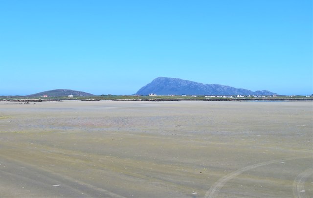
Eilean nan Corr is a small island situated in Loch Maree, located in the county of Inverness-shire, Scotland. Loch Maree is one of Scotland's largest freshwater lochs and is renowned for its exceptional natural beauty. Eilean nan Corr, also known as the "Island of the Otter," is a prominent feature of this picturesque landscape.

The island spans approximately 1.5 hectares (3.7 acres) and is covered in lush vegetation, including a variety of native trees and plants. It is home to a diverse range of wildlife, with otters being the most notable inhabitants. As a result, the island has become a popular destination for nature enthusiasts and birdwatchers.

Eilean nan Corr has a rich history, with evidence of human presence dating back to prehistoric times. It is believed that the island was once used as a burial site, as ancient cairns and burial mounds have been discovered there. In more recent history, the island was reportedly used as a hiding place for cattle during times of conflict.

Access to the island is possible by boat, either private or through organized tours. Visitors can enjoy the peacefulness of the surroundings, taking in the stunning views of Loch Maree and the surrounding mountains. The island offers an excellent opportunity for nature photography, birdwatching, and exploring the diverse flora and fauna.

Overall, Eilean nan Corr is a hidden gem within the Scottish Highlands, offering a unique and tranquil experience for those seeking to immerse themselves in nature and explore the rich history of the area.

If you have any feedback on the listing, please let us know in the comments section below.

Eilean nan Corr Images

Images are sourced within 2km of 57.519909/-7.3271116 or Grid Reference NF8160. Thanks to Geograph Open Source API. All images are credited.

Pony and ruin, Carinish
End of the road at Àird Mhòr
House at Carinish
House at Carinish
Marshy area at Carinish Seemingly a naturally infilled loch.
Marshy area at Carinish
Seemingly a naturally infilled loch.
Outside Talla Chairinis, North Uist Outside a community hall
Outside Talla Chairinis, North Uist
Outside a community hall
Blar Chairinis Site of battle in 1601.
Blar Chairinis
Site of battle in 1601.
Stone barn at Carinish
The ruins of Trinity Temple (Teampull na Trianaid) According to the plaque "Medieval monastery and college of European significance, founded by Beathag, daughter of Somhairle (Somerled).  Enlarged about 1350 to 1390 by Amie Mic Ruarie, first wife of John, Lord of the Isles.  Reconstructed in the 16th century.  Destroyed after the reformation.  Later restored in the 19th century by Dotair Ban."
The ruins of Trinity Temple (Teampull na Trianaid)
According to the plaque "Medieval monastery and college of European significance, founded by Beathag, daughter of Somhairle (Somerled). Enlarged about 1350 to 1390 by Amie Mic Ruarie, first wife of John, Lord of the Isles. Reconstructed in the 16th century. Destroyed after the reformation. Later restored in the 19th century by Dotair Ban."
Field and houses at Carinish And also the site of Feith na Fala (The ditch of blood) - a battle waged in 1601 between the MacLeods and the MacDonalds.
Field and houses at Carinish
And also the site of Feith na Fala (The ditch of blood) - a battle waged in 1601 between the MacLeods and the MacDonalds.
Bagh a’ Ghriasaiche
Bagh a’ Ghriasaiche
Fèithe na Fala - The ditch of blood
View from Temple View Hotel Teampull na Trionaid is a ruined 13th-century church and seminary at Carinish, North Uist, Scotland. Amie mac Ruari is said to have rebuilt the church in the 14th century after her divorce from John of Islay, Lord of the Isles. The ruins are protected as a scheduled monument.
View from Temple View Hotel
Teampull na Trionaid is a ruined 13th-century church and seminary at Carinish, North Uist, Scotland. Amie mac Ruari is said to have rebuilt the church in the 14th century after her divorce from John of Islay, Lord of the Isles. The ruins are protected as a scheduled monument.
Closer to the temple The ruins of Trinity Temple (Teampull na Trianaid)
Closer to the temple
The ruins of Trinity Temple (Teampull na Trianaid)
Free Church, Cairinis Current OS maps show this as a church, but older versions show it as a pub, which was its original purpose. Enough said.
Free Church, Cairinis
Current OS maps show this as a church, but older versions show it as a pub, which was its original purpose. Enough said.
A not very useful gate A rusty old metal gate at the point where a fence once crossed the track.
A not very useful gate
A rusty old metal gate at the point where a fence once crossed the track.
Track above Loch Creag nan Speireag This track, which is indistinct in places, forms part of the Hebridean Way, a relatively new walking route through the Western Isles.
Track above Loch Creag nan Speireag
This track, which is indistinct in places, forms part of the Hebridean Way, a relatively new walking route through the Western Isles.
Cotton grass, Creag nan Speireag Looking over cotton grass towards Loch nan Speireag and the houses at Gearraidh Cladach.
Cotton grass, Creag nan Speireag
Looking over cotton grass towards Loch nan Speireag and the houses at Gearraidh Cladach.
A sandy island surrounded by sand This is the part of the extensive area of tidal sand on the east side of Baile Sear island. The sand must be firm due to the number of vehicle tyre tracks across it. Looking due east towards the profile of Eabhal.
A sandy island surrounded by sand
This is the part of the extensive area of tidal sand on the east side of Baile Sear island. The sand must be firm due to the number of vehicle tyre tracks across it. Looking due east towards the profile of Eabhal.
Show me another place!

Eilean nan Corr is located at Grid Ref: NF8160 (Lat: 57.519909, Lng: -7.3271116)

Unitary Authority: Na h-Eileanan an Iar

Police Authority: Highlands and Islands

What 3 Words

///pothole.ripen.waving. Near Balivanich, Na h-Eileanan Siar

Related Wikis

Teampull na Trionaid

Teampull na Trionaid ("trinity church") is a ruined 13th-century Augustinian nunnery at Carinish, on North Uist, in the Outer Hebrides of Scotland. �...

Battle of Carinish

The Battle of Carinish was a Scottish clan battle fought in North Uist in 1601. It was part of a year of feuding between Clan MacLeod of Dunvegan and the...

Bail' Iochdrach

Bail' Iochdrach or Baliochrach (Scottish Gaelic: Am Baile Ìochdrach) is a village on Benbecula in the Outer Hebrides, Scotland. Baliochrach is within the...

Carinish

Carinish (Scottish Gaelic: Càirinis), is a hamlet on North Uist, in the Outer Hebrides, Scotland. It is in the south of the island, about two miles (three...

Nearby Amenities

Located within 500m of 57.519909,-7.3271116
Passing Place
Lat/Long: 57.5175452/-7.3206303
Passing Place
Lat/Long: 57.5179048/-7.3200238
The data included in this document is from www.openstreetmap.org. The data is made available under ODbL.

Have you been to Eilean nan Corr?

Leave your review of Eilean nan Corr below (or comments, questions and feedback).