Garbh-eilean Beag

Island in Inverness-shire

Scotland

Garbh-eilean Beag

Pony and ruin, Carinish
Pony and ruin, Carinish Credit: Hugh Venables

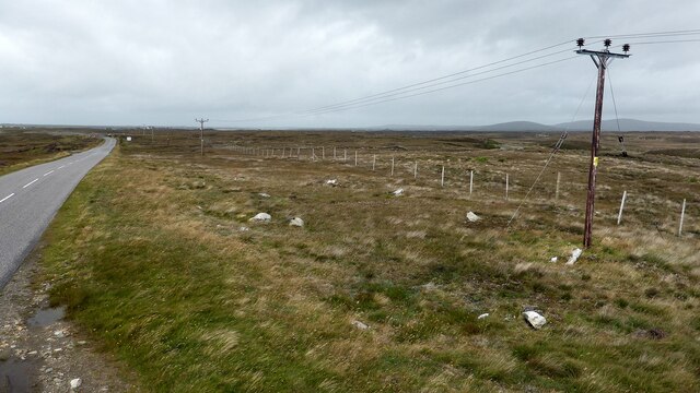
Garbh-eilean Beag is a small uninhabited island located in Inverness-shire, Scotland. Situated off the west coast, the island is part of the Inner Hebrides archipelago. With a total area of approximately 0.1 square kilometers, Garbh-eilean Beag is characterized by its rugged and rocky terrain.

The island is surrounded by the clear waters of the Atlantic Ocean, and its coastline features steep cliffs and rocky outcrops. The absence of sandy beaches makes it less accessible to visitors, contributing to its untouched and secluded atmosphere. Despite its small size, Garbh-eilean Beag supports a diverse range of plant and animal species, including seabirds, seals, and various marine life.

Due to its remote location and lack of human activity, Garbh-eilean Beag offers a unique opportunity for nature enthusiasts and wildlife photographers to observe and capture the island's unspoiled beauty. The rocky landscape provides a habitat for a variety of seabirds, including guillemots, razorbills, and puffins, which nest on the cliffs.

Access to Garbh-eilean Beag is limited and can be challenging, as there are no regular transportation services to the island. However, it can be reached by private boat or chartered tours from nearby coastal towns like Mallaig or Arisaig. Visitors are advised to check the weather conditions and tides before planning a trip to ensure a safe and enjoyable experience.

Overall, Garbh-eilean Beag is a picturesque and secluded island that offers an opportunity to disconnect from the outside world and immerse oneself in the raw beauty of nature.

If you have any feedback on the listing, please let us know in the comments section below.

Garbh-eilean Beag Images

Images are sourced within 2km of 57.522523/-7.3210375 or Grid Reference NF8160. Thanks to Geograph Open Source API. All images are credited.

Pony and ruin, Carinish
End of the road at Àird Mhòr
House at Carinish
House at Carinish
Marshy area at Carinish Seemingly a naturally infilled loch.
Marshy area at Carinish
Seemingly a naturally infilled loch.
Outside Talla Chairinis, North Uist Outside a community hall
Outside Talla Chairinis, North Uist
Outside a community hall
Blar Chairinis Site of battle in 1601.
Blar Chairinis
Site of battle in 1601.
Stone barn at Carinish
The ruins of Trinity Temple (Teampull na Trianaid) According to the plaque "Medieval monastery and college of European significance, founded by Beathag, daughter of Somhairle (Somerled).  Enlarged about 1350 to 1390 by Amie Mic Ruarie, first wife of John, Lord of the Isles.  Reconstructed in the 16th century.  Destroyed after the reformation.  Later restored in the 19th century by Dotair Ban."
The ruins of Trinity Temple (Teampull na Trianaid)
According to the plaque "Medieval monastery and college of European significance, founded by Beathag, daughter of Somhairle (Somerled). Enlarged about 1350 to 1390 by Amie Mic Ruarie, first wife of John, Lord of the Isles. Reconstructed in the 16th century. Destroyed after the reformation. Later restored in the 19th century by Dotair Ban."
Field and houses at Carinish And also the site of Feith na Fala (The ditch of blood) - a battle waged in 1601 between the MacLeods and the MacDonalds.
Field and houses at Carinish
And also the site of Feith na Fala (The ditch of blood) - a battle waged in 1601 between the MacLeods and the MacDonalds.
Bagh a’ Ghriasaiche
Bagh a’ Ghriasaiche
Fèithe na Fala - The ditch of blood
View from Temple View Hotel Teampull na Trionaid is a ruined 13th-century church and seminary at Carinish, North Uist, Scotland. Amie mac Ruari is said to have rebuilt the church in the 14th century after her divorce from John of Islay, Lord of the Isles. The ruins are protected as a scheduled monument.
View from Temple View Hotel
Teampull na Trionaid is a ruined 13th-century church and seminary at Carinish, North Uist, Scotland. Amie mac Ruari is said to have rebuilt the church in the 14th century after her divorce from John of Islay, Lord of the Isles. The ruins are protected as a scheduled monument.
Closer to the temple The ruins of Trinity Temple (Teampull na Trianaid)
Closer to the temple
The ruins of Trinity Temple (Teampull na Trianaid)
Free Church, Cairinis Current OS maps show this as a church, but older versions show it as a pub, which was its original purpose. Enough said.
Free Church, Cairinis
Current OS maps show this as a church, but older versions show it as a pub, which was its original purpose. Enough said.
A not very useful gate A rusty old metal gate at the point where a fence once crossed the track.
A not very useful gate
A rusty old metal gate at the point where a fence once crossed the track.
Track above Loch Creag nan Speireag This track, which is indistinct in places, forms part of the Hebridean Way, a relatively new walking route through the Western Isles.
Track above Loch Creag nan Speireag
This track, which is indistinct in places, forms part of the Hebridean Way, a relatively new walking route through the Western Isles.
Cotton grass, Creag nan Speireag Looking over cotton grass towards Loch nan Speireag and the houses at Gearraidh Cladach.
Cotton grass, Creag nan Speireag
Looking over cotton grass towards Loch nan Speireag and the houses at Gearraidh Cladach.
Carinish stone circle Sadly the road cuts through this stone circle. <span class="nowrap"><a title="https://canmore.org.uk/site/10249/north-uist-carinish" rel="nofollow ugc noopener" href="https://canmore.org.uk/site/10249/north-uist-carinish">Link</a><img style="margin-left:2px;" alt="External link" title="External link - shift click to open in new window" src="https://s1.geograph.org.uk/img/external.png" width="10" height="10"/></span>
Carinish stone circle
Sadly the road cuts through this stone circle. LinkExternal link
Show me another place!

Garbh-eilean Beag is located at Grid Ref: NF8160 (Lat: 57.522523, Lng: -7.3210375)

Unitary Authority: Na h-Eileanan an Iar

Police Authority: Highlands and Islands

What 3 Words

///forkful.buck.plausible. Near Balivanich, Na h-Eileanan Siar

Related Wikis

Teampull na Trionaid

Teampull na Trionaid ("trinity church") is a ruined 13th-century Augustinian nunnery at Carinish, on North Uist, in the Outer Hebrides of Scotland. �...

Battle of Carinish

The Battle of Carinish was a Scottish clan battle fought in North Uist in 1601. It was part of a year of feuding between Clan MacLeod of Dunvegan and the...

Carinish

Carinish (Scottish Gaelic: Càirinis), is a hamlet on North Uist, in the Outer Hebrides, Scotland. It is in the south of the island, about two miles (three...

Bail' Iochdrach

Bail' Iochdrach or Baliochrach (Scottish Gaelic: Am Baile Ìochdrach) is a village on Benbecula in the Outer Hebrides, Scotland. Baliochrach is within the...

Nearby Amenities

Located within 500m of 57.522523,-7.3210375
Post Box
Collection Times: Mo-Fr 14:00; Sa 09:30
Post Box Type: lamp
Royal Cypher: scottish_crown
Lat/Long: 57.5238889/-7.3144068
Telephone
Booth: KX100
Covered: booth
Payment Coins: yes
Lat/Long: 57.524198/-7.3145919
Passing Place
Lat/Long: 57.5183217/-7.3183545
Parking
Lat/Long: 57.5195628/-7.3169181
Bus Stop
Bench: yes
Bus: yes
Naptan AtcoCode: 6010774
Naptan NaptanCode: 94726572
Public Transport: platform
Shelter: yes
Lat/Long: 57.5225833/-7.3139173
Turning Circle
Lat/Long: 57.5215608/-7.3162026
Bagh a' Ghriasaiche
Natural: bay
Lat/Long: 57.5235778/-7.3193622
Board Type: history
Information: board
Tourism: information
Lat/Long: 57.5217156/-7.3134211
Board Type: history
Information: board
Tourism: information
Lat/Long: 57.5210633/-7.317012
Historic: yes
Note: Battle of Carinish - "Ditch of blood"
Lat/Long: 57.5220208/-7.3137269
Carabhat
Place: neighbourhood
Lat/Long: 57.5226273/-7.3135525
Power: pole
Lat/Long: 57.5256521/-7.315619
Power: pole
Lat/Long: 57.5255797/-7.3151398
Power: pole
Lat/Long: 57.5258614/-7.3166904
Power: pole
Lat/Long: 57.5262352/-7.3174481
Power: pole
Lat/Long: 57.5265303/-7.3180578
Power: pole
Lat/Long: 57.5236962/-7.3134847
Power: pole
Lat/Long: 57.5268112/-7.3186631
Barrier: cattle_grid
Lat/Long: 57.5242751/-7.3150783
Power: pole
Lat/Long: 57.521707/-7.3129114
Power: pole
Lat/Long: 57.520886/-7.3132977
Power: pole
Lat/Long: 57.5205374/-7.3138288
Power: pole
Lat/Long: 57.5201773/-7.3143974
Power: pole
Lat/Long: 57.5204683/-7.315135
Power: pole
Lat/Long: 57.5209206/-7.3143223
Power: pole
Lat/Long: 57.5212446/-7.3137456
Power: pole
Lat/Long: 57.5215255/-7.3148104
Power: pole
Lat/Long: 57.5200189/-7.3159477
Power: pole
Lat/Long: 57.5198691/-7.3174363
Power: pole
Lat/Long: 57.5194989/-7.3152584
Power: pole
Lat/Long: 57.5191921/-7.315658
Power: pole
Lat/Long: 57.5195796/-7.3160255
Power: pole
Lat/Long: 57.520844/-7.3162554
Power: pole
Lat/Long: 57.5215642/-7.3140399
Power: pole
Lat/Long: 57.5211501/-7.3155822
Power: pole
Lat/Long: 57.5203838/-7.3167865
Power: pole
Lat/Long: 57.520067/-7.31717
Passing Place
Lat/Long: 57.5191142/-7.3176168
The data included in this document is from www.openstreetmap.org. The data is made available under ODbL.

Have you been to Garbh-eilean Beag?

Leave your review of Garbh-eilean Beag below (or comments, questions and feedback).