Hamalan
Island in Inverness-shire
Scotland
Hamalan

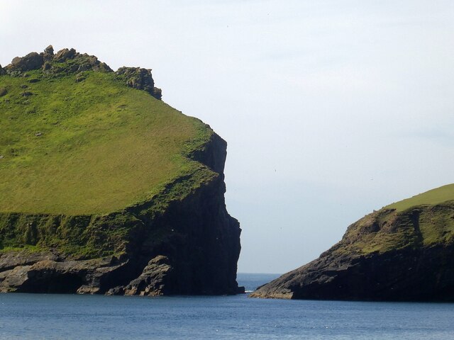
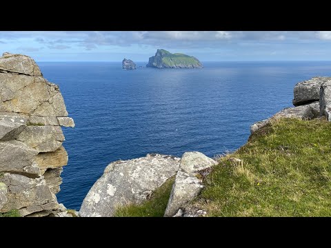
Hamalan is a remote island located in Inverness-shire, Scotland. It is known for its rugged beauty, with dramatic cliffs, rocky beaches, and lush greenery covering much of the island. The island is only accessible by boat, adding to its sense of seclusion and tranquility.
Hamalan is home to a small population of residents who live in quaint cottages scattered throughout the island. The main village is located on the eastern coast, where visitors can find a few shops and restaurants serving locally sourced seafood and traditional Scottish cuisine.
The island is a popular destination for outdoor enthusiasts, with opportunities for hiking, birdwatching, and fishing. The surrounding waters are teeming with marine life, making it a great spot for wildlife spotting and diving.
Despite its remote location, Hamalan has a rich history, with ancient ruins and archaeological sites scattered across the island. Visitors can explore these historic sites and learn about the island's past through guided tours and interpretive displays.
Overall, Hamalan offers a unique and peaceful escape for those looking to experience the natural beauty and rich history of the Scottish Highlands.
If you have any feedback on the listing, please let us know in the comments section below.
Hamalan Images
Images are sourced within 2km of 57.793202/-8.5532084 or Grid Reference NF1097. Thanks to Geograph Open Source API. All images are credited.


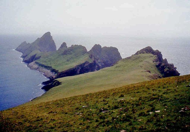


![Ruabhal, St Kilda Bagged on a circuit of six Hirta TUMPs on a sunny afternoon.
Name: Ruabhal
Hill number: 12797
Height: 130m / 427ft
Parent (Ma/M): 1636 Conachair
Section: 25: St Kilda
County/UA: Na h-Eileanan Siar [Western Isles] (UA)
Island: Hirta
Class: Tump (100-199m)
Grid ref: NF 09577 97873
Summit feature: rocky tor
Drop: 32m
Col: 98m NF095980](https://s0.geograph.org.uk/geophotos/04/18/10/4181056_d000fe76.jpg)


Hamalan is located at Grid Ref: NF1097 (Lat: 57.793202, Lng: -8.5532084)
Unitary Authority: Na h-Eileanan an Iar
Police Authority: Highlands and Islands
What 3 Words
///revise.detect.existence. Near Balivanich, Na h-Eileanan Siar
Nearby Locations
Related Wikis

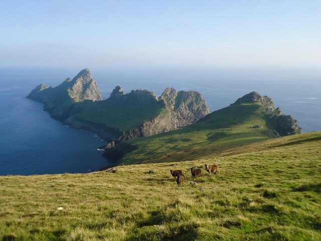
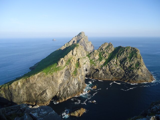
Dùn
Dùn is an island in St Kilda, Scotland. It is nearly 1 mile (1.6 kilometres) long. Its name simply means "fort" in Scottish Gaelic (for more information...

Hirta
Hirta (Scottish Gaelic: Hiort) is the largest island in the St Kilda archipelago, on the western edge of Scotland. The names Hiort (in Scottish Gaelic...

Stac Levenish
Stac Levenish or Stac Leibhinis (sometimes simply called Levenish/Leibhinis) is a sea stack in the St Kilda archipelago in Scotland. Lying 2.5 kilometres...

St Kilda, Scotland
St Kilda (Scottish Gaelic: Hiort) is an isolated archipelago situated 64 kilometres (40 mi) west-northwest of North Uist in the North Atlantic Ocean. It...
Related Videos

St Kilda, Scotland's Island on the Edge (scenic film + guide)
ST KILDA TRAVEL GUIDE https://www.goingthewholehogg.com/visit-st-kilda-scotland/ ➤ BECOME OUR PATRON ...
St Kilda World Heritage Site
A bucket list trip to St Kilda. I hadn't intended filming much at all. But I took what little footage I had to make a short.

Old Photographs And Footage Of Bird Fowling On St Kilda Scotland
Old photographs and footage of bird fowling on St Kilda, in the Outer Hebrides. Often described as the islands at the edge of the ...
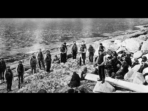
Old Photographs And Footage Of Fowlers On St Kilda Outer Hebrides Scotland
Old photographs and footage of Fowlers on St Kilda, in the Outer Hebrides. Often described as the islands at the edge of the world ...
Nearby Amenities
Located within 500m of 57.793202,-8.5532084Have you been to Hamalan?
Leave your review of Hamalan below (or comments, questions and feedback).