Coire an Fhuarail

Corrie (Glacial Valley) in Inverness-shire

Scotland

Coire an Fhuarail

Path towards Sgurr an Fhuarail
Path towards Sgurr an Fhuarail Credit: Steven Brown

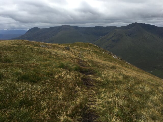
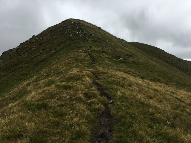
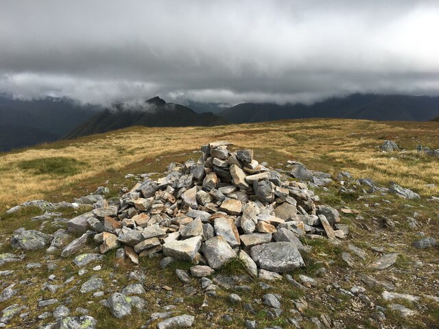
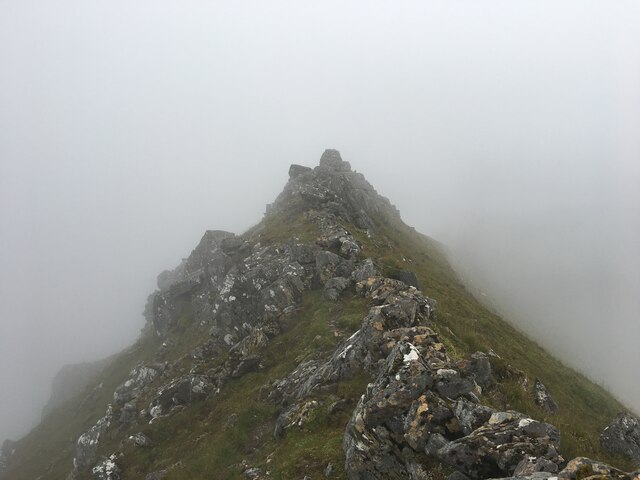
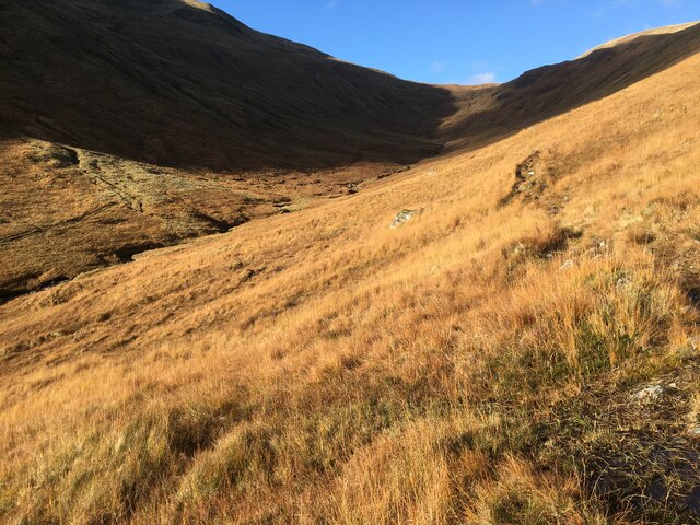
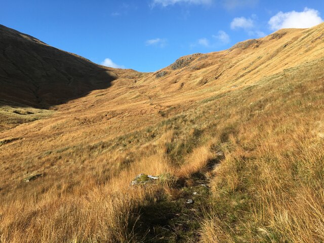
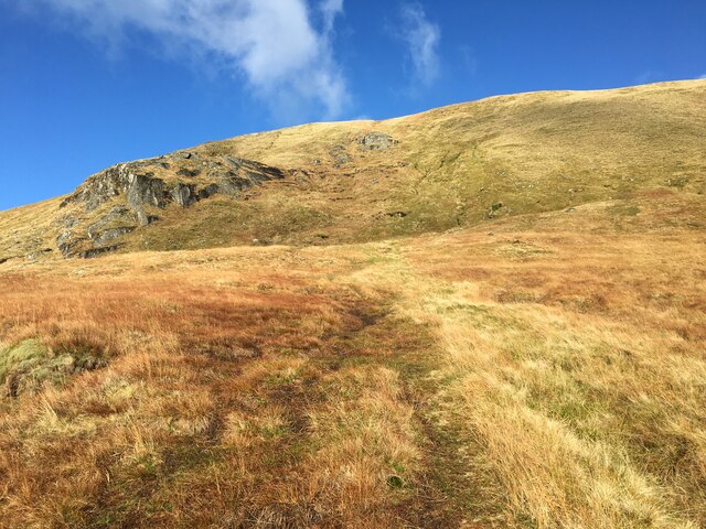
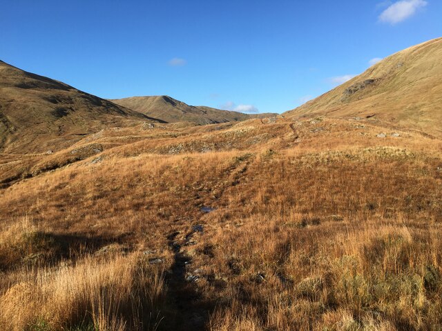
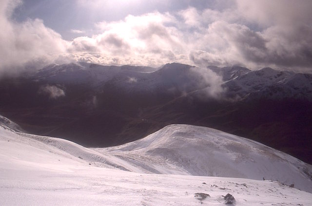
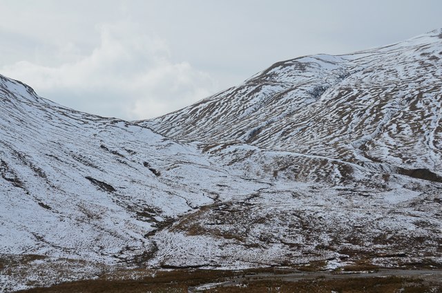
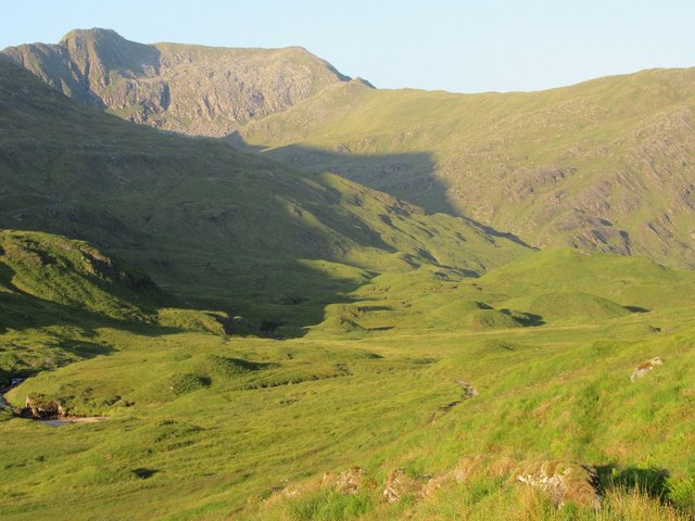
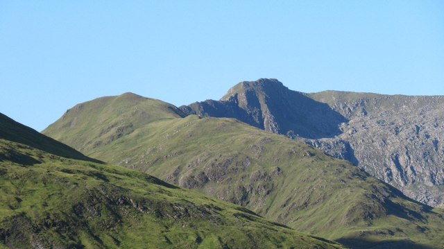
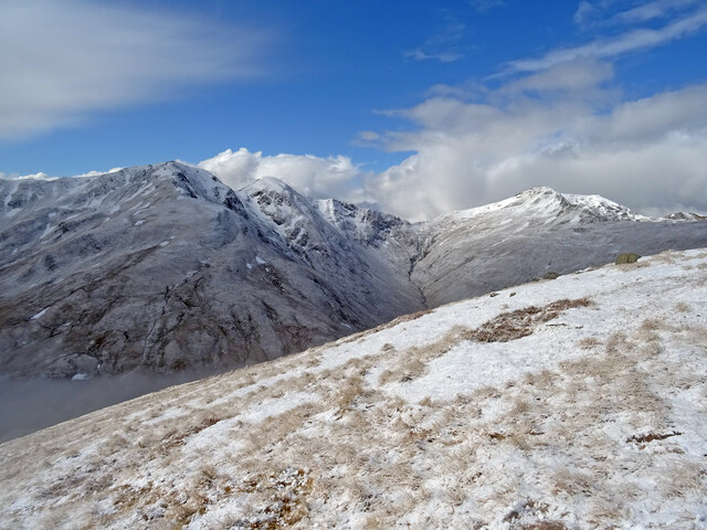
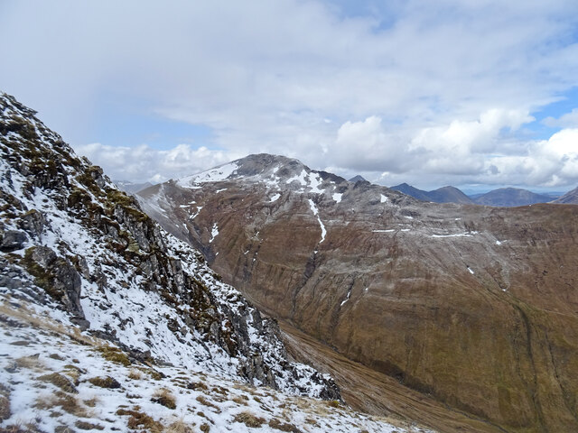
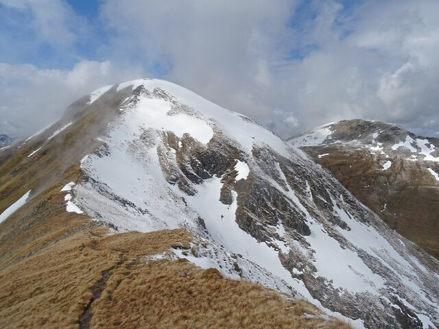
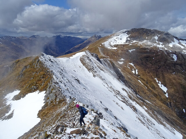
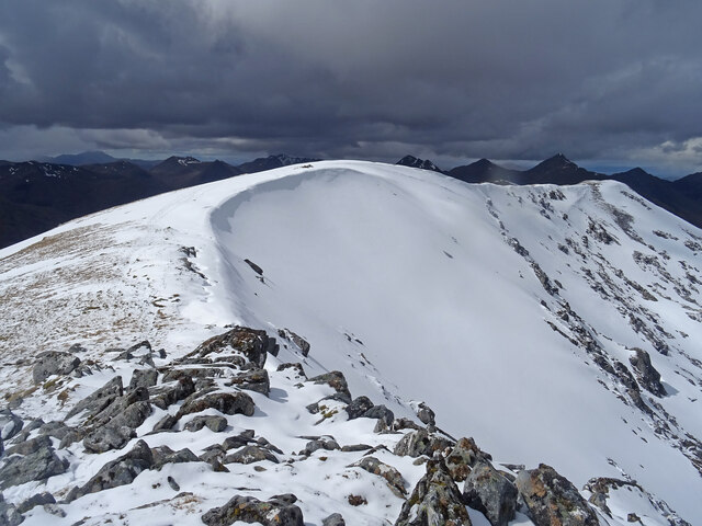
Coire an Fhuarail is a glacial valley located in Inverness-shire, Scotland. It is situated in the Cairngorms National Park, known for its stunning landscapes and diverse wildlife. The valley is surrounded by steep, rocky slopes and is carved out by the action of glaciers during the last Ice Age.

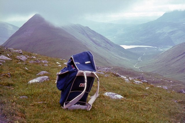
The valley is home to a variety of plant and animal species, including rare alpine plants and birds of prey such as golden eagles. The rugged terrain and remote location make it a popular destination for hikers, climbers, and nature enthusiasts looking to explore the Scottish Highlands.

Coire an Fhuarail offers stunning views of the surrounding mountains and valleys, making it a favorite spot for photographers and artists seeking inspiration from the natural beauty of the landscape. The valley is also a designated Special Area of Conservation, ensuring the protection of its unique ecosystem and wildlife.

Overall, Coire an Fhuarail is a must-visit destination for those looking to experience the raw beauty and natural wonders of the Scottish Highlands.

If you have any feedback on the listing, please let us know in the comments section below.

Coire an Fhuarail Images

Images are sourced within 2km of 57.178017/-5.2258131 or Grid Reference NH0514. Thanks to Geograph Open Source API. All images are credited.

Path towards Sgurr an Fhuarail
Path on Sgurr an Fhuarail
Cairn on Aonach Meadhoin
Summit of Sgurr a’ Bhealaich Dheirg
An Coarann Beag
An Coarann Beag
Towards Bealach a’ Choinich
Path towards An Cnapach
Bealach a’ Choinich
Bealach a’ Choinich
Meall a' Charra Top on the north side of Sgùrr a' Bhealaich Dheirg, Glen Shiel.
Meall a' Charra
Top on the north side of Sgùrr a' Bhealaich Dheirg, Glen Shiel.
South end of Ciste Dhubh Looking down An Caorann Beag.
South end of Ciste Dhubh
Looking down An Caorann Beag.
Snow-streaked hillsides from An Caorann Mor Looking towards the Bealach a' Choinich between Am Bathach and Ciste Dhubh.
Snow-streaked hillsides from An Caorann Mor
Looking towards the Bealach a' Choinich between Am Bathach and Ciste Dhubh.
Sgùrr a' Bhealaich Dheirg View from Fionngleann, upper Glen Affric. Note the basket of eggs glacial deposits.
Sgùrr a' Bhealaich Dheirg
View from Fionngleann, upper Glen Affric. Note the basket of eggs glacial deposits.
Sreath a' Ghlas-choire A very fine ridge up from the Affric side to Sgùrr a' Bhealaich Dheirg,  It is quite narrow in places but in Summer, presents no scrambling.
Sreath a' Ghlas-choire
A very fine ridge up from the Affric side to Sgùrr a' Bhealaich Dheirg, It is quite narrow in places but in Summer, presents no scrambling.
A Spring Day on An Cnapach Climbing the southern slopes of An Cnapach, itself a southern outlier of the Munro of Ciste Dhubh. Fresh snow has fallen on the first day of May and its more of a winter scene than spring. Lovely day to be out between the snow showers.
A Spring Day on An Cnapach
Climbing the southern slopes of An Cnapach, itself a southern outlier of the Munro of Ciste Dhubh. Fresh snow has fallen on the first day of May and its more of a winter scene than spring. Lovely day to be out between the snow showers.
North Ridge Sgurr an Fhuarail On the steep north ridge of the subsidiary top of Sgurr an Fhuarail looking across to the Munro of Sgurr a' Bhealaich Dheirg, both peaks on the Brothers of Kintail. A fine day to be on some fine peaks between the wintry showers.
North Ridge Sgurr an Fhuarail
On the steep north ridge of the subsidiary top of Sgurr an Fhuarail looking across to the Munro of Sgurr a' Bhealaich Dheirg, both peaks on the Brothers of Kintail. A fine day to be on some fine peaks between the wintry showers.
On the Brothers Descending the first peak of the Brothers of Kintail on the north side of Glen Shiel. The north side of all the peaks are still holding a lot of snow.
On the Brothers
Descending the first peak of the Brothers of Kintail on the north side of Glen Shiel. The north side of all the peaks are still holding a lot of snow.
Taking Care on the Brothers The walker and 2 dogs are taking care to descend carefully on some of the rocky terrain between Aonach Meadhoin and Sgurr a' Bhealaich Dheirg on the Brothers of Kintail.
Taking Care on the Brothers
The walker and 2 dogs are taking care to descend carefully on some of the rocky terrain between Aonach Meadhoin and Sgurr a' Bhealaich Dheirg on the Brothers of Kintail.
Summit View Looking across the snow covered ridge of Sgurr a' Bhealaich Dheirg in Kintail.
In the distance can be seen some of the Five Sisters of Kintail.
Summit View
Looking across the snow covered ridge of Sgurr a' Bhealaich Dheirg in Kintail. In the distance can be seen some of the Five Sisters of Kintail.
Show me another place!

Coire an Fhuarail is located at Grid Ref: NH0514 (Lat: 57.178017, Lng: -5.2258131)

Unitary Authority: Highland

Police Authority: Highlands and Islands

What 3 Words

///fearfully.windmill.mushroom. Near Glenelg, Highland

Nearby Locations

Coire an Fhuarail

Related Wikis

Aonach Meadhoin

Aonach Meadhoin is a Munro mountain situated in the Kintail region of Scotland. It stands on the northern side of Glen Shiel some 31 kilometres south east...

Sgùrr a' Bhealaich Dheirg

Sgùrr a' Bhealaich Dheirg (Scottish Gaelic for 'peak of the red gap') is a mountain in Kintail on the northern side of Glen Shiel in the Scottish Highlands...

Am Bàthach

Am Bàthach is a Scottish mountain situated at the head of Glen Shiel, at the western end of Loch Cluanie some 38 km (24 mi) south east of Kyle of Lochalsh...

Ciste Dhubh

Ciste Dhubh is a mountain in the Scottish Highlands, between Glen Shiel and Glen Affric. With a height of 979 metres (3,212 ft), it is classed as a Munro...

Nearby Amenities

Located within 500m of 57.178017,-5.2258131
Sgurr an Fhuarail
Natural: peak
Source: NPE
Lat/Long: 57.1749952/-5.2215858
The data included in this document is from www.openstreetmap.org. The data is made available under ODbL.

Have you been to Coire an Fhuarail?

Leave your review of Coire an Fhuarail below (or comments, questions and feedback).