Coire nan Clach

Corrie (Glacial Valley) in Inverness-shire

Scotland

Coire nan Clach

South ridge of Beinn Odhar Mhòr The south ridge of Beinn Odhar Mhòr. The summit of Beinn Odhar Mhòr is in the centre of the photo.
South ridge of Beinn Odhar Mhòr Credit: Jonathan Venn

The requested URL returned error: 429 Too Many Requests

If you have any feedback on the listing, please let us know in the comments section below.

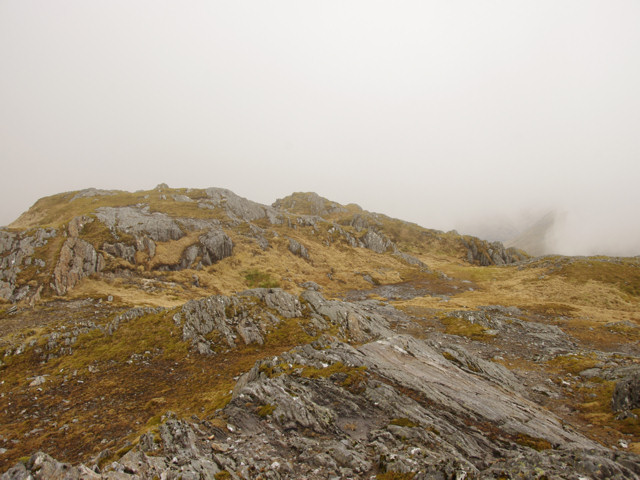
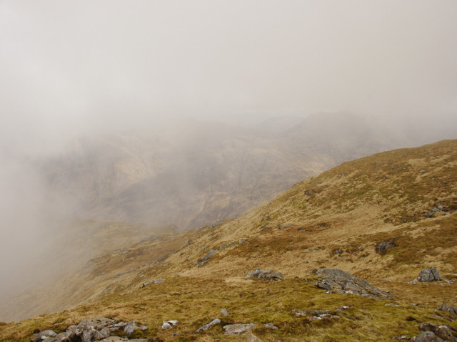
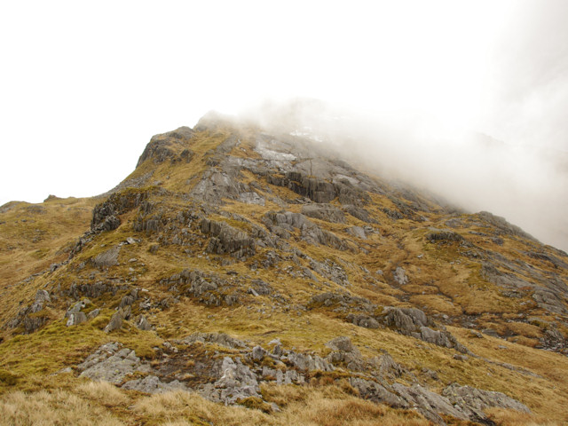
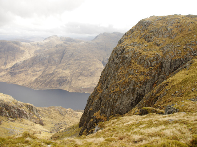
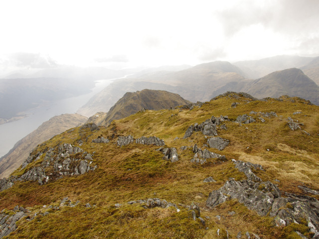
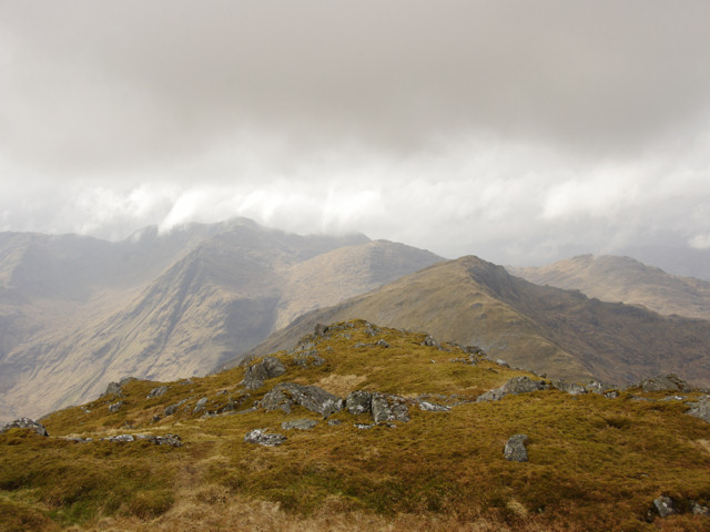
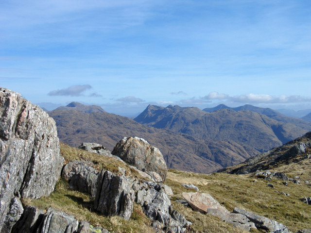
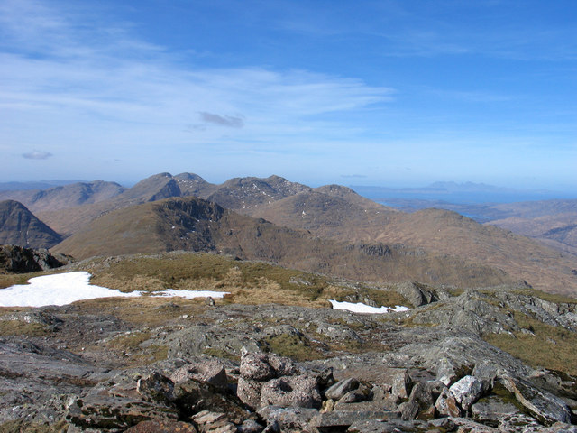
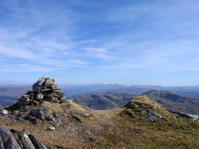
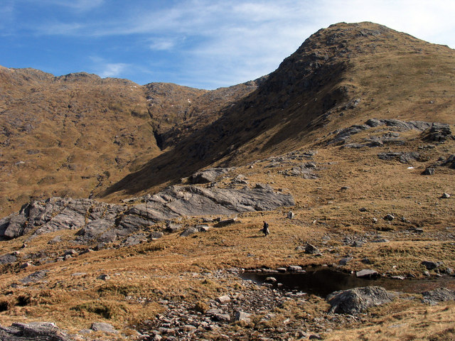
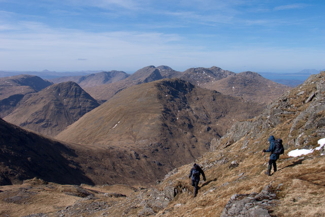
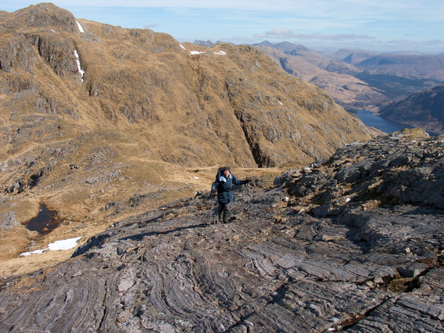
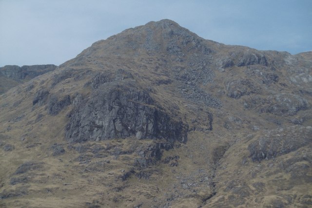
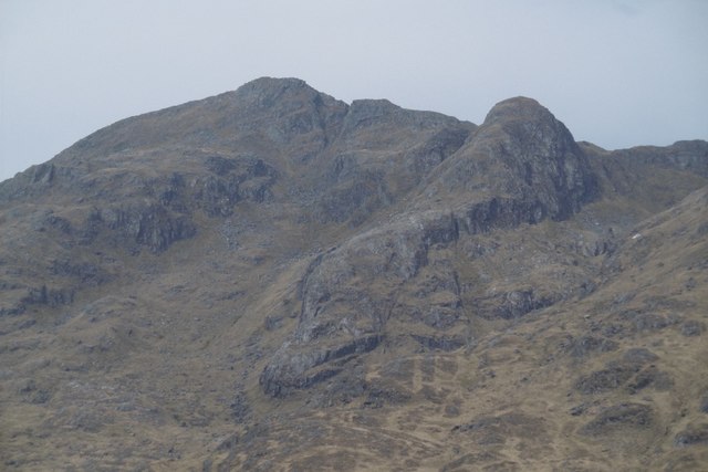
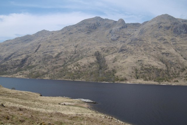
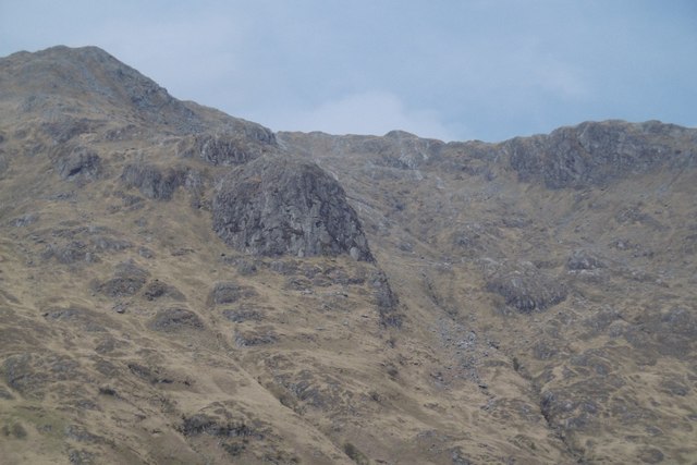
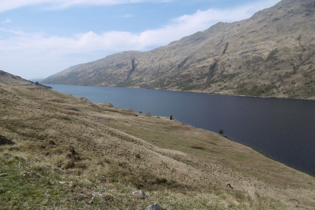
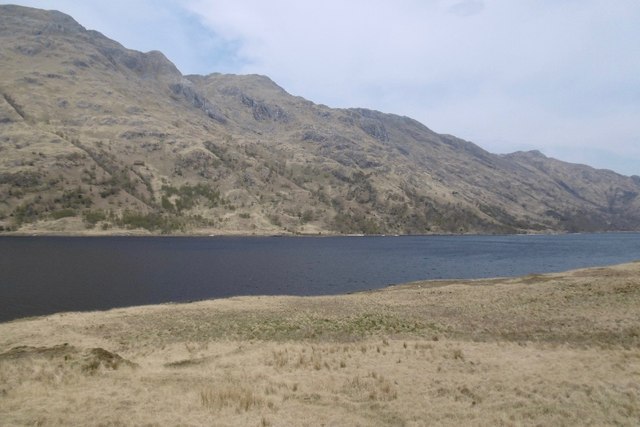
Coire nan Clach Images

Images are sourced within 2km of 56.845615/-5.5243889 or Grid Reference NM8578. Thanks to Geograph Open Source API. All images are credited.

South ridge of Beinn Odhar Mhòr The south ridge of Beinn Odhar Mhòr. The summit of Beinn Odhar Mhòr is in the centre of the photo.
South ridge of Beinn Odhar Mhòr
The south ridge of Beinn Odhar Mhòr. The summit of Beinn Odhar Mhòr is in the centre of the photo.
South ridge of Beinn Odhar Mhòr South ridge of Beinn Odhar Mhòr. Coire na Lotha is on the left in the mist.
South ridge of Beinn Odhar Mhòr
South ridge of Beinn Odhar Mhòr. Coire na Lotha is on the left in the mist.
Looking up the north ridge of Beinn Odhar Beag Looking up the north ridge of Beinn Odhar Beag.
Looking up the north ridge of Beinn Odhar Beag
Looking up the north ridge of Beinn Odhar Beag.
Crags overlooking Loch Shiel Crags overlooking Loch Shiel.
Crags overlooking Loch Shiel
Crags overlooking Loch Shiel.
Summit of Beinn Odhar Beag Summit of Beinn Odhar Beag. Loch Shiel visible to the left.
Summit of Beinn Odhar Beag
Summit of Beinn Odhar Beag. Loch Shiel visible to the left.
Summit of Beinn Odhar Beag Summit of Beinn Odhar Beag. Beinn Mhic Cedidh is in the middle distance
Summit of Beinn Odhar Beag
Summit of Beinn Odhar Beag. Beinn Mhic Cedidh is in the middle distance
Rocks of north-west ridge of Beinn Odhar Mhòr The summit of Beinn Odhar Mhòr lies not far to the right out of view. Among the complex of distant mountains Streap is thought to be central.
Rocks of north-west ridge of Beinn Odhar Mhòr
The summit of Beinn Odhar Mhòr lies not far to the right out of view. Among the complex of distant mountains Streap is thought to be central.
Summit area of Beinn Odhar Mhòr Some of the remains of the cylindrical trig point of Beinn Odhar Mhòr can be seen in the foreground of the image; more sections lie down a slope perhaps having been rolled there by playful visitors! The view beyond is to Beinn Mhic Cedidh with mountains of the Rois-Bheinn group further to the west.
Summit area of Beinn Odhar Mhòr
Some of the remains of the cylindrical trig point of Beinn Odhar Mhòr can be seen in the foreground of the image; more sections lie down a slope perhaps having been rolled there by playful visitors! The view beyond is to Beinn Mhic Cedidh with mountains of the Rois-Bheinn group further to the west.
Summit cairn and knolls of Beinn Odhar Bheag Beinn Odhar Bheag and Beinn Odhar Mhor are adjacent mountains, their naming is a little odd in that the lower one is named as the larger peak; probably another feature of the pair such as bulk was considered. In the far distance, to the east, the snowed peak is Ben Nevis.
Summit cairn and knolls of Beinn Odhar Bheag
Beinn Odhar Bheag and Beinn Odhar Mhor are adjacent mountains, their naming is a little odd in that the lower one is named as the larger peak; probably another feature of the pair such as bulk was considered. In the far distance, to the east, the snowed peak is Ben Nevis.
Ridge with rock slabs rising to Beinn Odhar Bheag The image was recorded from the Bealach a' Choire Bhuidhe which is the low point between Beinn Mhic Cèdidh which rises behind the camera position and Beinn Odhar Bheag.
Ridge with rock slabs rising to Beinn Odhar Bheag
The image was recorded from the Bealach a' Choire Bhuidhe which is the low point between Beinn Mhic Cèdidh which rises behind the camera position and Beinn Odhar Bheag.
Steep slope south of Beinn Odhar Mhòr The walkers are descending from Beinn Odhar Mhòr en route for Beinn Odhar Bheag. Beinn Mhic Cedidh is the central mountain in the mid-distance, the Rois-Bheinn group being beyond it.
Steep slope south of Beinn Odhar Mhòr
The walkers are descending from Beinn Odhar Mhòr en route for Beinn Odhar Bheag. Beinn Mhic Cedidh is the central mountain in the mid-distance, the Rois-Bheinn group being beyond it.
Rock slabs on north-east ridge of Beinn Odhar Bheag Fine rock slabs on the ridge rising to Beinn Odhar Bheag from its col with Beinn Odhar Mhòr, which is the mountain occupying much of the image.
Rock slabs on north-east ridge of Beinn Odhar Bheag
Fine rock slabs on the ridge rising to Beinn Odhar Bheag from its col with Beinn Odhar Mhòr, which is the mountain occupying much of the image.
Crag, Sgùrr na Boneid A large clean looking crag on the Loch Shiel flank of Beinn Odhar Mhòr.
Crag, Sgùrr na Boneid
A large clean looking crag on the Loch Shiel flank of Beinn Odhar Mhòr.
Beinn Odhar Bheag and Sgùrr an Tuirc A sharp buttress beside the summit of Beinn Odhar Bheag.
Beinn Odhar Bheag and Sgùrr an Tuirc
A sharp buttress beside the summit of Beinn Odhar Bheag.
Loch Shiel and Beinn Odhar Bheag A view to the Moidart shore (Inverness-shire) from the logging road.  Some good looking but hard to access crags about.
Loch Shiel and Beinn Odhar Bheag
A view to the Moidart shore (Inverness-shire) from the logging road. Some good looking but hard to access crags about.
Sgùrr an Iubhair A sharply truncated spur on the Loch Shiel side of Beinn Odhar Mhòr.
Sgùrr an Iubhair
A sharply truncated spur on the Loch Shiel side of Beinn Odhar Mhòr.
Loch Shiel View from the top of a climb between the forest edge and Guesachan.
Loch Shiel
View from the top of a climb between the forest edge and Guesachan.
Loch Shiel View towards Glenfinnan from the logging road with the steep Beinn Odhar face and oakwoods opposite.
Loch Shiel
View towards Glenfinnan from the logging road with the steep Beinn Odhar face and oakwoods opposite.
Show me another place!

Coire nan Clach is located at Grid Ref: NM8578 (Lat: 56.845615, Lng: -5.5243889)

Unitary Authority: Highland

Police Authority: Highlands and Islands

What 3 Words

///justifies.afternoon.perky. Near Arisaig, Highland

Related Wikis

Beinn Odhar Bheag

Beinn Odhar Bheag (882 m) is a mountain in the Northwest Highlands of Scotland, south of the village of Glenfinnan in Moidart, Lochaber. It shares the...

Lech-a-Vuie Platform railway station

Lech-a-Vuie Platform railway station (NM860813), Lechavuie or Lech-a-Vute was not constructed for public use. It stood close to the A830 road to the east...

Sgùrr Ghiubhsachain

Sgùrr Ghiubhsachain is a mountain in the Lochaber area in the west of Scotland. Its summit is the highest point in a group of mountains that stand south...

A830 road

The A830, also known as the Road to the Isles (though it forms only a part of the historic route) is a major road in Lochaber, Scottish Highlands. It connects...

Have you been to Coire nan Clach?

Leave your review of Coire nan Clach below (or comments, questions and feedback).