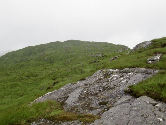
Coire na Craoibhe

Corrie (Glacial Valley) in Argyllshire

Scotland

Coire na Craoibhe

Ridge east of Beinn Ruighe Raonuill
Ridge east of Beinn Ruighe Raonuill Credit: Richard Webb

The requested URL returned error: 429 Too Many Requests

If you have any feedback on the listing, please let us know in the comments section below.

Coire na Craoibhe Images

Images are sourced within 2km of 56.751593/-5.5187266 or Grid Reference NM8467. Thanks to Geograph Open Source API. All images are credited.

Ridge east of Beinn Ruighe Raonuill
Forestry track junction in Glen Hurich The track to the left is the route to Resourie bothy as indicated by 'The Bothy' sign in the grass verge on the left.
Forestry track junction in Glen Hurich
The track to the left is the route to Resourie bothy as indicated by 'The Bothy' sign in the grass verge on the left.
Forestry track in Glen Hurich
Forestry track beside the River Hurich The traffic cones are marking where part of the banking has been eroded.
Forestry track beside the River Hurich
The traffic cones are marking where part of the banking has been eroded.
Rickety wooden footbridge over Allt Féith Dhomhnuill The image was made in May 2004 when the bridge was in a poor state, in 2017, it may no longer be there - OS mapping at larger scales do not show it.
Rickety wooden footbridge over Allt Féith Dhomhnuill
The image was made in May 2004 when the bridge was in a poor state, in 2017, it may no longer be there - OS mapping at larger scales do not show it.
Tree growing among mine spoils The site is that of the Fee Donald Mine close to the  Allt Féith Dhomhnuill. Though it's not apparent in the image the tree appears to be growing from some structure, most likely a disused wheel pit.
Tree growing among mine spoils
The site is that of the Fee Donald Mine close to the Allt Féith Dhomhnuill. Though it's not apparent in the image the tree appears to be growing from some structure, most likely a disused wheel pit.
Trig point and cairn at Druim Glas Druim Glas is a minor hill east of the high point of a minor road connecting the village of Strontian with the remote settlement at Polloch. The Kingairloch hills are in the distance.
Trig point and cairn at Druim Glas
Druim Glas is a minor hill east of the high point of a minor road connecting the village of Strontian with the remote settlement at Polloch. The Kingairloch hills are in the distance.
Bealach Fèith nan Laogh Approaching the high point of the pass between Strontian and Glen Hurich.  Quite a pech if self propelled, but I was motorised this time.  My first crossing was on foot after walking from the ferry opposite Fort William across Ardgour.
Bealach Fèith nan Laogh
Approaching the high point of the pass between Strontian and Glen Hurich. Quite a pech if self propelled, but I was motorised this time. My first crossing was on foot after walking from the ferry opposite Fort William across Ardgour.
Above Glen Hurich Some extremely rough ground beside the road pass between Strontian and Glen Hurich.
Above Glen Hurich
Some extremely rough ground beside the road pass between Strontian and Glen Hurich.
Forest edge, Glen Hurich Beside the Polloch to Strontian road.
Forest edge, Glen Hurich
Beside the Polloch to Strontian road.
Cattle grid, Glenhurich Forest Entering the trees on the descent from the Bealach Fèith nan Laogh.
Cattle grid, Glenhurich Forest
Entering the trees on the descent from the Bealach Fèith nan Laogh.
End of forest road in Gleann an Dubh Choirein near Loch Shiel This site is a bit farther on from that marked on the map but this track on the north of the glen had been extended for timber extraction unlike its southside counterpart which has no harvestable timber for now.
End of forest road in Gleann an Dubh Choirein near Loch Shiel
This site is a bit farther on from that marked on the map but this track on the north of the glen had been extended for timber extraction unlike its southside counterpart which has no harvestable timber for now.
Trackless forest on southside of Gleann an Dubh Choirein near Loch Shiel
Track back down Gleann an Dubh Choirein near Loch Shiel from track end
General view west from Gleann an Dubh Choirein near Loch Shiel Snowy Resipol in the background.
General view west from Gleann an Dubh Choirein near Loch Shiel
Snowy Resipol in the background.
View north from new track end in Gleann an Dubh Choirein near Loch Shiel
Uninviting conditions beyond track end in Gleann an Dubh Choirein near Loch Shiel
Track end on south side of Gleann an Dubh Choirein near Loch Shiel There is a terminal turning spot then a lesser track extending on from it. However the north side track is by far the more engineered and well-surfaced as far as it goes.
Track end on south side of Gleann an Dubh Choirein near Loch Shiel
There is a terminal turning spot then a lesser track extending on from it. However the north side track is by far the more engineered and well-surfaced as far as it goes.
Show me another place!

Coire na Craoibhe is located at Grid Ref: NM8467 (Lat: 56.751593, Lng: -5.5187266)

Unitary Authority: Highland

Police Authority: Highlands and Islands

What 3 Words

///mirroring.slacker.factories. Near Fort William, Highland

Nearby Locations

Coire na Craoibhe

Related Wikis

Sgùrr Dhòmhnuill

Sgurr Dhòmhnuill or Sgurr Dhòmhnaill is a mountain in western Scotland. The summit lies about ten kilometres (six miles) northeast of Strontian.
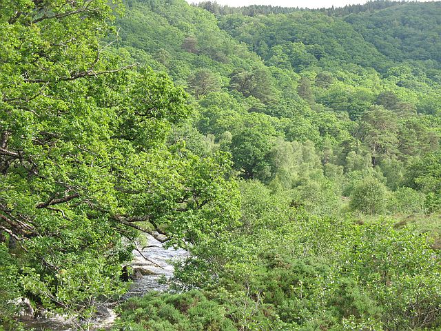
Ariundle Oakwood

Ariundle Oakwood (Scottish Gaelic: Àirigh Fhionndail, "the shieling of the white meadow") is situated to the north of the village of Strontian in the Sunart...

Càrn na Nathrach

Carn na Nathrach (786 m) is a mountain in the Northwest Highlands of Scotland. It is located in the Ardgour area of Lochaber. A very remote mountain, it...

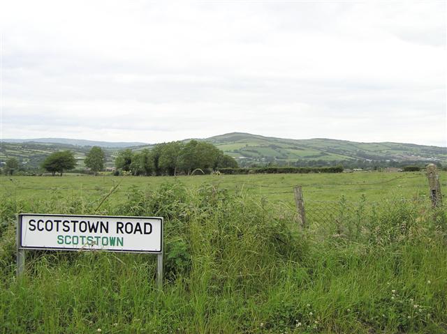
Scotstown, County Tyrone

Scotstown is a townland in County Tyrone, Northern Ireland. It is situated in the historic barony of Strabane Lower and the civil parish of Urney and covers...

Have you been to Coire na Craoibhe?

Leave your review of Coire na Craoibhe below (or comments, questions and feedback).