Coire Liunndrein

Corrie (Glacial Valley) in Argyllshire

Scotland

Coire Liunndrein

Knoll south of Glas Bheinn The rock-sloped knoll at the right side of the image is part of the feature named on OS maps as Maol nan Gobhar; it lies to the south of Glas Bheinn which is the farther mountain.
Knoll south of Glas Bheinn Credit: Trevor Littlewood

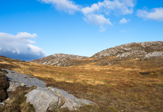
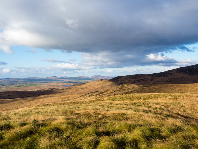
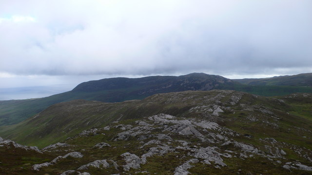
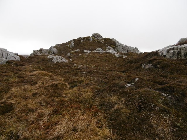
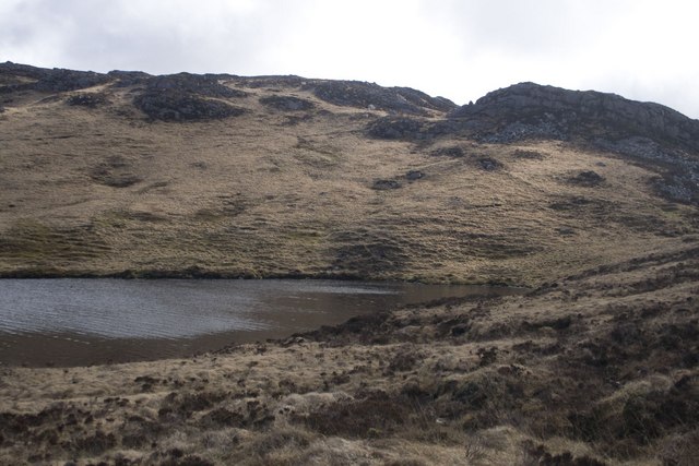
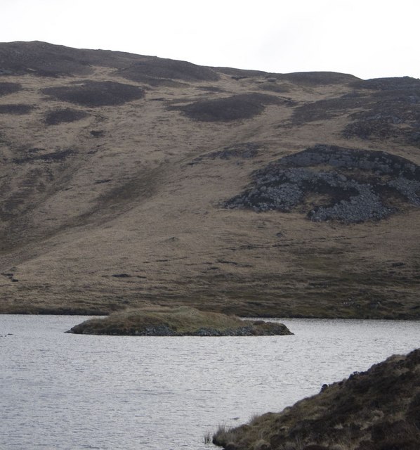
Coire Liunndrein, located in Argyllshire, Scotland, is a picturesque glacial valley, commonly known as a corrie. Nestled amidst the breathtaking Scottish Highlands, this natural beauty spot is a haven for outdoor enthusiasts and nature lovers alike.

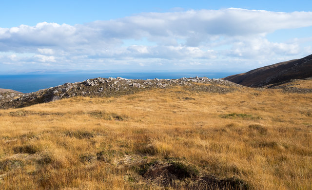
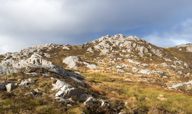
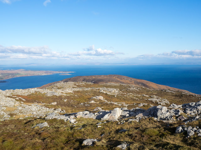
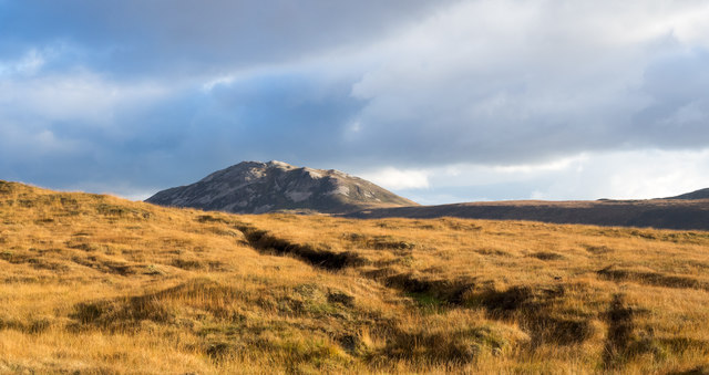
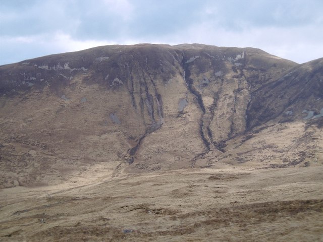
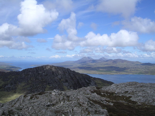
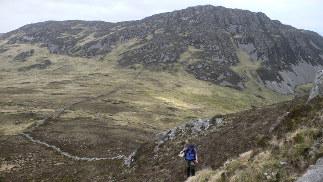
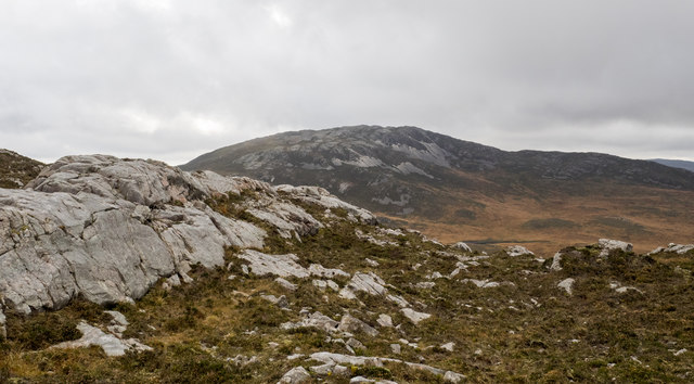
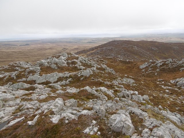
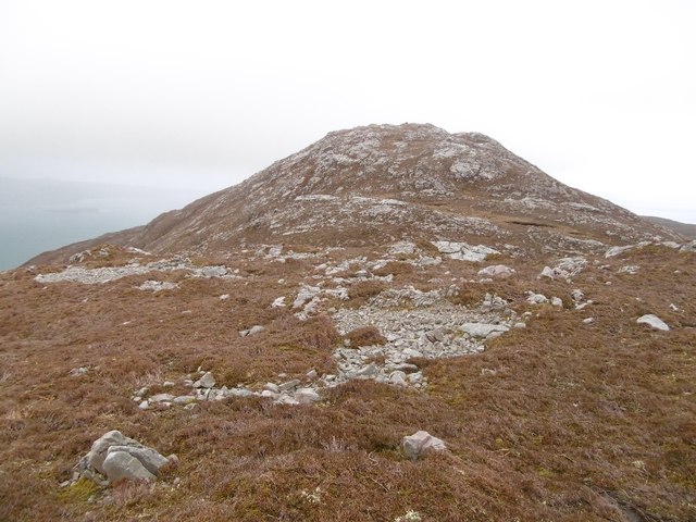
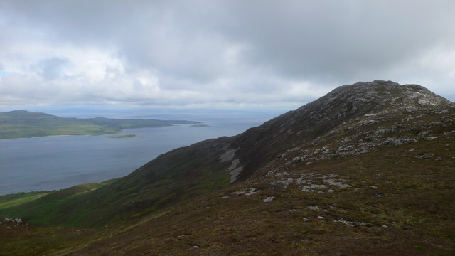
Surrounded by towering mountains, Coire Liunndrein boasts stunning landscapes that showcase the rugged beauty of the region. The valley itself is characterized by steep cliffs and a U-shaped glacial trough, carved out by the movement of ancient glaciers. This geological formation provides a dramatic backdrop for visitors to explore and admire.

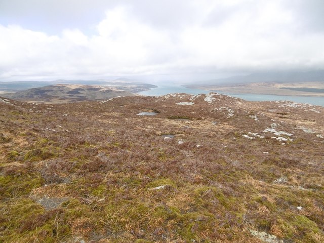
The corrie is home to a diverse range of flora and fauna, with its sheltered location offering a unique habitat for many species. It is not uncommon to spot red deer, wild goats, and a variety of bird species such as golden eagles and peregrine falcons in the area. The valley is also adorned with colorful wildflowers during the warmer months, adding to its natural charm.

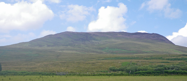
Coire Liunndrein offers ample opportunities for outdoor activities, including hiking, climbing, and wildlife watching. There are several trails that crisscross the valley, catering to both experienced hikers and casual walkers. A popular route is the ascent to the summit of Beinn Ime, the highest peak in the Arrochar Alps, which provides panoramic views of the surrounding landscape.

In summary, Coire Liunndrein is a captivating glacial valley in Argyllshire, Scotland. Its awe-inspiring beauty, diverse ecosystem, and range of outdoor activities make it a must-visit destination for those seeking to immerse themselves in the natural wonders of the Scottish Highlands.

If you have any feedback on the listing, please let us know in the comments section below.

Coire Liunndrein Images

Images are sourced within 2km of 55.75494/-6.0889093 or Grid Reference NR4358. Thanks to Geograph Open Source API. All images are credited.

Knoll south of Glas Bheinn The rock-sloped knoll at the right side of the image is part of the feature named on OS maps as Maol nan Gobhar; it lies to the south of Glas Bheinn which is the farther mountain.
Knoll south of Glas Bheinn
The rock-sloped knoll at the right side of the image is part of the feature named on OS maps as Maol nan Gobhar; it lies to the south of Glas Bheinn which is the farther mountain.
Rock-topped rib south of Am Màm Am Màm is a minor feature, a rocky rise between the higher peaks, Glas Bheinn and Beinn Bheigier. This feature, also a minor one is a low rise on the moorland of the broad ridge connecting those mountain locations.
Rock-topped rib south of Am Màm
Am Màm is a minor feature, a rocky rise between the higher peaks, Glas Bheinn and Beinn Bheigier. This feature, also a minor one is a low rise on the moorland of the broad ridge connecting those mountain locations.
Summit area of Glas Bheinn Two mountain walkers approaching the summit of Glas Bheinn.
Summit area of Glas Bheinn
Two mountain walkers approaching the summit of Glas Bheinn.
Declining slope of Glas Bheinn Glas Bheinn has two tops of a similar height, each regarded as being at 472 metres. The view is from the north-eastern of those tops and includes Beinn na Caillich with the sea south of Jura lying beyond.
Declining slope of Glas Bheinn
Glas Bheinn has two tops of a similar height, each regarded as being at 472 metres. The view is from the north-eastern of those tops and includes Beinn na Caillich with the sea south of Jura lying beyond.
Ground south of Lochan Dubh Lochan Dubh lies to the right, out of the image as does the peak Glas Bheinn. The distant, partly cloud-shadowed  ridge rises presumably to Sgorr nam Faoileann.
Ground south of Lochan Dubh
Lochan Dubh lies to the right, out of the image as does the peak Glas Bheinn. The distant, partly cloud-shadowed ridge rises presumably to Sgorr nam Faoileann.
Slopes drained by Sruthan Allallaidh Sruthan Allallaidh is a minor water course draining in part the western side of Glas Bheinn. Beinn Bheigier is the distant peak.
Slopes drained by Sruthan Allallaidh
Sruthan Allallaidh is a minor water course draining in part the western side of Glas Bheinn. Beinn Bheigier is the distant peak.
Beinn na Cailleach A steep gullied slope above Gleann Choireadail.
Beinn na Cailleach
A steep gullied slope above Gleann Choireadail.
Summit of Glas Bheinn The summit of Glas Bheinn on Islay, looking across the Sound of Islay to the Paps of Jura
Summit of Glas Bheinn
The summit of Glas Bheinn on Islay, looking across the Sound of Islay to the Paps of Jura
Looking across the Maol nan Ghobar spur to Beinn Bheigier
Heading up the NE ridge of Glas Bheinn with Sgorr nan Faoileann in the background
Rock outcrop west of summit of Sgorr nam Faoileann The rocks are at a height of around 380 metres, rather less than 50 metres below the mountain summit. Glas Bheinn is beyond.
Rock outcrop west of summit of Sgorr nam Faoileann
The rocks are at a height of around 380 metres, rather less than 50 metres below the mountain summit. Glas Bheinn is beyond.
East side of Sgorr nam Faoileann View up the Sound of Islay.
East side of Sgorr nam Faoileann
View up the Sound of Islay.
Summit, Sgorr nam Faoileann There is a substantial cairn at the summit. Like most hills on Islay and Jura, the rock is quartzite.
Summit, Sgorr nam Faoileann
There is a substantial cairn at the summit. Like most hills on Islay and Jura, the rock is quartzite.
West ridge, Sgorr nam Faoileann A lot of exposed quartzite - the rough moorland contrasts with the view of greenery on the more fertile parts of the island.
West ridge, Sgorr nam Faoileann
A lot of exposed quartzite - the rough moorland contrasts with the view of greenery on the more fertile parts of the island.
Sgorr Nam Faoileann View along the east ridge.
Sgorr Nam Faoileann
View along the east ridge.
Summit of Sgorr nam Faoileann
South-east corner of Loch Allallaidh With lower slopes of Am Màm behind. The loch occupies four gridsquares, 
NR 4158, NR 4258, NR 4157 and NR 42 57, with each of its two small islands lying in a different gridsquare - challenging from a geograph point of view!
South-east corner of Loch Allallaidh
With lower slopes of Am Màm behind. The loch occupies four gridsquares, NR 4158, NR 4258, NR 4157 and NR 42 57, with each of its two small islands lying in a different gridsquare - challenging from a geograph point of view!
The larger of the two islets in Loch Allallaidh The other islet lies to the north-west and is in gridsquare NR 4158.
The larger of the two islets in Loch Allallaidh
The other islet lies to the north-west and is in gridsquare NR 4158.
Show me another place!

Coire Liunndrein is located at Grid Ref: NR4358 (Lat: 55.75494, Lng: -6.0889093)

Unitary Authority: Argyll and Bute

Police Authority: Argyll and West Dunbartonshire

What 3 Words

///operated.searching.wipes. Near Ballygrant, Argyll & Bute

Nearby Locations

Coire Liunndrein

Related Wikis

Beinn Bheigeir

Beinn Bheigeir (occasionally anglicised as "Ben Vicar") is a hill on the island of Islay in Scotland, UK. At 491 m, it is the highest of the seven 'Marilyn...

Islay

Islay ( EYE-lə; Scottish Gaelic: Ìle, Scots: Ila) is the southernmost island of the Inner Hebrides of Scotland. Known as "The Queen of the Hebrides",...

Claig Castle

Claig Castle was a stronghold of the Clan Donald or MacDonald in the south of Scotland. == History == The castle was once a massive fort described as a...

Ardtalla

Ardtalla (Scottish Gaelic: 'Àird Talla') is a place name and estate in the southeast coastal area of Islay, Scotland. The name derives from Gaelic Àird...

Have you been to Coire Liunndrein?

Leave your review of Coire Liunndrein below (or comments, questions and feedback).