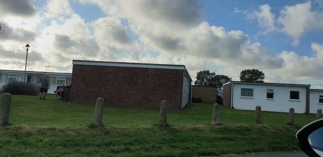
California Gap

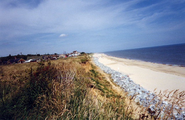
Coastal Marsh, Saltings in Norfolk Great Yarmouth

England

California Gap

Scratby village sign, repainted Scratby and California share a sign featuring a lifebelt, the Royal Albert lifeboat, an oar and some ruins with a glazed window, probably representing Scratby church which was demolished in 1548. On the right is what I believe to be a lifeboat shed and perhaps a beacon.
Scratby village sign, repainted Credit: Jane Rackham

California Gap is a coastal marsh located in Norfolk, England. Situated on the eastern coast, it is a part of the larger Norfolk Coast Area of Outstanding Natural Beauty. The marsh is characterized by its vast expanse of saltmarshes and saltings, which provide a unique habitat for a diverse range of flora and fauna.

The California Gap marsh is situated at the mouth of the River Glaven and is influenced by the tides of the North Sea. This tidal influence creates a dynamic environment, with the marshes being periodically covered and exposed by the changing tides. The marshes are composed of a mixture of muddy and sandy sediments, which are rich in nutrients and support a variety of plant species.

The plants found in California Gap marsh include sea lavender, sea purslane, and various species of grasses and reeds. These plants not only stabilize the marshland but also provide important feeding and nesting grounds for numerous bird species. The marshes are particularly known for attracting migratory birds such as curlews, redshanks, and avocets.

In addition to its ecological importance, California Gap marsh is also a popular destination for nature enthusiasts and birdwatchers. The area offers picturesque views of the marshland, the North Sea, and the surrounding coastal landscape. Visitors can explore the marshes through a network of walking trails, which provide an opportunity to observe the diverse wildlife and appreciate the natural beauty of the area.

Overall, California Gap marsh in Norfolk is a significant coastal habitat that supports a wide range of plant and animal species. Its dynamic and ever-changing environment, along with its scenic appeal, make it a valuable natural asset within the Norfolk Coast Area of Outstanding Natural Beauty.

If you have any feedback on the listing, please let us know in the comments section below.

California Gap Images

Images are sourced within 2km of 52.671429/1.7247569 or Grid Reference TG5114. Thanks to Geograph Open Source API. All images are credited.

Scratby village sign, repainted Scratby and California share a sign featuring a lifebelt, the Royal Albert lifeboat, an oar and some ruins with a glazed window, probably representing Scratby church which was demolished in 1548. On the right is what I believe to be a lifeboat shed and perhaps a beacon.
Scratby village sign, repainted
Scratby and California share a sign featuring a lifebelt, the Royal Albert lifeboat, an oar and some ruins with a glazed window, probably representing Scratby church which was demolished in 1548. On the right is what I believe to be a lifeboat shed and perhaps a beacon.
California bungalows Bungalows in California, from California Road.
California bungalows
Bungalows in California, from California Road.
Beach  Scratby Nr Great Yarmouth Norfolk Beach at Scratby Nr Great Yarmouth.
Beach Scratby Nr Great Yarmouth Norfolk
Beach at Scratby Nr Great Yarmouth.
The California Tavern California Nr Great Yarmouth The California Tavern, California Cliffs, Great Yarmouth.
The California Tavern California Nr Great Yarmouth
The California Tavern, California Cliffs, Great Yarmouth.
Caravan Site, California, Norfolk
Sunrise Taken on the beach early one April morning.
Sunrise
Taken on the beach early one April morning.
The Tower Caravan Park - Caister Water Tower The Tower Caravan Park off Covent Garden Road, and Caister’s unmistakable Water Tower in the background.
The Tower Caravan Park - Caister Water Tower
The Tower Caravan Park off Covent Garden Road, and Caister’s unmistakable Water Tower in the background.
Dunes & Beach - Caister Lower pathway beside the dunes and beach at the northern end of Caister.
Dunes & Beach - Caister
Lower pathway beside the dunes and beach at the northern end of Caister.
Beach at northern end of Caister A section of beach further along from the north end of Caister, this section is a mixture of sand and pebbles.
Beach at northern end of Caister
A section of beach further along from the north end of Caister, this section is a mixture of sand and pebbles.
Station Road going in the direction of California Station Road, and to the right is Flint Cottage. At the extent to which the road can be seen in the picture, but out of view, is the B1159 and crossroad. The road straight over at the crossroad leads to California.
Station Road going in the direction of California
Station Road, and to the right is Flint Cottage. At the extent to which the road can be seen in the picture, but out of view, is the B1159 and crossroad. The road straight over at the crossroad leads to California.
Caister Water Tower Caister Water Tower photographed from Covent Garden Road is nowadays a feature to this much built up housing estate. This particular spot between the bungalows creates a nice short vista to the water tower.
Caister Water Tower
Caister Water Tower photographed from Covent Garden Road is nowadays a feature to this much built up housing estate. This particular spot between the bungalows creates a nice short vista to the water tower.
Dunes & Beach - Caister Looking down from the dunes, and along the beach. The lower footpath is a tarmacked surface, which is ideal for wheelchairs and the easy stroll. To the right, and out of view from the position where I took the photo, is a small car-park, accessed from the end of Second Avenue.
Dunes & Beach - Caister
Looking down from the dunes, and along the beach. The lower footpath is a tarmacked surface, which is ideal for wheelchairs and the easy stroll. To the right, and out of view from the position where I took the photo, is a small car-park, accessed from the end of Second Avenue.
Caister Beach View of Caister beach from the lower footpath. The windfarm on Scroby Sands in the North Sea spanning the photo’s horizon is at a distance of 2.5 kilometres from the coast. ‘Fact File’ (Each turbine tower is 60m high, weighs approximately 200 tonnes and has 40m long blades… the foundations are 4m diameter steel cylinders…) the source of information was taken from a Powergen hoarding. The photo’s vertical centre line taken from a compass is 114 degrees ESE of magnetic North.
Caister Beach
View of Caister beach from the lower footpath. The windfarm on Scroby Sands in the North Sea spanning the photo’s horizon is at a distance of 2.5 kilometres from the coast. ‘Fact File’ (Each turbine tower is 60m high, weighs approximately 200 tonnes and has 40m long blades… the foundations are 4m diameter steel cylinders…) the source of information was taken from a Powergen hoarding. The photo’s vertical centre line taken from a compass is 114 degrees ESE of magnetic North.
Upper Footpath - North of Caister Upper footpath running alongside the dunes and beach. This section of the beach lies roughly between Caister and California.
Upper Footpath - North of Caister
Upper footpath running alongside the dunes and beach. This section of the beach lies roughly between Caister and California.
Scratby Road and Thoroughfare Lane junction The car is emerging onto Scratby Road from Thoroughfare Lane. Scratby Hall is behind the clump of trees to the right of the picture; in the years 1948-1986 it was a school for boys, named Duncan Hall School – See <span class="nowrap"><a title="www.home.earthlink.net/~duncanhallschool" rel="nofollow ugc noopener" href="http://www.home.earthlink.net/~duncanhallschool">Link</a><img style="margin-left:2px;" alt="External link" title="External link - shift click to open in new window" src="https://s1.geograph.org.uk/img/external.png" width="10" height="10"/></span>
Scratby Road and Thoroughfare Lane junction
The car is emerging onto Scratby Road from Thoroughfare Lane. Scratby Hall is behind the clump of trees to the right of the picture; in the years 1948-1986 it was a school for boys, named Duncan Hall School – See LinkExternal link
Beach Road - Scratby A well looked after and scenic area of Beach Road. Following this road all the way to the coast and then bearing right will take you to California.
Beach Road - Scratby
A well looked after and scenic area of Beach Road. Following this road all the way to the coast and then bearing right will take you to California.
B1159 Scratby Road & Beach Road Junction B1159 Scratby Road and Beach Road junction, not an easy junction to get out of, Scratby Road is quite a busy road this time of the year.
B1159 Scratby Road & Beach Road Junction
B1159 Scratby Road and Beach Road junction, not an easy junction to get out of, Scratby Road is quite a busy road this time of the year.
Long-distance view to Scroby Sands wind farm (1) Scroby Sands wind farm is Great Britain's second offshore wind farm (completed in December 2004). It is located in the North Sea, 2.5 km off the coast of Great Yarmouth. The farm was commissioned by Powergen Renewables Offshore, a division of one of the UK's major electricity producing companies, and it is expected to produce up to a maximum of 60 megawatts of power (sufficient for supplying 41000 homes). The farm has 30 wind turbines, each with three 40 metre blades rotating around a centre-point some 60 metres above the mean sea level on hollow 4.5 metre diameter steel masts, in from 13 to 20 metres depth of water. The masts are piled up to 30 metres into the sea bed, to provide stability on a substrate of shifting sands.

For more detailed information see  <span class="nowrap"><a title="http://en.wikipedia.org/wiki/Scroby_Sands_wind_farm" rel="nofollow ugc noopener" href="http://en.wikipedia.org/wiki/Scroby_Sands_wind_farm">Link</a><img style="margin-left:2px;" alt="External link" title="External link - shift click to open in new window" src="https://s1.geograph.org.uk/img/external.png" width="10" height="10"/></span>
Long-distance view to Scroby Sands wind farm (1)
Scroby Sands wind farm is Great Britain's second offshore wind farm (completed in December 2004). It is located in the North Sea, 2.5 km off the coast of Great Yarmouth. The farm was commissioned by Powergen Renewables Offshore, a division of one of the UK's major electricity producing companies, and it is expected to produce up to a maximum of 60 megawatts of power (sufficient for supplying 41000 homes). The farm has 30 wind turbines, each with three 40 metre blades rotating around a centre-point some 60 metres above the mean sea level on hollow 4.5 metre diameter steel masts, in from 13 to 20 metres depth of water. The masts are piled up to 30 metres into the sea bed, to provide stability on a substrate of shifting sands. For more detailed information see LinkExternal link
Show me another place!

California Gap is located at Grid Ref: TG5114 (Lat: 52.671429, Lng: 1.7247569)

Administrative County: Norfolk

District: Great Yarmouth

Police Authority: Norfolk

What 3 Words

///eternity.pitchers.motored. Near Ormesby St Margaret, Norfolk

Nearby Locations

California Gap California

Related Wikis

California Halt railway station

California Halt was a railway station on the Midland and Great Northern Joint Railway which served the Norfolk village of California, England. == History... ==

Scratby Halt railway station

Scratby Halt was a railway station on the Midland and Great Northern Joint Railway which served the Norfolk village of Scratby, England. == History... ==

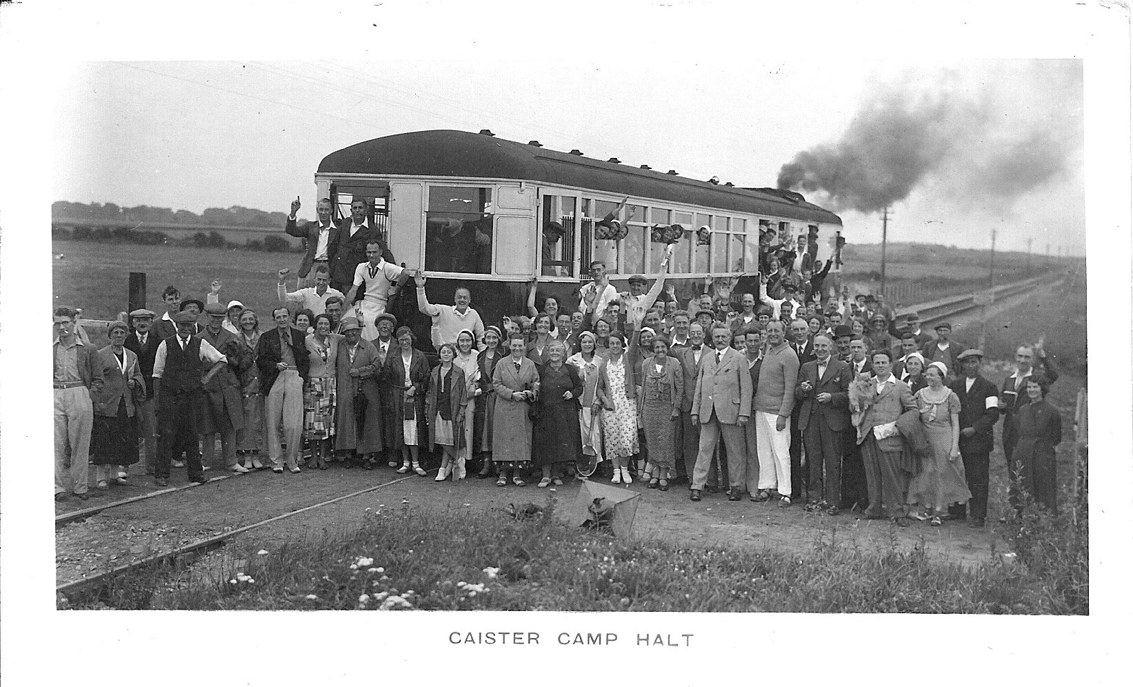
Caister Camp Halt railway station

Caister Camp Halt was a railway station on the Midland and Great Northern Joint Railway which served the holiday camps near the Norfolk coastal town of...

Blitz and Pieces

Blitz and Pieces is a museum in Scratby in Great Yarmouth, England, owned and operated by Darren Stride. Based on the British Home Front during World...

Duncan Hall School

Duncan Hall School was a boys’ prep school at Scratby Hall in Ormesby St Margaret with Scratby, Norfolk from 1949 to 1986, with girls admitted from 1979...

Great Ormesby railway station

Great Ormesby railway station was a station in Ormesby St Margaret, Norfolk. It was opened in 1877 and later became part of the Midland and Great Northern...

Ormesby St Margaret with Scratby

Ormesby St Margaret with Scratby is a civil parish in the English county of Norfolk. It is made up of the inland village of Ormesby St Margaret and the...

Caister Academy

Caister Academy, formerly known as Caister High School, is a coeducational secondary school located in the seaside village of Caister-on-Sea in Norfolk...

Nearby Amenities

Located within 500m of 52.671429,1.7247569
Source: PGS
Lat/Long: 52.6744048/1.7220949
California Halt
Historic Railway: station
Railway: site
Source: NPE
Wikidata: Q5020527
Wikipedia: en:California Halt railway station
Lat/Long: 52.671914/1.7190902
Bus Stop
Sunbeach Holiday Village, adj
Naptan AtcoCode: 2900O0123
Naptan Bearing: SE
Naptan BusStopType: CUS
Naptan CommonName: Sunbeach Holiday Village
Naptan Indicator: adj
Naptan Landmark: os Sunbeach Holiday Village
Naptan Locality: California
Naptan NaptanCode: nfodmtpm
Naptan PlusbusZoneRef: YARMTH
Naptan Street: California Road
Naptan Verified: no
Source: naptan_import
Lat/Long: 52.6721156/1.7189297
Bus Stop
Sunbeach Holiday Village, opp
Naptan AtcoCode: 2900O0124
Naptan Bearing: NW
Naptan CommonName: Sunbeach Holiday Village
Naptan Indicator: opp
Naptan Landmark: Sunbeach Holiday Village
Naptan Locality: California
Naptan NaptanCode: nfodmtpt
Naptan PlusbusZoneRef: YARMTH
Naptan Street: California Road
Naptan Verified: no
Source: naptan_import
Lat/Long: 52.6720298/1.7190852
California
Name Lt: Kalifornija
Place: village
Source: OS_OpenData_StreetView
Lat/Long: 52.6730486/1.717918
Turning Circle
Lat/Long: 52.6747465/1.7201781
Bench
Backrest: no
Material: wood
Seats: 2
Lat/Long: 52.6683829/1.7261617
Traffic Calming: bump
Lat/Long: 52.6726783/1.7204567
Colour: white
Communication Mobile Phone: yes
Man Made: mast
Material: metal
Operator: Three UK;EE
Tower Construction: freestanding
Tower Type: communication
Lat/Long: 52.6719946/1.7190378
Give Way
Lat/Long: 52.6720658/1.7195468
The data included in this document is from www.openstreetmap.org. The data is made available under ODbL.

Have you been to California Gap?

Leave your review of California Gap below (or comments, questions and feedback).