Calthorpe Level Marshes
Coastal Marsh, Saltings in Norfolk Broadland
England
Calthorpe Level Marshes
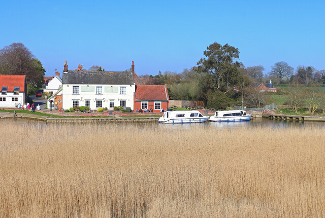
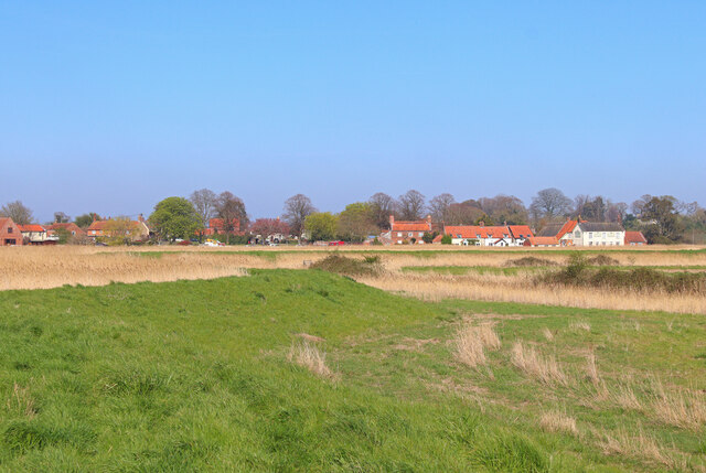
Calthorpe Level Marshes, located in Norfolk, England, is a vast coastal marshland and salt marsh area that stretches along the North Sea coast. The marshes are situated between the villages of Calthorpe and Eccles-on-Sea, covering an extensive area of approximately 1,000 hectares.
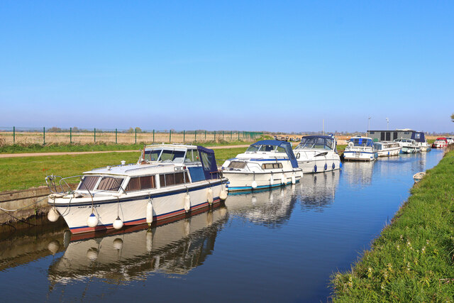
The landscape of Calthorpe Level Marshes is characterized by its flatness, with large expanses of open grassland and reed beds intermingled with tidal creeks and channels. The marshland is subject to regular tidal inundation, as it lies within the coastal floodplain. This dynamic environment is influenced by the ebb and flow of the tides, creating a unique habitat that supports a diverse range of plant and animal species.
The marshes are home to a variety of salt-tolerant vegetation, including samphire, sea lavender, and cordgrass. These plants not only provide food and shelter for numerous bird species but also help to stabilize the marshland against erosion. Calthorpe Level Marshes is an important breeding ground and feeding area for several wading birds, such as avocets, redshanks, and lapwings. It is also a haven for migratory birds, attracting species like geese, ducks, and waders during the winter months.
The marshes are managed by various conservation organizations, including the Norfolk Wildlife Trust, to ensure the preservation of this valuable ecosystem. Access to the marshes is provided through designated footpaths and bird hides, allowing visitors to appreciate the stunning natural surroundings and observe the wildlife in their natural habitat.
Overall, Calthorpe Level Marshes in Norfolk is a significant coastal marsh and salt marsh system that supports a diverse range of plant and animal life. It serves as a vital habitat for many bird species and provides a serene and picturesque setting for nature enthusiasts and visitors alike.
If you have any feedback on the listing, please let us know in the comments section below.
Calthorpe Level Marshes Images
Images are sourced within 2km of 52.63381/1.5791027 or Grid Reference TG4210. Thanks to Geograph Open Source API. All images are credited.


Calthorpe Level Marshes is located at Grid Ref: TG4210 (Lat: 52.63381, Lng: 1.5791027)
Administrative County: Norfolk
District: Broadland
Police Authority: Norfolk
What 3 Words
///inflating.bootleg.friction. Near Acle, Norfolk
Nearby Locations
Related Wikis

Stokesby with Herringby
Stokesby with Herringby is a civil parish in the English county of Norfolk. It comprises the village of Stokesby and the surrounding rural area. It is...

Damgate Marshes, Acle
Damgate Marshes, Acle is a 64.7-hectare (160-acre) biological Site of Special Scientific Interest between Norwich and Great Yarmouth in Norfolk. It is...

Acle
Acle ( AY-kəl) is a market town on the River Bure on the Norfolk Broads in Norfolk, located halfway between Norwich and Great Yarmouth. It has the only...

Blofield and Flegg Rural District
Blofield and East and West Flegg Rural Districts were adjacent rural districts in Norfolk, England from 1894 to 1935. They were formed under the Local...
Nearby Amenities
Located within 500m of 52.63381,1.5791027Have you been to Calthorpe Level Marshes?
Leave your review of Calthorpe Level Marshes below (or comments, questions and feedback).