Irlam's Beach

Coastal Marsh, Saltings in Essex Tendring

England

Irlam's Beach

Stone Point, Walton-on-the-Naze Stone Point at Hamford Water, Walton-on-the-Naze. Thames barges are visible lining the opposite bank.
Stone Point, Walton-on-the-Naze Credit: Hobs

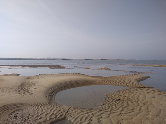
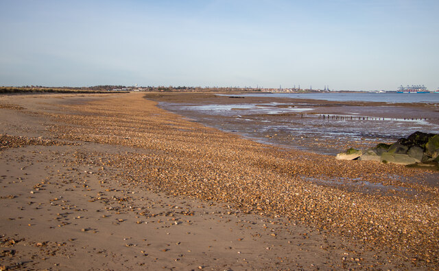
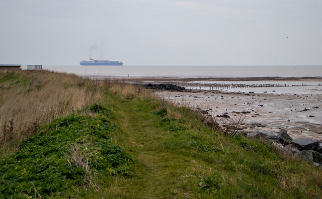
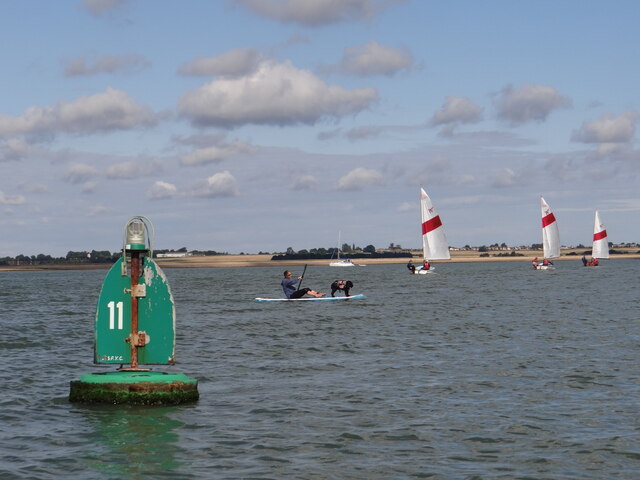
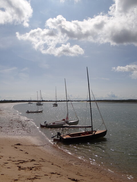
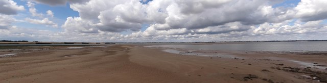
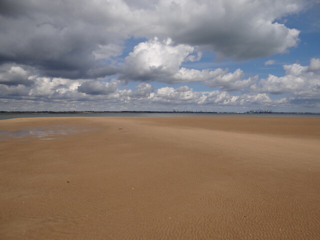
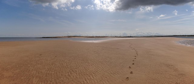
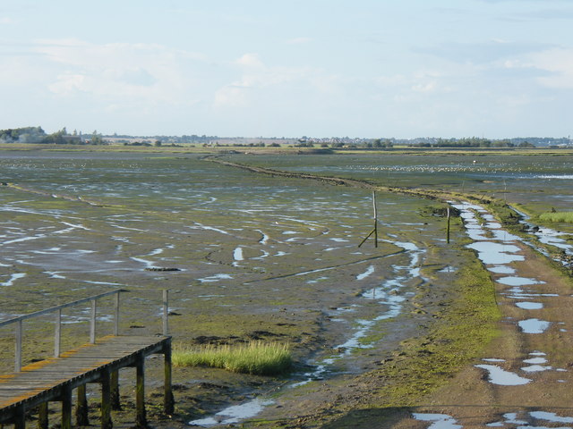
Irlam's Beach, located in Essex, England, is a picturesque coastal marsh area known for its stunning saltings. Situated along the banks of the River Crouch, this natural haven offers visitors a unique and tranquil experience, away from the hustle and bustle of city life.

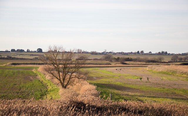
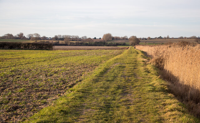
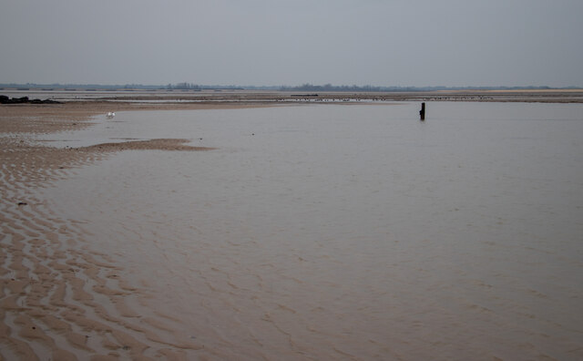
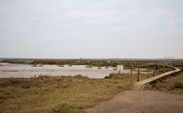
The beach is characterized by its vast expanse of marshland, which is a result of the river's tidal movements. The marshes are home to a diverse array of flora and fauna, including various species of grasses, reeds, and wildflowers. These vegetation types provide essential habitats for numerous bird species, making Irlam's Beach a popular destination for birdwatchers and nature enthusiasts.

The saltings, which are salt marshes, are another highlight of Irlam's Beach. These marshy areas are formed by the accumulation of saltwater brought in by the tides. They are characterized by their unique flora, such as samphire and sea lavender, which have adapted to the saline conditions. The saltings also serve as crucial feeding grounds for wading birds and other wildlife.

Visitors to Irlam's Beach can enjoy leisurely walks along designated trails that meander through the marshes, providing stunning views of the surrounding landscape. The beach is also a popular spot for picnicking, as it offers a peaceful setting to unwind and enjoy the natural beauty.

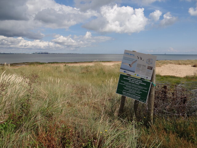
It is important to note that Irlam's Beach is a protected area, designated as a Site of Special Scientific Interest (SSSI). This conservation status ensures the preservation of the unique ecosystem and its inhabitants, making it a haven for both wildlife and nature enthusiasts alike.

If you have any feedback on the listing, please let us know in the comments section below.

Irlam's Beach Images

Images are sourced within 2km of 51.898837/1.2540899 or Grid Reference TM2327. Thanks to Geograph Open Source API. All images are credited.

Stone Point, Walton-on-the-Naze Stone Point at Hamford Water, Walton-on-the-Naze. Thames barges are visible lining the opposite bank.
Stone Point, Walton-on-the-Naze
Stone Point at Hamford Water, Walton-on-the-Naze. Thames barges are visible lining the opposite bank.
Looking to Harwich from the shore at Ramsey On the coast, with a view of the North Sea.
Looking to Harwich from the shore at Ramsey
On the coast, with a view of the North Sea.
Looking inland from the sea wall at Little Oakley
The Essex Way along Long Bank, Ramsey This is the Essex Way long distance footpath.
The Essex Way along Long Bank, Ramsey
This is the Essex Way long distance footpath.
Irlam's Beach, Little Oakley This area is part of Hamford Water National Nature Reserve & SSSI: <span class="nowrap"><a title="https://www.gov.uk/government/publications/essexs-national-nature-reserves/essexs-national-nature-reserves#hamford-water" rel="nofollow ugc noopener" href="https://www.gov.uk/government/publications/essexs-national-nature-reserves/essexs-national-nature-reserves#hamford-water">Link</a><img style="margin-left:2px;" alt="External link" title="External link - shift click to open in new window" src="https://s1.geograph.org.uk/img/external.png" width="10" height="10"/></span>
Irlam's Beach, Little Oakley
This area is part of Hamford Water National Nature Reserve & SSSI: LinkExternal link
Looking to the North Sea at Little Oakley As seen from sea wall footpath.

The coastal area is part of the Hamford Water National Nature Reserve & SSSI. <span class="nowrap"><a title="https://www.gov.uk/government/publications/essexs-national-nature-reserves/essexs-national-nature-reserves#hamford-water" rel="nofollow ugc noopener" href="https://www.gov.uk/government/publications/essexs-national-nature-reserves/essexs-national-nature-reserves#hamford-water">Link</a><img style="margin-left:2px;" alt="External link" title="External link - shift click to open in new window" src="https://s1.geograph.org.uk/img/external.png" width="10" height="10"/></span>
Looking to the North Sea at Little Oakley
As seen from sea wall footpath. The coastal area is part of the Hamford Water National Nature Reserve & SSSI. LinkExternal link
Private walkway, Hamford Water National Nature Reserve This walkway on Hamford Water National Nature Reserve <span class="nowrap"><a title="https://www.gov.uk/government/publications/essexs-national-nature-reserves/essexs-national-nature-reserves#hamford-water" rel="nofollow ugc noopener" href="https://www.gov.uk/government/publications/essexs-national-nature-reserves/essexs-national-nature-reserves#hamford-water">Link</a><img style="margin-left:2px;" alt="External link" title="External link - shift click to open in new window" src="https://s1.geograph.org.uk/img/external.png" width="10" height="10"/></span> is marked 'private' for the use of Little Oakley and District Wildfowlers’ Association.

Hamford Water is also a SSSI.
Private walkway, Hamford Water National Nature Reserve
This walkway on Hamford Water National Nature Reserve LinkExternal link is marked 'private' for the use of Little Oakley and District Wildfowlers’ Association. Hamford Water is also a SSSI.
Island Point North Cardinal Buoy Helping to keep vessels from running aground on Mussel Scarfe, this buoy directs traffic to pass it to the north as it exits Walton Channel and joins the Hamford Water.   At night a quick white flashing light is emitted.
Island Point North Cardinal Buoy
Helping to keep vessels from running aground on Mussel Scarfe, this buoy directs traffic to pass it to the north as it exits Walton Channel and joins the Hamford Water. At night a quick white flashing light is emitted.
Doggy Paddle! Plenty of activity on the water around starboard channel marker No 11
Doggy Paddle!
Plenty of activity on the water around starboard channel marker No 11
Free parking at Stone Point Selection of craft anchored to the south of Stone Point on the Walton Channel.  The crews are enjoying the sunshine on dry land!
Free parking at Stone Point
Selection of craft anchored to the south of Stone Point on the Walton Channel. The crews are enjoying the sunshine on dry land!
Stone Point panorama View of the Walton Channel and Hamford Water as they meet near the Mulberry Harbour vessels on the banks.  Note the several navigation buoys designed to keep traffic from running aground.
Stone Point panorama
View of the Walton Channel and Hamford Water as they meet near the Mulberry Harbour vessels on the banks. Note the several navigation buoys designed to keep traffic from running aground.
Almost in the next gridsquare If the tides were spring rather than neaps, I might have stood on the next gridsquare to the north. Felixstowe docks can be seen in the distance.
Almost in the next gridsquare
If the tides were spring rather than neaps, I might have stood on the next gridsquare to the north. Felixstowe docks can be seen in the distance.
Stone Point View of the tip of Stone point from the plentiful sands to the north.
Stone Point
View of the tip of Stone point from the plentiful sands to the north.
Little terns information board at Stone Point
No 6 Port navigation buoy Starboard navigation buoy No 7 can be seen to the left in the distance.
No 6 Port navigation buoy
Starboard navigation buoy No 7 can be seen to the left in the distance.
Port navigation buoy No 4A
Port Navigation Buoy No 4 "High Hill"
No 5 Starboard Channel Buoy
Show me another place!

Irlam's Beach is located at Grid Ref: TM2327 (Lat: 51.898837, Lng: 1.2540899)

Administrative County: Essex

District: Tendring

Police Authority: Essex

What 3 Words

///pills.going.searcher. Near Dovercourt, Essex

Related Wikis

Pewit Island

Pewit Island is an uninhabited island at the north of Hamford Water off the coast of the English county of Essex. The nearest town is the port of Harwich...

Hamford Water

Hamford Water is a 2,185.8-hectare (5,401-acre) biological Site of Special Scientific Interest between Walton-on-the-Naze and Harwich in Essex. The site...

Little Oakley, Essex

Little Oakley is a village in Essex, England, on the western outskirts of Harwich. The parish population at the 2011 census was 1,171.It is the site of...

Horsey Island

Horsey Island is an island in the parish of Thorpe-le-Soken, Essex. It lies in Hamford Water and is part of the Hamford Water National Nature Reserve,...

Have you been to Irlam's Beach?

Leave your review of Irlam's Beach below (or comments, questions and feedback).