The Spit

Coastal Marsh, Saltings in Kent Canterbury

England

The Spit

The hen harrier's eye A detail of the mural painted on the Shellness blockhouse  <a href="https://www.geograph.org.uk/photo/4109177">TR0567 : Hen Harrier: graffiti art at Shellness</a> by artist ATM.
The hen harrier's eye Credit: Stefan Czapski

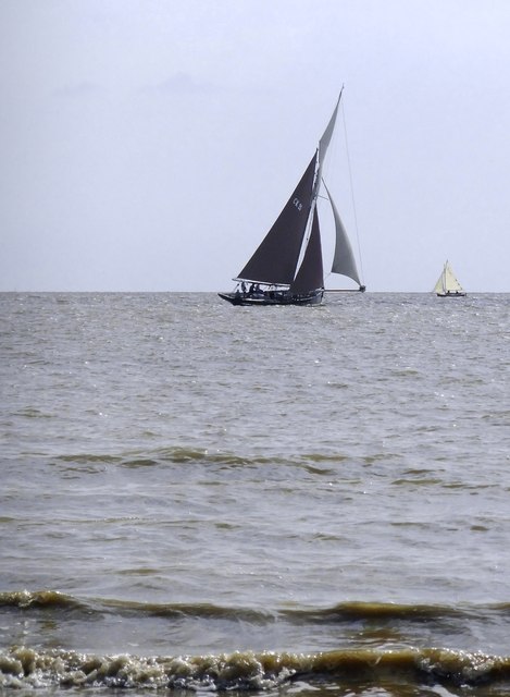
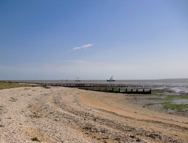
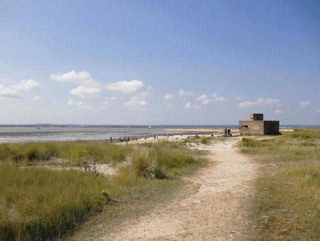
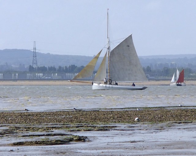
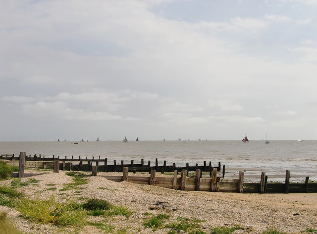
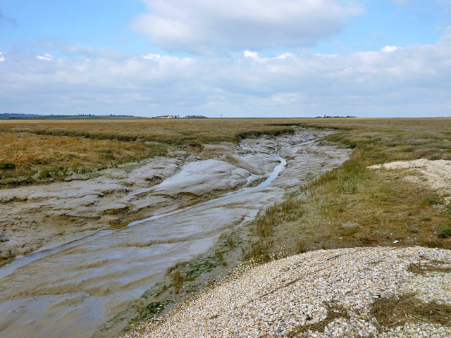
The Spit is a prominent coastal marsh and saltings located in Kent, England. Covering an area of approximately 450 hectares, it is a significant natural feature of the region. The site is situated at the mouth of the River Stour, where it meets the North Sea, and is a part of the larger Sandwich and Pegwell Bay National Nature Reserve.

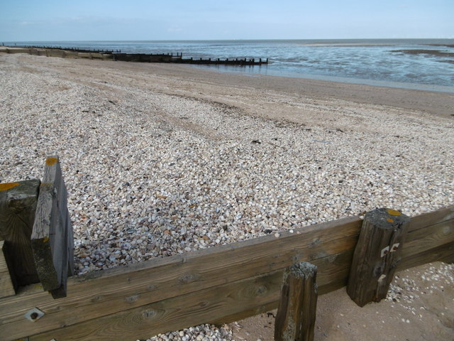
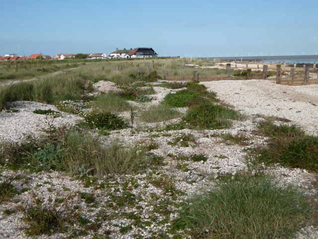
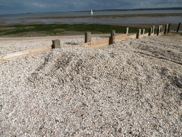
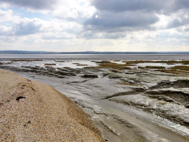
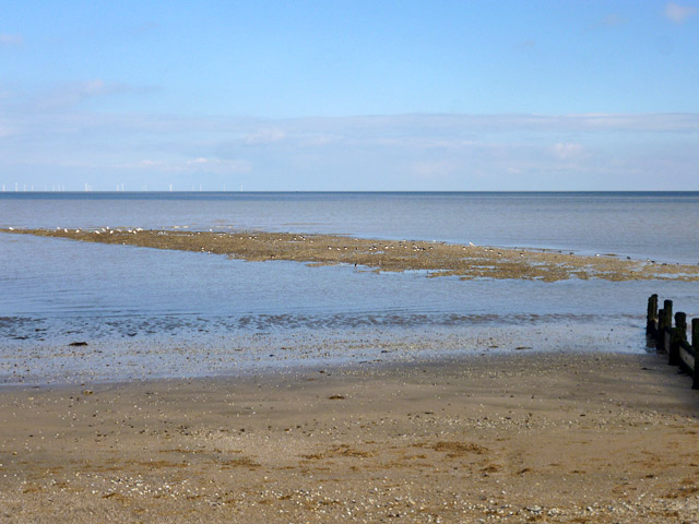
The Spit is characterized by a diverse range of habitats, making it an important ecological site. The area consists of saltmarshes, mudflats, sand dunes, and shingle beaches, providing a unique environment for various plant and animal species. The marshes are home to a variety of salt-tolerant plant species, such as samphire, sea lavender, and glasswort, which thrive in the brackish conditions.

The site is also a haven for birdlife, attracting numerous species throughout the year. It serves as an important breeding ground for wading birds like avocets, redshanks, and oystercatchers. During migration seasons, it becomes a temporary home to thousands of waterfowl, including ducks, geese, and waders.

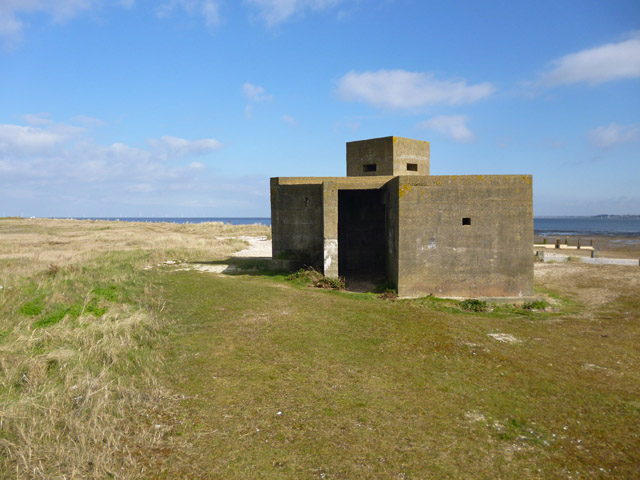
Apart from its ecological significance, The Spit holds historical importance as well. It was a vital defense location during World War II, with remnants of military structures still visible today. The area also boasts archaeological finds dating back to the Roman period, adding to its cultural heritage.

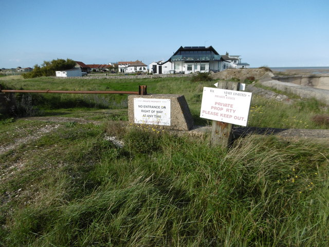
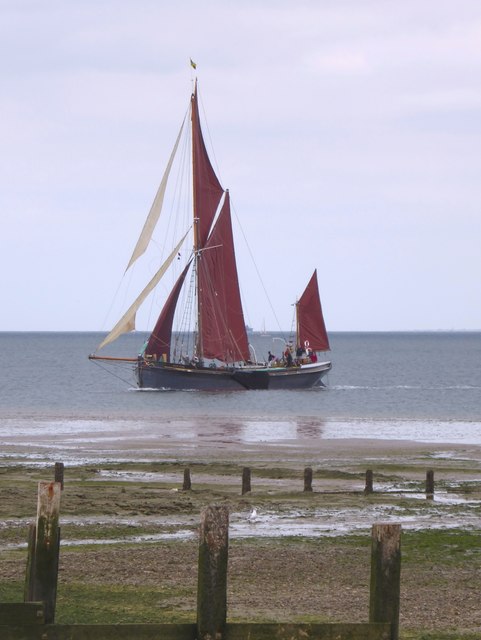
Visitors to The Spit can enjoy its natural beauty through various walking trails and observation points. The site is managed by the Royal Society for the Protection of Birds (RSPB) and provides opportunities for educational activities, birdwatching, and wildlife photography.

If you have any feedback on the listing, please let us know in the comments section below.

The Spit Images

Images are sourced within 2km of 51.369306/0.9692207 or Grid Reference TR0667. Thanks to Geograph Open Source API. All images are credited.

The hen harrier's eye A detail of the mural painted on the Shellness blockhouse  <a href="https://www.geograph.org.uk/photo/4109177">TR0567 : Hen Harrier: graffiti art at Shellness</a> by artist ATM.
The hen harrier's eye
A detail of the mural painted on the Shellness blockhouse TR0567 : Hen Harrier: graffiti art at Shellness by artist ATM.
Fishing smacks competing in the Swale Match Photo taken from the east-facing beach at Shellness, on the day of the Kentish Sail Association's 2015 Swale Barge and Smack Match.

The nearer of the two vessels is the Colne smack CK21, 'Maria', whose skipper was putting in a spirited and dashing performance.  I haven't yet, at the time of writing, heard the race results, but Maria simply flew along - surely the fastest vessel on the Swale.  She is said to have been built by Harris's of Rowhedge (just down-river from Colchester) at a date variously reported as 1886 or 1866 <span class="nowrap"><a title="http://www.smackdock.co.uk/smacklist/smacks.htm" rel="nofollow ugc noopener" href="http://www.smackdock.co.uk/smacklist/smacks.htm">Link</a><img style="margin-left:2px;" alt="External link" title="External link - shift click to open in new window" src="https://s1.geograph.org.uk/img/external.png" width="10" height="10"/></span>
Fishing smacks competing in the Swale Match
Photo taken from the east-facing beach at Shellness, on the day of the Kentish Sail Association's 2015 Swale Barge and Smack Match. The nearer of the two vessels is the Colne smack CK21, 'Maria', whose skipper was putting in a spirited and dashing performance. I haven't yet, at the time of writing, heard the race results, but Maria simply flew along - surely the fastest vessel on the Swale. She is said to have been built by Harris's of Rowhedge (just down-river from Colchester) at a date variously reported as 1886 or 1866 LinkExternal link
View from Shellness beach on the day of the 2015 Swale Match View a little to the north of east from a point near the Shellness blockhouse.  The white-sailed vessels offshore are Dutch barges, the nearer being 'De Twee Gezusters'.

In the far distance on the right can be seen the coast of the Kentish mainland, near Reculver.
View from Shellness beach on the day of the 2015 Swale Match
View a little to the north of east from a point near the Shellness blockhouse. The white-sailed vessels offshore are Dutch barges, the nearer being 'De Twee Gezusters'. In the far distance on the right can be seen the coast of the Kentish mainland, near Reculver.
Shellness blockhouse and spit Looking south-westwards along the landward portion of the spit towards the WW2 blockhouse.  Beyond the blockhouse the spit curves out into the Swale.  Visible in the far distance is the Kentish mainland near Faversham.
Shellness blockhouse and spit
Looking south-westwards along the landward portion of the spit towards the WW2 blockhouse. Beyond the blockhouse the spit curves out into the Swale. Visible in the far distance is the Kentish mainland near Faversham.
The fishing-smack 'Game Cock' at the mouth of the Swale Game Cock was built by Collar's of Whitstable in 1906  <span class="nowrap"><a title="http://www.smackdock.co.uk/smacklist/smacks.htm" rel="nofollow ugc noopener" href="http://www.smackdock.co.uk/smacklist/smacks.htm">Link</a><img style="margin-left:2px;" alt="External link" title="External link - shift click to open in new window" src="https://s1.geograph.org.uk/img/external.png" width="10" height="10"/></span>   and carries the Faversham registration F76, so this is where she belongs - just as much a part of this coastal landscape as are the oystercatchers on the muddy shore.  

The picture was taken shortly after the start of the Kentish Sail Association's Swale Match, looking south-east from Shellness in the general direction of Seasalter.

<a href="https://www.geograph.org.uk/photo/4615430">TR0164 : A fishing-smack moored in Faversham Creek: 'Game Cock'</a> is a closer view, taken at the end of the day's sailing.
The fishing-smack 'Game Cock' at the mouth of the Swale
Game Cock was built by Collar's of Whitstable in 1906 LinkExternal link and carries the Faversham registration F76, so this is where she belongs - just as much a part of this coastal landscape as are the oystercatchers on the muddy shore. The picture was taken shortly after the start of the Kentish Sail Association's Swale Match, looking south-east from Shellness in the general direction of Seasalter. TR0164 : A fishing-smack moored in Faversham Creek: 'Game Cock' is a closer view, taken at the end of the day's sailing.
Shellness beach on the day of the 2015 Swale Match Looking roughly ENE from a point north of the blockhouse.  Photo taken at about 10.10 on the day of the Kentish Sail Association's annual Swale Match.
Shellness beach on the day of the 2015 Swale Match
Looking roughly ENE from a point north of the blockhouse. Photo taken at about 10.10 on the day of the Kentish Sail Association's annual Swale Match.
Shells at Shellness The hamlet of Shellness and the promontory of Shell Ness to the south, as well as the dwellings at Shellbeach to the north are well named as there are millions of shells on the beaches here. This is alongside Shellness and the shells have piled up against the groyne.
Shells at Shellness
The hamlet of Shellness and the promontory of Shell Ness to the south, as well as the dwellings at Shellbeach to the north are well named as there are millions of shells on the beaches here. This is alongside Shellness and the shells have piled up against the groyne.
Looking towards Shellness from Shell Ness The hamlet of Shellness and the promontory of Shell Ness to the south, as well as the dwellings at Shellbeach to the north are well named as there are millions of shells on the beaches here. This is the view of Shellness from near Shell Ness.
Looking towards Shellness from Shell Ness
The hamlet of Shellness and the promontory of Shell Ness to the south, as well as the dwellings at Shellbeach to the north are well named as there are millions of shells on the beaches here. This is the view of Shellness from near Shell Ness.
Shells piled up at Shell Ness The hamlet of Shellness and the promontory of Shell Ness to the south, as well as the dwellings at Shellbeach to the north are well named as there are millions of shells on the beaches here. This is at Shellness and the shells have piled up against the groyne, rather like sand or pebbles would elsewhere. 

Herne Bay to the left and Whitstable in the centre can be seen across The Swale.
Shells piled up at Shell Ness
The hamlet of Shellness and the promontory of Shell Ness to the south, as well as the dwellings at Shellbeach to the north are well named as there are millions of shells on the beaches here. This is at Shellness and the shells have piled up against the groyne, rather like sand or pebbles would elsewhere. Herne Bay to the left and Whitstable in the centre can be seen across The Swale.
Keep out of Shellness Shellness is a private estate and notices all around tell casual walkers to keep out. However, at the end of the path along the sea wall from Leysdown Country Park, you just walk along the beach below the high tide level and it brings you past the hamlet, still giving good views of the variety of interesting houses. This view is the approach from the southern end towards Shell Ness. 

For an account of the walk see <span class="nowrap"><a title="http://theknitnursechronicles.blogspot.co.uk/2012/08/shellness-isle-of-sheppey.html" rel="nofollow ugc noopener" href="http://theknitnursechronicles.blogspot.co.uk/2012/08/shellness-isle-of-sheppey.html">Link</a><img style="margin-left:2px;" alt="External link" title="External link - shift click to open in new window" src="https://s1.geograph.org.uk/img/external.png" width="10" height="10"/></span>
Keep out of Shellness
Shellness is a private estate and notices all around tell casual walkers to keep out. However, at the end of the path along the sea wall from Leysdown Country Park, you just walk along the beach below the high tide level and it brings you past the hamlet, still giving good views of the variety of interesting houses. This view is the approach from the southern end towards Shell Ness. For an account of the walk see LinkExternal link
The former coastguard cottages at Shellness Shellness is a private estate and notices all around tell casual walkers to keep out. However, at the end of the path along the sea wall from Leysdown Country Park, you just walk along the beach below the high tide level and it brings you past the hamlet, still giving good views of the variety of interesting houses. These are the old coastguard cottages at the southern end. See also <a title="https://www.geograph.org.uk/photo/4426318" href="https://www.geograph.org.uk/photo/4426318">Link</a>

For an account of the walk see <span class="nowrap"><a title="http://theknitnursechronicles.blogspot.co.uk/2012/08/shellness-isle-of-sheppey.html" rel="nofollow ugc noopener" href="http://theknitnursechronicles.blogspot.co.uk/2012/08/shellness-isle-of-sheppey.html">Link</a><img style="margin-left:2px;" alt="External link" title="External link - shift click to open in new window" src="https://s1.geograph.org.uk/img/external.png" width="10" height="10"/></span>
The former coastguard cottages at Shellness
Shellness is a private estate and notices all around tell casual walkers to keep out. However, at the end of the path along the sea wall from Leysdown Country Park, you just walk along the beach below the high tide level and it brings you past the hamlet, still giving good views of the variety of interesting houses. These are the old coastguard cottages at the southern end. See also Link For an account of the walk see LinkExternal link
Odd building, Hamlet of Shellness The 'Hamlet' is a private estate of small bungalows and larger blocks. This stands out from the norm, both in style and its location closest to the sea.
Odd building, Hamlet of Shellness
The 'Hamlet' is a private estate of small bungalows and larger blocks. This stands out from the norm, both in style and its location closest to the sea.
Pillbox, Shellness Those who know more about these things than I do have identified this as Shellness Extended Defence Officer's Post: a Royal Navy post responsible for the East Swale minefield.
Pillbox, Shellness
Those who know more about these things than I do have identified this as Shellness Extended Defence Officer's Post: a Royal Navy post responsible for the East Swale minefield.
Swale mud and saltings At the end of the shell beach of Shellness, saltings start. There appears to be a good deal more of these than mapped, bucking the usual trend of saltings loss. This may be because the projecting and protecting beach of Shellness has grown.
Swale mud and saltings
At the end of the shell beach of Shellness, saltings start. There appears to be a good deal more of these than mapped, bucking the usual trend of saltings loss. This may be because the projecting and protecting beach of Shellness has grown.
Sandbank off Shellness The tide is falling and the bank has been taken over by a large number of birds, mainly Oystercatchers.
Sandbank off Shellness
The tide is falling and the bank has been taken over by a large number of birds, mainly Oystercatchers.
Former coastguard cottages, Shellness Now absorbed within the private estate called the Hamlet of Shellness.
Former coastguard cottages, Shellness
Now absorbed within the private estate called the Hamlet of Shellness.
Saltings channel, Shellness Looking from the returned end of the Shellness shell beach up a channel which appears only to tidally supply and drain the extensive area of saltings here. The middle and right horizon is formed by the sea wall which is some way away.
Saltings channel, Shellness
Looking from the returned end of the Shellness shell beach up a channel which appears only to tidally supply and drain the extensive area of saltings here. The middle and right horizon is formed by the sea wall which is some way away.
The Swale Match, 2016: sailing barge 'Marjorie' tacking off Shellness Tacking close inshore  - seconds later she turned to port.
The Swale Match, 2016: sailing barge 'Marjorie' tacking off Shellness
Tacking close inshore - seconds later she turned to port.
Show me another place!

The Spit is located at Grid Ref: TR0667 (Lat: 51.369306, Lng: 0.9692207)

Administrative County: Kent

District: Canterbury

Police Authority: Kent

What 3 Words

///clearing.seaside.evaporate. Near Whitstable, Kent

Nearby Locations

The Spit

Related Wikis

Shellness

Shellness is a small coastal hamlet on the most easterly point of the Isle of Sheppey in the Borough of Swale in the English county of Kent. The settlement...

Battle of Graveney Marsh

The Battle of Graveney Marsh, on the night of 27 September 1940 in Kent, England, was the last ground engagement involving a foreign force to take place...

South Swale

South Swale is a 410.5-hectare (1,014-acre) Local Nature Reserve (as South Bank of the Swale) north of Faversham in Kent. It is owned by Kent County Council...

Seasalter

Seasalter is a village (and district council ward) in the Canterbury District of Kent, England. Seasalter is on the north coast of Kent, between the towns...

Seasalter Levels

Seasalter Levels is a 71.4-hectare (176-acre) Local Nature Reserve in Seasalter, on the western outskirts of Whitstable in Kent. It is owned and managed...

Great Fire of Whitstable, 1869

The Great Fire of Whitstable in 1869 devastated the coastal town of Whitstable in Kent, England.On the evening of Wednesday, 16 November 1869, the fire...

Whitstable Lifeboat Station

Whitstable Lifeboat Station is a Royal National Lifeboat Institution (RNLI) station located in Whitstable in the English county of Kent.The station was...

Whitstable

Whitstable () is a town in the Canterbury district, on the north coast of Kent adjoining the convergence of the Swale Estuary and the Greater Thames Estuary...

Nearby Amenities

Located within 500m of 51.369306,0.9692207
The Spit
Place: locality
Lat/Long: 51.370193/0.969978
Seamark Type: wreck
Seamark Wreck Category: hull_showing
Lat/Long: 51.3686994/0.9701871
The data included in this document is from www.openstreetmap.org. The data is made available under ODbL.

Have you been to The Spit?

Leave your review of The Spit below (or comments, questions and feedback).