Wick Marsh

Coastal Marsh, Saltings in Essex Colchester

England

Wick Marsh

Fingringhoe marsh & ranges
Fingringhoe marsh & ranges Credit: Mr James D

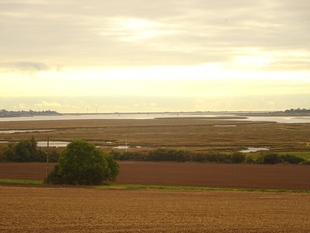
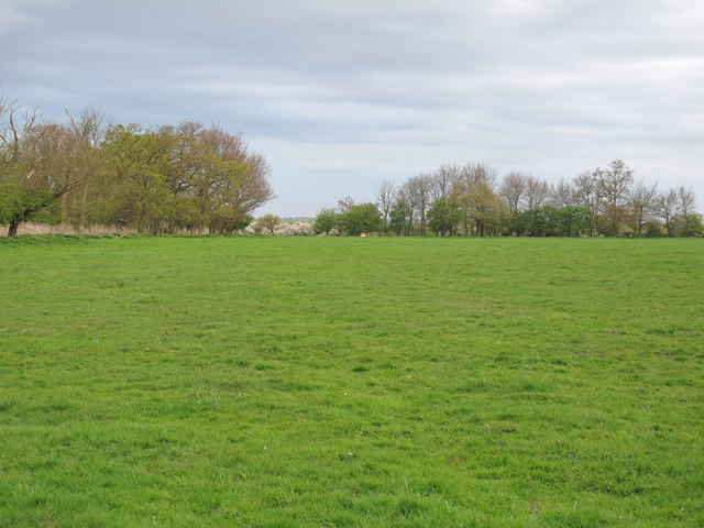
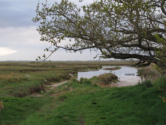
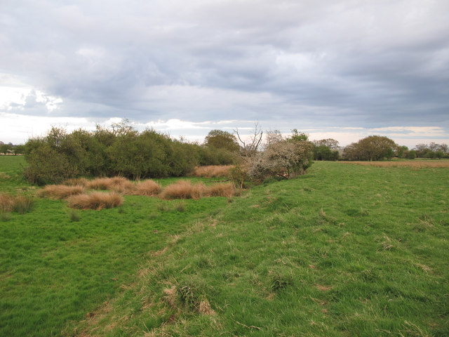
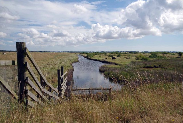
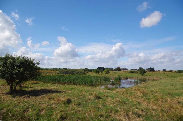
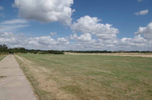
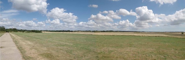
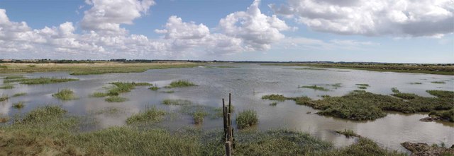
Wick Marsh, located in Essex, is a picturesque coastal marshland characterized by its unique landscape and diverse ecosystem. Stretching along the coast, it is part of the wider estuarine system of the River Crouch and the North Sea. The marsh consists of an extensive area of low-lying land, mainly composed of salt marshes and saltings.

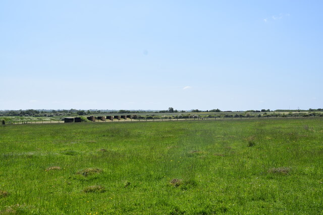
The marshland is subject to tidal influence, with water levels fluctuating throughout the day. Rich in nutrients and minerals, the marshes support a variety of plant species, including salt-tolerant grasses, reeds, and samphire. These plants create a striking mosaic of colors, especially during the summer months when they bloom. The area is also home to a wide range of wildlife, including birds, insects, and small mammals.

Wick Marsh is a haven for birdwatchers and nature enthusiasts. It serves as an important breeding ground and feeding site for numerous species, including waders, geese, and ducks. The salt marshes provide an ideal habitat for many bird species, attracting them during both migration and breeding seasons.

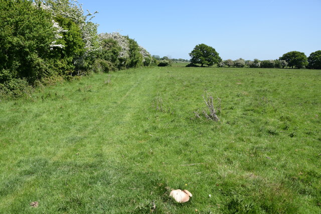
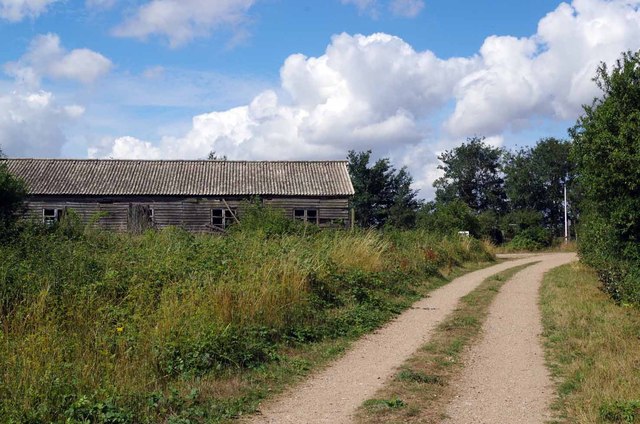
Visitors to Wick Marsh can explore the various footpaths and trails that crisscross the area, offering stunning views of the marshland and its abundant wildlife. The marsh is also a popular spot for fishing and boating, providing recreational opportunities for locals and tourists alike.

Overall, Wick Marsh is a remarkable coastal marshland, offering a tranquil and scenic environment for both nature lovers and those seeking outdoor activities. Its unique ecosystem and diverse wildlife make it a must-visit destination for anyone interested in exploring the natural beauty of Essex.

If you have any feedback on the listing, please let us know in the comments section below.
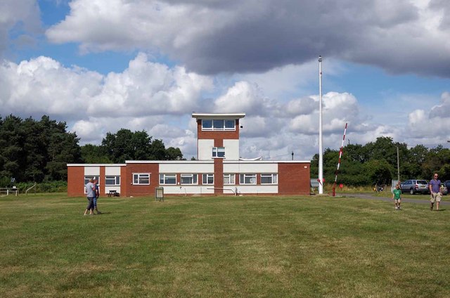
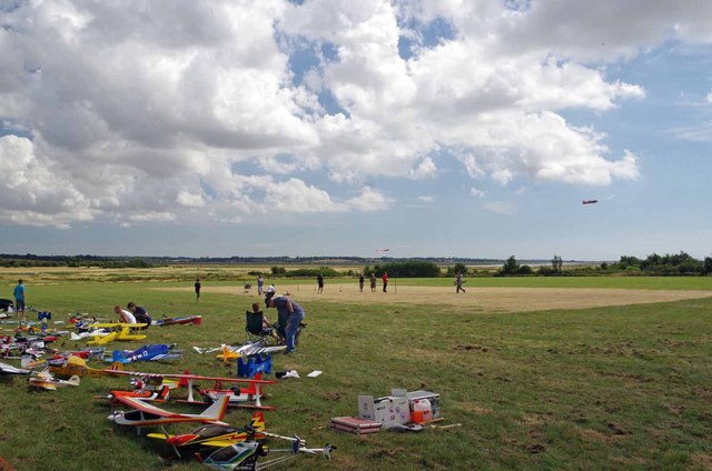
Wick Marsh Images

Images are sourced within 2km of 51.819897/0.95008064 or Grid Reference TM0317. Thanks to Geograph Open Source API. All images are credited.

Fingringhoe marsh & ranges
Sheep pasture on Fingrinhoe Ranges I am on the public footpath which skirts the norther edge of the military firing ranges. The path can only be walked when the red flags are not flying. Just in front of me is a large field mushroom.
Sheep pasture on Fingrinhoe Ranges
I am on the public footpath which skirts the norther edge of the military firing ranges. The path can only be walked when the red flags are not flying. Just in front of me is a large field mushroom.
Fingrinhoe Ranges Some of the training infrastructure on this military rifle range. Taken just south of South House Farm, from the public footpath which skirts part of the northern edge of the ranges. The footpath can only be walked when the red flags are not flying.
Fingrinhoe Ranges
Some of the training infrastructure on this military rifle range. Taken just south of South House Farm, from the public footpath which skirts part of the northern edge of the ranges. The footpath can only be walked when the red flags are not flying.
South Green Road near Fingringhoe, Essex South Green Road is a quiet lane in a rural part of Essex.
South Green Road near Fingringhoe, Essex
South Green Road is a quiet lane in a rural part of Essex.
Fingringhoe Ranges A public footpath leads through the military practice ranges - only accessible when the red flag is not flying.
Fingringhoe Ranges
A public footpath leads through the military practice ranges - only accessible when the red flag is not flying.
Fingringhoe Marsh This section of the marsh is close to a military practice range - only accessible when the red flag is not flying.
Fingringhoe Marsh
This section of the marsh is close to a military practice range - only accessible when the red flag is not flying.
Silted ditch between fields, Fingringhoe Ranges A silted up ditch close to a footpath near Fingringhoe Ranges, accessible only when the red flag is not flying.
Silted ditch between fields, Fingringhoe Ranges
A silted up ditch close to a footpath near Fingringhoe Ranges, accessible only when the red flag is not flying.
Red sky over arable land View over arable field, near South House Farm, just before sunset.
Red sky over arable land
View over arable field, near South House Farm, just before sunset.
Dike on Fingringhoe Range For one day a year (the first Sunday of August) the guns of Fingringhoe Ranges fall silent for 
<a href="https://www.geograph.org.uk/photo/3585348">TM0218 : The Five Parishes Show</a> (Peldon, Abberton, Gt Wigborough, Langenhoe & Little Wigborough). The general public are allowed access to the Ranges, there is no prohibition against walking around on the formal paths. Straying from these could prove very unpleasant due to unexploded ordnance.
Dike on Fingringhoe Range
For one day a year (the first Sunday of August) the guns of Fingringhoe Ranges fall silent for TM0218 : The Five Parishes Show (Peldon, Abberton, Gt Wigborough, Langenhoe & Little Wigborough). The general public are allowed access to the Ranges, there is no prohibition against walking around on the formal paths. Straying from these could prove very unpleasant due to unexploded ordnance.
Path & Old Hut on Fingringhoe Range For one day a year (the first Sunday of August) the guns of Fingringhoe Ranges fall silent for 
<a href="https://www.geograph.org.uk/photo/3585348">TM0218 : The Five Parishes Show</a> (Peldon, Abberton, Gt Wigborough, Langenhoe & Little Wigborough). The general public are allowed access to the Ranges, there is no prohibition against walking around on the formal paths. Straying from these could prove very unpleasant due to unexploded ordnance.
Path & Old Hut on Fingringhoe Range
For one day a year (the first Sunday of August) the guns of Fingringhoe Ranges fall silent for TM0218 : The Five Parishes Show (Peldon, Abberton, Gt Wigborough, Langenhoe & Little Wigborough). The general public are allowed access to the Ranges, there is no prohibition against walking around on the formal paths. Straying from these could prove very unpleasant due to unexploded ordnance.
Pond on Fingeringhoe Range Taken during <a href="https://www.geograph.org.uk/photo/3585348">TM0218 : The Five Parishes Show</a>
Pond on Fingeringhoe Range
The Five Parishes Show Each Year for the past 81 years the Five Parishes Horticultural Society has put on a country show. For many years it has been held on the <a href="https://www.geograph.org.uk/photo/3585351">TM0218 : Fingringhoe Ranges</a> by permission of the Commander Defence Training Estate East. The Five Parishes are Abberton, Little Wigborough, Peldon, Great Wigborough & Langenhoe. This is the main arena with Suffolk Punches giving a display. Suffolk Punches are on the Rare Breeds Survival Trust's <span class="nowrap"><a title="https://www.rbst.org.uk/" rel="nofollow ugc noopener" href="https://www.rbst.org.uk/">Link</a><img style="margin-left:2px;" alt="External link" title="External link - shift click to open in new window" src="https://s1.geograph.org.uk/img/external.png" width="10" height="10"/></span> critically endangered list there less than fifty breeding mares and only a hand full of stallions left in the U.K <span class="nowrap"><a title="http://www.suffolkpunchtrust.org/" rel="nofollow ugc noopener" href="http://www.suffolkpunchtrust.org/">Link</a><img style="margin-left:2px;" alt="External link" title="External link - shift click to open in new window" src="https://s1.geograph.org.uk/img/external.png" width="10" height="10"/></span>
The Five Parishes Show
Each Year for the past 81 years the Five Parishes Horticultural Society has put on a country show. For many years it has been held on the TM0218 : Fingringhoe Ranges by permission of the Commander Defence Training Estate East. The Five Parishes are Abberton, Little Wigborough, Peldon, Great Wigborough & Langenhoe. This is the main arena with Suffolk Punches giving a display. Suffolk Punches are on the Rare Breeds Survival Trust's LinkExternal link critically endangered list there less than fifty breeding mares and only a hand full of stallions left in the U.K LinkExternal link
Fingringhoe Ranges Part of the training infrastructure on <a href="https://www.geograph.org.uk/photo/195074">TM0218 : Fingringhoe  Range</a>
Fingringhoe Ranges
Part of the training infrastructure on TM0218 : Fingringhoe Range
Range Control The main observation and admin building on <a href="https://www.geograph.org.uk/photo/3585351">TM0218 : Fingringhoe Ranges</a>
Range Control
The main observation and admin building on TM0218 : Fingringhoe Ranges
Range & Radio Models Colchester Model Aircraft Club <span class="nowrap"><a title="http://www.webjam.com/colchestermac_intro/about_us" rel="nofollow ugc noopener" href="http://www.webjam.com/colchestermac_intro/about_us">Link</a><img style="margin-left:2px;" alt="External link" title="External link - shift click to open in new window" src="https://s1.geograph.org.uk/img/external.png" width="10" height="10"/></span> giving a flying demo at <a href="https://www.geograph.org.uk/photo/3585348">TM0218 : The Five Parishes Show</a> on <a href="https://www.geograph.org.uk/photo/195074">TM0218 : Fingringhoe  Range</a>
Range & Radio Models
Colchester Model Aircraft Club LinkExternal link giving a flying demo at TM0218 : The Five Parishes Show on TM0218 : Fingringhoe Range
Across Fingringhoe Ranges The Military Training Ground and Danger Area stretch almost as far as the eye can see!
Across Fingringhoe Ranges
The Military Training Ground and Danger Area stretch almost as far as the eye can see!
Range Panorama Fingringohe Range and its danger area cover at least eight square Kilometres
Range Panorama
Fingringohe Range and its danger area cover at least eight square Kilometres
Geedon Creek Panorama This picture was taken during <a href="https://www.geograph.org.uk/photo/3585348">TM0218 : The Five Parishes Show</a> when there is public access to the <a href="https://www.geograph.org.uk/photo/3585351">TM0218 : Fingringhoe Ranges</a>
Geedon Creek Panorama
This picture was taken during TM0218 : The Five Parishes Show when there is public access to the TM0218 : Fingringhoe Ranges
Show me another place!

Wick Marsh is located at Grid Ref: TM0317 (Lat: 51.819897, Lng: 0.95008064)

Administrative County: Essex

District: Colchester

Police Authority: Essex

What 3 Words

///heightens.method.crumples. Near Rowhedge, Essex

Related Wikis

Fingringhoe Wick

Fingringhoe Wick is a 48.6-hectare (120-acre) nature reserve in Fingringhoe in Essex. It is managed by the Essex Wildlife Trust, which runs a visitor centre...

Colne Estuary

Colne Estuary is a 2915 hectare biological and geological Site of Special Scientific Interest near Brightlingsea in Essex. It is also a Nature Conservation...

Fingringhoe

Fingringhoe is a village and civil parish in the City of Colchester district of Essex, England. The centre of the village is classified as a conservation...

Mersea Island

Mersea Island is an island in Essex, England, in the Blackwater and Colne estuaries to the south-east of Colchester. Its name comes from the Old English...

Langenhoe

Langenhoe is a village in the City of Colchester district of Essex, England, located south of Colchester. According to the 2001 census it had a population...

Abberton, Essex

Abberton is a village in the City of Colchester district of Essex, England. It is located approximately 0.62 mi (1.00 km) east of Abberton Reservoir and...

Ray Island

Ray Island, also known as the Ray, is a 40.5-hectare (100-acre) nature reserve west of Mersea Island in Essex. It is owned by the National Trust, who bought...

1884 Colchester earthquake

The Colchester earthquake, also known as the Great English earthquake, occurred on the morning of 22 April 1884 at 09:18. It caused considerable damage...

Nearby Amenities

Located within 500m of 51.819897,0.95008064
Wick Marsh
Place: locality
Source: OS_OpenData_StreetView
Lat/Long: 51.8186155/0.9519501
The data included in this document is from www.openstreetmap.org. The data is made available under ODbL.

Have you been to Wick Marsh?

Leave your review of Wick Marsh below (or comments, questions and feedback).