Harty Marshes

Coastal Marsh, Saltings in Kent Swale

England

Harty Marshes

Bridge Over a Dike (Sheppey) This bridge over the dike in Swale Nature Reserve leads to a 2km nature trail here the reeds have not been allowed to remain so there is open water for ducks and the like.
Bridge Over a Dike (Sheppey) Credit: Glyn Baker

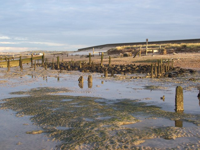
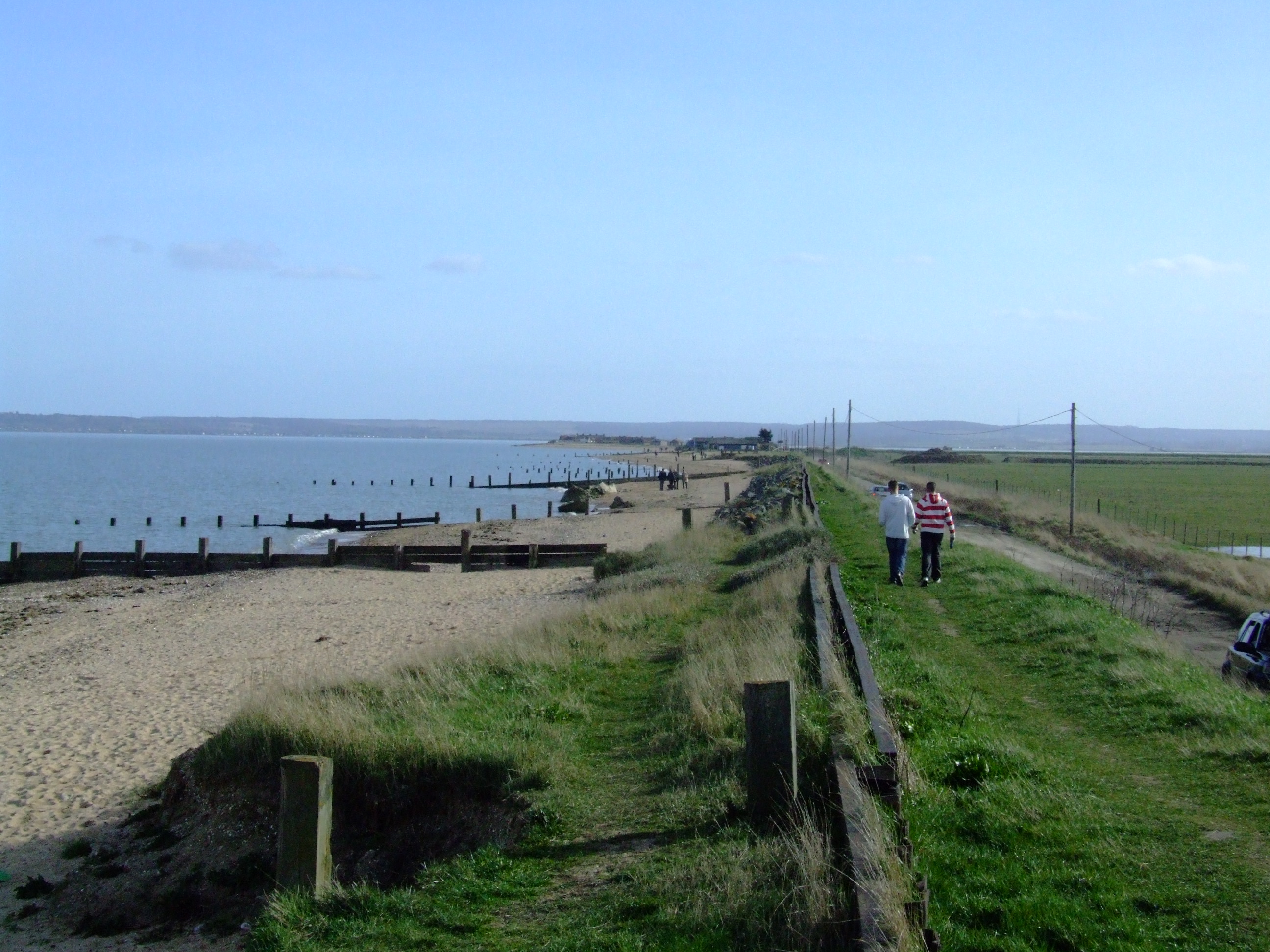
Harty Marshes, located in Kent, England, is a coastal marshland characterized by its unique ecosystem of salt marshes and saltings. Covering an area of approximately 1,500 hectares, it is situated on the Isle of Sheppey, surrounded by the waters of the Thames Estuary and the Swale. This vast expanse of wetland is renowned for its rich biodiversity and serves as a valuable habitat for a wide range of plant and animal species.

The marshes feature a mosaic of different habitats, including saltmarsh, mudflats, reedbeds, and grazing marshes, each supporting its own unique plant and wildlife communities. The saltmarshes are particularly significant, as they provide a crucial breeding ground for many bird species, such as avocets, redshanks, and lapwings. The mudflats attract a variety of wading birds, including dunlins and curlews.

Harty Marshes are also home to a diverse range of plant species that have adapted to the saline environment. Sea lavender, sea purslane, and saltmarsh grasses are among the vegetation that thrives in these salt marshes.

The area is managed by various conservation organizations to maintain its ecological balance and protect its fragile habitats. Grazing by cattle and sheep is carefully controlled to prevent overgrazing, ensuring the preservation of the diverse vegetation and the marshes' overall ecological health.

Harty Marshes offer not only a haven for wildlife but also provide opportunities for outdoor activities such as bird watching, walking, and photography. It is a popular destination for nature enthusiasts and visitors seeking to immerse themselves in the tranquility of this unique coastal marshland.

If you have any feedback on the listing, please let us know in the comments section below.

Harty Marshes Images

Images are sourced within 2km of 51.370379/0.89985629 or Grid Reference TR0167. Thanks to Geograph Open Source API. All images are credited.

Bridge Over a Dike (Sheppey) This bridge over the dike in Swale Nature Reserve leads to a 2km nature trail here the reeds have not been allowed to remain so there is open water for ducks and the like.
Bridge Over a Dike (Sheppey)
This bridge over the dike in Swale Nature Reserve leads to a 2km nature trail here the reeds have not been allowed to remain so there is open water for ducks and the like.
Managed Wetland (Sheppey) The environment of Swale Nature Reserve is actively managed to provide a multitude of wetland habitats for all kinds of bird and animal life. In the background is one of the many bird hides around the reserve.
Managed Wetland (Sheppey)
The environment of Swale Nature Reserve is actively managed to provide a multitude of wetland habitats for all kinds of bird and animal life. In the background is one of the many bird hides around the reserve.
Harty Church This is Harty church.  The hamlet that it served has long gone.  The building is a real architectural treasure; built in 1089 it is substantially unchanged, although much of the wood has been replaced over the centuries.  In recent times the  tower has had to have many wooden pantiles replaced after repeated attacks by woodpeckers.  One remarkable feature is that despite being only yards from a local 240v power distribution line the church has no electricity and is lit by wick oil lamps and candles.
Harty Church
This is Harty church. The hamlet that it served has long gone. The building is a real architectural treasure; built in 1089 it is substantially unchanged, although much of the wood has been replaced over the centuries. In recent times the tower has had to have many wooden pantiles replaced after repeated attacks by woodpeckers. One remarkable feature is that despite being only yards from a local 240v power distribution line the church has no electricity and is lit by wick oil lamps and candles.
The Last Post I wonder when the last letter was picked up from here? The Victorian letterbox is in the wall of a brick barn a few yards from Harty Church.
The Last Post
I wonder when the last letter was picked up from here? The Victorian letterbox is in the wall of a brick barn a few yards from Harty Church.
Lane to Harty Church This shot is looking back along the lane to Harty Church with Park Farm’s Drive to the right, it has been planted as an avenue of oak trees, unfortunately not English Oak the cups of the acorns are all hairy and the leaves are too spiky. However given a hundred years or so and this will be a magnificent sight.
Lane to Harty Church
This shot is looking back along the lane to Harty Church with Park Farm’s Drive to the right, it has been planted as an avenue of oak trees, unfortunately not English Oak the cups of the acorns are all hairy and the leaves are too spiky. However given a hundred years or so and this will be a magnificent sight.
The Ferry Inn The building here has seen a few centuries come and go. This was an essential rest stop for persons crossing to and from the mainland not just an alehouse but an inn. The Ferry Inn seems to be thriving despite the lack of any habitation in the immediate area.
The Ferry Inn
The building here has seen a few centuries come and go. This was an essential rest stop for persons crossing to and from the mainland not just an alehouse but an inn. The Ferry Inn seems to be thriving despite the lack of any habitation in the immediate area.
Game Pens at Elliot's Farm These are the rearing pens for game birds at Elliot's Farm. They have all mod cons including gas heating!
Game Pens at Elliot's Farm
These are the rearing pens for game birds at Elliot's Farm. They have all mod cons including gas heating!
Shooters' Hide on Path to Muswell Manor One of hundreds of straw hides for shooters. Around here the whole area is managed for partridge and ducks. The large number of hides indicates that shooting is big business around here; even so the environmental management must be fairly sound on the path from Elliotts Farm to Muswell Manor. I saw foour weasels (in different places), two marsh harriers (or maybe the same one twice) and hundreds of partridges. I think this is known as a target-rich environment.
Shooters' Hide on Path to Muswell Manor
One of hundreds of straw hides for shooters. Around here the whole area is managed for partridge and ducks. The large number of hides indicates that shooting is big business around here; even so the environmental management must be fairly sound on the path from Elliotts Farm to Muswell Manor. I saw foour weasels (in different places), two marsh harriers (or maybe the same one twice) and hundreds of partridges. I think this is known as a target-rich environment.
St Thomas, Harty, Kent The most isolated church in Kent.
St Thomas, Harty, Kent
The most isolated church in Kent.
St Thomas, Harty, Kent - East end
St Thomas, Harty, Kent - Window Depicting Saint Thomas
St Thomas, Harty, Kent - Window
Depicting Saint Thomas
Bridleway to Mocketts I'm not sure how one is supposed to access this bridleway as the gate seemed to be locked but it would have been a very muddy walk after recent rain.
The signs on the gate warn of: - underwater obstacles; uneven surfaces; slippery surface; and sudden drop. Well, who'd have thought it on a right of way across a marsh amid drainage ditches?
Mocketts is on the higher ground in the distance at <a href="https://www.geograph.org.uk/gridref/TR013665">TR013665</a>.
Bridleway to Mocketts
I'm not sure how one is supposed to access this bridleway as the gate seemed to be locked but it would have been a very muddy walk after recent rain. The signs on the gate warn of: - underwater obstacles; uneven surfaces; slippery surface; and sudden drop. Well, who'd have thought it on a right of way across a marsh amid drainage ditches? Mocketts is on the higher ground in the distance at TR013665.
Capel Fleet One of the main drains on Harty Marsh.
Capel Fleet
One of the main drains on Harty Marsh.
Capel Fleet Outflow from pump which raises water from one channel to another at Pump Hill, near the Raptor Viewpoint.
Capel Fleet
Outflow from pump which raises water from one channel to another at Pump Hill, near the Raptor Viewpoint.
Fly tip in a ditch Beside the Harty Road.
Fly tip in a ditch
Beside the Harty Road.
Cereal crop on Harty Marsh I was surprised to see this crop of cereal (probably wheat) on the marsh as most of the land here is used for grazing. The higher ground with Mocketts Cottages on the right is about two kilometres away.
Cereal crop on Harty Marsh
I was surprised to see this crop of cereal (probably wheat) on the marsh as most of the land here is used for grazing. The higher ground with Mocketts Cottages on the right is about two kilometres away.
Capel Fleet from Capel Gate This area is designated as a wildfowl reserve. The Old Counter Wall (a sea defence) is visible on the left. Capel Fleet was the channel which separated the Isle of Harty from mainland Sheppey in days gone by.
Capel Fleet from Capel Gate
This area is designated as a wildfowl reserve. The Old Counter Wall (a sea defence) is visible on the left. Capel Fleet was the channel which separated the Isle of Harty from mainland Sheppey in days gone by.
Looking down Capel Hill From Capel Hill Farm. Capel Fleet at the foot of the hill marks the southern boundary of the square. Mocketts is on the higher ground in the distance (in <a href="https://www.geograph.org.uk/gridref/TR0166">TR0166</a>) - at a similar height to Capel Hill (20m).
Looking down Capel Hill
From Capel Hill Farm. Capel Fleet at the foot of the hill marks the southern boundary of the square. Mocketts is on the higher ground in the distance (in TR0166) - at a similar height to Capel Hill (20m).
Show me another place!

Harty Marshes is located at Grid Ref: TR0167 (Lat: 51.370379, Lng: 0.89985629)

Administrative County: Kent

District: Swale

Police Authority: Kent

What 3 Words

///startles.heartburn.marker. Near Leysdown-on-Sea, Kent

Related Wikis

Harty

Harty is a small hamlet on the Isle of Sheppey in Kent consisting of a few cottages, a church and a public house, the Ferry Inn (a Grade II listed building...

Church of St Thomas the Apostle, Harty

The Church of St Thomas the Apostle in Harty on the Isle of Sheppey in the county of Kent is a Grade II* listed building. The date of founding cannot...

The Swale

The Swale is a tidal channel of the Thames estuary that separates the Isle of Sheppey from the rest of Kent. On its banks is a 6,509.4-hectare (16,085...

Oare Marshes

Oare Marshes is a 71.4-hectare (176-acre) Local Nature Reserve north of Faversham in Kent. It is owned and managed by Kent Wildlife Trust. It is part...

Harty Road Halt railway station

Harty Road Halt is a disused railway station between Eastchurch and Leysdown-on-Sea. It opened in 1905 and closed in 1950. == References == == External... ==
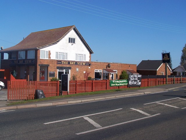
Bay View, Kent

Bay View is a hamlet in the civil parish of Leysdown, on the east side of the Isle of Sheppey in the borough of Swale in Kent, England. In 2020 it had...

South Swale

South Swale is a 410.5-hectare (1,014-acre) Local Nature Reserve (as South Bank of the Swale) north of Faversham in Kent. It is owned by Kent County Council...

Leysdown-on-Sea

Leysdown-on-Sea is a village on the east coast of the Isle of Sheppey, in the borough of Swale in Kent, England. In 2020 it had an estimated population...

Nearby Amenities

Located within 500m of 51.370379,0.89985629
The data included in this document is from www.openstreetmap.org. The data is made available under ODbL.

Have you been to Harty Marshes?

Leave your review of Harty Marshes below (or comments, questions and feedback).