Maplin Sands

Coastal Marsh, Saltings in Essex Rochford

England

Maplin Sands

Foulness Island from the air The sea in the foreground is part of the Shoeburyness Danger Area. The Dengie Peninsula can be seen in the distance.
Foulness Island from the air Credit: Thomas Nugent

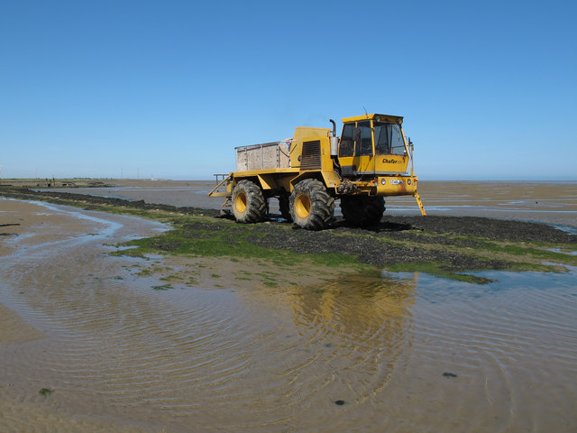
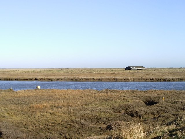
Maplin Sands is a coastal marsh and saltings located in Essex, England. Stretching across a vast area, it is situated on the northern side of the Thames Estuary, between the towns of Southend-on-Sea and Foulness Island. This unique ecosystem is known for its diverse wildlife and stunning natural beauty.

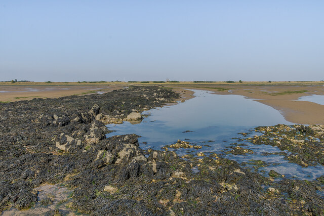
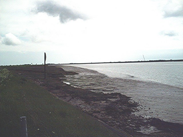
The landscape of Maplin Sands consists of extensive mudflats, salt marshes, and sand dunes. These habitats provide a rich and varied environment for a wide range of plant and animal species. The salt marshes are particularly important, as they act as a buffer zone between the land and sea, protecting the coastline from erosion.

The area is home to a plethora of bird species, making it a paradise for birdwatchers. During the winter months, thousands of wading birds migrate to Maplin Sands, including dunlins, curlews, and redshanks. In addition, it serves as a breeding ground for several rare and endangered species, such as the little tern and avocet.

Maplin Sands is also of historical significance. It was once used as a military testing site during World War II and the Cold War. Today, remnants of these activities, including abandoned bunkers and structures, can still be found scattered across the marshland.

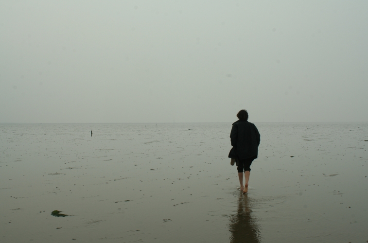
The area is a popular destination for nature enthusiasts, offering various walking trails and observation points. Visitors can explore the vast expanse of the marshes, taking in the breathtaking views and observing the diverse wildlife that thrives in this unique coastal habitat.

If you have any feedback on the listing, please let us know in the comments section below.

Maplin Sands Images

Images are sourced within 2km of 51.555431/0.91155946 or Grid Reference TR0188. Thanks to Geograph Open Source API. All images are credited.

Foulness Island from the air The sea in the foreground is part of the Shoeburyness Danger Area. The Dengie Peninsula can be seen in the distance.
Foulness Island from the air
The sea in the foreground is part of the Shoeburyness Danger Area. The Dengie Peninsula can be seen in the distance.
The Broomway The Broomway is a track (a Public Right of Way) over Maplin Sands which provides access between Foulness Island and Great Wakering via Wakering Stairs. It was the only means of access, other than by boat, between the island and the mainland until the 20th century. 

It is accessible only at low tides, and is bordered by dangerous soft muddy sands, some of which act as quicksand. Over the years many people have died on The Broomway, either due to the incoming tide or by being caught by quicksand. The Broomway is connected to Foulness and the mainland by a series of constructed hards or headways over the soft sand.

In older times the track was marked by a series of stakes, which resembled upturned brooms, hence the name "The Broomway". 

Although the track is a Public Right of Way - parts are classified as Byway Open to All Traffic, others as Public Footpath - access is controlled by the Ministry of Defence which has a large installation on Foulness. Access can be suspended at any time.

Guided tours of The Broomway are available from Nature Break Wildlife Cruises <span class="nowrap"><a title="http://www.wildlifetrips.org.uk/" rel="nofollow ugc noopener" href="http://www.wildlifetrips.org.uk/">Link</a><img style="margin-left:2px;" alt="External link" title="External link - shift click to open in new window" src="https://s1.geograph.org.uk/img/external.png" width="10" height="10"/></span>
The Broomway
The Broomway is a track (a Public Right of Way) over Maplin Sands which provides access between Foulness Island and Great Wakering via Wakering Stairs. It was the only means of access, other than by boat, between the island and the mainland until the 20th century. It is accessible only at low tides, and is bordered by dangerous soft muddy sands, some of which act as quicksand. Over the years many people have died on The Broomway, either due to the incoming tide or by being caught by quicksand. The Broomway is connected to Foulness and the mainland by a series of constructed hards or headways over the soft sand. In older times the track was marked by a series of stakes, which resembled upturned brooms, hence the name "The Broomway". Although the track is a Public Right of Way - parts are classified as Byway Open to All Traffic, others as Public Footpath - access is controlled by the Ministry of Defence which has a large installation on Foulness. Access can be suspended at any time. Guided tours of The Broomway are available from Nature Break Wildlife Cruises LinkExternal link
Broomway Tractor This is the "tractor" which provides tours along the Broomway, seen here near Asplins Headway.

It is a converted crop sprayer, and forms the transport for the "Tractor Tour" of The Broomway by Nature Break Wildlife Cruises <span class="nowrap"><a title="http://www.wildlifetrips.org.uk/" rel="nofollow ugc noopener" href="http://www.wildlifetrips.org.uk/">Link</a><img style="margin-left:2px;" alt="External link" title="External link - shift click to open in new window" src="https://s1.geograph.org.uk/img/external.png" width="10" height="10"/></span>
Broomway Tractor
This is the "tractor" which provides tours along the Broomway, seen here near Asplins Headway. It is a converted crop sprayer, and forms the transport for the "Tractor Tour" of The Broomway by Nature Break Wildlife Cruises LinkExternal link
The Broomway The Broomway is a track (a Public Right of Way) over Maplin Sands which provides access between Foulness Island and Great Wakering via Wakering Stairs. It was the only means of access, other than by boat, between the island and the mainland until the 20th century. 

It is accessible only at low tides, and is bordered by dangerous soft muddy sands, some of which act as quicksand. Over the years many people have died on The Broomway, either due to the incoming tide or by being caught by quicksand. The Broomway is connected to Foulness and the mainland by a series of constructed hards or headways over the soft sand.

In older times the track was marked by a series of stakes, which resembled upturned brooms, hence the name "The Broomway". 

Although the track is a Public Right of Way - parts are classified as Byway Open to All Traffic, others as Public Footpath - access is controlled by the Ministry of Defence which has a large installation on Foulness. Access can be suspended at any time.

Guided tours of The Broomway are available from Nature Break Wildlife Cruises <span class="nowrap"><a title="http://www.wildlifetrips.org.uk/" rel="nofollow ugc noopener" href="http://www.wildlifetrips.org.uk/">Link</a><img style="margin-left:2px;" alt="External link" title="External link - shift click to open in new window" src="https://s1.geograph.org.uk/img/external.png" width="10" height="10"/></span>
The Broomway
The Broomway is a track (a Public Right of Way) over Maplin Sands which provides access between Foulness Island and Great Wakering via Wakering Stairs. It was the only means of access, other than by boat, between the island and the mainland until the 20th century. It is accessible only at low tides, and is bordered by dangerous soft muddy sands, some of which act as quicksand. Over the years many people have died on The Broomway, either due to the incoming tide or by being caught by quicksand. The Broomway is connected to Foulness and the mainland by a series of constructed hards or headways over the soft sand. In older times the track was marked by a series of stakes, which resembled upturned brooms, hence the name "The Broomway". Although the track is a Public Right of Way - parts are classified as Byway Open to All Traffic, others as Public Footpath - access is controlled by the Ministry of Defence which has a large installation on Foulness. Access can be suspended at any time. Guided tours of The Broomway are available from Nature Break Wildlife Cruises LinkExternal link
Towards Shelford Head An unidentified metal object on the Broomway with Shelford Head in the background.
Towards Shelford Head
An unidentified metal object on the Broomway with Shelford Head in the background.
Causeway, Asplin's Head The end of the causeway at Asplin's Head providing a route off the Broomway to Foulness Island across the very soft mud along the shoreline.
Causeway, Asplin's Head
The end of the causeway at Asplin's Head providing a route off the Broomway to Foulness Island across the very soft mud along the shoreline.
At Asplin's Head A rusted marker post at the end of the causeway at Asplin's Head.  The causeway provides a route off the Broomway to Foulness Island across the very soft mud along the shoreline.
At Asplin's Head
A rusted marker post at the end of the causeway at Asplin's Head. The causeway provides a route off the Broomway to Foulness Island across the very soft mud along the shoreline.
Causeway, Asplin's Head The causeway at Asplin's Head providing a route off the Broomway to Foulness Island across the very soft mud along the shoreline.
Causeway, Asplin's Head
The causeway at Asplin's Head providing a route off the Broomway to Foulness Island across the very soft mud along the shoreline.
Causeway, Asplin's Head A rusted marker post at the end of the causeway at Asplin's Head.  The causeway provides a route off the Broomway to Foulness Island across the very soft mud along the shoreline.
Causeway, Asplin's Head
A rusted marker post at the end of the causeway at Asplin's Head. The causeway provides a route off the Broomway to Foulness Island across the very soft mud along the shoreline.
At Asplin's Head The end of the causeway at Asplin's Head providing a route off the Broomway to Foulness Island across the very soft mud along the shoreline.  The circular wall in the background was built to form a reservoir for the experimental burning of fuel.
At Asplin's Head
The end of the causeway at Asplin's Head providing a route off the Broomway to Foulness Island across the very soft mud along the shoreline. The circular wall in the background was built to form a reservoir for the experimental burning of fuel.
Causeway, Asplin's Head Looking along the causeway at Asplin's Head providing a route off the Broomway to Foulness Island across the very soft mud along the shoreline.
Causeway, Asplin's Head
Looking along the causeway at Asplin's Head providing a route off the Broomway to Foulness Island across the very soft mud along the shoreline.
Off the Broomway A creek running through firm mud and Dwarf Eelgrass (Zostera noltii) off the Broomway near Shelford Head.
Off the Broomway
A creek running through firm mud and Dwarf Eelgrass (Zostera noltii) off the Broomway near Shelford Head.
Show me another place!

Maplin Sands is located at Grid Ref: TR0188 (Lat: 51.555431, Lng: 0.91155946)

Administrative County: Essex

District: Rochford

Police Authority: Essex

What 3 Words

///monument.these.positions. Near Great Wakering, Essex

Nearby Locations

Maplin Sands

Related Wikis

Maplin Sands

The Maplin Sands are mudflats on the northern bank of the Thames estuary, off Foulness Island, near Southend-on-Sea in Essex, England, though they actually...

Foulness SSSI

Foulness SSSI is a 10,702 hectare biological Site of Special Scientific Interest covering the shoreline between Southend-on-Sea and the Crouch estuary...

Havengore Island

Havengore Island is a low-lying, marshy island in the civil parish of Foulness, in the Rochford district, in the county of Essex, England. It is bounded...

Foulness Island

Foulness Island () is a closed island on the east coast of Essex in England, which is separated from the mainland by narrow creeks. In the 2001 census...

New England Island

New England Island is an uninhabited island in Essex, England. One road crosses the island, connecting it with bridges to Foulness and to the mainland...

The Broomway

The Broomway, also formerly called the "Broom Road", is a public right of way over the foreshore at Maplin Sands off the coast of Essex, England. Most...

Saint Mary the Virgin, Foulness Island

Saint Mary the Virgin is a parish of the Church of England on Foulness Island, in Essex, England. Before the 15th century, the island of Foulness was divided...

Rushley Island

Rushley Island is a small uninhabited island in Essex, England. It is the smallest of six islands comprising an archipelago in Essex, and is privately...

Have you been to Maplin Sands?

Leave your review of Maplin Sands below (or comments, questions and feedback).