King's Hard

Coastal Marsh, Saltings in Essex Colchester

England

King's Hard

Feldy View Revisited My prediction made in 2005 see <a href="https://www.geograph.org.uk/photo/45732">TM0013 : Feldy View</a> is rapidly becoming true you can't see Feldy Marshes any more because of the trees!
Feldy View Revisited Credit: Glyn Baker

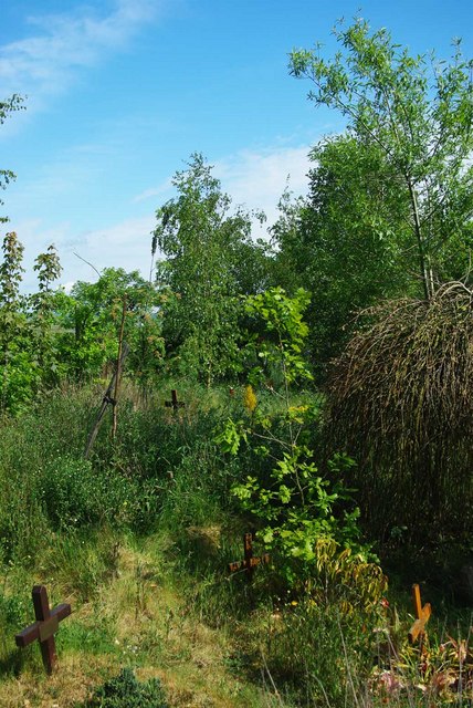
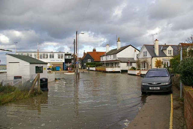
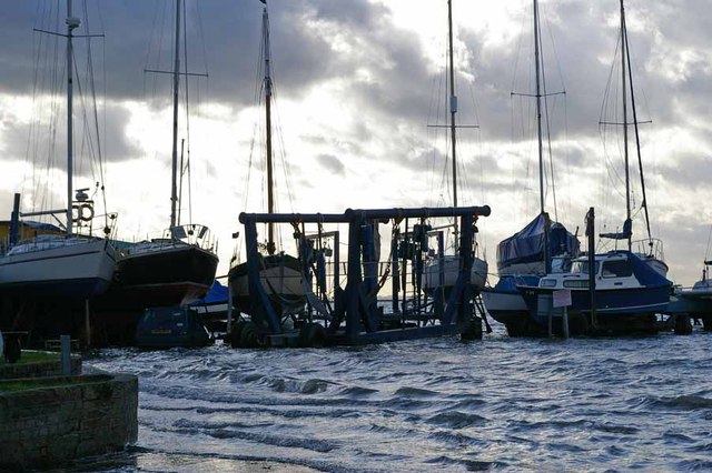
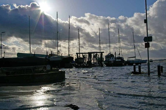
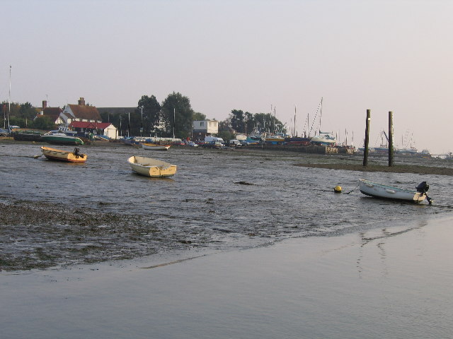
King's Hard is a natural coastal marshland located in Essex, England. It forms part of the larger St. Osyth's Priory Estate, which encompasses a diverse range of habitats, including salt marshes, mudflats, and saltings. The area is known for its unique ecosystem, rich biodiversity, and stunning natural beauty.

The marshland is situated along the coast of the North Sea, providing a crucial habitat for numerous bird species, fish, and invertebrates. It acts as an important breeding ground and feeding site for migratory birds such as avocets, redshanks, and dunlins. These birds are attracted to the area due to the abundance of food sources found in the mudflats and shallow waters.

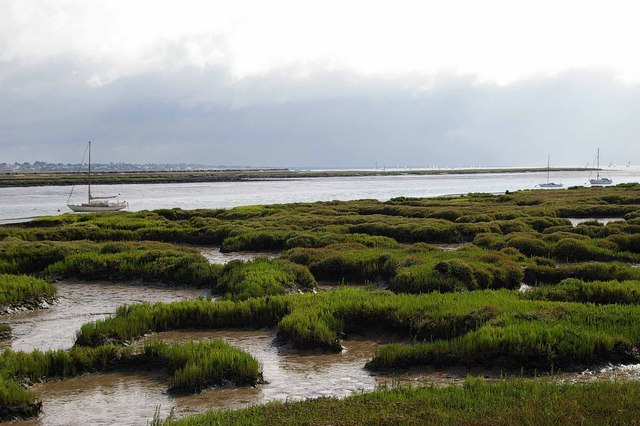
The saltings in King's Hard are characterized by a mix of salt-tolerant plants, such as samphire and sea lavender, which thrive in the brackish conditions. These plants not only help stabilize the soil but also provide a source of food for various insects and grazing animals.

The marshland is also significant from a geological perspective, as it showcases the natural processes of sedimentation and erosion along the coastline. It is a dynamic environment, constantly shaped by the tides and changing sea levels.

King's Hard is a popular destination for nature enthusiasts, birdwatchers, and photographers who come to appreciate its breathtaking landscapes and observe the diverse wildlife. Various walking trails and observation points allow visitors to explore the marshland while minimizing disturbance to the delicate ecosystem.

Efforts are made to protect and preserve King's Hard, as it is recognized as an important nature reserve and conservation area. Conservation organizations and local authorities work together to manage the site, ensuring the continued survival of its unique flora and fauna.

If you have any feedback on the listing, please let us know in the comments section below.
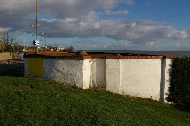
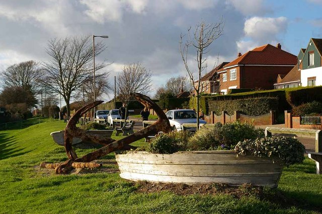
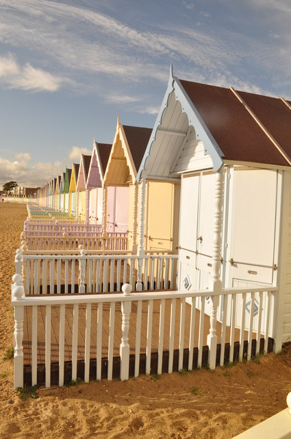
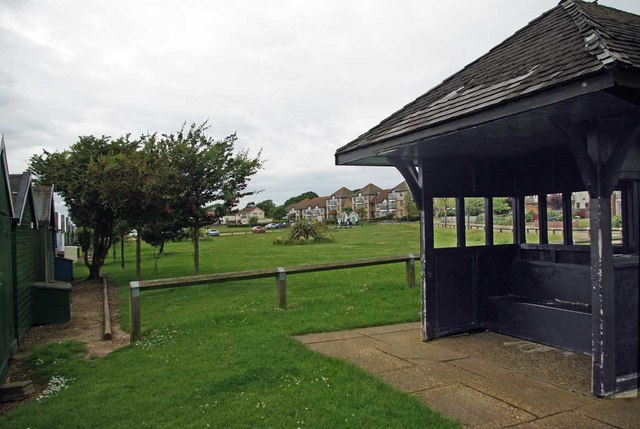
King's Hard Images

Images are sourced within 2km of 51.771818/0.90994638 or Grid Reference TM0012. Thanks to Geograph Open Source API. All images are credited.

Feldy View Revisited My prediction made in 2005 see <a href="https://www.geograph.org.uk/photo/45732">TM0013 : Feldy View</a> is rapidly becoming true you can't see Feldy Marshes any more because of the trees!
Feldy View Revisited
My prediction made in 2005 see TM0013 : Feldy View is rapidly becoming true you can't see Feldy Marshes any more because of the trees!
Dabchicks sailing club Dabchicks sailing club in West Mersea, Essex.
Dabchicks sailing club
Dabchicks sailing club in West Mersea, Essex.
Victory pub, Mersea Island Victory pub is located on  Mersea Island. Directly behind the photographer is the Blackwater estuary, the black banner in the centre of the building read   "A great place to sink a few"   very appropriate bearing in mind its location.
Victory pub, Mersea Island
Victory pub is located on Mersea Island. Directly behind the photographer is the Blackwater estuary, the black banner in the centre of the building read "A great place to sink a few" very appropriate bearing in mind its location.
The Captain's Table Inside the Company Shed is a fish restaurant. It only sells "Fruits of the Sea" you have to supply your own carbohydrate (however only bread is allowed!) the quality of the fayre is such that punters queue up for a table. Also with no licence you can bring your own wines, the shop just across the road does a fair trade in Mersea Wine from <a href="https://www.geograph.org.uk/photo/2121334">TM0313 : Mersea Island Vineyard</a>
The Captain's Table
Inside the Company Shed is a fish restaurant. It only sells "Fruits of the Sea" you have to supply your own carbohydrate (however only bread is allowed!) the quality of the fayre is such that punters queue up for a table. Also with no licence you can bring your own wines, the shop just across the road does a fair trade in Mersea Wine from TM0313 : Mersea Island Vineyard
High Tide Near Dabchicks Sailing Club Looking towards "The Lane" in West Mersea
High Tide Near Dabchicks Sailing Club
Looking towards "The Lane" in West Mersea
Not a Dry Dock! This part of Mersea Hard is only submerged at the highest of tides.
Not a Dry Dock!
This part of Mersea Hard is only submerged at the highest of tides.
Mersea Hard A very High Tide at Mersea Hard
Mersea Hard
A very High Tide at Mersea Hard
Seafront Gun Emplacement This Café is built in a WW2 gun emplacement. Until the early 1970's there were two at this point, the other was converted into a rain shelter. It became rather insanitary despite a public convenience a few yards away and so demolition ensued. Buses stopped terminating on the Esplanade in the 1950's for fear of them causing subsidence into the soldiers dormitories under the road. There is another closer view at <a href="https://www.geograph.org.uk/photo/2576024">TM0112 : Mersea Gun Shelter Café</a>
Seafront Gun Emplacement
This Café is built in a WW2 gun emplacement. Until the early 1970's there were two at this point, the other was converted into a rain shelter. It became rather insanitary despite a public convenience a few yards away and so demolition ensued. Buses stopped terminating on the Esplanade in the 1950's for fear of them causing subsidence into the soldiers dormitories under the road. There is another closer view at TM0112 : Mersea Gun Shelter Café
Mersea Gun Shelter Café This is one of the last two remaining of four WW2 gun emplacements on West Mersea seafront. Three were converted to retail outlets and one to a rain shelter. The rough concrete has been rendered for aesthetic reasons. You can see the café from the other direction at <a href="https://www.geograph.org.uk/photo/2576004">TM0112 : Seafront Gun Emplacement</a>. There is a smaller version at <a href="https://www.geograph.org.uk/photo/2993027">TM0212 : Blockhouse Kiosk</a>
Mersea Gun Shelter Café
This is one of the last two remaining of four WW2 gun emplacements on West Mersea seafront. Three were converted to retail outlets and one to a rain shelter. The rough concrete has been rendered for aesthetic reasons. You can see the café from the other direction at TM0112 : Seafront Gun Emplacement. There is a smaller version at TM0212 : Blockhouse Kiosk
Victoria Esplanade West Mersea out of season (you can park on the front!)
Victoria Esplanade
West Mersea out of season (you can park on the front!)
Pastel Beach Huts £25k for a shed!!!
Pastel Beach Huts
£25k for a shed!!!
Former Putting Green in the 1960's and 70's the greensward behind the shelter was a putting green.
Former Putting Green
in the 1960's and 70's the greensward behind the shelter was a putting green.
Blockhouse Kiosk This is a smaller version of the <a href="https://www.geograph.org.uk/photo/2576004">TM0112 : Seafront Gun Emplacement</a> further along the beach. It was for many years used as a kiosk for selling ice creams and buckets, spades and little paper flags for sand castles etc.
Blockhouse Kiosk
This is a smaller version of the TM0112 : Seafront Gun Emplacement further along the beach. It was for many years used as a kiosk for selling ice creams and buckets, spades and little paper flags for sand castles etc.
Mersea Sewage Works Until this facility was built the collecting of cockles from West Mersea beach was  a bit of an extreme sport!
Mersea Sewage Works
Until this facility was built the collecting of cockles from West Mersea beach was a bit of an extreme sport!
Mersea Island Royal British Legion Club In Barfield Road
Mersea Island Royal British Legion Club
In Barfield Road
The Coast Inn, West Mersea A Public House and Restaurant on the Coast Road on the far west of the island.
The Coast Inn, West Mersea
A Public House and Restaurant on the Coast Road on the far west of the island.
Fountain Court West Mersea These residential properties were built on the site of The Fountain public house, hence the name. They are on the corner of the B1025 and East Road opposite the Police Station.
Fountain Court West Mersea
These residential properties were built on the site of The Fountain public house, hence the name. They are on the corner of the B1025 and East Road opposite the Police Station.
Charleston Court West Mersea Located in Seaview Avenue, these flats were built on the site of the former Two Tides public house. They were named after the landlord of the pub, (at his own request,) who sold the site for development.
Charleston Court West Mersea
Located in Seaview Avenue, these flats were built on the site of the former Two Tides public house. They were named after the landlord of the pub, (at his own request,) who sold the site for development.
Show me another place!

King's Hard is located at Grid Ref: TM0012 (Lat: 51.771818, Lng: 0.90994638)

Administrative County: Essex

District: Colchester

Police Authority: Essex

What 3 Words

///newer.forks.broker. Near West Mersea, Essex

Related Wikis

West Mersea Priory

West Mersea Priory was a Benedictine priory in West Mersea, Essex, England. It was founded in 1046 and granted by Edward the Confessor to the Abbey of...

West Mersea

West Mersea is a town and electoral ward in Essex, England. It is the larger (in terms of population) of two settlements on Mersea Island, south of Colchester...

West Mersea Yacht Club

West Mersea Yacht Club (WMYC) is a British yacht club that has its clubhouse in Coast Road, West Mersea, Mersea Island, Essex. It is on the estuary of...

Great Cob Island

Great Cob island is a small island in the estuary of the River Blackwater in Essex, England, the United Kingdom. The island is an area of low-lying salt...

Barrow Hill, Essex

Barrow Hill is a hamlet in Essex, England. It is located on Mersea Island, approximately 2 km (1.2 mi) north-northeast of West Mersea near to where the...

Ray Island

Ray Island, also known as the Ray, is a 40.5-hectare (100-acre) nature reserve west of Mersea Island in Essex. It is owned by the National Trust, who bought...

Mersea Island

Mersea Island is an island in Essex, England, in the Blackwater and Colne estuaries to the south-east of Colchester. Its name comes from the Old English...

Bradwell nuclear power station

Bradwell nuclear power station is a Magnox-design nuclear power station that is undergoing decommissioning. It is located on the Dengie peninsula at the...

Nearby Amenities

Located within 500m of 51.771818,0.90994638
Source: PGS
Lat/Long: 51.7734492/0.9162948
Source: PGS
Lat/Long: 51.7735227/0.9155156
Source: PGS
Lat/Long: 51.7735668/0.9149376
Source: PGS
Lat/Long: 51.7735957/0.9141979
Source: PGS
Lat/Long: 51.7736372/0.9131566
Source: PGS
Lat/Long: 51.7736763/0.9118397
Source: PGS
Lat/Long: 51.7736982/0.9106087
Source: PGS
Lat/Long: 51.7737289/0.9100264
Source: PGS
Lat/Long: 51.7737695/0.9092669
Source: PGS
Lat/Long: 51.7739683/0.907626
Source: PGS
Lat/Long: 51.7739991/0.906529
Source: PGS
Lat/Long: 51.7739677/0.9059982
Source: PGS
Lat/Long: 51.7738955/0.9044421
Source: PGS
Lat/Long: 51.7738114/0.9039256
Coast Road
Naptan AtcoCode: 1500IM02571
Naptan BusStopType: CUS
Naptan NaptanCode: esxjpdad
Naptan Verified: no
Public Transport: platform
Source: naptan
Lat/Long: 51.7749968/0.9073239
Generator Method: photovoltaic
Generator Output Electricity: yes
Generator Source: solar
Generator Type: solar_photovoltaic_panel
Location: roof
Power: generator
Lat/Long: 51.7758548/0.906989
Generator Method: photovoltaic
Generator Output Electricity: yes
Generator Source: solar
Generator Type: solar_photovoltaic_panel
Location: roof
Power: generator
Lat/Long: 51.7758481/0.9070507
Generator Method: photovoltaic
Generator Output Electricity: yes
Generator Source: solar
Generator Type: solar_photovoltaic_panel
Location: roof
Power: generator
Lat/Long: 51.7755992/0.9095907
Generator Method: photovoltaic
Generator Output Electricity: yes
Generator Source: solar
Generator Type: solar_photovoltaic_panel
Location: roof
Power: generator
Lat/Long: 51.7740889/0.9137803
Generator Method: photovoltaic
Generator Output Electricity: yes
Generator Source: solar
Generator Type: solar_photovoltaic_panel
Location: roof
Power: generator
Lat/Long: 51.7754697/0.9126243
Generator Method: photovoltaic
Generator Output Electricity: yes
Generator Source: solar
Generator Type: solar_photovoltaic_panel
Location: roof
Power: generator
Lat/Long: 51.7757087/0.9090382
Generator Method: photovoltaic
Generator Output Electricity: yes
Generator Source: solar
Generator Type: solar_photovoltaic_panel
Location: roof
Power: generator
Lat/Long: 51.7758614/0.9074771
Generator Method: photovoltaic
Generator Output Electricity: yes
Generator Source: solar
Generator Type: solar_photovoltaic_panel
Location: roof
Power: generator
Lat/Long: 51.7761601/0.9087807
Generator Method: photovoltaic
Generator Output Electricity: yes
Generator Source: solar
Generator Type: solar_photovoltaic_panel
Location: roof
Power: generator
Lat/Long: 51.7761634/0.9088665
Generator Method: photovoltaic
Generator Output Electricity: yes
Generator Source: solar
Generator Type: solar_photovoltaic_panel
Location: roof
Power: generator
Lat/Long: 51.7755328/0.9066215
St Peter's Well
Historic: memorial
Memorial: plaque
Lat/Long: 51.7745811/0.9081038
Board Type: history
Information: board
Tourism: information
Lat/Long: 51.7746287/0.9085702
The data included in this document is from www.openstreetmap.org. The data is made available under ODbL.

Have you been to King's Hard?

Leave your review of King's Hard below (or comments, questions and feedback).