Abbot's Hall Saltings

Coastal Marsh, Saltings in Essex Colchester

England

Abbot's Hall Saltings

Breach B This panorama shows part of the largest continuous stretch of salt-marsh in Essex. It was created by Essex Wildlife Trust <span class="nowrap"><a title="http://www.essexwt.org.uk/visitor_centres__nature_reserves/abbotts_hall_farm/" rel="nofollow ugc noopener" href="http://www.essexwt.org.uk/visitor_centres__nature_reserves/abbotts_hall_farm/">Link</a><img style="margin-left:2px;" alt="External link" title="External link - shift click to open in new window" src="https://s1.geograph.org.uk/img/external.png" width="10" height="10"/></span> by cutting five breaches in the existing sea wall in October 2002, thus allowing 200 acres of reclaimed farmland to revert to a more natural state. You can see the scene in 2007 at <a href="https://www.geograph.org.uk/photo/550777">TL9613 : New Saltmarsh</a> "Breach B" is the largest of the gaps.
Breach B Credit: Glyn Baker

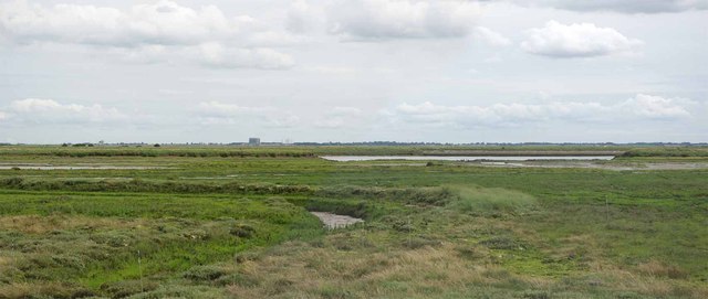
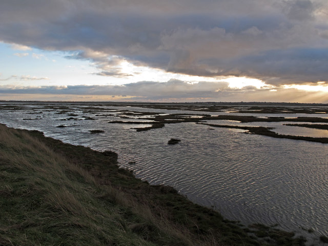
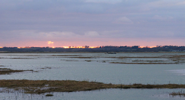
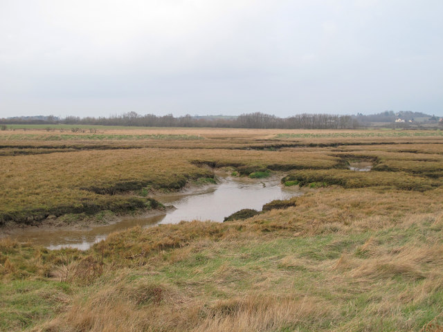
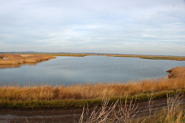
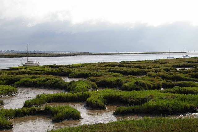
Abbot's Hall Saltings is a coastal marsh located in Essex, England. It is situated in close proximity to the village of Great Totham, and stretches along the banks of the River Blackwater. This area is commonly referred to as saltings, which are low-lying, marshy lands that are regularly flooded by tidal waters.

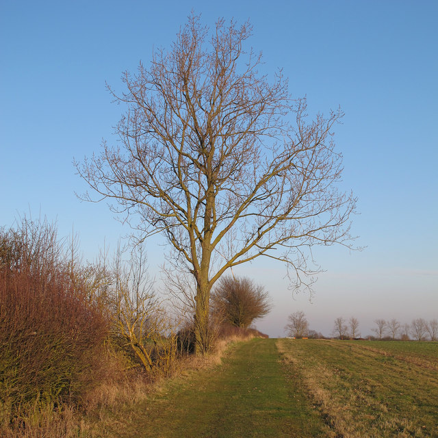
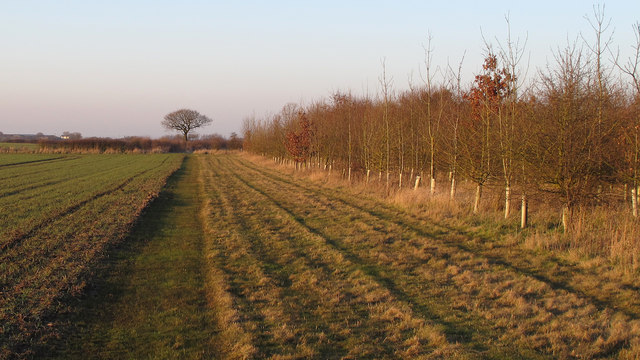
The saltings at Abbot's Hall are an important and ecologically diverse habitat, supporting a wide variety of plant and animal species. The marshes are predominantly covered in salt-tolerant grasses and shrubs, such as sea lavender, sea purslane, and samphire. These plants not only provide food and shelter for numerous bird species, but also help to stabilize the marshland and prevent erosion.

The area is a popular destination for birdwatchers, as it serves as an important breeding ground and wintering site for many migratory birds. Species that can be spotted here include avocets, redshanks, dunlins, and curlews. Additionally, the marshes support a range of other wildlife including reptiles, amphibians, and small mammals.

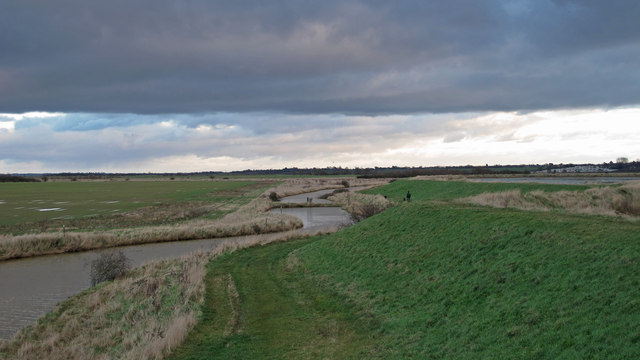
Abbot's Hall Saltings is managed as a nature reserve by the Essex Wildlife Trust, with the aim of preserving its unique ecology and promoting public awareness and appreciation of the area. The reserve offers several walking trails and viewing points, allowing visitors to explore and observe the diverse wildlife in a peaceful and natural setting.

Overall, Abbot's Hall Saltings is an important and valuable coastal marsh, providing a vital habitat for a wide range of plant and animal species, and offering a tranquil and educational experience for nature enthusiasts.

If you have any feedback on the listing, please let us know in the comments section below.

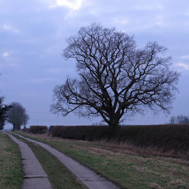
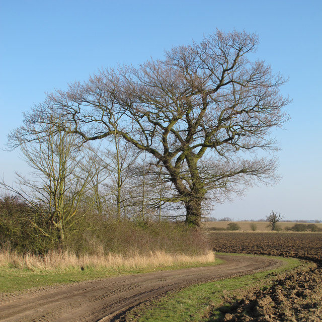
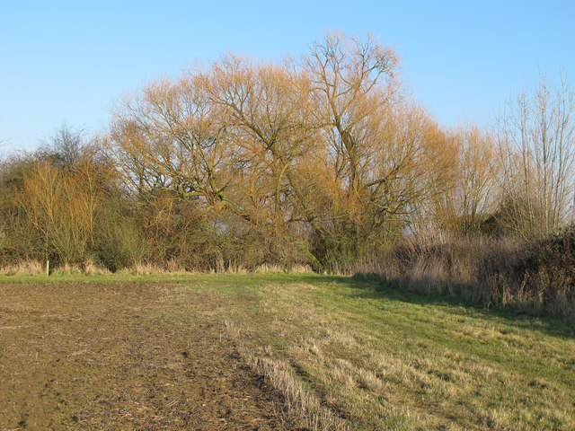
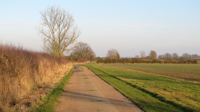
Abbot's Hall Saltings Images

Images are sourced within 2km of 51.787397/0.86635628 or Grid Reference TL9713. Thanks to Geograph Open Source API. All images are credited.

Breach B This panorama shows part of the largest continuous stretch of salt-marsh in Essex. It was created by Essex Wildlife Trust <span class="nowrap"><a title="http://www.essexwt.org.uk/visitor_centres__nature_reserves/abbotts_hall_farm/" rel="nofollow ugc noopener" href="http://www.essexwt.org.uk/visitor_centres__nature_reserves/abbotts_hall_farm/">Link</a><img style="margin-left:2px;" alt="External link" title="External link - shift click to open in new window" src="https://s1.geograph.org.uk/img/external.png" width="10" height="10"/></span> by cutting five breaches in the existing sea wall in October 2002, thus allowing 200 acres of reclaimed farmland to revert to a more natural state. You can see the scene in 2007 at <a href="https://www.geograph.org.uk/photo/550777">TL9613 : New Saltmarsh</a> "Breach B" is the largest of the gaps.
Breach B
This panorama shows part of the largest continuous stretch of salt-marsh in Essex. It was created by Essex Wildlife Trust LinkExternal link by cutting five breaches in the existing sea wall in October 2002, thus allowing 200 acres of reclaimed farmland to revert to a more natural state. You can see the scene in 2007 at TL9613 : New Saltmarsh "Breach B" is the largest of the gaps.
Field with sheep Sheep at Copt Hall Farm, owned by the National Trust.
Field with sheep
Sheep at Copt Hall Farm, owned by the National Trust.
Abbot's Hall Saltings As seen from the sea wall near the National Trust's Copt Hall Farm. The water is Salcott Channel, part of the Blackwater Estuary.
Abbot's Hall Saltings
As seen from the sea wall near the National Trust's Copt Hall Farm. The water is Salcott Channel, part of the Blackwater Estuary.
Borrow Dyke near Copthall Saltings This borrow dyke is behind the seawall at Copthall Saltings. To the left is the National Trust Copt Hall Marshes.
Borrow Dyke near Copthall Saltings
This borrow dyke is behind the seawall at Copthall Saltings. To the left is the National Trust Copt Hall Marshes.
Sunset over Salcott Channel Taken from the seawall between Copthall Saltings and the National Trust's Copt Hall Marshes.
Sunset over Salcott Channel
Taken from the seawall between Copthall Saltings and the National Trust's Copt Hall Marshes.
Abbot's Hall Saltings Salt marsh seen from the sea wall on the boundary of the National Trust's Copt Hall Marshes.
Abbot's Hall Saltings
Salt marsh seen from the sea wall on the boundary of the National Trust's Copt Hall Marshes.
Farm and Church Copt Hall Farm outbuildings and church of St Nicholas, Little Wigborough.
Farm and Church
Copt Hall Farm outbuildings and church of St Nicholas, Little Wigborough.
Lower Barn: from the south This barn at Copt Hall Farm is named on the map as "Lower Barn", this view from the south.
Lower Barn: from the south
This barn at Copt Hall Farm is named on the map as "Lower Barn", this view from the south.
Winter Oak Silhouetted against the winter sky, this oak is near the track that leads to Lower Barn <a title="https://www.geograph.org.uk/photo/3328130" href="https://www.geograph.org.uk/photo/3328130">Link</a> at the National Trust's Copt Hall Marshes.
Winter Oak
Silhouetted against the winter sky, this oak is near the track that leads to Lower Barn Link at the National Trust's Copt Hall Marshes.
Oak on field boundary, Abbotts Hall Farm Oak near farm track in arable land at Essex Wildlife Trust's Abbotts Hall Farm, Great Wigborough.
Oak on field boundary, Abbotts Hall Farm
Oak near farm track in arable land at Essex Wildlife Trust's Abbotts Hall Farm, Great Wigborough.
Willow on field boundary, Abbotts Hall Farm One of a number of willows near a pond close to marsh barn at Essex Wildlife Trust's Abbotts Hall Farm, Great Wigborough.
Willow on field boundary, Abbotts Hall Farm
One of a number of willows near a pond close to marsh barn at Essex Wildlife Trust's Abbotts Hall Farm, Great Wigborough.
Track along field boundary,  Abbotts Hall Farm One of the main permissive paths near arable land at Essex Wildlife Trust's Abbotts Hall Farm, Great Wigborough.
Track along field boundary, Abbotts Hall Farm
One of the main permissive paths near arable land at Essex Wildlife Trust's Abbotts Hall Farm, Great Wigborough.
Tree on field boundary, Abbotts Hall Farm Looking east along a field margin and permissive path at Essex Wildlife Trust's Abbotts Hall Farm, Great Wigborough.
Tree on field boundary, Abbotts Hall Farm
Looking east along a field margin and permissive path at Essex Wildlife Trust's Abbotts Hall Farm, Great Wigborough.
Saplings, field margin, arable land: Abbotts Hall Farm Looking north along a permissive path near a small plantation of saplings at Essex Wildlife Trust's Abbotts Hall Farm, Great Wigborough.
Saplings, field margin, arable land: Abbotts Hall Farm
Looking north along a permissive path near a small plantation of saplings at Essex Wildlife Trust's Abbotts Hall Farm, Great Wigborough.
Wigborough Road, Little Wigborough To the right of the image is the village sign for Little Wigborough.
Wigborough Road, Little Wigborough
To the right of the image is the village sign for Little Wigborough.
Great Wigborough, Essex The village of Great Wigborough lies a few miles to the south of Colchester.
Great Wigborough, Essex
The village of Great Wigborough lies a few miles to the south of Colchester.
Maldon Road, Great Wigborough The house to the left is a farmhouse.
Maldon Road, Great Wigborough
The house to the left is a farmhouse.
Joyce's Head Fleet Taken from the sea wall path that circles Old Hall Marshes.
Joyce's Head Fleet
Taken from the sea wall path that circles Old Hall Marshes.
Show me another place!

Abbot's Hall Saltings is located at Grid Ref: TL9713 (Lat: 51.787397, Lng: 0.86635628)

Administrative County: Essex

District: Colchester

Police Authority: Essex

What 3 Words

///vegetable.studio.purest. Near West Mersea, Essex

Related Wikis

Nearby Amenities

Located within 500m of 51.787397,0.86635628
Abbot's Hall Saltings
Place: locality
Lat/Long: 51.78605/0.8663469
The data included in this document is from www.openstreetmap.org. The data is made available under ODbL.

Have you been to Abbot's Hall Saltings?

Leave your review of Abbot's Hall Saltings below (or comments, questions and feedback).