Haven Point

Coastal Marsh, Saltings in Essex Rochford

England

Haven Point

From east shore of Rushley Island across Narrow Cuts towards Havengore Island View east across the saltgrass marshes from near the eastern sea wall of Rushley Island, overlooking the channel known as Narrow Cuts with the western side of Havengore Island in the background.
From east shore of Rushley Island across Narrow Cuts towards Havengore Island Credit: Tom Loosemore

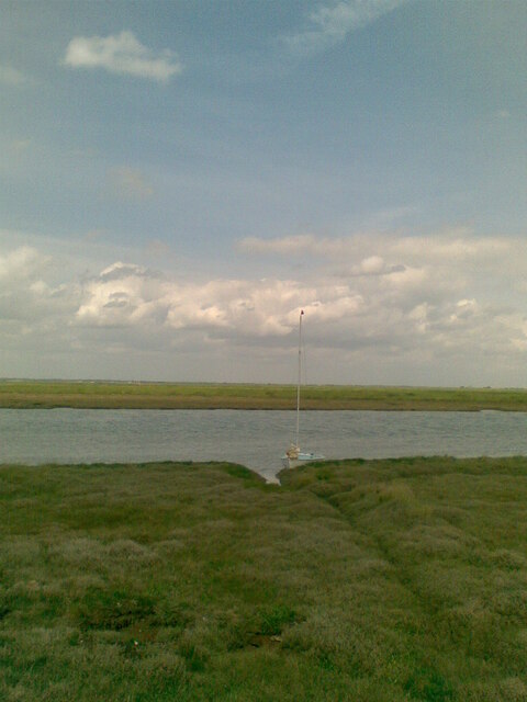
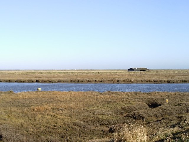
Haven Point, located in Essex, England, is a mesmerizing coastal marshland known for its unique and diverse ecosystem. Nestled between the North Sea and the River Crouch, this area encompasses a vast expanse of salt marshes and saltings, making it an ideal habitat for a wide range of flora and fauna.

The marshes of Haven Point are formed by the deposition of sediment carried by the river and the tides, resulting in a complex network of channels, creeks, and mudflats. These intertidal zones are home to an abundance of marine life, including crabs, fish, and various species of birds. The marshes are also characterized by their extensive salt-tolerant vegetation, such as cordgrasses, samphire, and sea lavender, which thrive in the brackish waters.

Haven Point is a haven for birdwatchers, as it serves as an important stopover site for migrating birds. During the spring and autumn, flocks of wading birds, such as curlews, oystercatchers, and redshanks, can be spotted feeding on the mudflats. The area also supports breeding colonies of avocets, which are a rare and iconic sight with their distinctive long, upturned bills.

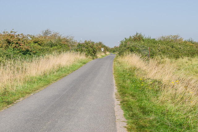
Aside from its ecological significance, Haven Point offers picturesque views and tranquil surroundings. Visitors can explore the marshes on foot along the network of footpaths and trails, immersing themselves in the serene coastal landscape. The area is also popular among photographers and artists, as its ever-changing scenery, influenced by the tides and seasons, provides endless inspiration.

Overall, Haven Point in Essex is a captivating coastal marshland, offering a rich tapestry of wildlife, stunning vistas, and a peaceful retreat into nature.

If you have any feedback on the listing, please let us know in the comments section below.

Haven Point Images

Images are sourced within 2km of 51.553724/0.8510868 or Grid Reference TQ9787. Thanks to Geograph Open Source API. All images are credited.

From east shore of Rushley Island across Narrow Cuts towards Havengore Island View east across the saltgrass marshes from near the eastern sea wall of Rushley Island, overlooking the channel known as Narrow Cuts with the western side of Havengore Island in the background.
From east shore of Rushley Island across Narrow Cuts towards Havengore Island
View east across the saltgrass marshes from near the eastern sea wall of Rushley Island, overlooking the channel known as Narrow Cuts with the western side of Havengore Island in the background.
Ford onto Rushley Island Crossing Havengore Creek
Ford onto Rushley Island
Crossing Havengore Creek
Havengore Farm Taken on a Foulness Heritage Centre open day on the way to Churchend.
Havengore Farm
Taken on a Foulness Heritage Centre open day on the way to Churchend.
New England Creek This creek separates Havengore Island from the smaller New England Island and also Foulness Island itself. The white birds that can just about be seen are a bunch of avocets.
New England Creek
This creek separates Havengore Island from the smaller New England Island and also Foulness Island itself. The white birds that can just about be seen are a bunch of avocets.
Towards Sharpsness Head Looking across an area of firm mud from just off the Broomway, with Sharpsness Head on Foulness Island in the background.
Towards Sharpsness Head
Looking across an area of firm mud from just off the Broomway, with Sharpsness Head on Foulness Island in the background.
Stairs Road Lane connecting Great Wakering with Wakering Stairs, crossing military land forming part of MOD Shoeburyness.  The give way sign in the background is where the lane crosses one of the sidings that serve the land.
Stairs Road
Lane connecting Great Wakering with Wakering Stairs, crossing military land forming part of MOD Shoeburyness. The give way sign in the background is where the lane crosses one of the sidings that serve the land.
Watchtower A watchtower at Wakering Stairs, overlooking the Maplin Sands artillery ranges.
Watchtower
A watchtower at Wakering Stairs, overlooking the Maplin Sands artillery ranges.
Sea wall Looking along the sea wall at Wakering Stairs.
Sea wall
Looking along the sea wall at Wakering Stairs.
Wakering Stairs The causeway at Wakering Stairs, forming the start of the Broomway along Maplin Sands.
Wakering Stairs
The causeway at Wakering Stairs, forming the start of the Broomway along Maplin Sands.
Sea wall Looking along the sea wall at Wakering Stairs.
Sea wall
Looking along the sea wall at Wakering Stairs.
Stairs Road Looking along Stairs Road from the sea wall at Wakering Stairs.  On the left is a watchtower overlooking the Maplin Sands artillery ranges.
Stairs Road
Looking along Stairs Road from the sea wall at Wakering Stairs. On the left is a watchtower overlooking the Maplin Sands artillery ranges.
Wakering Stairs The causeway at Wakering Stairs forming the start of the Broomway.
Wakering Stairs
The causeway at Wakering Stairs forming the start of the Broomway.
On the Broomway Looking across an area of firm mud on the Broomway, with the start of the path at Wakering Stairs in the background.
On the Broomway
Looking across an area of firm mud on the Broomway, with the start of the path at Wakering Stairs in the background.
On the Broomway An area of cordgrass on the Broomway, near the start of the path at Wakering Stairs.
On the Broomway
An area of cordgrass on the Broomway, near the start of the path at Wakering Stairs.
On the Broomway Looking across firm mud and Dwarf Eelgrass (Zostera noltii) on the Broomway, with the start of the path at Wakering Stairs in the right distance.
On the Broomway
Looking across firm mud and Dwarf Eelgrass (Zostera noltii) on the Broomway, with the start of the path at Wakering Stairs in the right distance.
Towards Havengore Bridge Looking towards Havengore Bridge across firm mud and Dwarf Eelgrass (Zostera noltii) off the Broomway.  The original bridge was completed in 1922, before which the only means of access to Foulness Island from the mainland was on foot or cart using the Broomway.  The current bridge dates from 1988.
Towards Havengore Bridge
Looking towards Havengore Bridge across firm mud and Dwarf Eelgrass (Zostera noltii) off the Broomway. The original bridge was completed in 1922, before which the only means of access to Foulness Island from the mainland was on foot or cart using the Broomway. The current bridge dates from 1988.
Off the Broomway Looking across firm mud and Dwarf Eelgrass (Zostera noltii) off the Broomway.  In the background is the wreck of a trawler at TQ98728643 with a container ship en route out of the Thames estuary in the far distance.
Off the Broomway
Looking across firm mud and Dwarf Eelgrass (Zostera noltii) off the Broomway. In the background is the wreck of a trawler at TQ98728643 with a container ship en route out of the Thames estuary in the far distance.
Show me another place!

Haven Point is located at Grid Ref: TQ9787 (Lat: 51.553724, Lng: 0.8510868)

Administrative County: Essex

District: Rochford

Police Authority: Essex

What 3 Words

///purchaser.clock.smallest. Near Great Wakering, Essex

Nearby Locations

Haven Point

Related Wikis

The Broomway

The Broomway, also formerly called the "Broom Road", is a public right of way over the foreshore at Maplin Sands off the coast of Essex, England. Most...

Havengore Island

Havengore Island is a low-lying, marshy island in the civil parish of Foulness, in the Rochford district, in the county of Essex, England. It is bounded...

Rushley Island

Rushley Island is a small uninhabited island in Essex, England. It is the smallest of six islands comprising an archipelago in Essex, and is privately...

New England Island

New England Island is an uninhabited island in Essex, England. One road crosses the island, connecting it with bridges to Foulness and to the mainland...

Nearby Amenities

Located within 500m of 51.553724,0.8510868
Created By: dmgroom_coastlines
Lat/Long: 51.5550799/0.8504955
Railway: switch
Lat/Long: 51.5531506/0.846182
Railway: level_crossing
Lat/Long: 51.5534007/0.8469192
Railway: level_crossing
Lat/Long: 51.5539567/0.8477565
Railway: level_crossing
Lat/Long: 51.5540071/0.8477511
Q Battery
Lat/Long: 51.5533447/0.8482231
Railway: level_crossing
Lat/Long: 51.5538867/0.8477565
The data included in this document is from www.openstreetmap.org. The data is made available under ODbL.

Have you been to Haven Point?

Leave your review of Haven Point below (or comments, questions and feedback).