Brancaster Marsh

Coastal Marsh, Saltings in Norfolk King's Lynn and West Norfolk

England

Brancaster Marsh

Pleasant path Just about the most perfect surface for a footpath. Clean, well-defined, flat, firm but not too soft nor too hard, no mud, no puddles, no dog poop, no litter!
Pleasant path Credit: Ian Paterson

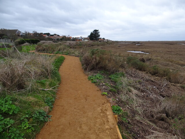
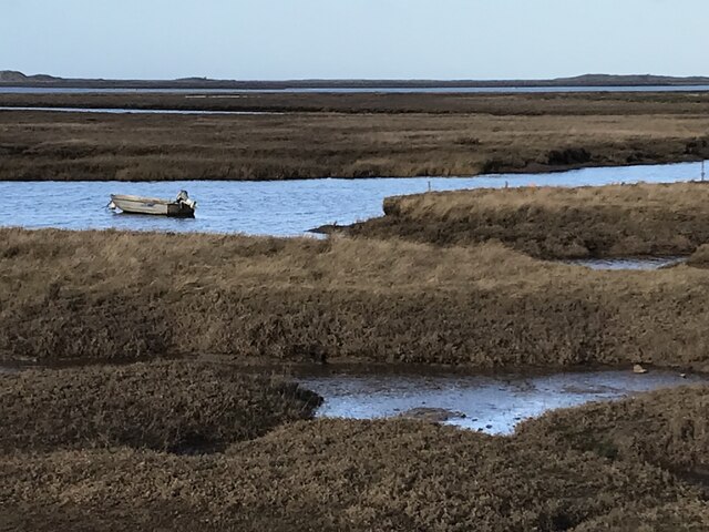
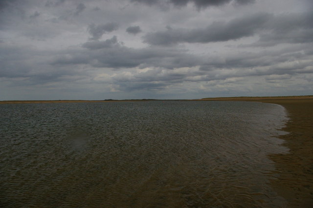
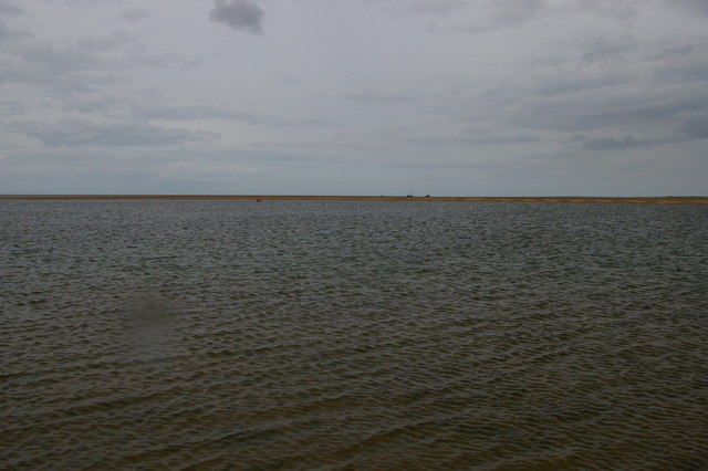
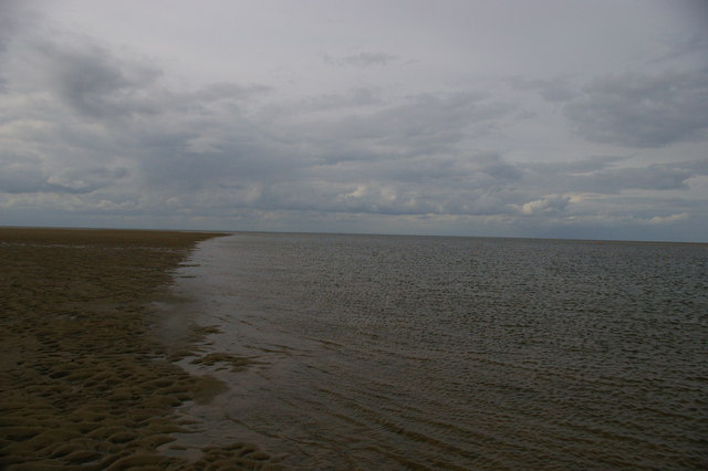
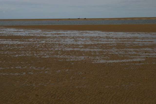
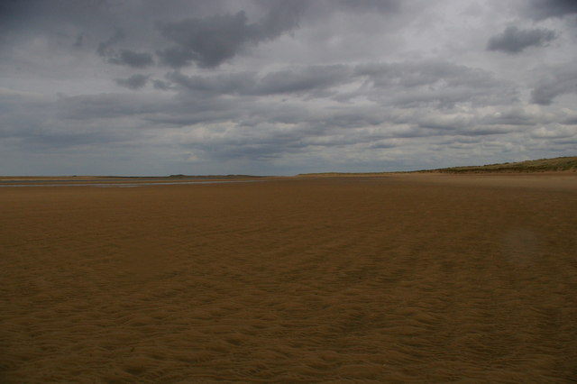
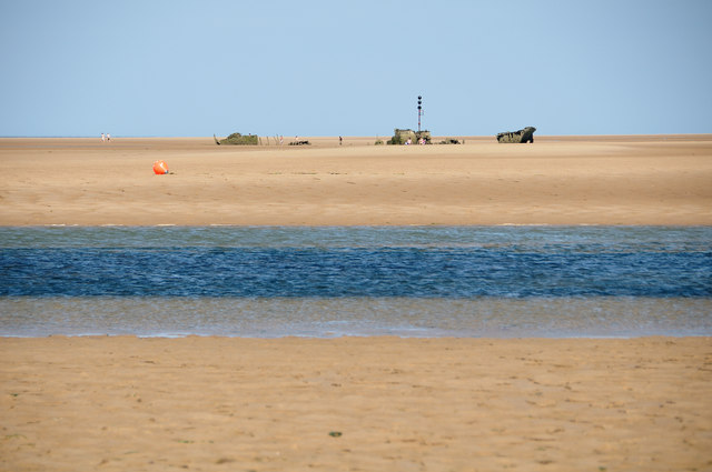
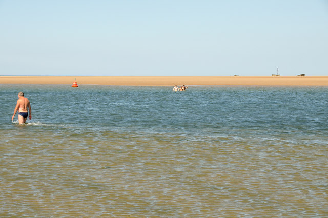
Brancaster Marsh is a coastal marshland located in Norfolk, England. It stretches along the North Norfolk coast and is renowned for its vast expanse of salt marshes and saltings. The marshland is situated adjacent to the village of Brancaster and is part of the larger Norfolk Coast Area of Outstanding Natural Beauty.

The marsh is predominantly made up of tidal mudflats, salt marshes, and sand dunes. It is a highly dynamic and ever-changing landscape due to the constant influence of tides and coastal processes. The area is heavily influenced by the tides of the North Sea, which create a unique habitat for a wide variety of plants and animals.

The marsh is home to a rich biodiversity, with numerous species of birds, insects, and plants thriving in this unique ecosystem. It serves as an important breeding ground and feeding site for many bird species, including waders such as avocets, oystercatchers, and redshanks. Additionally, the marshland supports a diverse range of plant life, including sea lavender, samphire, and cordgrass.

The marshland is a popular destination for birdwatchers, nature enthusiasts, and walkers, who are attracted by its scenic beauty and abundant wildlife. The area is also of historical significance, as remnants of ancient human activity, including Roman and medieval salt-working sites, can be found scattered across the landscape.

Overall, Brancaster Marsh offers a unique and captivating experience for visitors, combining stunning natural beauty with a rich ecological and historical heritage.

If you have any feedback on the listing, please let us know in the comments section below.

Brancaster Marsh Images

Images are sourced within 2km of 52.97251/0.65423733 or Grid Reference TF7844. Thanks to Geograph Open Source API. All images are credited.

Pleasant path Just about the most perfect surface for a footpath. Clean, well-defined, flat, firm but not too soft nor too hard, no mud, no puddles, no dog poop, no litter!
Pleasant path
Just about the most perfect surface for a footpath. Clean, well-defined, flat, firm but not too soft nor too hard, no mud, no puddles, no dog poop, no litter!
Saltmarsh and creeks, Brancaster Staithe A view from the car park of the White Horse
Saltmarsh and creeks, Brancaster Staithe
A view from the car park of the White Horse
Signpost in the garden of the White Horse, Brancaster Staithe The garden and car park abut the saltmarshes at this popular North Norfolk hostelry.
Signpost in the garden of the White Horse, Brancaster Staithe
The garden and car park abut the saltmarshes at this popular North Norfolk hostelry.
Brancaster across the marshes
Royal West Norfolk Golf Club: war memorial gates The gate records members and other associates of the club killed in the two World Wars.  At the head of those killed in the Second World War is H.R.H. the Duke of Kent.
Royal West Norfolk Golf Club: war memorial gates
The gate records members and other associates of the club killed in the two World Wars. At the head of those killed in the Second World War is H.R.H. the Duke of Kent.
Brancaster Beach, and the clubhouse of the Royal West Norfolk Golf Club
Marsh Road, between the Royal West Norfolk Golf Club and the marshes
Brancaster Beach looking east
Brancaster Harbour, with a wreck in the distance
Brancaster Harbour
Brancaster Harbour
Brancaster Beach The Royal West Norfolk Golf Club clubhouse in the distance.
Brancaster Beach
The Royal West Norfolk Golf Club clubhouse in the distance.
Brancaster Harbour, distant wreck
Brancaster Beach looking east
Brancaster Beach Brancaster beach with SS Vina in the background. (350mm eqv. lens)
Brancaster Beach
Brancaster beach with SS Vina in the background. (350mm eqv. lens)
Outflow channel & SS Vina This is the outflow channel you have to cross to visit the shipwreck. On low tides it is possible, but be warned the tide can easily cut you off.
Outflow channel & SS Vina
This is the outflow channel you have to cross to visit the shipwreck. On low tides it is possible, but be warned the tide can easily cut you off.
Outflow channel, Brancaster Bay Some children nearly missed getting back across the outflow channel before the tide came in. They are up to their chests.
Outflow channel, Brancaster Bay
Some children nearly missed getting back across the outflow channel before the tide came in. They are up to their chests.
Western Brancaster Harbour, Brancaster Bay Taken from the south of the outflow channel at a very low tide. Here, it was just possible to walk through the water to a sand bar on the northern side, but it was probably 1 metre deep. The ship wreck SS Vina can be seen in the distance.

The camera location was fixed using a Nikon GP-1 GPS unit attached to the camera. This is embedded in the EXIF data.
Western Brancaster Harbour, Brancaster Bay
Taken from the south of the outflow channel at a very low tide. Here, it was just possible to walk through the water to a sand bar on the northern side, but it was probably 1 metre deep. The ship wreck SS Vina can be seen in the distance. The camera location was fixed using a Nikon GP-1 GPS unit attached to the camera. This is embedded in the EXIF data.
Western Brancaster Harbour, Brancaster Bay Taken from the south of the outflow channel at a very low tide. Ship wreck SS Vina and Scolt Head Island can be seen in the distance. When you walk there, they are a lot further away than you imagined. Also, the beach undulates a lot and for this reason you need to be careful, as it is easy to caught out by the tide.

The camera location was fixed using a Nikon GP-1 GPS unit attached to the camera. This is embedded in the EXIF data.
Western Brancaster Harbour, Brancaster Bay
Taken from the south of the outflow channel at a very low tide. Ship wreck SS Vina and Scolt Head Island can be seen in the distance. When you walk there, they are a lot further away than you imagined. Also, the beach undulates a lot and for this reason you need to be careful, as it is easy to caught out by the tide. The camera location was fixed using a Nikon GP-1 GPS unit attached to the camera. This is embedded in the EXIF data.
Show me another place!

Brancaster Marsh is located at Grid Ref: TF7844 (Lat: 52.97251, Lng: 0.65423733)

Administrative County: Norfolk

District: King's Lynn and West Norfolk

Police Authority: Norfolk

What 3 Words

///reporting.juniors.talking. Near Hunstanton, Norfolk

Related Wikis

Branodunum

Branodunum was an ancient Roman fort to the east of the modern English village of Brancaster in Norfolk. Its Roman name derives from the local Celtic language...

Royal West Norfolk Golf Club

Royal West Norfolk Golf Club is a golf club in Brancaster, Norfolk, England, about 7 miles (11 km) east of Hunstanton, between Brancaster Bay and the salt...
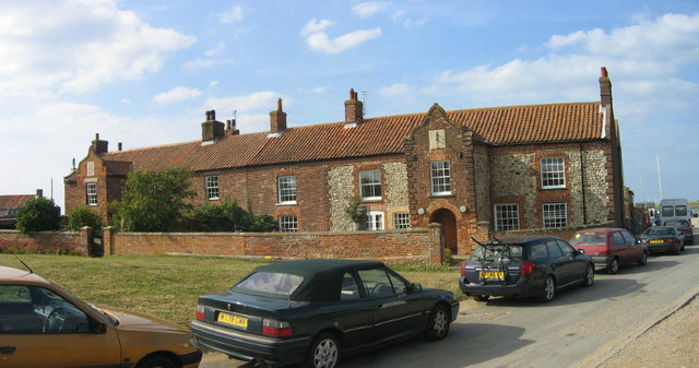
Brancaster

Brancaster is a village and civil parish on the north coast of the English county of Norfolk. The civil parish of Brancaster comprises Brancaster itself...

Brancaster Staithe

Brancaster Staithe is a village on the north coast of the English county of Norfolk. Brancaster Staithe merges with Burnham Deepdale, forming one village...

Nearby Amenities

Located within 500m of 52.97251,0.65423733
Source: PGS
Lat/Long: 52.976768/0.6546942
Golf: pin
Lat/Long: 52.9743745/0.6542449
Golf: pin
Lat/Long: 52.9747668/0.649187
Golf: pin
Lat/Long: 52.9757239/0.6537141
Golf: pin
Lat/Long: 52.9744176/0.6587284
Golf: pin
Lat/Long: 52.9738985/0.6608288
Golf: pin
Lat/Long: 52.975972/0.6537888
Golf: pin
Lat/Long: 52.9756184/0.6510993
Golf: pin
Lat/Long: 52.9741602/0.6558318
The data included in this document is from www.openstreetmap.org. The data is made available under ODbL.

Have you been to Brancaster Marsh?

Leave your review of Brancaster Marsh below (or comments, questions and feedback).