Lower Redbrook

Settlement in Monmouthshire

Wales

Lower Redbrook

Woodland footpath This footpath in woodland on Highbury Plains is followed by Offa's Dyke Path.
Woodland footpath Credit: Philip Halling

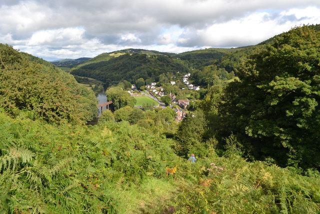
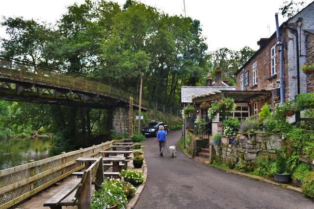
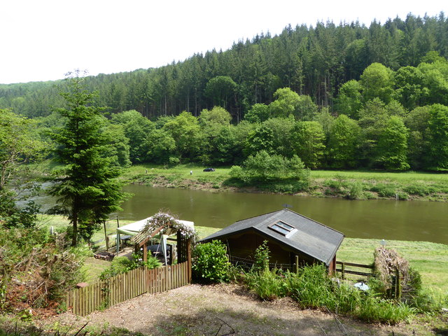
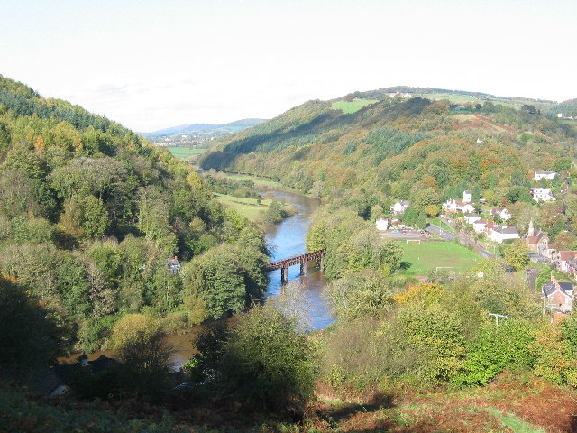
Lower Redbrook is a quaint village located in Monmouthshire, Wales. Situated along the banks of the River Wye, it offers stunning views of the surrounding countryside. With a population of around 300, the village exudes a peaceful and close-knit atmosphere.

The history of Lower Redbrook can be traced back to the 18th century when it was a thriving industrial community centered around the iron and tinplate industries. Today, remnants of its industrial past can still be seen in the form of old factories and warehouses.

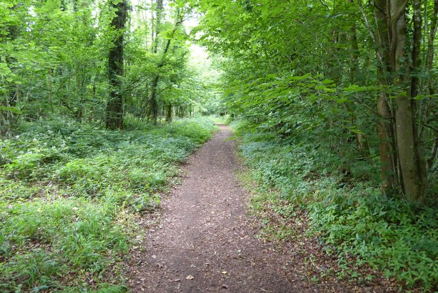
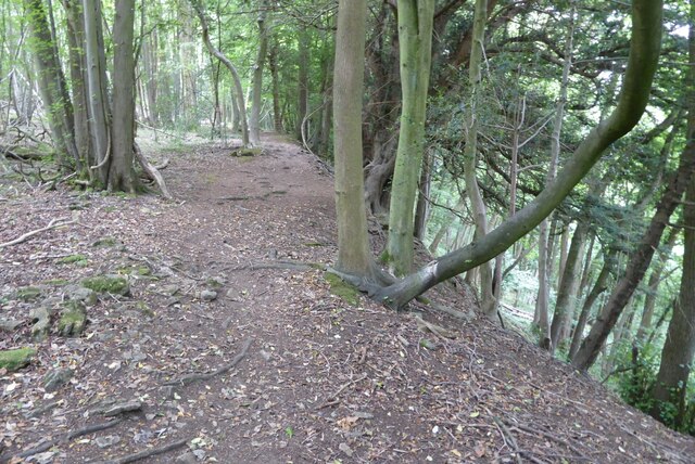
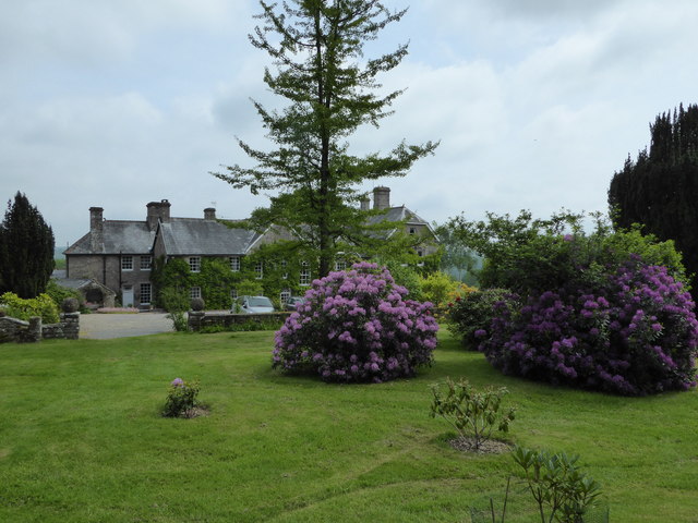
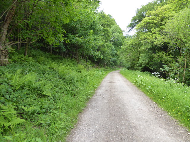
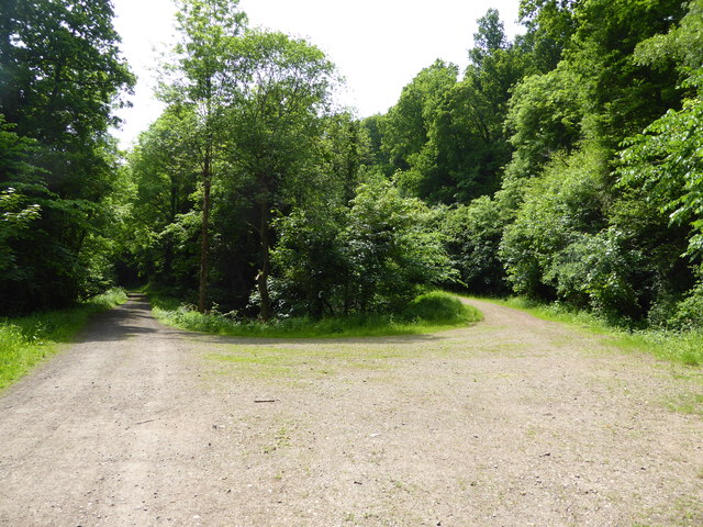
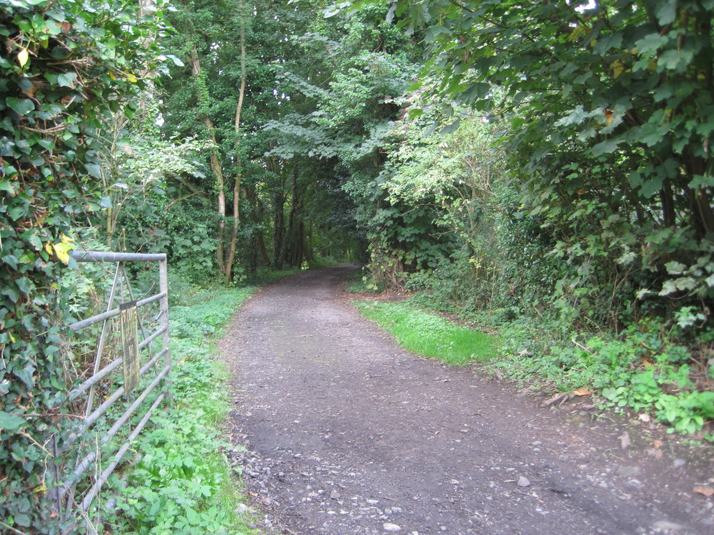
The village is home to a number of charming stone cottages, some of which date back to the 19th century. These traditional buildings add to the village's charm and character. The Wye Valley Walk, a popular hiking trail that follows the course of the River Wye, passes through Lower Redbrook, attracting outdoor enthusiasts and nature lovers.

Lower Redbrook offers a range of amenities to its residents and visitors. The village has a local pub that serves delicious food and drinks, providing a cozy spot to unwind and socialize. Additionally, there is a community hall that hosts various events and gatherings throughout the year.

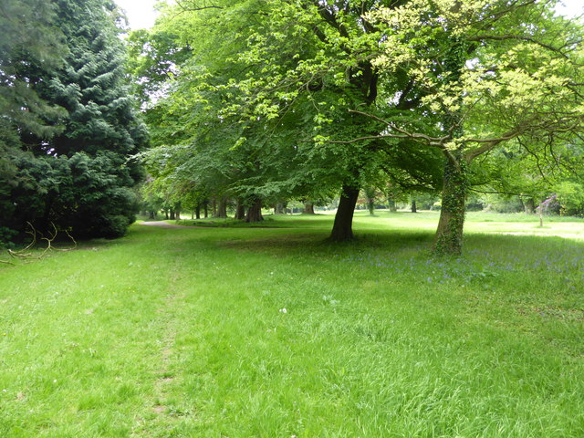
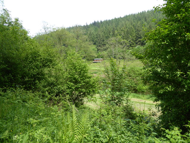
The surrounding natural beauty of Lower Redbrook makes it an ideal destination for outdoor activities. Boating, fishing, and hiking are popular pastimes in the area. The nearby Wye Valley also offers opportunities for wildlife spotting and birdwatching.

Overall, Lower Redbrook is a picturesque village that combines a rich industrial heritage with stunning natural landscapes, making it an appealing destination for both locals and tourists alike.

If you have any feedback on the listing, please let us know in the comments section below.

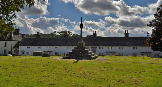
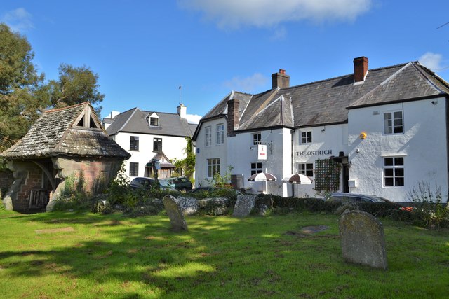
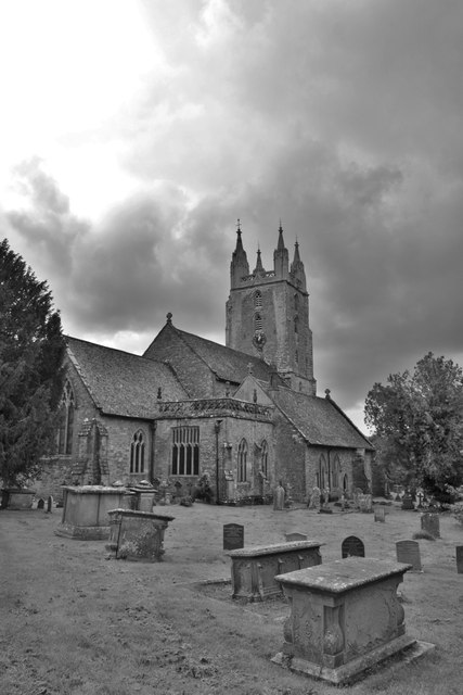
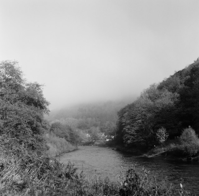
Lower Redbrook Images

Images are sourced within 2km of 51.784043/-2.6710693 or Grid Reference SO5309. Thanks to Geograph Open Source API. All images are credited.

Woodland footpath This footpath in woodland on Highbury Plains is followed by Offa's Dyke Path.
Woodland footpath
This footpath in woodland on Highbury Plains is followed by Offa's Dyke Path.
Footpath in Highbury Wood Footpath through Highbury Wood above Redbrook.  Offa's Dyke Path follows this footpath.
Footpath in Highbury Wood
Footpath through Highbury Wood above Redbrook. Offa's Dyke Path follows this footpath.
View From Highbury Woods To Lower Redbrook
View From Highbury Woods
To Lower Redbrook
Bridge Over The River Wye Connecting Lower Redbrook to the lovely Boat Inn!
Bridge Over The River Wye
Connecting Lower Redbrook to the lovely Boat Inn!
Boat Inn Near Redbrook A lovely looking place. Sadly we were there before opening time
Boat Inn Near Redbrook
A lovely looking place. Sadly we were there before opening time
A Line Of Land Rovers In Redbrook A fine display of all ages
A Line Of Land Rovers In Redbrook
A fine display of all ages
Newland Almshouses With the magnificent cross in the foreground
Newland Almshouses
With the magnificent cross in the foreground
The Ostrich, Newland An ancient inn from the 17th century. Many of the occupants of the centuries old graves opposite could well have drunk there!
The Ostrich, Newland
An ancient inn from the 17th century. Many of the occupants of the centuries old graves opposite could well have drunk there!
Newland Parish Church The 'cathedral of the forest'
Newland Parish Church
The 'cathedral of the forest'
Redbrook, Wye Valley A view of Redbrook on a misty morning, taken with a medium format Mamiya twin lens camera.
Redbrook, Wye Valley
A view of Redbrook on a misty morning, taken with a medium format Mamiya twin lens camera.
On a footpath through the grounds of The Argoed near Penallt Lovely parkland here.
On a footpath through the grounds of The Argoed near Penallt
Lovely parkland here.
Rear of the Argoed at Penallt A lovely Victorian country house above the Wye Valley, once owned by Robert Plant, lead singer of Led Zeppelin, who recorded some albums at nearby Rockfield Studios in the 1980's. 

It has since been owned by a branch of my family (a great grandfather in common) who prospered in a chain of sports shops and other business interests I believe.

This house has its own Wikipedia article, impressive.<span class="nowrap"><a title="https://en.wikipedia.org/wiki/The_Argoed,_Penallt" rel="nofollow ugc noopener" href="https://en.wikipedia.org/wiki/The_Argoed,_Penallt">Link</a><img style="margin-left:2px;" alt="External link" title="External link - shift click to open in new window" src="https://s1.geograph.org.uk/img/external.png" width="10" height="10"/></span>
Rear of the Argoed at Penallt
A lovely Victorian country house above the Wye Valley, once owned by Robert Plant, lead singer of Led Zeppelin, who recorded some albums at nearby Rockfield Studios in the 1980's. It has since been owned by a branch of my family (a great grandfather in common) who prospered in a chain of sports shops and other business interests I believe. This house has its own Wikipedia article, impressive.LinkExternal link
View across the River Wye near Whitebrook To a fishing bothy on the English bank.
View across the River Wye near Whitebrook
To a fishing bothy on the English bank.
Fishing bothy on the River Wye Nice bothy.
Fishing bothy on the River Wye
Nice bothy.
On the Wye Valley Walk between Whitebrook and Redbrook On the old railway line trackbed.
On the Wye Valley Walk between Whitebrook and Redbrook
On the old railway line trackbed.
Fishing bothy on the River Wye Lovely location on a slow bend of the river.
Fishing bothy on the River Wye
Lovely location on a slow bend of the river.
Junction of tracks I wonder where the other one goes to or comes from.
Junction of tracks
I wonder where the other one goes to or comes from.
Carving beside the Wye Valley Walk A really good carving of two salmon I believe.
Carving beside the Wye Valley Walk
A really good carving of two salmon I believe.
Show me another place!

Lower Redbrook is located at Grid Ref: SO5309 (Lat: 51.784043, Lng: -2.6710693)

Unitary Authority: Monmouthshire

Police Authority: Gwent

What 3 Words

///swung.guideline.houseboat. Near Coleford, Gloucestershire

Related Wikis

Penallt Halt railway station

Penallt Halt was a request stop on the former Wye Valley Railway. It was opened on 1 August 1931 and closed in 1959. Penallt Halt and Redbrook Station...

Penallt Viaduct

Penallt Viaduct is a viaduct that formerly carried the Wye Valley Railway over the River Wye, which at this location forms the border between England...

Redbrook on Wye railway station

Redbrook on Wye railway station was a station serving the village of Redbrook on the now disused Wye Valley Railway. It was opened on 1 November 1876 with...

Redbrook

Redbrook is a village in Gloucestershire, England, adjoining the border with Monmouthshire, Wales. It is located on the River Wye and is within the Wye...

Redbrook Incline Bridge

The Redbrook Incline Bridge is a nineteenth-century tramway bridge that crosses the B4231 road at Redbrook on the England–Wales border. The bridge straddles...

Newland Oak

The Newland Oak was a veteran oak tree in Newland, Gloucestershire in England. Originally part of the ancient woodland of the Forest of Dean, it survived...

Graig Wood

Graig Wood is a Site of Special Scientific Interest (SSSI), noted for its biological characteristics, in Monmouthshire, south east Wales. It forms part...

Highbury Wood

Highbury Wood (grid reference SO540086) is a 50.74-hectare (125.4-acre) biological Site of Special Scientific Interest in Gloucestershire, notified in...

Nearby Amenities

Located within 500m of 51.784043,-2.6710693
Bus Stop
Newland Turn
Bench: no
Bin: no
Bus: yes
Naptan AtcoCode: 1600GL3973
Naptan Bearing: SE
Naptan CommonName: Newland Turn
Naptan NaptanCode: gloadadt
Naptan Street: Redbrook Rd A466
Naptan Verified: no
Public Transport: platform
Shelter: no
Source: naptan_import
Lat/Long: 51.7879444/-2.6746004
Bus Stop
Wye's Green
Bus: yes
Naptan AtcoCode: 1600GL3975
Naptan Bearing: S
Naptan CommonName: Wye's Green
Naptan NaptanCode: gloadagd
Naptan Street: Redbrook Rd A466
Naptan Verified: no
Public Transport: platform
Source: naptan_import
Lat/Long: 51.7840176/-2.6725992
Bus Stop
Wye's Green
Bench: yes
Bin: yes
Bus: yes
Lit: yes
Naptan AtcoCode: 1600GL3976
Naptan Bearing: N
Naptan CommonName: Wye's Green
Naptan NaptanCode: gloadaga
Naptan Street: Redbrook Rd A466
Naptan Verified: no
Network: Newport Bus
Operator: Forest of Dean District Council
Public Transport: platform
Shelter: no
Source: naptan_import
Lat/Long: 51.7839582/-2.6727846
Redbrook
Is In: Gloucestershire, England, UK
Place: village
Wikidata: Q7305513
Wikipedia: en:Redbrook
Lat/Long: 51.7839863/-2.6717131
Penallt
Historic Railway: halt
Railway: site
Wikidata: Q15265860
Wikipedia: en:Penallt Halt railway station
Lat/Long: 51.7840568/-2.6742368
Redbrook on Wye
Historic Railway: station
Railway: site
Wikidata: Q7305514
Wikipedia: en:Redbrook on Wye railway station
Lat/Long: 51.7875076/-2.674835
Crossing
Crossing: uncontrolled
Crossing Island: no
Crossing Ref: zebra
Lat/Long: 51.7843306/-2.6724465
Restaurant
Lat/Long: 51.7843233/-2.6722995
Post Office
Redbrook Village Stores
Addr City: Redbrook
Addr Postcode: NP25 4LY
Brand: Post Office
Brand Wikidata: Q1783168
Fhrs Id: 785299
Opening Hours: Mo-Fr 07:30-19:30; Sa 08:00-19:00; Su 09:00-16:00; PH 09:00-16:00
Shop: yes
Source Name: survey
Lat/Long: 51.7849245/-2.6720627
Telephone
Booth: KX100
Covered: booth
Mapillary: 2802526613395208
Source: Bing + survey
Survey Date: 2020-07-11
Lat/Long: 51.78501/-2.6722117
Pub
The Bell Inn
Addr City: Monmouth
Addr Postcode: NP25 4LZ
Addr Suburb: Redbrook
Fhrs Id: 740413
Live Music: yes
Opening Hours: Mo-Su 12:00-15:00,19:00-23:00
Outdoor Seating: yes
Phone: +441600 713612
Toilets: yes
Website: https://www.thebellinnredbrook.co.uk
Wikidata: Q56174138
Lat/Long: 51.7837969/-2.6724539
Post Box
Collection Times: Mo-Fr 16:30; Sa 08:45
Note: Reference obscured (Aug-22)
Operator: Royal Mail
Operator Wikidata: Q638098
Post Box Type: wall
Royal Cypher: EIIR
Royal Cypher Wikidata: Q33102113
Lat/Long: 51.7849468/-2.6721698
Defibrillator
Defibrillator Location: at corner of car park
Emergency: defibrillator
Indoor: no
Lat/Long: 51.7854523/-2.6725997
Historic: memorial
Memorial: war_memorial
Lat/Long: 51.7859331/-2.6725997
Access: yes
Leisure: slipway
Lat/Long: 51.784942/-2.6731513
Leisure: slipway
Lat/Long: 51.7849445/-2.673936
Barrier: yes
Lat/Long: 51.7864434/-2.673436
Give Way
Direction: backward
Lat/Long: 51.7823541/-2.6738016
Direction: SSE
Generator Method: photovoltaic
Generator Output Electricity: yes
Generator Solar Modules: 18
Generator Source: solar
Generator Type: solar_photovoltaic_panel
Location: roof
Power: generator
Lat/Long: 51.7876877/-2.6729581
Post Box
Collection Times: Mo-Fr 09:00; Sa 07:00
Operator: Royal Mail
Operator Wikidata: Q638098
Post Box Type: wall
Ref: NP25 501D
Royal Cypher: GR
Royal Cypher Wikidata: Q33102273
Lat/Long: 51.7849666/-2.6741517
Pub
Boat Inn
Addr City: Monmouth
Addr Postcode: NP25 4AJ
Addr Street: Lone Lane
Alt Name: Boat Inn Penallt
Email: info@theboatinnpenallt.co.uk
Opening Hours: Mo-Sa 12:00-23:00; Su 12:00-20:00
Outdoor Seating: yes
Toilets: yes
Website: https://www.theboatinnpenallt.co.uk
Lat/Long: 51.7849797/-2.6742467
Addr Housename: Wye View
Lat/Long: 51.7836951/-2.6753157
Addr Housename: Hazelmere
Lat/Long: 51.7823994/-2.6766605
Addr City: Monmouth
Addr Housename: Bridge Cottage
Addr Street: Lone Lane
Addr Suburb: Penallt
Lat/Long: 51.7848289/-2.6741715
Addr Housename: Riverdene
Lat/Long: 51.7827586/-2.6760022
Addr Housename: Steps Cottage
Lat/Long: 51.7846393/-2.6742567
Recycling
Covered: no
Indoor: no
Level: 0
Opening Hours: 24/7
Operator: Forest of Dean District COuncil
Recycling Plastic: yes
Recycling Type: container
Lat/Long: 51.7852107/-2.6732585
Drinking Water
Access: yes
Bottle: yes
Covered: no
Fee: no
Indoor: no
Lit: yes
Operator: Redbrook Village Stores
Lat/Long: 51.7848909/-2.6720997
Waste Basket
Covered: no
Indoor: no
Level: 0
Opening Hours: 24/7
Operator: Forest of Dean District COuncil
Lat/Long: 51.7851976/-2.6732396
Advertising: board
Lat/Long: 51.7849898/-2.6722111
The data included in this document is from www.openstreetmap.org. The data is made available under ODbL.

Have you been to Lower Redbrook?

Leave your review of Lower Redbrook below (or comments, questions and feedback).