Young's Grove

Wood, Forest in Monmouthshire

Wales

Young's Grove

Woodland footpath This footpath in woodland on Highbury Plains is followed by Offa's Dyke Path.
Woodland footpath Credit: Philip Halling

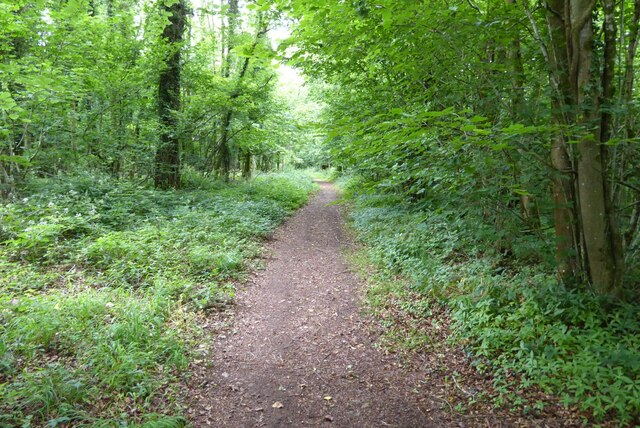
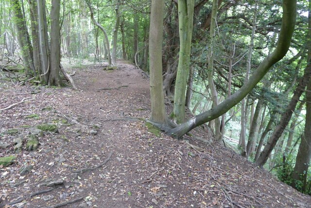
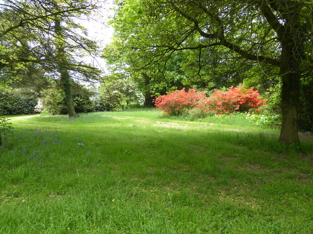
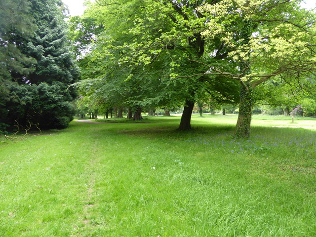
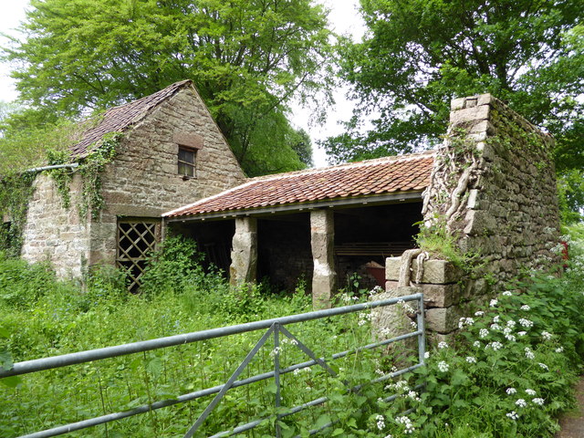
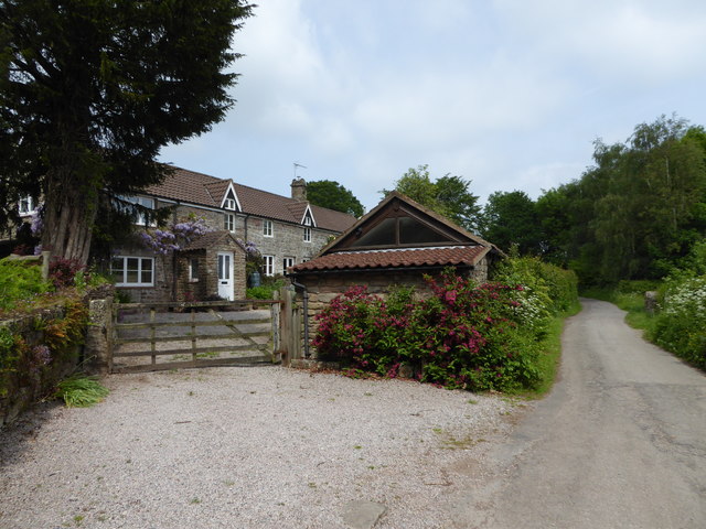
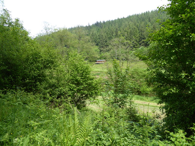
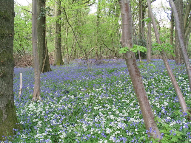
Young's Grove is a picturesque woodland located in Monmouthshire, Wales. Spanning over a vast area, the grove is known for its dense collection of trees, creating a serene and peaceful atmosphere. The woodland is predominantly composed of native species such as oak, beech, and birch, contributing to its natural beauty.

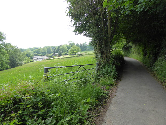
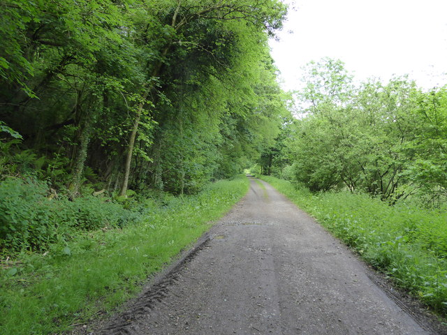
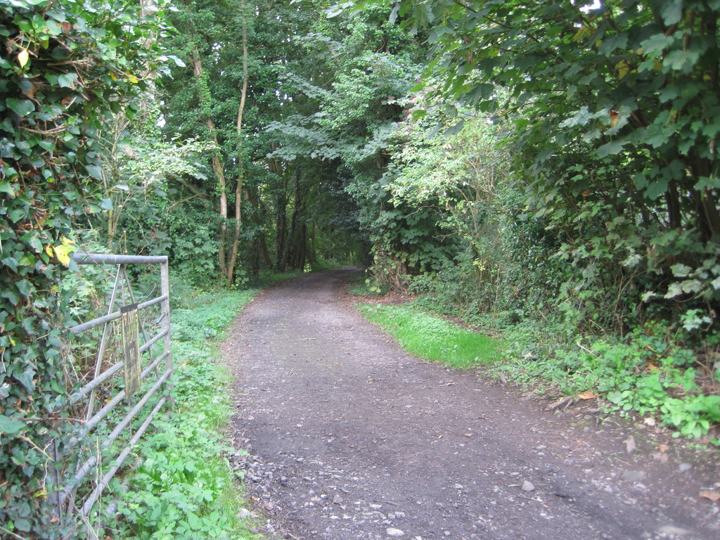
The grove offers various walking trails, allowing visitors to explore its enchanting surroundings. Well-maintained footpaths guide visitors through the forest, revealing stunning views of the surrounding landscape. Along the trails, one can encounter a diverse range of wildlife, including deer, foxes, and various bird species. Nature enthusiasts are often drawn to the grove for birdwatching opportunities.

Young's Grove is also home to a rich history. The woodland has existed for centuries, and remnants of ancient settlements can still be found within its depths. Archaeologists have discovered evidence of human activity in the area dating back to the Neolithic period, adding an intriguing layer of historical significance to the grove.

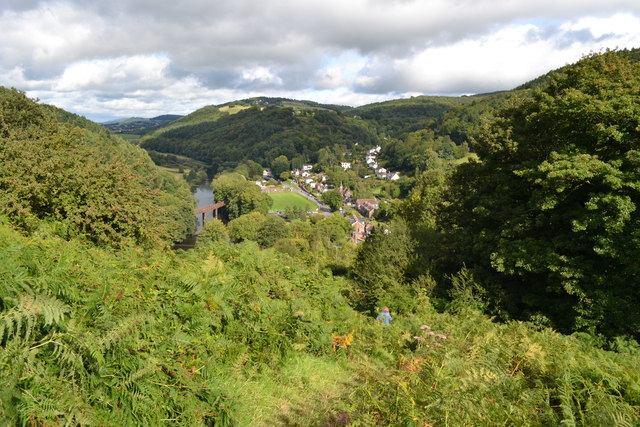
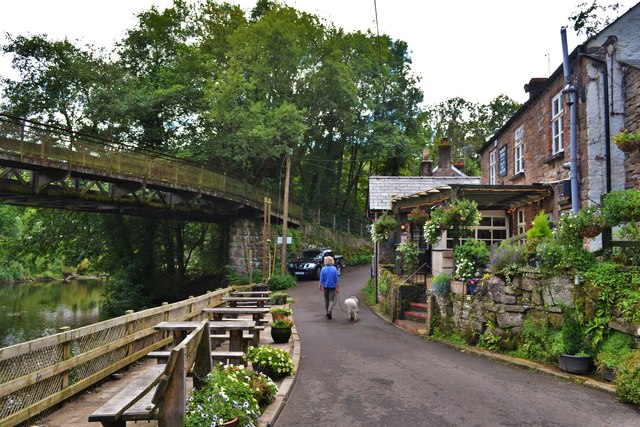
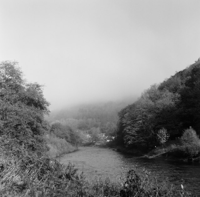
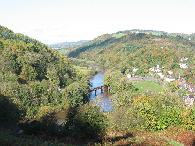
The grove is a popular destination for both locals and tourists seeking an escape from the hustle and bustle of everyday life. Its tranquil environment and breathtaking scenery make it an ideal spot for relaxation, hiking, and photography. The grove's proximity to other attractions, such as the Monmouthshire and Brecon Canal and the Wye Valley, further adds to its appeal.

Overall, Young's Grove in Monmouthshire is a captivating woodland that offers visitors a chance to immerse themselves in nature and explore the region's rich history.

If you have any feedback on the listing, please let us know in the comments section below.

Young's Grove Images

Images are sourced within 2km of 51.782629/-2.6777746 or Grid Reference SO5309. Thanks to Geograph Open Source API. All images are credited.

Woodland footpath This footpath in woodland on Highbury Plains is followed by Offa's Dyke Path.
Woodland footpath
This footpath in woodland on Highbury Plains is followed by Offa's Dyke Path.
Footpath in Highbury Wood Footpath through Highbury Wood above Redbrook.  Offa's Dyke Path follows this footpath.
Footpath in Highbury Wood
Footpath through Highbury Wood above Redbrook. Offa's Dyke Path follows this footpath.
View From Highbury Woods To Lower Redbrook
View From Highbury Woods
To Lower Redbrook
Bridge Over The River Wye Connecting Lower Redbrook to the lovely Boat Inn!
Bridge Over The River Wye
Connecting Lower Redbrook to the lovely Boat Inn!
Boat Inn Near Redbrook A lovely looking place. Sadly we were there before opening time
Boat Inn Near Redbrook
A lovely looking place. Sadly we were there before opening time
A Line Of Land Rovers In Redbrook A fine display of all ages
A Line Of Land Rovers In Redbrook
A fine display of all ages
Newland Almshouses With the magnificent cross in the foreground
Newland Almshouses
With the magnificent cross in the foreground
Newland Parish Church The 'cathedral of the forest'
Newland Parish Church
The 'cathedral of the forest'
Redbrook, Wye Valley A view of Redbrook on a misty morning, taken with a medium format Mamiya twin lens camera.
Redbrook, Wye Valley
A view of Redbrook on a misty morning, taken with a medium format Mamiya twin lens camera.
In the grounds of The Argoed at Penallt Scarlet Rhododendrons here.
In the grounds of The Argoed at Penallt
Scarlet Rhododendrons here.
On a footpath through the grounds of The Argoed near Penallt Lovely parkland here.
On a footpath through the grounds of The Argoed near Penallt
Lovely parkland here.
Footpath at The Argoed near Penallt Crossing a drive.
Footpath at The Argoed near Penallt
Crossing a drive.
Rear of the Argoed at Penallt A lovely Victorian country house above the Wye Valley, once owned by Robert Plant, lead singer of Led Zeppelin, who recorded some albums at nearby Rockfield Studios in the 1980's. 

It has since been owned by a branch of my family (a great grandfather in common) who prospered in a chain of sports shops and other business interests I believe.

This house has its own Wikipedia article, impressive.<span class="nowrap"><a title="https://en.wikipedia.org/wiki/The_Argoed,_Penallt" rel="nofollow ugc noopener" href="https://en.wikipedia.org/wiki/The_Argoed,_Penallt">Link</a><img style="margin-left:2px;" alt="External link" title="External link - shift click to open in new window" src="https://s1.geograph.org.uk/img/external.png" width="10" height="10"/></span>
Rear of the Argoed at Penallt
A lovely Victorian country house above the Wye Valley, once owned by Robert Plant, lead singer of Led Zeppelin, who recorded some albums at nearby Rockfield Studios in the 1980's. It has since been owned by a branch of my family (a great grandfather in common) who prospered in a chain of sports shops and other business interests I believe. This house has its own Wikipedia article, impressive.LinkExternal link
Disused farm buildings near Tregagle Nice old buildings.
Disused farm buildings near Tregagle
Nice old buildings.
The Reynolds A terrace at Tregagle.
The Reynolds
A terrace at Tregagle.
Monmouthshire lane near Tre-gagle One of my fave areas in this blessed county.
Monmouthshire lane near Tre-gagle
One of my fave areas in this blessed county.
On the Wye Valley Walk between Whitebrook and Redbrook On the Welsh bank heading north on the old railway line.
On the Wye Valley Walk between Whitebrook and Redbrook
On the Welsh bank heading north on the old railway line.
View across the River Wye near Whitebrook To a fishing bothy on the English bank.
View across the River Wye near Whitebrook
To a fishing bothy on the English bank.
Show me another place!

Young's Grove is located at Grid Ref: SO5309 (Lat: 51.782629, Lng: -2.6777746)

Unitary Authority: Monmouthshire

Police Authority: Gwent

What 3 Words

///tested.freshen.vibrating. Near Mitchel Troy, Monmouthshire

Related Wikis

Penallt Halt railway station

Penallt Halt was a request stop on the former Wye Valley Railway. It was opened on 1 August 1931 and closed in 1959. Penallt Halt and Redbrook Station...

Penallt Viaduct

Penallt Viaduct is a viaduct that formerly carried the Wye Valley Railway over the River Wye, which at this location forms the border between England...

Redbrook on Wye railway station

Redbrook on Wye railway station was a station serving the village of Redbrook on the now disused Wye Valley Railway. It was opened on 1 November 1876 with...

Redbrook

Redbrook is a village in Gloucestershire, England, adjoining the border with Monmouthshire, Wales. It is located on the River Wye and is within the Wye...

Redbrook Incline Bridge

The Redbrook Incline Bridge is a nineteenth-century tramway bridge that crosses the B4231 road at Redbrook on the England–Wales border. The bridge straddles...

Graig Wood

Graig Wood is a Site of Special Scientific Interest (SSSI), noted for its biological characteristics, in Monmouthshire, south east Wales. It forms part...

Pentwyn Farm Grasslands

Pentwyn Farm Grasslands is a nature reserve, and a series of agricultural fields, in Monmouthshire, southeast Wales. It was designated a Site of Special...

Highbury Wood

Highbury Wood (grid reference SO540086) is a 50.74-hectare (125.4-acre) biological Site of Special Scientific Interest in Gloucestershire, notified in...

Nearby Amenities

Located within 500m of 51.782629,-2.6777746
Bus Stop
Wye's Green
Bus: yes
Naptan AtcoCode: 1600GL3975
Naptan Bearing: S
Naptan CommonName: Wye's Green
Naptan NaptanCode: gloadagd
Naptan Street: Redbrook Rd A466
Naptan Verified: no
Public Transport: platform
Source: naptan_import
Lat/Long: 51.7840176/-2.6725992
Bus Stop
Wye's Green
Bench: yes
Bus: yes
Naptan AtcoCode: 1600GL3976
Naptan Bearing: N
Naptan CommonName: Wye's Green
Naptan NaptanCode: gloadaga
Naptan Street: Redbrook Rd A466
Naptan Verified: no
Public Transport: platform
Shelter: no
Source: naptan_import
Lat/Long: 51.7839582/-2.6727846
Redbrook
Is In: Gloucestershire, England, UK
Place: village
Wikidata: Q7305513
Wikipedia: en:Redbrook
Lat/Long: 51.7839863/-2.6717131
Penallt
Historic Railway: halt
Railway: site
Wikidata: Q15265860
Wikipedia: en:Penallt Halt railway station
Lat/Long: 51.7840568/-2.6742368
Crossing
Crossing: uncontrolled
Crossing Island: no
Crossing Ref: zebra
Lat/Long: 51.7843306/-2.6724465
Restaurant
Lat/Long: 51.7843233/-2.6722995
Post Office
Redbrook Village Stores
Addr Postcode: NP25 4LY
Fhrs Id: 785299
Shop: convenience
Source Name: survey
Lat/Long: 51.7849884/-2.6721224
Telephone
Booth: KX100
Covered: booth
Mapillary: 2802526613395208
Source: Bing + survey
Survey Date: 2020-07-11
Lat/Long: 51.78501/-2.6722117
Pub
The Bell Inn
Addr Postcode: NP25 4LZ
Fhrs Id: 740413
Wikidata: Q56174138
Lat/Long: 51.7837969/-2.6724539
Post Box
Collection Times: Mo-Fr 16:30; Sa 08:45
Note: Reference obscured (Aug-22)
Operator: Royal Mail
Operator Wikidata: Q638098
Post Box Type: wall
Royal Cypher: EIIR
Royal Cypher Wikidata: Q33102113
Lat/Long: 51.7849468/-2.6721698
Defibrillator
Defibrillator Location: at corner of car park
Emergency: defibrillator
Indoor: no
Lat/Long: 51.7854523/-2.6725997
Access: yes
Leisure: slipway
Lat/Long: 51.784942/-2.6731513
Leisure: slipway
Lat/Long: 51.7849445/-2.673936
Give Way
Direction: backward
Lat/Long: 51.7823541/-2.6738016
Post Box
Collection Times: Mo-Fr 09:00; Sa 07:00
Operator: Royal Mail
Operator Wikidata: Q638098
Post Box Type: wall
Ref: NP25 501D
Royal Cypher: GR
Royal Cypher Wikidata: Q33102273
Lat/Long: 51.7849666/-2.6741517
The data included in this document is from www.openstreetmap.org. The data is made available under ODbL.

Have you been to Young's Grove?

Leave your review of Young's Grove below (or comments, questions and feedback).