Turnford Marsh

Lake, Pool, Pond, Freshwater Marsh in Hertfordshire Broxbourne

England

Turnford Marsh

Shops on High Street, Cheshunt
Shops on High Street, Cheshunt Credit: David Howard

Turnford Marsh is a freshwater marsh located in Hertfordshire, England. It is situated near the village of Turnford, between the towns of Cheshunt and Waltham Cross. The marsh covers an area of approximately 30 hectares and is a designated Site of Special Scientific Interest (SSSI) due to its diverse and important wildlife.

The marsh consists of a combination of lakes, pools, and ponds, which are interconnected by a network of channels and waterways. These water bodies are fed by natural springs, as well as by water flowing from the nearby River Lea. The water in Turnford Marsh is predominantly freshwater, providing a suitable habitat for various aquatic plants and animals.

The marsh is characterized by its rich and diverse plant life, including reeds, rushes, and water lilies. These plants create a lush and vibrant environment, providing shelter and food for a variety of bird species, such as herons, swans, and ducks. The marsh is also home to a range of other wildlife, including frogs, toads, and various species of fish.

In addition to its ecological significance, Turnford Marsh is a popular recreational spot for local residents and visitors alike. It offers opportunities for birdwatching, fishing, and nature walks. The marsh is accessible via designated footpaths and is well-maintained, ensuring visitors can enjoy its natural beauty while preserving its delicate ecosystem.

If you have any feedback on the listing, please let us know in the comments section below.

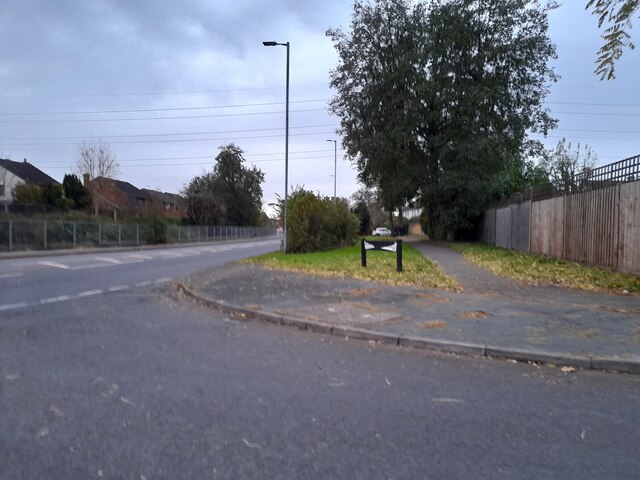
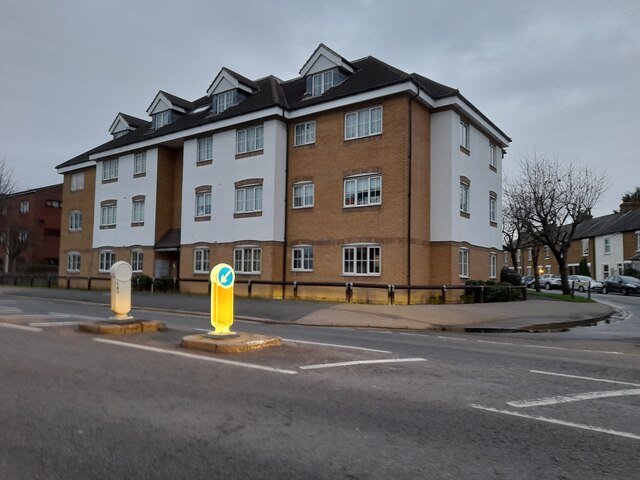
Turnford Marsh Images

Images are sourced within 2km of 51.722272/-0.01814785 or Grid Reference TL3604. Thanks to Geograph Open Source API. All images are credited.

Shops on High Street, Cheshunt
Mill Lane at the junction of High Street, Cheshunt
Brookfield Lane West, Turnford The road is split in two by the A10
Brookfield Lane West, Turnford
The road is split in two by the A10
Field by Brookfield Lane West, Turnford
Brookfield Lane West, Turnford
Houses on Brookfield Lane West, Turnford
Southbrook Drive, Turnford
Brookfield Lane West, Turnford
Houses on Perrysfield Road, Turnford The birch tree has suffered a recent accident, it was perfect a few years earlier.
Houses on Perrysfield Road, Turnford
The birch tree has suffered a recent accident, it was perfect a few years earlier.
Perrysfield Road, Turnford
Cheshunt Wash at the corner of Perrysfield Road
High Road, Turnford
High Road, Turnford
Great Cambridge Road, Turnford I didn't realise the Great Cambridge Road split in Cheshunt, as this is the name of it from Tottenham onwards, but no longer follows the newer section of the A10 but remained with the original part.
Great Cambridge Road, Turnford
I didn't realise the Great Cambridge Road split in Cheshunt, as this is the name of it from Tottenham onwards, but no longer follows the newer section of the A10 but remained with the original part.
Flats on High Street, Cheshunt
Bridge 37a Lee Navigation The present wooden footbridge is south of the site of the former brick bridge - the abutments of which can be seen here.
Bridge 37a Lee Navigation
The present wooden footbridge is south of the site of the former brick bridge - the abutments of which can be seen here.
Bridge 46 Lee Navigation The bridge carries a footpath running between Cadmore Lane, Cheshunt and Fishers Green.
Bridge 46 Lee Navigation
The bridge carries a footpath running between Cadmore Lane, Cheshunt and Fishers Green.
Approaching Aqueduct Lock Taken from the south of the lock - which is also enumerated Lock 8 on the Lee Navigation.
Approaching Aqueduct Lock
Taken from the south of the lock - which is also enumerated Lock 8 on the Lee Navigation.
Railway Pit One of the pits - now ponds - on Turnford Marsh to the west of the Lee Navigation and the River Lea. The name Railway Pit perhaps gives a clue as to the use of the sand and gravel extracted from this former quarry pit.
Railway Pit
One of the pits - now ponds - on Turnford Marsh to the west of the Lee Navigation and the River Lea. The name Railway Pit perhaps gives a clue as to the use of the sand and gravel extracted from this former quarry pit.
Show me another place!

Turnford Marsh is located at Grid Ref: TL3604 (Lat: 51.722272, Lng: -0.01814785)

Administrative County: Hertfordshire

District: Broxbourne

Police Authority: Hertfordshire

What 3 Words

///fork.then.later. Near Cheshunt, Hertfordshire

Nearby Locations

Turnford Marsh Turnford

Related Wikis

Aqueduct Lock

Aqueduct Lock (Number 8) is a lock on the River Lee Navigation close to Turnford. == Location == The lock is located in the River Lee Country Park and...

Wormley, Hertfordshire

Wormley is a village and former civil parish, lying between Hoddesdon and Cheshunt in the Broxbourne district, in the county of Hertfordshire, England...

Turnford, Hertfordshire

Turnford is a village in the Borough of Broxbourne, in Hertfordshire, England, in an area generally known as the Lee Valley. It is bounded by Wormley to...

Kings Weir

Kings Weir is a weir on the River Lea near Turnford and Nazeing in Hertfordshire, England. == Ecology == It is a well known fishery where barbel can be...

Haileybury Turnford

Haileybury Turnford (formerly Turnford School) is a coeducational secondary school and sixth form located in Turnford, Hertfordshire, England. Previously...

Cheshunt Lock

Cheshunt Lock (No 9) is a lock on the River Lee Navigation at Cheshunt, Hertfordshire. == Geography == The lock is located in the River Lee Country Park...

Turnford and Cheshunt Pits

The Turnford and Cheshunt Pits is a biological Site of Special Scientific Interest near Cheshunt in Hertfordshire and Essex and covers a total of 428.17...

Wormleybury Brook

Wormleybury Brook is a tributary of the River Lea which rises in the hills south of White Stubbs Lane in Hertfordshire, England.

Nearby Amenities

Located within 500m of 51.722272,-0.01814785
Created By: YahooApplet 1.0
Lat/Long: 51.7243608/-0.0206072
Waterway: lock_gate
Lat/Long: 51.7220541/-0.0142791
Cyclestreets Id: 22276
Traffic Calming: bump
Lat/Long: 51.7228348/-0.0142876
Created By: YahooApplet 1.0
Lat/Long: 51.7220279/-0.0253964
Created By: YahooApplet 1.0
Lat/Long: 51.7216091/-0.0251758
Created By: YahooApplet 1.1
Lat/Long: 51.7232491/-0.0251966
Created By: YahooApplet 1.1
Lat/Long: 51.7231927/-0.0247038
Created By: YahooApplet 1.1
Lat/Long: 51.723149/-0.024437
Created By: YahooApplet 1.1
Lat/Long: 51.7232123/-0.0239407
Created By: YahooApplet 1.1
Lat/Long: 51.7233388/-0.0234101
Created By: YahooApplet 1.1
Lat/Long: 51.7221093/-0.0248254
Created By: YahooApplet 1.1
Lat/Long: 51.7221157/-0.0245579
Created By: YahooApplet 1.1
Lat/Long: 51.7220825/-0.0244294
Mini Roundabout
Created By: YahooApplet 1.1
Direction: clockwise
Lat/Long: 51.72184/-0.023818
Created By: YahooApplet 1.1
Lat/Long: 51.7217139/-0.0235229
Created By: YahooApplet 1.1
Lat/Long: 51.7216338/-0.0232165
Created By: YahooApplet 1.1
Lat/Long: 51.7215574/-0.0227663
Created By: YahooApplet 1.1
Lat/Long: 51.7215641/-0.0226222
Created By: YahooApplet 1.1
Lat/Long: 51.7215909/-0.0223645
Created By: YahooApplet 1.1
Lat/Long: 51.7215644/-0.0220741
Created By: YahooApplet 1.1
Lat/Long: 51.7223717/-0.023099
Created By: YahooApplet 1.1
Lat/Long: 51.7225144/-0.0229971
Created By: YahooApplet 1.1
Lat/Long: 51.7226737/-0.0229381
Created By: YahooApplet 1.1
Lat/Long: 51.7228773/-0.0229219
Created By: YahooApplet 1.1
Lat/Long: 51.7230958/-0.0228413
Created By: YahooApplet 1.1
Lat/Long: 51.7232262/-0.0226588
Created By: YahooApplet 1.1
Lat/Long: 51.7232224/-0.0231743
Created By: YahooApplet 1.1
Lat/Long: 51.7234882/-0.0234423
Created By: YahooApplet 1.1
Lat/Long: 51.723681/-0.0233996
Created By: YahooApplet 1.1
Lat/Long: 51.7234918/-0.0223636
Created By: YahooApplet 1.1
Lat/Long: 51.7235673/-0.0223107
Created By: YahooApplet 1.1
Lat/Long: 51.7237937/-0.0222352
Created By: YahooApplet 1.1
Lat/Long: 51.7217132/-0.0219465
Created By: YahooApplet 1.1
Lat/Long: 51.7219729/-0.0215917
Created By: YahooApplet 1.1
Lat/Long: 51.7220623/-0.0214688
Created By: YahooApplet 1.1
Lat/Long: 51.7222352/-0.0212858
Created By: YahooApplet 1.1
Lat/Long: 51.7224879/-0.0211678
Created By: YahooApplet 1.1
Lat/Long: 51.7227766/-0.0211087
Created By: YahooApplet 1.1
Lat/Long: 51.7229733/-0.0212
Created By: YahooApplet 1.1
Lat/Long: 51.7232889/-0.0215006
Created By: YahooApplet 1.1
Lat/Long: 51.7234322/-0.0215271
Created By: YahooApplet 1.1
Lat/Long: 51.7237193/-0.0214463
Created By: YahooApplet 1.1
Lat/Long: 51.7223715/-0.0221978
Created By: YahooApplet 1.1
Lat/Long: 51.7227606/-0.0220366
Created By: YahooApplet 1.1
Lat/Long: 51.721999/-0.0223533
Created By: YahooApplet 1.1
Lat/Long: 51.7218402/-0.0213879
Created By: YahooApplet 1.1
Lat/Long: 51.7217403/-0.0213397
Created By: YahooApplet 1.1
Lat/Long: 51.7215675/-0.021404
Created By: YahooApplet 1.1
Lat/Long: 51.7212551/-0.0221761
Created By: YahooApplet 1.1
Lat/Long: 51.7208858/-0.0221221
Created By: YahooApplet 1.1
Lat/Long: 51.7211853/-0.0227235
Created By: YahooApplet 1.1
Lat/Long: 51.7226543/-0.0239527
Created By: YahooApplet 1.1
Lat/Long: 51.7225812/-0.0234642
Created By: YahooApplet 1.1
Lat/Long: 51.7228303/-0.0252771
Created By: YahooApplet 1.1
Lat/Long: 51.7228535/-0.0250516
Created By: YahooApplet 1.1
Lat/Long: 51.7228437/-0.024945
Created By: YahooApplet 1.1
Lat/Long: 51.7227373/-0.024333
Created By: YahooApplet 1.1
Lat/Long: 51.722588/-0.0251164
Created By: YahooApplet 1.1
Lat/Long: 51.7224948/-0.0249821
Created By: YahooApplet 1.1
Lat/Long: 51.722398/-0.0244832
Created By: YahooApplet 1.1
Lat/Long: 51.7195996/-0.0237541
Created By: YahooApplet 1.1
Lat/Long: 51.7196764/-0.023383
Created By: YahooApplet 1.1
Lat/Long: 51.7196863/-0.0229369
Created By: YahooApplet 1.1
Lat/Long: 51.7195895/-0.0224695
Created By: YahooApplet 1.1
Lat/Long: 51.7195166/-0.0222932
Created By: YahooApplet 1.1
Lat/Long: 51.719417/-0.0221224
Created By: YahooApplet 1.1
Lat/Long: 51.7192279/-0.0219242
Created By: YahooApplet 1.1
Lat/Long: 51.7189948/-0.0218117
Created By: YahooApplet 1.1
Lat/Long: 51.7186696/-0.0218223
Created By: YahooApplet 1.1
Lat/Long: 51.7191282/-0.0230507
Created By: YahooApplet 1.1
Lat/Long: 51.7192238/-0.0229764
Created By: YahooApplet 1.1
Lat/Long: 51.7193473/-0.0227829
Created By: YahooApplet 1.1
Lat/Long: 51.7193907/-0.0225194
Created By: YahooApplet 1.1
Lat/Long: 51.7186995/-0.0223372
Created By: YahooApplet 1.1
Lat/Long: 51.7187891/-0.022348
Created By: YahooApplet 1.1
Lat/Long: 51.7195836/-0.0219134
Created By: YahooApplet 1.1
Lat/Long: 51.7196597/-0.0218817
Created By: YahooApplet 1.1
Lat/Long: 51.7197483/-0.0218916
Created By: YahooApplet 1.1
Lat/Long: 51.7203312/-0.0222516
Created By: YahooApplet 1.1
Lat/Long: 51.7205769/-0.0216347
Created By: YahooApplet 1.1
Lat/Long: 51.7205171/-0.0224985
Created By: YahooApplet 1.1
Lat/Long: 51.7206237/-0.0228202
Created By: YahooApplet 1.1
Lat/Long: 51.7206268/-0.0233569
Created By: YahooApplet 1.1
Lat/Long: 51.7206604/-0.0234962
Created By: YahooApplet 1.1
Lat/Long: 51.7207965/-0.0241828
Created By: YahooApplet 1.1
Lat/Long: 51.7205246/-0.0235438
Created By: YahooApplet 1.1
Lat/Long: 51.7203381/-0.0235607
Created By: YahooApplet 1.1
Lat/Long: 51.7201616/-0.02348
Created By: YahooApplet 1.1
Lat/Long: 51.7199513/-0.0234261
Created By: YahooApplet 1.1
Lat/Long: 51.7201515/-0.0244884
Noexit: yes
Lat/Long: 51.7261654/-0.021728
Post Box
Operator: Royal Mail
Operator Wikidata: Q638098
Lat/Long: 51.7221205/-0.0253213
Power: tower
Lat/Long: 51.7225327/-0.0123835
Power: tower
Lat/Long: 51.7199911/-0.0136022
Waterway: lock_gate
Lat/Long: 51.7217737/-0.0143175
Shelter
Shelter Type: wildlife_hide
Source: GPS
Lat/Long: 51.7227157/-0.0121069
Noexit: yes
Lat/Long: 51.7259374/-0.0217294
Addr Housenumber: 1
Addr Postcode: EN10 6AN
Source: gps+mapnoter
Lat/Long: 51.7223382/-0.0253344
Addr Housenumber: 1
Source: gps+mapnoter
Lat/Long: 51.7211663/-0.0249339
Fixme: Turnford Cottages?
Source: gps+mapnoter
Lat/Long: 51.7209404/-0.024848
Bench
Source: gps+mapnoter
Lat/Long: 51.7193187/-0.0192261
Waste Basket
Source: gps+mapnoter
Waste: dog
Lat/Long: 51.7212329/-0.0191134
Bench
Source: gps+mapnoter
Lat/Long: 51.7206794/-0.0190091
Noexit: yes
Lat/Long: 51.7259316/-0.0207456
Marker: post
Utility: oil
Lat/Long: 51.7239694/-0.0215407
Marker: post
Utility: oil
Lat/Long: 51.7240459/-0.0224181
Marker: post
Utility: oil
Lat/Long: 51.7238509/-0.0208117
The data included in this document is from www.openstreetmap.org. The data is made available under ODbL.

Have you been to Turnford Marsh?

Leave your review of Turnford Marsh below (or comments, questions and feedback).