Turnford

Settlement in Hertfordshire Broxbourne

England

Turnford

Shops on High Street, Cheshunt
Shops on High Street, Cheshunt Credit: David Howard

Turnford is a village located in the county of Hertfordshire, England. Situated on the outskirts of the town of Broxbourne, it is part of the Broxbourne borough. The village lies approximately 17 miles north of central London and benefits from excellent transport links, making it an attractive residential area for commuters.

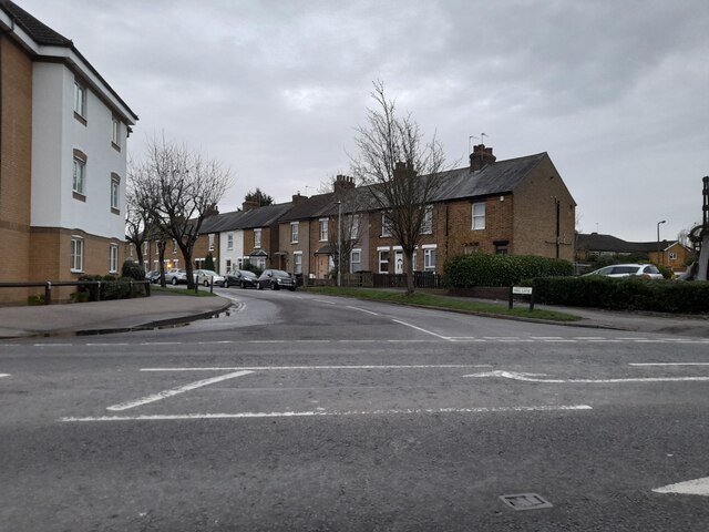
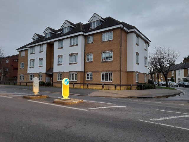
Historically, Turnford was an agricultural settlement, with farming being the main source of income for its residents. However, in recent years, the village has undergone significant development and urbanization, resulting in a mix of old and new buildings.

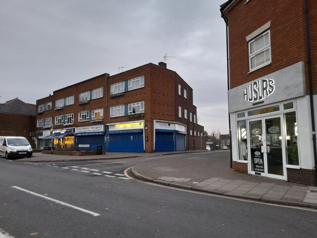
Today, Turnford is a thriving community with a range of amenities and facilities. It is home to several local shops, pubs, and restaurants, catering to the needs of its residents. The village also boasts a primary school, providing education for young children in the area.

Nature enthusiasts will appreciate the nearby River Lea, which runs through Turnford. Its scenic surroundings offer opportunities for leisurely walks and outdoor activities.

Turnford benefits from excellent transport connections. The village is served by a railway station, providing direct trains to London Liverpool Street and other major towns in the area. Additionally, the A10 road runs through the village, connecting it to neighboring towns and providing easy access to the motorway network.

Overall, Turnford is a vibrant and well-connected village, offering a pleasant living environment for its residents while maintaining its rural charm.

If you have any feedback on the listing, please let us know in the comments section below.
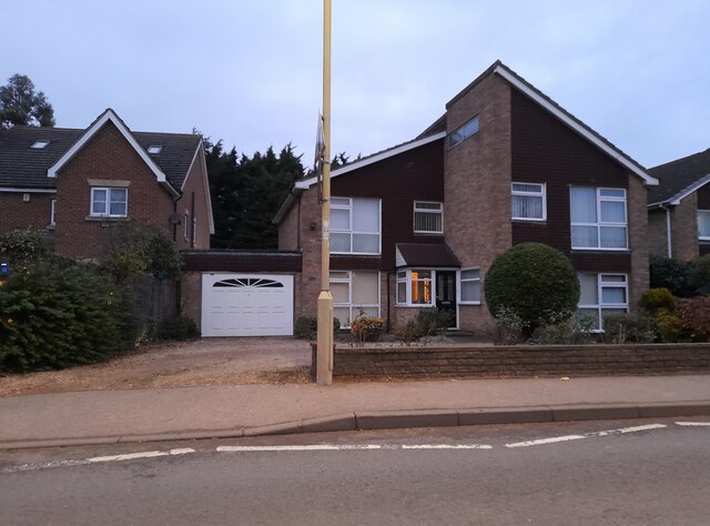
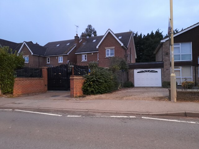
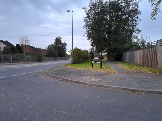
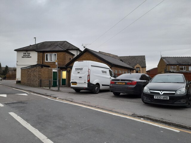
Turnford Images

Images are sourced within 2km of 51.723538/-0.029506 or Grid Reference TL3604. Thanks to Geograph Open Source API. All images are credited.

Shops on High Street, Cheshunt
Mill Lane at the junction of High Street, Cheshunt
Brookfield Lane West, Turnford The road is split in two by the A10
Brookfield Lane West, Turnford
The road is split in two by the A10
Field by Brookfield Lane West, Turnford
Brookfield Lane West, Turnford
Houses on Brookfield Lane West, Turnford
Southbrook Drive, Turnford
Brookfield Lane West, Turnford
Modern house on Brookfield Road West, Flamstead End This style was popular in the 70s, I had a flat like it once. <a title="https://www.geograph.org.uk/photo/4839443" href="https://www.geograph.org.uk/photo/4839443">Link</a>
Modern house on Brookfield Road West, Flamstead End
This style was popular in the 70s, I had a flat like it once. Link
Houses on Brookfield Road West, Flamstead End
Houses on Perrysfield Road, Turnford The birch tree has suffered a recent accident, it was perfect a few years earlier.
Houses on Perrysfield Road, Turnford
The birch tree has suffered a recent accident, it was perfect a few years earlier.
Perrysfield Road, Turnford
Cheshunt Wash at the corner of Perrysfield Road
High Road, Turnford
High Road, Turnford
Great Cambridge Road, Turnford I didn't realise the Great Cambridge Road split in Cheshunt, as this is the name of it from Tottenham onwards, but no longer follows the newer section of the A10 but remained with the original part.
Great Cambridge Road, Turnford
I didn't realise the Great Cambridge Road split in Cheshunt, as this is the name of it from Tottenham onwards, but no longer follows the newer section of the A10 but remained with the original part.
The Old English Gentleman pub, Cheshunt
Flats on High Street, Cheshunt
Bridge 37a Lee Navigation The present wooden footbridge is south of the site of the former brick bridge - the abutments of which can be seen here.
Bridge 37a Lee Navigation
The present wooden footbridge is south of the site of the former brick bridge - the abutments of which can be seen here.
Show me another place!

Turnford is located at Grid Ref: TL3604 (Lat: 51.723538, Lng: -0.029506)

Administrative County: Hertfordshire

District: Broxbourne

Police Authority: Hertfordshire

What 3 Words

///orders.dining.print. Near Cheshunt, Hertfordshire

Nearby Locations

Turnford Marsh Turnford

Related Wikis

Turnford, Hertfordshire

Turnford is a village in the Borough of Broxbourne, in Hertfordshire, England, in an area generally known as the Lee Valley. It is bounded by Wormley to...

Wormley, Hertfordshire

Wormley is a village and former civil parish, lying between Hoddesdon and Cheshunt in the Broxbourne district, in the county of Hertfordshire, England...

Wormleybury Brook

Wormleybury Brook is a tributary of the River Lea which rises in the hills south of White Stubbs Lane in Hertfordshire, England.

Aqueduct Lock

Aqueduct Lock (Number 8) is a lock on the River Lee Navigation close to Turnford. == Location == The lock is located in the River Lee Country Park and...

Wormley Rovers F.C.

Wormley Rovers Football Club is a football club based in Wormley, Hertfordshire. They are currently members of the Eastern Counties League Division One...

Kings Weir

Kings Weir is a weir on the River Lea near Turnford and Nazeing in Hertfordshire, England. == Ecology == It is a well known fishery where barbel can be...

Cheshunt Park

Cheshunt Park is a 40 hectare public park and Local Nature Reserve in Cheshunt in Hertfordshire. It is owned and managed by Broxbourne Borough Council...

Haileybury Turnford

Haileybury Turnford (formerly Turnford School) is a coeducational secondary school and sixth form located in Turnford, Hertfordshire, England. Previously...

Nearby Amenities

Located within 500m of 51.723538,-0.029506
Motorway Junction
Turnford Interchange
Lat/Long: 51.723166/-0.0334234
Created By: YahooApplet 1.0
Lat/Long: 51.7229905/-0.0319628
Created By: YahooApplet 1.0
Lat/Long: 51.7239748/-0.0309322
Created By: YahooApplet 1.0
Lat/Long: 51.7264045/-0.0289152
Created By: YahooApplet 1.0
Lat/Long: 51.7278005/-0.0280771
Created By: YahooApplet 1.0
Lat/Long: 51.7223018/-0.03376
Created By: YahooApplet 1.0
Lat/Long: 51.7218555/-0.0360682
Created By: YahooApplet 1.0
Lat/Long: 51.7226535/-0.0257998
Created By: YahooApplet 1.0
Lat/Long: 51.7224542/-0.0330119
Created By: YahooApplet 1.0
Lat/Long: 51.7252212/-0.0282856
Created By: YahooApplet 1.0
Lat/Long: 51.7261654/-0.0311609
Created By: YahooApplet 1.0
Lat/Long: 51.725713/-0.0297662
Created By: YahooApplet 1.0
Lat/Long: 51.7255867/-0.0293156
Created By: YahooApplet 1.0
Lat/Long: 51.7272955/-0.0260751
Created By: YahooApplet 1.0
Lat/Long: 51.7194224/-0.0323057
Crossing
Crossing: unmarked
Crossing Island: no
Crossing Markings: no
Tactile Paving: yes
Lat/Long: 51.7203221/-0.0311425
Created By: YahooApplet 1.0
Lat/Long: 51.7202735/-0.0309798
Created By: YahooApplet 1.0
Lat/Long: 51.7209376/-0.029913
Created By: YahooApplet 1.0
Lat/Long: 51.7210373/-0.0300578
Created By: YahooApplet 1.0
Lat/Long: 51.7197228/-0.0260236
Created By: YahooApplet 1.0
Lat/Long: 51.7193155/-0.0276302
Created By: YahooApplet 1.0
Lat/Long: 51.7194689/-0.02848
Created By: YahooApplet 1.0
Lat/Long: 51.7195322/-0.0292498
Created By: YahooApplet 1.0
Lat/Long: 51.7195421/-0.0295752
Created By: YahooApplet 1.0
Lat/Long: 51.7196019/-0.0302883
Created By: YahooApplet 1.0
Lat/Long: 51.7196919/-0.0307881
Created By: YahooApplet 1.0
Lat/Long: 51.7206587/-0.0254064
Created By: YahooApplet 1.0
Lat/Long: 51.7220279/-0.0253964
Created By: YahooApplet 1.0
Lat/Long: 51.7209943/-0.0252136
Created By: YahooApplet 1.0
Lat/Long: 51.7216091/-0.0251758
Created By: YahooApplet 1.0
Lat/Long: 51.7218515/-0.0287753
Created By: YahooApplet 1.0
Lat/Long: 51.7219181/-0.0289525
Created By: YahooApplet 1.0
Lat/Long: 51.7225927/-0.0283783
Created By: YahooApplet 1.0
Lat/Long: 51.7226161/-0.0285716
Created By: YahooApplet 1.0
Lat/Long: 51.7258161/-0.0297201
Created By: YahooApplet 1.0
Lat/Long: 51.7256699/-0.0292373
Created By: YahooApplet 1.0
Lat/Long: 51.7253578/-0.0269999
Created By: YahooApplet 1.0
Lat/Long: 51.7252778/-0.026925
Created By: YahooApplet 1.0
Lat/Long: 51.725497/-0.0267105
Created By: YahooApplet 1.0
Lat/Long: 51.7258423/-0.0263508
Created By: YahooApplet 1.0
Lat/Long: 51.7261914/-0.0260453
Created By: YahooApplet 1.0
Lat/Long: 51.7262379/-0.0261847
Created By: YahooApplet 1.0
Lat/Long: 51.7251317/-0.0270899
Created By: YahooApplet 1.0
Lat/Long: 51.7268927/-0.0334645
Created By: YahooApplet 1.0
Lat/Long: 51.7262082/-0.0315762
Created By: YahooApplet 1.0
Lat/Long: 51.7263942/-0.0315011
Created By: YahooApplet 1.0
Lat/Long: 51.7268196/-0.0322628
Created By: YahooApplet 1.0
Lat/Long: 51.7272117/-0.0334966
Created By: YahooApplet 1.0
Lat/Long: 51.7269724/-0.0322199
Created By: YahooApplet 1.0
Lat/Long: 51.7270389/-0.0336039
Created By: YahooApplet 1.0
Lat/Long: 51.7270389/-0.0284863
Created By: YahooApplet 1.0
Lat/Long: 51.7260753/-0.0338507
Created By: YahooApplet 1.0
Lat/Long: 51.7276436/-0.0265873
Created By: YahooApplet 1.0
Lat/Long: 51.7278031/-0.0273383
Created By: YahooApplet 1.0
Lat/Long: 51.7274211/-0.0274186
Created By: YahooApplet 1.0
Lat/Long: 51.7272184/-0.0274829
Created By: YahooApplet 1.0
Lat/Long: 51.7270588/-0.027628
Created By: YahooApplet 1.0
Lat/Long: 51.7269323/-0.0277782
Created By: YahooApplet 1.0
Lat/Long: 51.7267996/-0.0278369
Created By: YahooApplet 1.0
Lat/Long: 51.7266033/-0.0278799
Created By: YahooApplet 1.0
Lat/Long: 51.7264003/-0.027966
Created By: YahooApplet 1.0
Lat/Long: 51.7261549/-0.0281698
Created By: YahooApplet 1.0
Lat/Long: 51.7262547/-0.0285185
Created By: YahooApplet 1.0
Lat/Long: 51.7260287/-0.0277889
Noexit: yes
Lat/Long: 51.7268794/-0.0271237
Created By: YahooApplet 1.0
Lat/Long: 51.7226824/-0.0324609
Created By: YahooApplet 1.0
Lat/Long: 51.7233681/-0.0314512
Created By: YahooApplet 1.1
Lat/Long: 51.723279/-0.0257218
Created By: YahooApplet 1.1
Lat/Long: 51.7232491/-0.0251966
Created By: YahooApplet 1.1
Lat/Long: 51.7231927/-0.0247038
Created By: YahooApplet 1.1
Lat/Long: 51.723149/-0.024437
Created By: YahooApplet 1.1
Lat/Long: 51.7232123/-0.0239407
Created By: YahooApplet 1.1
Lat/Long: 51.7233388/-0.0234101
Created By: YahooApplet 1.1
Lat/Long: 51.7221093/-0.0248254
Created By: YahooApplet 1.1
Lat/Long: 51.7221157/-0.0245579
Created By: YahooApplet 1.1
Lat/Long: 51.7220825/-0.0244294
Mini Roundabout
Created By: YahooApplet 1.1
Direction: clockwise
Lat/Long: 51.72184/-0.023818
Created By: YahooApplet 1.1
Lat/Long: 51.7217139/-0.0235229
Created By: YahooApplet 1.1
Lat/Long: 51.7216338/-0.0232165
Created By: YahooApplet 1.1
Lat/Long: 51.7223717/-0.023099
Created By: YahooApplet 1.1
Lat/Long: 51.7225144/-0.0229971
Created By: YahooApplet 1.1
Lat/Long: 51.7226737/-0.0229381
Created By: YahooApplet 1.1
Lat/Long: 51.7228773/-0.0229219
Created By: YahooApplet 1.1
Lat/Long: 51.7230958/-0.0228413
Created By: YahooApplet 1.1
Lat/Long: 51.7232262/-0.0226588
Created By: YahooApplet 1.1
Lat/Long: 51.7232224/-0.0231743
Created By: YahooApplet 1.1
Lat/Long: 51.7234882/-0.0234423
Created By: YahooApplet 1.1
Lat/Long: 51.723681/-0.0233996
Created By: YahooApplet 1.1
Lat/Long: 51.7234918/-0.0223636
Created By: YahooApplet 1.1
Lat/Long: 51.7235673/-0.0223107
Created By: YahooApplet 1.1
Lat/Long: 51.7226543/-0.0239527
Created By: YahooApplet 1.1
Lat/Long: 51.7225812/-0.0234642
Created By: YahooApplet 1.1
Lat/Long: 51.7227436/-0.0258507
Created By: YahooApplet 1.1
Lat/Long: 51.7228303/-0.0252771
Created By: YahooApplet 1.1
Lat/Long: 51.7228535/-0.0250516
Created By: YahooApplet 1.1
Lat/Long: 51.7228437/-0.024945
Created By: YahooApplet 1.1
Lat/Long: 51.7227373/-0.024333
Created By: YahooApplet 1.1
Lat/Long: 51.722588/-0.0251164
Created By: YahooApplet 1.1
Lat/Long: 51.7224948/-0.0249821
Created By: YahooApplet 1.1
Lat/Long: 51.722398/-0.0244832
Created By: YahooApplet 1.1
Lat/Long: 51.7225381/-0.0262637
Created By: YahooApplet 1.1
Lat/Long: 51.7227173/-0.0265639
Created By: YahooApplet 1.1
Lat/Long: 51.7229102/-0.0268381
Created By: YahooApplet 1.1
Lat/Long: 51.7229533/-0.026929
Created By: YahooApplet 1.1
Lat/Long: 51.7229433/-0.0271761
Created By: YahooApplet 1.1
Lat/Long: 51.7226907/-0.0277448
Created By: YahooApplet 1.1
Lat/Long: 51.7223318/-0.0266719
Created By: YahooApplet 1.1
Lat/Long: 51.7221729/-0.0269074
Created By: YahooApplet 1.1
Lat/Long: 51.7219632/-0.0271703
Created By: YahooApplet 1.1
Lat/Long: 51.7219499/-0.0275899
Created By: YahooApplet 1.1
Lat/Long: 51.7219929/-0.0279547
Created By: YahooApplet 1.1
Lat/Long: 51.7207697/-0.0258609
Created By: YahooApplet 1.1
Lat/Long: 51.7207795/-0.0261781
Created By: YahooApplet 1.1
Lat/Long: 51.7209983/-0.0261576
Created By: YahooApplet 1.1
Lat/Long: 51.7207829/-0.0267092
Created By: YahooApplet 1.1
Lat/Long: 51.7208225/-0.0270089
Created By: YahooApplet 1.1
Lat/Long: 51.7209027/-0.0272778
Created By: YahooApplet 1.1
Lat/Long: 51.7210555/-0.0274387
Created By: YahooApplet 1.1
Lat/Long: 51.7211817/-0.027524
Created By: YahooApplet 1.1
Lat/Long: 51.7213845/-0.0276797
Created By: YahooApplet 1.1
Lat/Long: 51.7214644/-0.0278838
Created By: YahooApplet 1.1
Lat/Long: 51.7214577/-0.0281518
Created By: YahooApplet 1.1
Lat/Long: 51.721288/-0.0286833
Created By: YahooApplet 1.1
Lat/Long: 51.7209591/-0.0277768
Created By: YahooApplet 1.1
Lat/Long: 51.7214077/-0.0283132
Created By: YahooApplet 1.1
Lat/Long: 51.7216105/-0.0284576
Created By: YahooApplet 1.1
Lat/Long: 51.7213346/-0.0285275
Created By: YahooApplet 1.1
Lat/Long: 51.7210685/-0.0283127
Created By: YahooApplet 1.1
Lat/Long: 51.7197319/-0.0295201
Created By: YahooApplet 1.1
Lat/Long: 51.7199492/-0.0296064
Created By: YahooApplet 1.1
Lat/Long: 51.7200319/-0.0296706
Created By: YahooApplet 1.1
Lat/Long: 51.7201452/-0.0297723
Created By: YahooApplet 1.1
Lat/Long: 51.7203275/-0.0299064
Created By: YahooApplet 1.1
Lat/Long: 51.7204741/-0.0299332
Created By: YahooApplet 1.1
Lat/Long: 51.720617/-0.0298202
Created By: YahooApplet 1.1
Lat/Long: 51.7201383/-0.0293697
Created By: YahooApplet 1.1
Lat/Long: 51.7202513/-0.0292515
Created By: YahooApplet 1.1
Lat/Long: 51.7203975/-0.029247
Created By: YahooApplet 1.1
Lat/Long: 51.7200721/-0.0299757
Created By: YahooApplet 1.1
Lat/Long: 51.7200386/-0.030218
Created By: YahooApplet 1.1
Lat/Long: 51.7201053/-0.0304377
Created By: YahooApplet 1.1
Lat/Long: 51.7196865/-0.0269882
Created By: YahooApplet 1.1
Lat/Long: 51.7198191/-0.0269826
Created By: YahooApplet 1.1
Lat/Long: 51.7199391/-0.027144
Created By: YahooApplet 1.1
Lat/Long: 51.720215/-0.0279168
Created By: YahooApplet 1.1
Lat/Long: 51.7202451/-0.0279859
Created By: YahooApplet 1.1
Lat/Long: 51.7201886/-0.0280823
Created By: YahooApplet 1.1
Lat/Long: 51.7199755/-0.0282654
Created By: YahooApplet 1.1
Lat/Long: 51.7198727/-0.0283134
Created By: YahooApplet 1.1
Lat/Long: 51.7203977/-0.0280662
Created By: YahooApplet 1.1
Lat/Long: 51.7206009/-0.0279476
Created By: YahooApplet 1.1
Lat/Long: 51.7208301/-0.0278625
Created By: YahooApplet 1.1
Lat/Long: 51.7200949/-0.0269616
Created By: YahooApplet 1.1
Lat/Long: 51.7207965/-0.0241828
Traffic Signals
Traffic Signals: crossing
Traffic Signals Direction: forward
Lat/Long: 51.7224676/-0.025672
Post Box
Operator: Royal Mail
Operator Wikidata: Q638098
Lat/Long: 51.7221205/-0.0253213
Restaurant
Cumin Bar & Restaurant
Addr City: Enfield
Addr Housenumber: 13
Addr Postcode: EN10 6AJ
Addr Street: High Road, Turnford
Cuisine: indian
Delivery: yes
Opening Hours: Mo-Su 16:00-22:00
Phone: +44 1992 469 437
Takeaway: yes
Website: https://www.cuminbar.co.uk/
Lat/Long: 51.7228602/-0.0257501
Noexit: yes
Lat/Long: 51.7265418/-0.0252541
Noexit: yes
Lat/Long: 51.7260666/-0.0250105
Parking
Created By: Potlatch 0.10e
Wheelchair: no
Lat/Long: 51.7259817/-0.0244944
Bus Stop
Thomas Rochford Way
Naptan AtcoCode: 210021701160
Naptan Bearing: N
Naptan CommonName: Thomas Rochford Way
Naptan Crossing: Broomfield Avenue
Naptan Indicator: opp
Naptan Landmark: Broomfield Avenue
Naptan NaptanCode: hrtamdwa
Naptan PlusbusZoneRef: CHESHNT
Naptan ShortCommonName: NA
Naptan Street: High Road
Naptan Verified: no
Public Transport: platform
Source: naptan_import
Lat/Long: 51.7202555/-0.0258434
Bus Stop
Canada Fields
Naptan AtcoCode: 210021701170
Naptan Bearing: W
Naptan CommonName: Canada Fields
Naptan Crossing: Huron Road
Naptan Indicator: W-bound
Naptan Landmark: Huron Road
Naptan NaptanCode: hrtamdwd
Naptan PlusbusZoneRef: BROXBRN;CHESHNT
Naptan ShortCommonName: NA
Naptan Street: Vancouver Road
Naptan Verified: no
Public Transport: platform
Source: naptan_import
Lat/Long: 51.7233015/-0.0294464
Bus Stop
Bulls Head PH
Local Ref: NR
Naptan AtcoCode: 210021701180
Naptan Bearing: N
Naptan CommonName: Bulls Head PH
Naptan Crossing: Rochford Close
Naptan Indicator: nr
Naptan Landmark: Rochford Close
Naptan NaptanCode: hrtamdwg
Naptan PlusbusZoneRef: BROXBRN;CHESHNT
Naptan ShortCommonName: NA
Naptan Street: High Road
Naptan Verified: no
Public Transport: platform
Source: naptan_import
Lat/Long: 51.7228394/-0.0260204
Bus Stop
Hertford Regional College
Local Ref: NR
Naptan AtcoCode: 210021702720
Naptan Bearing: S
Naptan CommonName: Hertford Regional College
Naptan Crossing: The New River Carvery
Naptan Indicator: nr
Naptan Landmark: The New River Carvery
Naptan NaptanCode: hrtamaga
Naptan PlusbusZoneRef: BROXBRN;CHESHNT
Naptan ShortCommonName: NA
Naptan Street: High Road
Naptan Verified: no
Public Transport: platform
Source: naptan_import
Lat/Long: 51.7259796/-0.0261298
Bus Stop
Bulls Head PH
Bus: yes
Naptan AtcoCode: 210021702740
Naptan Bearing: S
Naptan CommonName: Bulls Head PH
Naptan Crossing: Groom Road
Naptan Indicator: opp
Naptan Landmark: Groom Road
Naptan NaptanCode: hrtamagd
Naptan PlusbusZoneRef: CHESHNT
Naptan ShortCommonName: NA
Naptan Street: High Road
Naptan Verified: no
Public Transport: platform
Shelter: yes
Source: naptan_import
Lat/Long: 51.7223245/-0.0254885
Crossing
Lat/Long: 51.724717/-0.0266952
Noexit: yes
Lat/Long: 51.7253787/-0.0271822
Crossing
Lat/Long: 51.7247991/-0.0266315
Crossing
Lat/Long: 51.7261363/-0.0260872
Crossing
Crossing: yes
Lat/Long: 51.7261872/-0.0262291
Traffic Signals
Lat/Long: 51.7230883/-0.0283974
Traffic Signals
Lat/Long: 51.7232751/-0.0284996
Traffic Signals
Lat/Long: 51.7233217/-0.0281168
Addr Housenumber: 31
Source: gps+mapnoter
Lat/Long: 51.7199718/-0.0257567
Addr Housenumber: 6
Addr Postcode: EN10 6AN
Source: gps+mapnoter
Lat/Long: 51.7226904/-0.0255625
Addr Housenumber: 1
Addr Postcode: EN10 6AN
Source: gps+mapnoter
Lat/Long: 51.7223382/-0.0253344
Addr Housenumber: 11
Source: gps+mapnoter
Lat/Long: 51.7261343/-0.0266263
Addr Housenumber: 11
Source: gps+mapnoter
Lat/Long: 51.7207753/-0.0251324
Addr Housenumber: 1
Source: gps+mapnoter
Lat/Long: 51.7211663/-0.0249339
Fixme: Turnford Cottages?
Source: gps+mapnoter
Lat/Long: 51.7209404/-0.024848
Noexit: yes
Lat/Long: 51.7262878/-0.0244303
Noexit: yes
Lat/Long: 51.7250767/-0.0253093
Noexit: yes
Lat/Long: 51.7252969/-0.0254926
Barrier: yes
Lat/Long: 51.724336/-0.0326536
Colour: red
Marker: post
Material: concrete
Utility: gas
Lat/Long: 51.7249211/-0.0265976
Colour: red
Marker: post
Material: concrete
Utility: gas
Lat/Long: 51.7248924/-0.0264944
Marker: post
Utility: oil
Lat/Long: 51.7244008/-0.0274303
Marker: post
Utility: oil
Lat/Long: 51.7244001/-0.0274255
Marker: post
Utility: oil
Lat/Long: 51.7240326/-0.0264103
Marker: post
Utility: oil
Lat/Long: 51.724035/-0.0261882
Marker: aerial
Utility: oil
Lat/Long: 51.724035/-0.0261784
Marker: post
Utility: oil
Lat/Long: 51.7240459/-0.0224181
Marker: post
Utility: oil
Lat/Long: 51.724528/-0.0278588
Street Lamp
Lat/Long: 51.7246808/-0.0277655
Street Lamp
Lat/Long: 51.7245439/-0.0277613
Street Lamp
Lat/Long: 51.7243348/-0.0277122
Street Lamp
Lat/Long: 51.7244144/-0.0276278
Marker: aerial
Utility: oil
Lat/Long: 51.7253627/-0.0337042
Street Lamp
Lat/Long: 51.7253312/-0.0336888
Street Lamp
Lat/Long: 51.7256108/-0.0338103
Street Lamp
Lat/Long: 51.7258874/-0.0339536
Street Lamp
Lat/Long: 51.7260532/-0.0340594
Street Lamp
Lat/Long: 51.7262835/-0.0342738
Street Lamp
Lat/Long: 51.7250423/-0.0336181
Street Lamp
Lat/Long: 51.7247622/-0.0335531
Street Lamp
Lat/Long: 51.7244821/-0.0335418
Street Lamp
Lat/Long: 51.724189/-0.0335243
Street Lamp
Lat/Long: 51.7237553/-0.03352
Marker: post
Utility: oil
Lat/Long: 51.7253512/-0.0335377
Street Lamp
Lat/Long: 51.7232825/-0.0335362
Street Lamp
Lat/Long: 51.7228228/-0.0335566
Marker: aerial
Utility: oil
Lat/Long: 51.7245263/-0.0278872
Crossing
Button Operated: yes
Crossing: traffic_signals
Crossing Island: no
Crossing Markings: dots
Tactile Paving: yes
Lat/Long: 51.7224982/-0.0256928
Traffic Signals
Traffic Signals: crossing
Traffic Signals Direction: backward
Lat/Long: 51.7225283/-0.0257138
Crossing
Crossing: unmarked
Crossing Island: no
Crossing Markings: no
Tactile Paving: yes
Lat/Long: 51.7202824/-0.0309652
The data included in this document is from www.openstreetmap.org. The data is made available under ODbL.

Have you been to Turnford?

Leave your review of Turnford below (or comments, questions and feedback).