Cheshunt Marsh

Lake, Pool, Pond, Freshwater Marsh in Hertfordshire Broxbourne

England

Cheshunt Marsh

Cheshunt Railway Station A class 379 Electric Multiple Unit departing from Cheshunt.
Cheshunt Railway Station Credit: David Robinson

Cheshunt Marsh is a freshwater marsh located in Hertfordshire, England. Covering an area of approximately 100 acres, it is characterized by a diverse range of aquatic habitats, including lakes, pools, and ponds. The marsh is situated within the larger Lee Valley Regional Park, a designated Site of Special Scientific Interest (SSSI) due to its exceptional biodiversity and ecological value.

The marsh is primarily fed by the River Lea, which meanders through the area, providing a constant supply of freshwater. This creates an ideal environment for a wide variety of plant and animal species to thrive. The vegetation within Cheshunt Marsh is dominated by reeds, rushes, and sedges, which provide important cover and nesting sites for numerous bird species.

The lakes, pools, and ponds within the marsh are home to a rich array of aquatic life. These water bodies support a diverse range of fish species, including roach, bream, pike, and carp. Additionally, the marsh provides important breeding grounds for amphibians such as frogs, toads, and newts.

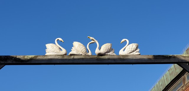
Cheshunt Marsh is not only a haven for wildlife but also a popular destination for nature enthusiasts and birdwatchers. The marsh offers several walking trails and observation points, allowing visitors to immerse themselves in the tranquil surroundings while observing the abundant birdlife. Common sightings include herons, kingfishers, swans, and various species of ducks.

Overall, Cheshunt Marsh is a vital freshwater ecosystem in Hertfordshire, providing a sanctuary for a wide range of plant and animal species. Its natural beauty and ecological significance make it a valuable asset within the Lee Valley Regional Park.

If you have any feedback on the listing, please let us know in the comments section below.

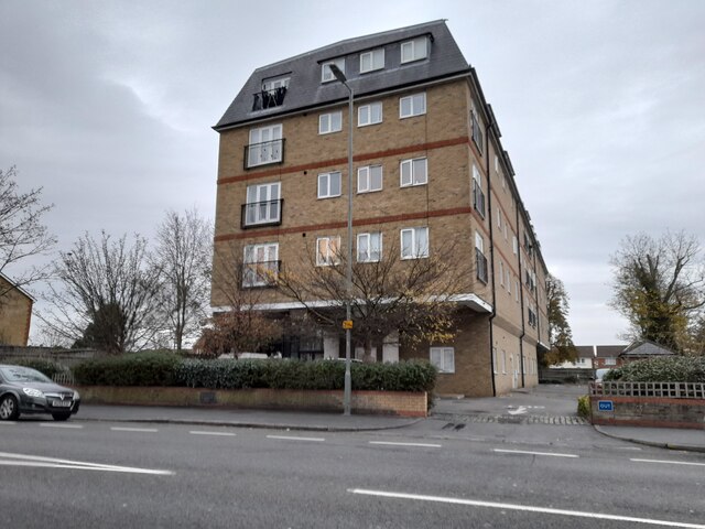
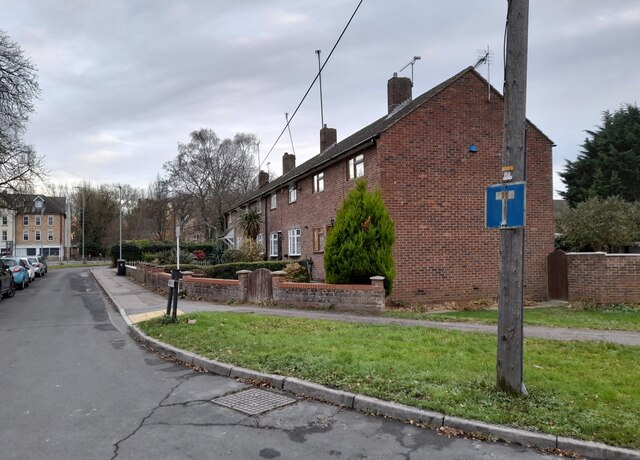
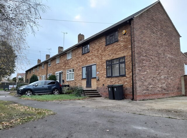
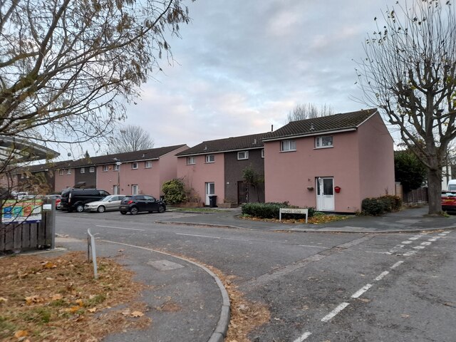
Cheshunt Marsh Images

Images are sourced within 2km of 51.691703/-0.019541354 or Grid Reference TL3601. Thanks to Geograph Open Source API. All images are credited.

Cheshunt Railway Station A class 379 Electric Multiple Unit departing from Cheshunt.
Cheshunt Railway Station
A class 379 Electric Multiple Unit departing from Cheshunt.
Swans over the Road, Waltham Cross I believe these were formerly a pub sign.
Swans over the Road, Waltham Cross
I believe these were formerly a pub sign.
Eleanor Cross, Waltham Cross This has been cleaned up since I last visited.
Eleanor Cross, Waltham Cross
This has been cleaned up since I last visited.
KFC, Waltham Cross
KFC, Waltham Cross
Eleanor Cross Road, Waltham Cross
Waltham Cross bus stand
Houses on Eleanor Cross Road, Waltham Cross
High Street, Waltham Cross
Houses on Sewardstone Road, Waltham Abbey
Green on Powdermill Lane, Waltham Abbey
Hunger Cure cafe on High Street, Waltham Cross
Waltham Cross Job Centre
Flats on Crossbrook Street, Cheshunt
Leaview, Waltham Abbey
Row of houses on Walton Gardens, Waltham Abbey
Fishers Close, Waltham Cross
Show me another place!

Cheshunt Marsh is located at Grid Ref: TL3601 (Lat: 51.691703, Lng: -0.019541354)

Administrative County: Hertfordshire

District: Broxbourne

Police Authority: Hertfordshire

What 3 Words

///once.locked.saying. Near Cheshunt, Hertfordshire

Related Wikis

Canoeing at the 2012 Summer Olympics

Canoeing at the 2012 Summer Olympics in London were contested in two main disciplines: canoe slalom, from 29 July to 2 August, and canoe sprint, from 6...

Lee Valley White Water Centre

Lee Valley White Water Centre (previously known as Broxbourne White Water Canoe Centre) is a white-water slalom centre in the Middle Lea Valley, in the...

Small River Lea

The Small River Lea is a minor tributary of the River Lea, which flows through the Lee Valley Park between Cheshunt and Enfield Lock. It forms part of...

Lee Valley Park

Lee Valley Regional Park is a 10,000-acre (40 km2) 26 miles (42 km) long linear park, much of it green spaces, running through the northeast of Greater...

Waltham Town Lock

Waltham Town Lock (No 11) is a lock on the River Lee Navigation at Waltham Cross, Hertfordshire. The lock is located in the River Lee Country Park which...

Lea Valley

The Lea Valley, the valley of the River Lea, has been used as a transport corridor, a source of sand and gravel, an industrial area, a water supply for...

Waltham Abbey Royal Gunpowder Mills

The Royal Gunpowder Mills are a former industrial site in Waltham Abbey, England. It was one of three Royal Gunpowder Mills in the United Kingdom (the...

Millhead Stream

The Millhead Stream is a minor tributary of the River Lea in England. The stream flows north to south across the Waltham Abbey flood plain and through...

Related Videos

Unraveling Secrets of a Historic Landmark: 4K UK Hiking Saturday!

Cheshunt to Broxbourne walk. River Lee Country Park and Waltham Abbey. Length: 12 km (7.5 miles) Grading: Easy Rating: 1 out ...

Everything About Dogs Ep1-Top 5 Dog Walking Tips

Hi guys, and welcome to, or welcome back to Sonnies List Of Things. This short video that we have for you today is a top 5 list of ...

Exploring Waltham abbey and Broxbourne via Cheshunt- Walk and Talk

Join me for another short walk and talk My collection of walking videos can be found at ...

Lee Valley White Water Center Walking Tour during 2023 Kayak Cross Championship London UK

This is a walking video tour during 2023 Canoe Slalom World Championship held at Lee Valley White Water - Station Rd, ...

Nearby Amenities

Located within 500m of 51.691703,-0.019541354
Crossing Barrier: full
Railway: level_crossing
Lat/Long: 51.6915816/-0.0254872
Power: tower
Lat/Long: 51.6928288/-0.0138766
Power: tower
Lat/Long: 51.689977/-0.0131041
Power: tower
Lat/Long: 51.6927118/-0.0144087
Power: tower
Lat/Long: 51.6898067/-0.0136362
Leisure: slipway
Lat/Long: 51.6876128/-0.016724
Leisure: slipway
Lat/Long: 51.6877681/-0.0167078
Fixme: continue
Lat/Long: 51.6894045/-0.0167695
Leisure: slipway
Lat/Long: 51.688569/-0.0174199
Leisure: slipway
Lat/Long: 51.6882974/-0.0172868
Crossing Barrier: full
Railway: level_crossing
Lat/Long: 51.6915836/-0.0255308
Turning Circle
Lat/Long: 51.6893448/-0.0171105
Barrier: kissing_gate
Lat/Long: 51.6882515/-0.0222694
Barrier: kissing_gate
Lat/Long: 51.6913517/-0.0228568
Barrier: kissing_gate
Lat/Long: 51.6893386/-0.0232102
Bench
Lat/Long: 51.6881376/-0.0219639
Barrier: kissing_gate
Lat/Long: 51.6939296/-0.0140052
Barrier: cycle_barrier
Lat/Long: 51.6923406/-0.0250984
Leisure: fishing
Lat/Long: 51.6938629/-0.0247136
Bench
Lat/Long: 51.6944951/-0.0247954
Fixme: approximate -- recheck
Lat/Long: 51.6896883/-0.0165449
Bench
Lat/Long: 51.687813/-0.0160519
Barrier: bollard
Lat/Long: 51.6893261/-0.0168708
Barrier: bollard
Lat/Long: 51.6892046/-0.0170894
Barrier: bollard
Lat/Long: 51.6892379/-0.0169379
Barrier: bollard
Lat/Long: 51.6892081/-0.0170264
Barrier: bollard
Lat/Long: 51.6892571/-0.0169084
Barrier: bollard
Lat/Long: 51.6892097/-0.0171471
Barrier: bollard
Lat/Long: 51.6892911/-0.0168856
Barrier: bollard
Lat/Long: 51.6892151/-0.0172095
Barrier: bollard
Lat/Long: 51.689218/-0.0169728
Bench
Source: gps+mapnoter
Lat/Long: 51.6875817/-0.0183456
Bench
Source: gps+mapnoter
Lat/Long: 51.6883682/-0.0188369
Bench
Source: gps+mapnoter
Lat/Long: 51.688516/-0.0189276
Bench
Source: gps+mapnoter
Lat/Long: 51.6882783/-0.0187858
Bench
Source: gps+mapnoter
Lat/Long: 51.6884302/-0.0188756
Bench
Source: gps+mapnoter
Lat/Long: 51.6887044/-0.0189843
Bench
Source: gps+mapnoter
Lat/Long: 51.6885832/-0.0189511
Bench
Source: gps+mapnoter
Lat/Long: 51.6876472/-0.0184563
Bench
Source: gps+mapnoter
Lat/Long: 51.6876988/-0.0185253
Bench
Source: gps+mapnoter
Lat/Long: 51.6875167/-0.0182287
Leisure: fishing
Lat/Long: 51.6955329/-0.0207875
Bench
Source: gps+mapnoter
Lat/Long: 51.6960277/-0.0202265
Bench
Source: gps+mapnoter
Lat/Long: 51.6951571/-0.0207284
Leisure: fishing
Lat/Long: 51.6950158/-0.0210812
Leisure: fishing
Lat/Long: 51.6944822/-0.0214058
Leisure: fishing
Lat/Long: 51.6952519/-0.0208465
Bench
Source: gps+mapnoter
Lat/Long: 51.6934579/-0.0216725
Bench
Source: gps+mapnoter
Lat/Long: 51.6940676/-0.0213531
Bench
Backrest: yes
Source: gps+mapnoter
Lat/Long: 51.6927857/-0.0222355
Waste Basket
Source: gps+mapnoter
Waste: dog
Lat/Long: 51.6914395/-0.021804
Disc Golf: hole
Ref: 2
Source: gps+mapnoter
Lat/Long: 51.6919743/-0.0184482
Disc Golf: tee
Ref: 2
Source: gps+mapnoter
Lat/Long: 51.6920641/-0.0174692
Disc Golf: tee
Ref: 3
Source: gps+mapnoter
Lat/Long: 51.6922271/-0.0185823
Disc Golf: hole
Ref: 1
Source: gps+mapnoter
Lat/Long: 51.6919423/-0.0171556
Disc Golf: tee
Ref: 3
Source: gps+mapnoter
Lat/Long: 51.6934325/-0.0191242
Disc Golf: hole
Ref: 9
Source: gps+mapnoter
Lat/Long: 51.6923285/-0.0172788
Disc Golf: tee
Ref: 1
Source: gps+mapnoter
Lat/Long: 51.6914503/-0.0180997
Disc Golf: tee
Source: gps+mapnoter
Lat/Long: 51.6924765/-0.0174451
Disc Golf: hole
Ref: 5
Source: gps+mapnoter
Lat/Long: 51.6947276/-0.0184777
Disc Golf: tee
Ref: 8
Source: gps+mapnoter
Lat/Long: 51.6935505/-0.0179762
Disc Golf: tee
Ref: 7
Source: gps+mapnoter
Lat/Long: 51.6941158/-0.0175685
Disc Golf: hole
Ref: 7
Source: gps+mapnoter
Lat/Long: 51.6937899/-0.0176972
Disc Golf: hole
Ref: 4
Source: gps+mapnoter
Lat/Long: 51.6939329/-0.0190169
Disc Golf: tee
Ref: 4
Source: gps+mapnoter
Lat/Long: 51.6936372/-0.0186844
Disc Golf: hole
Ref: 8
Source: gps+mapnoter
Lat/Long: 51.6925197/-0.0172386
Disc Golf: hole
Ref: 7
Source: gps+mapnoter
Lat/Long: 51.694307/-0.0178152
Disc Golf: tee
Ref: 5
Source: gps+mapnoter
Lat/Long: 51.6941358/-0.0191563
Disc Golf: tee
Ref: 6
Lat/Long: 51.6949089/-0.0177696
Information: disc golf
Tourism: information
Lat/Long: 51.6909014/-0.0179334
Lee Valley Disc Golf Course
Leisure: pitch
Lat/Long: 51.6911408/-0.0171915
Bench
Source: gps+mapnoter
Lat/Long: 51.6885864/-0.0182974
Toilets
Access: customers
Level: 1
Lat/Long: 51.688727/-0.0170025
Cafe
Brew Street
Addr City: Waltham Cross
Addr Postcode: EN9 1AB
Addr Street: Station Road
Breakfast: yes
Diet Vegetarian: yes
Fhrs Id: 479236
Fhrs Local Authority Id: PI/000049545
Level: 1
Opening Hours: We-Fr 09:00-16:00; Sa,Su 09:00-16:30; Mo,Tu off
Source Addr: FHRS Open Data
Lat/Long: 51.6889958/-0.01712
Barrier: bollard
Lat/Long: 51.6883618/-0.0235914
Answer: C
Marker: post
Orienteering: marker
Ref: 11
Sport: orienteering
Lat/Long: 51.6906405/-0.0178883
Answer: B
Marker: post
Orienteering: marker
Ref: 13
Sport: orienteering
Lat/Long: 51.692524/-0.0225707
Barrier: bollard
Lat/Long: 51.6884537/-0.023726
Leisure: slipway
Lat/Long: 51.6886154/-0.0162644
Bench
Source: gps+mapnoter
Lat/Long: 51.6882146/-0.0187523
Bench
Source: gps+mapnoter
Lat/Long: 51.6880859/-0.0187132
Bench
Source: gps+mapnoter
Lat/Long: 51.6881541/-0.0187322
Bench
Lat/Long: 51.6886771/-0.0189784
Bench
Lat/Long: 51.688644/-0.0189708
Bench
Lat/Long: 51.6886119/-0.0189631
Bench
Lat/Long: 51.6885495/-0.0189413
Bench
Lat/Long: 51.6884878/-0.0189128
Bench
Lat/Long: 51.6884562/-0.0188935
Bench
Lat/Long: 51.688398/-0.0188569
Bench
Lat/Long: 51.6883362/-0.0188178
Bench
Lat/Long: 51.688306/-0.0188015
Bench
Lat/Long: 51.6882461/-0.018769
Bench
Lat/Long: 51.6881856/-0.0187405
Bench
Lat/Long: 51.6881223/-0.0187202
Bench
Lat/Long: 51.6881009/-0.0187578
Bench
Lat/Long: 51.6881318/-0.0187654
Bench
Lat/Long: 51.6881667/-0.0187787
Bench
Lat/Long: 51.6881967/-0.0187888
Bench
Lat/Long: 51.6882297/-0.0188051
Bench
Lat/Long: 51.6882597/-0.0188193
Bench
Lat/Long: 51.6882918/-0.0188371
Bench
Lat/Long: 51.6883198/-0.0188554
Bench
Lat/Long: 51.6883501/-0.0188722
Bench
Lat/Long: 51.68838/-0.0188955
Bench
Lat/Long: 51.6884103/-0.0189128
Bench
Lat/Long: 51.6884405/-0.0189342
Bench
Lat/Long: 51.6884695/-0.0189525
Bench
Lat/Long: 51.6884966/-0.0189692
Bench
Lat/Long: 51.6885303/-0.0189865
Bench
Lat/Long: 51.6883526/-0.018926
Bench
Lat/Long: 51.6883227/-0.0189082
Bench
Lat/Long: 51.6882905/-0.0188889
Bench
Lat/Long: 51.6882631/-0.0188711
Bench
Lat/Long: 51.6882332/-0.0188529
Bench
Lat/Long: 51.688203/-0.018834
Bench
Lat/Long: 51.6881727/-0.0188203
Bench
Lat/Long: 51.6881365/-0.0188117
Bench
Lat/Long: 51.6876717/-0.018491
Bench
Lat/Long: 51.6876254/-0.0184229
Bench
Lat/Long: 51.6876027/-0.0183832
Bench
Lat/Long: 51.687559/-0.0183039
Bench
Lat/Long: 51.6875388/-0.0182684
Bench
Lat/Long: 51.6875007/-0.0182663
Bench
Lat/Long: 51.687524/-0.0183055
Bench
Lat/Long: 51.6875432/-0.0183441
Bench
Lat/Long: 51.6875646/-0.0183781
Bench
Lat/Long: 51.6875867/-0.0184193
Bench
Lat/Long: 51.6876087/-0.0184544
Bench
Lat/Long: 51.6876324/-0.0184925
Bench
Lat/Long: 51.6876579/-0.018524
Bench
Lat/Long: 51.6876821/-0.0185545
Bench
Lat/Long: 51.6876664/-0.0185951
Bench
Lat/Long: 51.6876434/-0.0185631
Bench
Lat/Long: 51.6876172/-0.0185301
Bench
Lat/Long: 51.6875961/-0.018494
Bench
Lat/Long: 51.6875728/-0.0184549
Bench
Lat/Long: 51.6875517/-0.0184208
Bench
Lat/Long: 51.6875293/-0.0183771
Bench
Lat/Long: 51.6875082/-0.018341
Bench
Lat/Long: 51.6876305/-0.0185987
Bench
Lat/Long: 51.6876062/-0.0185657
Bench
Lat/Long: 51.6875829/-0.0185306
Bench
Lat/Long: 51.6875596/-0.0184935
Bench
Lat/Long: 51.6875372/-0.0184513
Bench
Lat/Long: 51.6875152/-0.0184152
Entrance: main
Lat/Long: 51.688976/-0.0169918
Above & Below
Shop: water_sports
Website: https://www.aboveandbelowkayak.com/
Lat/Long: 51.6887151/-0.0174199
Bench
Lat/Long: 51.6881311/-0.0181192
The data included in this document is from www.openstreetmap.org. The data is made available under ODbL.

Have you been to Cheshunt Marsh?

Leave your review of Cheshunt Marsh below (or comments, questions and feedback).