Nutfield Marsh

Lake, Pool, Pond, Freshwater Marsh in Surrey Tandridge

England

Nutfield Marsh

Hungerford Lake at Priory Farm, South Nutfield Looking SE from Priory Farm Plant Centre. <span class="nowrap"><a title="http://www.prioryfarm.co.uk/" rel="nofollow ugc noopener" href="http://www.prioryfarm.co.uk/">Link</a><img style="margin-left:2px;" alt="External link" title="External link - shift click to open in new window" src="https://s1.geograph.org.uk/img/external.png" width="10" height="10"/></span>
Hungerford Lake at Priory Farm, South Nutfield Credit: Rib

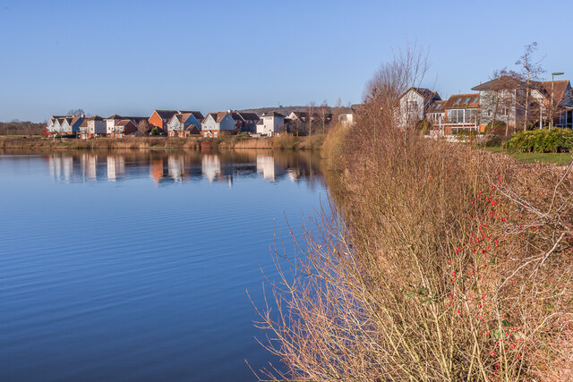
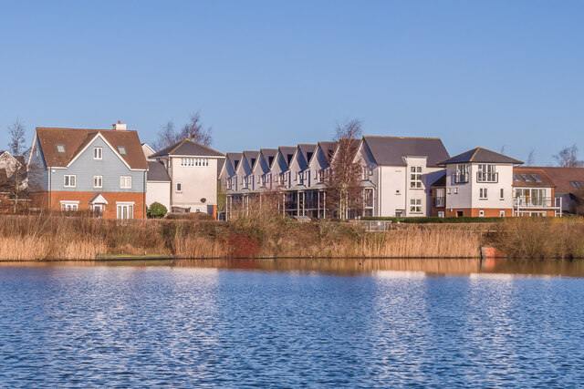
Nutfield Marsh is a picturesque freshwater marsh located in Surrey, England. Situated in the village of Nutfield near Redhill, this serene natural habitat encompasses a vast area of around 60 hectares. The marsh is primarily composed of a combination of lakes, pools, and ponds, creating a diverse and thriving ecosystem.

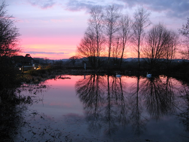
The main feature of Nutfield Marsh is its expansive lake, which acts as a focal point for both wildlife and visitors alike. The lake is home to a variety of aquatic plants, including water lilies and reeds, which provide shelter and food for a wide range of bird species. Birdwatchers frequently flock to the marsh to catch a glimpse of species such as herons, swans, and ducks, which can be seen gracefully gliding across the water.

In addition to the lake, Nutfield Marsh also boasts several smaller pools and ponds, each with its own unique characteristics. These smaller bodies of water provide a habitat for amphibians such as frogs and newts, as well as an assortment of insects and small invertebrates.

The marsh is surrounded by lush vegetation, including wet meadows and wet woodland, which further enhances its natural beauty. The diverse plant life attracts an array of butterflies, dragonflies, and other insects, adding to the rich biodiversity of the area.

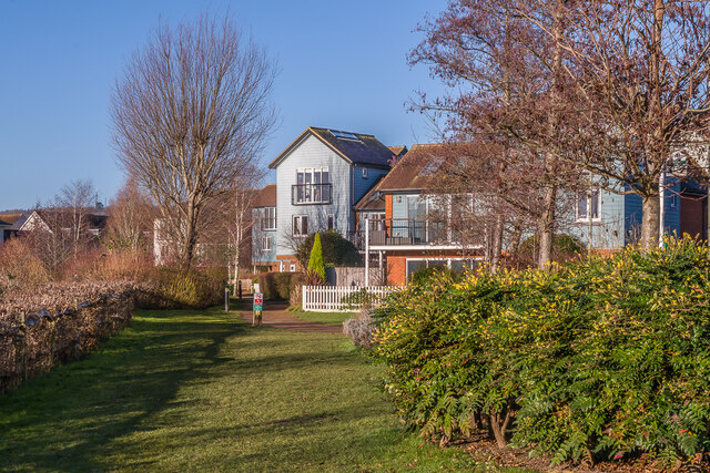
Nutfield Marsh is not only a haven for wildlife but also a popular destination for nature enthusiasts and those seeking tranquility. The marsh offers various walking trails, allowing visitors to explore its hidden gems while immersing themselves in the peaceful surroundings. Its proximity to residential areas makes it easily accessible and a perfect escape from the hustle and bustle of everyday life.

If you have any feedback on the listing, please let us know in the comments section below.

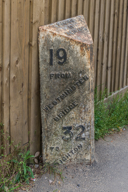
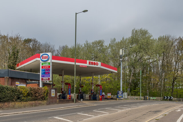
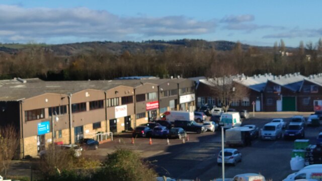
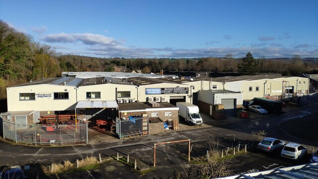
Nutfield Marsh Images

Images are sourced within 2km of 51.248346/-0.13790659 or Grid Reference TQ3051. Thanks to Geograph Open Source API. All images are credited.

Hungerford Lake at Priory Farm, South Nutfield Looking SE from Priory Farm Plant Centre. <span class="nowrap"><a title="http://www.prioryfarm.co.uk/" rel="nofollow ugc noopener" href="http://www.prioryfarm.co.uk/">Link</a><img style="margin-left:2px;" alt="External link" title="External link - shift click to open in new window" src="https://s1.geograph.org.uk/img/external.png" width="10" height="10"/></span>
Hungerford Lake at Priory Farm, South Nutfield
Looking SE from Priory Farm Plant Centre. LinkExternal link
Priory Farm Snowman - South Nutfield Giant Snowman opposite entrance to Priory Farm Shop, South Nutfield
Priory Farm Snowman - South Nutfield
Giant Snowman opposite entrance to Priory Farm Shop, South Nutfield
Priory Farm, South Nutfield The easy way to build snowmen. Giant snowman looks on as a companion is constructed. Opposite entrance to Priory Farm Shop, South Nutfield<span class="nowrap"><a title="http://www.prioryfarm.co.uk/au_home.php" rel="nofollow ugc noopener" href="http://www.prioryfarm.co.uk/au_home.php">Link</a><img style="margin-left:2px;" alt="External link" title="External link - shift click to open in new window" src="https://s1.geograph.org.uk/img/external.png" width="10" height="10"/></span>
Priory Farm, South Nutfield
The easy way to build snowmen. Giant snowman looks on as a companion is constructed. Opposite entrance to Priory Farm Shop, South NutfieldLinkExternal link
Priory Farm discovery walk Entrance to the discovery walk, one of a number of activities at Priory Farm.
Priory Farm discovery walk
Entrance to the discovery walk, one of a number of activities at Priory Farm.
Priory Farm The farm building complex, which among other things houses the farm shop.
Priory Farm
The farm building complex, which among other things houses the farm shop.
Towards Redhill Aerodrome The buildings of Redhill Aerodrome can be seen in the middle distance in this view from the Greensand Way south of Nutfield.
Towards Redhill Aerodrome
The buildings of Redhill Aerodrome can be seen in the middle distance in this view from the Greensand Way south of Nutfield.
Priory Farm Some of the buildings of Priory Farm, with the delivery entrance to the farmshop on the right.
Priory Farm
Some of the buildings of Priory Farm, with the delivery entrance to the farmshop on the right.
Priory Farm A view of the fishing lake at Priory Farm
Priory Farm
A view of the fishing lake at Priory Farm
Nutfield Landscape A typically agricultural scene at Nutfield
Nutfield Landscape
A typically agricultural scene at Nutfield
London Road Looking south along London Road.  

The milepost on the right is one of a standard design for one along this route, which was built in 1816 as a direct route from Gatton Point south to Povey Cross, near Gatwick.

The post shows the distances to/from Brighton and Westminster Bridge on the two faces, but in a different order according to the direction of travel. On the top face is the locality (here the Parish of Reigate, as it was at the time).  

See  <a href="https://www.geograph.org.uk/photo/6907428">TQ2851 : Milestone</a> for a close up of the face seen here, <a href="https://www.geograph.org.uk/photo/6907425">TQ2851 : Milestone</a> for a close up of the opposite face and <a href="https://www.geograph.org.uk/photo/2917092">TQ2851 : London Road</a> for a wider view in opposite direction.
London Road
Looking south along London Road. The milepost on the right is one of a standard design for one along this route, which was built in 1816 as a direct route from Gatton Point south to Povey Cross, near Gatwick. The post shows the distances to/from Brighton and Westminster Bridge on the two faces, but in a different order according to the direction of travel. On the top face is the locality (here the Parish of Reigate, as it was at the time). See TQ2851 : Milestone for a close up of the face seen here, TQ2851 : Milestone for a close up of the opposite face and TQ2851 : London Road for a wider view in opposite direction.
Milestone Close up of the milestone in <a href="https://www.geograph.org.uk/photo/2917092">TQ2851 : London Road</a>, one of a standard design for one along this route, which was built in 1816 as a direct route from Gatton Point south to Povey Cross, near Gatwick.  For a photo of the opposite face, showing same places and distances but in the other order, see <a href="https://www.geograph.org.uk/photo/6907428">TQ2851 : Milestone</a>.
Milestone
Close up of the milestone in TQ2851 : London Road, one of a standard design for one along this route, which was built in 1816 as a direct route from Gatton Point south to Povey Cross, near Gatwick. For a photo of the opposite face, showing same places and distances but in the other order, see TQ2851 : Milestone.
Milestone Close up of the milestone in <a href="https://www.geograph.org.uk/photo/6907414">TQ2851 : London Road</a>, one of a standard design for one along this route, which was built in 1816 as a direct route from Gatton Point south to Povey Cross, near Gatwick.  For a photo of the opposite face, showing same places and distances but in the other order, see <a href="https://www.geograph.org.uk/photo/6907425">TQ2851 : Milestone</a>.
Milestone
Close up of the milestone in TQ2851 : London Road, one of a standard design for one along this route, which was built in 1816 as a direct route from Gatton Point south to Povey Cross, near Gatwick. For a photo of the opposite face, showing same places and distances but in the other order, see TQ2851 : Milestone.
Gatton Point Road junction where the 1816 direct turnpike to Povey Cross, near Gatwick, (now the A23) met the original route through Reigate (now the A242 for this section).  Perhaps appropriate to what was one a key road junction, it is now the site of an Esso petrol station.
Gatton Point
Road junction where the 1816 direct turnpike to Povey Cross, near Gatwick, (now the A23) met the original route through Reigate (now the A242 for this section). Perhaps appropriate to what was one a key road junction, it is now the site of an Esso petrol station.
Ormside Way Industrial units Front elevations of some of the units in Ormside Way
Ormside Way Industrial units
Front elevations of some of the units in Ormside Way
Ormside Way Industrial Estate Elevations of some of the units in the Ormside Way Industrial Estate, Redhill
Ormside Way Industrial Estate
Elevations of some of the units in the Ormside Way Industrial Estate, Redhill
Watercolour A major housing development on the site of the old Holmethorpe sand quarry, marketed as Watercolour, built over the first 15 years or so of the 21st Century. The lake was landscaped from the quarry itself and is now a nature reserve.
Watercolour
A major housing development on the site of the old Holmethorpe sand quarry, marketed as Watercolour, built over the first 15 years or so of the 21st Century. The lake was landscaped from the quarry itself and is now a nature reserve.
Watercolour A major housing development on the site of the old Holmethorpe sand quarry, marketed as Watercolour, built over the first 15 years or so of the 21st Century. The houses here are in Lilley Mead and Holmesdale Avenue.
Watercolour
A major housing development on the site of the old Holmethorpe sand quarry, marketed as Watercolour, built over the first 15 years or so of the 21st Century. The houses here are in Lilley Mead and Holmesdale Avenue.
Watercolour A major housing development on the site of the old Holmethorpe sand quarry, marketed as Watercolour, built over the first 15 years or so of the 21st Century. The houses here are in The Moors and Lilley Mead.  The lake was landscaped from the quarry itself and is now a nature reserve.
Watercolour
A major housing development on the site of the old Holmethorpe sand quarry, marketed as Watercolour, built over the first 15 years or so of the 21st Century. The houses here are in The Moors and Lilley Mead. The lake was landscaped from the quarry itself and is now a nature reserve.
Show me another place!

Nutfield Marsh is located at Grid Ref: TQ3051 (Lat: 51.248346, Lng: -0.13790659)

Administrative County: Surrey

District: Tandridge

Police Authority: Surrey

What 3 Words

///swept.riding.reply. Near Redhill, Surrey

Nearby Locations

Nutfield Marsh Glebe Lake

Related Wikis

Nutfield Marshes

Nutfield Marshes is a 62-hectare (150-acre) nature reserve near Nutfield in Surrey. It is managed by the Surrey Wildlife Trust.These former sand quarries...

Nutfield, Surrey

Nutfield is a village and civil parish in the Tandridge District of Surrey, England. It lies in the Weald immediately south of the Greensand Ridge and...

Merstham F.C.

Merstham Football Club is a football club based in Merstham, Surrey, England. Affiliated to the Surrey FA, they are currently members of the Isthmian League...

Nutfield Priory

Nutfield Priory is a Grade II listed country house in Nutfield, Surrey. It was constructed between 1872 and 1874 by John Gibson. It is now a hotel and...

Reigate and Banstead

Reigate and Banstead is a local government district with borough status in east Surrey, England. It includes the towns of Reigate, Redhill, Horley and...

The Hawthorns School

The Hawthorns School is an independent preparatory school for boys and girls aged 2 years to 13 years in Bletchingley, Surrey, England. The headmaster...

Carrington School

Carrington School is a coeducational secondary school located in Redhill, Surrey, England.Initially known as The Warwick School, it was founded in September...

Merstham railway station

Merstham railway station is in Merstham, Surrey, England. It is on the Brighton Main Line, 20 miles 59 chains (33.4 km) measured from London Charing Cross...

Nearby Amenities

Located within 500m of 51.248346,-0.13790659
Pub
Inn on the Pond
Created By: Potlatch 0.9c
Toilets Wheelchair: no
Wheelchair: limited
Lat/Long: 51.2475637/-0.1352898
Barrier: stile
Lat/Long: 51.2446188/-0.137412
Barrier: kissing_gate
Lat/Long: 51.2453534/-0.1420899
Barrier: kissing_gate
Lat/Long: 51.2470543/-0.1352693
Sport: sailing
Lat/Long: 51.251548/-0.1368108
Barrier: stile
Lat/Long: 51.2496376/-0.1354511
Bench
Backrest: yes
Seats: 3
Lat/Long: 51.2493242/-0.1443155
Bench
Backrest: yes
Seats: 2
Lat/Long: 51.2494188/-0.1415622
Bench
Backrest: yes
Lat/Long: 51.2495268/-0.1345704
Leisure: picnic_table
Lat/Long: 51.2495046/-0.1407469
Chilmead Barns
Place: neighbourhood
Lat/Long: 51.2456429/-0.1434524
Barrier: kissing_gate
Lat/Long: 51.2472201/-0.1384929
Mercers Country Park
Place: locality
Lat/Long: 51.250687/-0.1390689
Power: pole
Lat/Long: 51.2494055/-0.1346952
Power: pole
Source: Bing
Lat/Long: 51.2486131/-0.1341802
Power: pole
Source: Bing
Lat/Long: 51.249016/-0.1342446
Barrier: kissing_gate
Lat/Long: 51.244661/-0.1372023
Leisure: picnic_table
Source: gps
Lat/Long: 51.2525997/-0.1381254
Addr Housename: Warners Cottage
Lat/Long: 51.2507721/-0.1358051
Addr Housename: Dairy Cottage
Lat/Long: 51.2507768/-0.1355669
Bench
Backrest: no
Source: gps
Lat/Long: 51.2496486/-0.13542
The data included in this document is from www.openstreetmap.org. The data is made available under ODbL.

Have you been to Nutfield Marsh?

Leave your review of Nutfield Marsh below (or comments, questions and feedback).