Wragg Marsh

Coastal Marsh, Saltings in Lincolnshire South Holland

England

Wragg Marsh

One misty moisty morning When cloudy was the weather etc.  Surfleet Marsh Farmhouse appears out of the gloom.
One misty moisty morning Credit: Ian Paterson

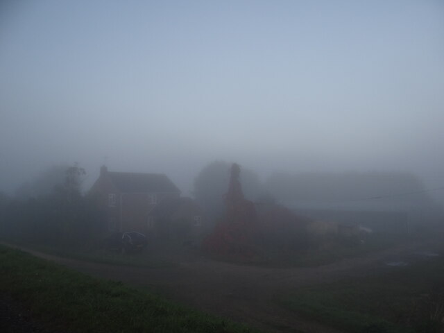
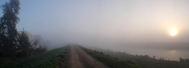
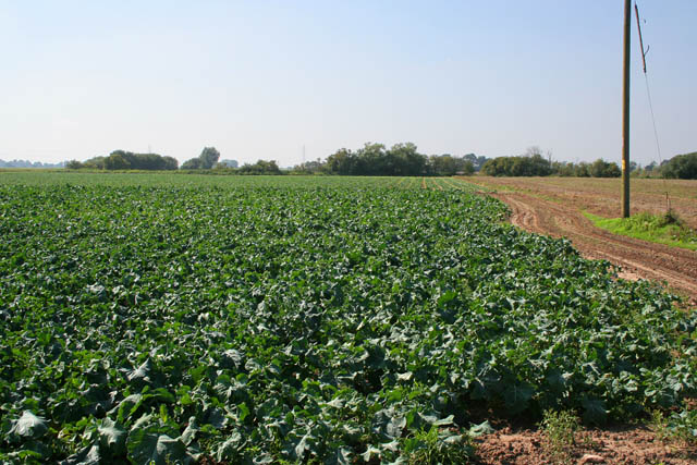
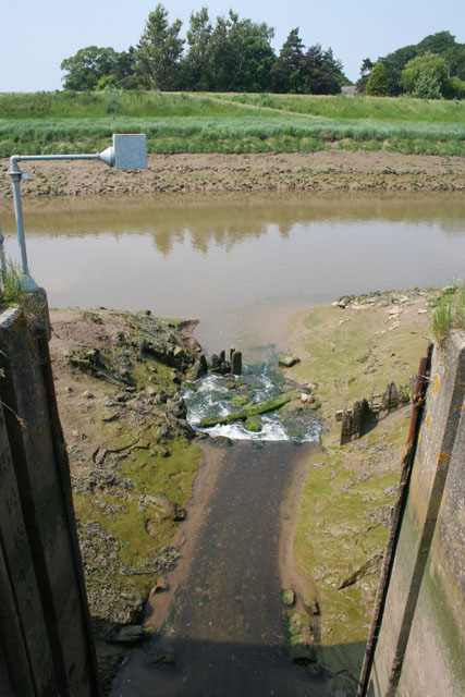
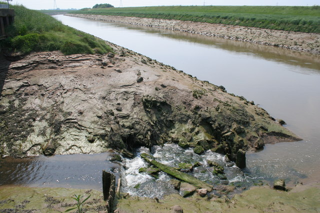
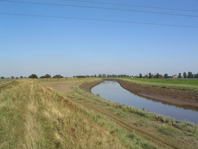
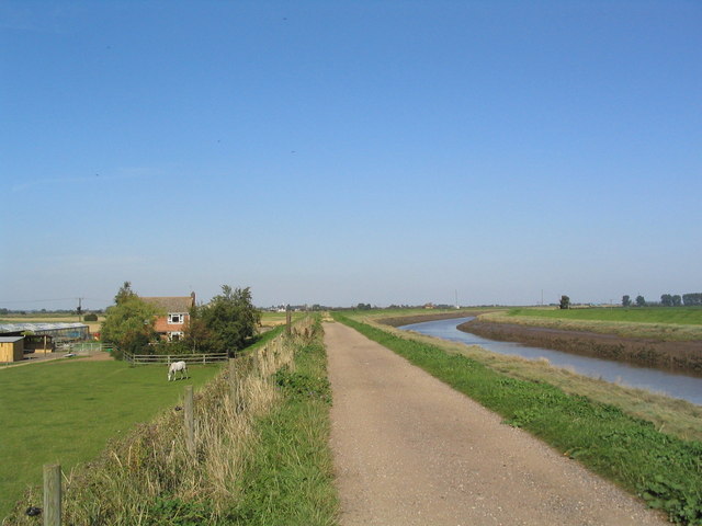
Wragg Marsh is a coastal marshland located in Lincolnshire, England. Stretching along the eastern coast of the country, it is characterized by its vast expanse of salt marshes, also known as saltings. This unique ecosystem is influenced by the regular tides of the North Sea, which create a delicate balance between land and water.

The marshland is home to a diverse range of plant and animal species that have adapted to this dynamic environment. Salt-tolerant vegetation such as samphire and sea lavender thrive here, providing food and shelter for numerous bird species. Wragg Marsh is particularly renowned for its rich birdlife, attracting both resident and migratory species. Visitors can spot wading birds like curlews, redshanks, and oystercatchers, as well as various gulls and terns.

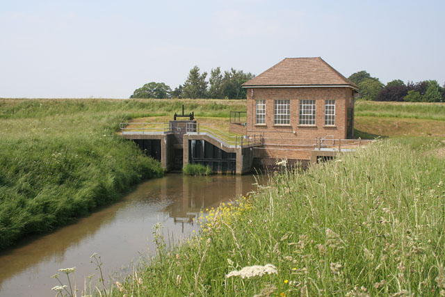
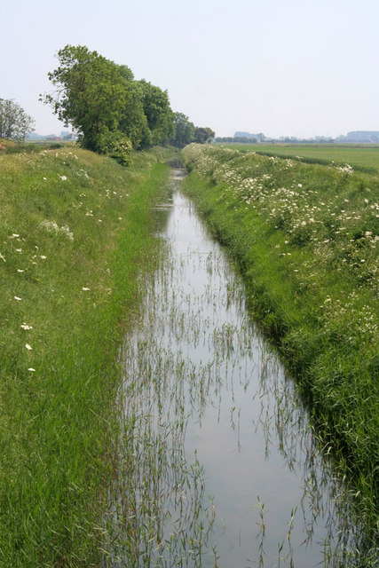
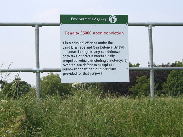
The marshes play a crucial role in providing habitats for these birds and other wildlife. The extensive mudflats and channels offer abundant food sources, including worms, mollusks, and small fish. Additionally, the marshland acts as a natural buffer, helping to protect the adjacent land from coastal erosion and flooding.

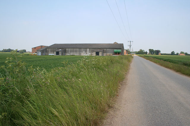
Wragg Marsh is not only significant for its ecological value but also for its historical and cultural importance. The region has a long history of human habitation, with evidence of Roman settlements and medieval salt production. Today, the marshland is a popular destination for nature enthusiasts and birdwatchers, offering mesmerizing views of the expansive salt marshes, the sparkling sea, and the distant horizon.

If you have any feedback on the listing, please let us know in the comments section below.
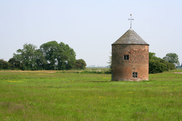
Wragg Marsh Images

Images are sourced within 2km of 52.852881/-0.065325151 or Grid Reference TF3030. Thanks to Geograph Open Source API. All images are credited.

One misty moisty morning When cloudy was the weather etc.  Surfleet Marsh Farmhouse appears out of the gloom.
One misty moisty morning
When cloudy was the weather etc. Surfleet Marsh Farmhouse appears out of the gloom.
Morning panorama A glorious autumn day is in store once the sun disperses the mist.
Morning panorama
A glorious autumn day is in store once the sun disperses the mist.
Farm track at Crown Farm This bridleway goes from Carrington Road to the River Welland in <a href="https://www.geograph.org.uk/gridref/TF2892">TF2892</a>.
Farm track at Crown Farm
This bridleway goes from Carrington Road to the River Welland in TF2892.
Carrington Road There are several houses and farms dotted along this road that leads to Moulton Marsh.
Carrington Road
There are several houses and farms dotted along this road that leads to Moulton Marsh.
Farmland off Carrington Road Looking towards the A17 (you can just make out the traffic on the horizon), Fosdyke Bridge and the Wash.
Farmland off Carrington Road
Looking towards the A17 (you can just make out the traffic on the horizon), Fosdyke Bridge and the Wash.
Carrington Road looking towards Moulton Marsh Straight Fenland road leading to the River Welland. The orange mesh sacks contain newly harvested onions.
Carrington Road looking towards Moulton Marsh
Straight Fenland road leading to the River Welland. The orange mesh sacks contain newly harvested onions.
Farming on the Lincolnshire Fens Brassica growing seems to be a favourite occupation round here. The River Wellend is just beyond the trees on the distant horizon in <a href="https://www.geograph.org.uk/gridref/TF2829">TF2829</a>
Farming on the Lincolnshire Fens
Brassica growing seems to be a favourite occupation round here. The River Wellend is just beyond the trees on the distant horizon in TF2829
Farmland on the Lincolnshire Fens Looking across Moulton Common. The traffic on the A17 can be seen on the horizon, <a href="https://www.geograph.org.uk/gridref/TF3229">TF3229</a>. The track from Middle Farm <a href="https://www.geograph.org.uk/photo/188647">TF3127 : Footpath and Farm</a> to Three Bridges <a href="https://www.geograph.org.uk/gridref/TF3230">TF3230</a> runs across the middle of the photograph You can see a change in the vegetation were it follows a drain across the fields.
Farmland on the Lincolnshire Fens
Looking across Moulton Common. The traffic on the A17 can be seen on the horizon, TF3229. The track from Middle Farm TF3127 : Footpath and Farm to Three Bridges TF3230 runs across the middle of the photograph You can see a change in the vegetation were it follows a drain across the fields.
The unknown soldier Triumph in death. 

The solitary remnant of the parade <a href="https://www.geograph.org.uk/photo/6967134">TF3031 : Trooping the colour</a> lies down when all around have deserted.  All is not lost as a new life is just beginning.
The unknown soldier
Triumph in death. The solitary remnant of the parade TF3031 : Trooping the colour lies down when all around have deserted. All is not lost as a new life is just beginning.
Lord's Drain Pumping Station The sluice bears the date 1957 and the pumping station, 1962. At high tide the river Welland, beyond the flood bank, is about level with the top of the sluice wall. The sluice and pumps operate automatically, controlled by a water level sensor on the drain outfall into the river. See <a href="https://www.geograph.org.uk/photo/183927">TF2930 : Lord's Drain outfall</a>
Lord's Drain Pumping Station
The sluice bears the date 1957 and the pumping station, 1962. At high tide the river Welland, beyond the flood bank, is about level with the top of the sluice wall. The sluice and pumps operate automatically, controlled by a water level sensor on the drain outfall into the river. See TF2930 : Lord's Drain outfall
Lord's Drain outfall High water level in the River Welland is marked by the grass line on the opposite bank. Note the water level sensor on the metal arm.
Lord's Drain outfall
High water level in the River Welland is marked by the grass line on the opposite bank. Note the water level sensor on the metal arm.
Wragg Marsh near Spalding These large sheds are for packing and storing the crops from the large Wragg Marsh Farm. Marsh Road comes to an end in this square.
Wragg Marsh near Spalding
These large sheds are for packing and storing the crops from the large Wragg Marsh Farm. Marsh Road comes to an end in this square.
Lord's Drain, Wragg Marsh Part of the complex Fenland drainage system.
Lord's Drain, Wragg Marsh
Part of the complex Fenland drainage system.
On the flood bank at Wragg Marsh Environment Agency sign at the access point to the public footpath along the bank.
On the flood bank at Wragg Marsh
Environment Agency sign at the access point to the public footpath along the bank.
Round building, Wragg Marsh House A mystery building. Could it have been a dovecote, or maybe a windmill?

After just under 7 years since I took my photograph and someone has discovered what this is - a pigeoncote! Thanks Richard for letting me know. See his picture <a href="https://www.geograph.org.uk/photo/3333783">TF2930 : Pigeoncote near Wragg Marsh Farm</a>
Round building, Wragg Marsh House
A mystery building. Could it have been a dovecote, or maybe a windmill? After just under 7 years since I took my photograph and someone has discovered what this is - a pigeoncote! Thanks Richard for letting me know. See his picture TF2930 : Pigeoncote near Wragg Marsh Farm
River Welland at low tide This clearly shows the high water mark. Looking upstream from Lord's Drain outfall with the South Bank to the left and the Surfleet Bank to the right.
River Welland at low tide
This clearly shows the high water mark. Looking upstream from Lord's Drain outfall with the South Bank to the left and the Surfleet Bank to the right.
River Welland, view north-east (seaward) A tidal river. A cycle route, and the Macmillan Way, runs along the embankment  towards Boston
River Welland, view north-east (seaward)
A tidal river. A cycle route, and the Macmillan Way, runs along the embankment towards Boston
Surfleet Marsh Farm, River Welland Note how much lower farm is compared with high-water level on the tidal Welland.
Surfleet Marsh Farm, River Welland
Note how much lower farm is compared with high-water level on the tidal Welland.
Show me another place!

Wragg Marsh is located at Grid Ref: TF3030 (Lat: 52.852881, Lng: -0.065325151)

Administrative County: Lincolnshire

District: South Holland

Police Authority: Lincolnshire

What 3 Words

///glass.tumblers.cluttered. Near Sutterton, Lincolnshire

Nearby Locations

The Spinney Wragg Marsh

Related Wikis

Parts of Holland

The Parts of Holland is a historical division of Lincolnshire, England, encompassing the south-east of the county. The name is still recognised locally...

Fosdyke

Fosdyke is a village and civil parish in the Borough of Boston, Lincolnshire, England. The population of the civil parish at the 2011 census was 480. It...

Moulton Seas End

Moulton Seas End is a village in the civil parish of The Moultons and the South Holland district of Lincolnshire, England. It is 5 miles (8 km) north...

Surfleet railway station

Surfleet railway station was a station in Surfleet, Lincolnshire, England. It closed to passenger traffic on 11 September 1961. The rail line is now the...

Nearby Amenities

Located within 500m of 52.852881,-0.065325151
Wragg Marsh
Place: locality
Source: Bing
Lat/Long: 52.8499528/-0.0646468
Wragg Marsh
Place: locality
Source: Bing
Lat/Long: 52.8544154/-0.0637263
Colour: red and white
Marker: aerial
Utility: gas
Lat/Long: 52.852522/-0.0586034
The data included in this document is from www.openstreetmap.org. The data is made available under ODbL.

Have you been to Wragg Marsh?

Leave your review of Wragg Marsh below (or comments, questions and feedback).