Hill Marsh

Coastal Marsh, Saltings in Lincolnshire South Holland

England

Hill Marsh

Surfleet bank Also known as sea bank.
Surfleet bank Credit: J.Hannan-Briggs

Hill Marsh is a coastal marsh and saltings located in Lincolnshire, England. It is situated along the eastern coast of the county, near the town of Mablethorpe. The marsh is a unique and ecologically important area, characterized by its diverse flora and fauna.

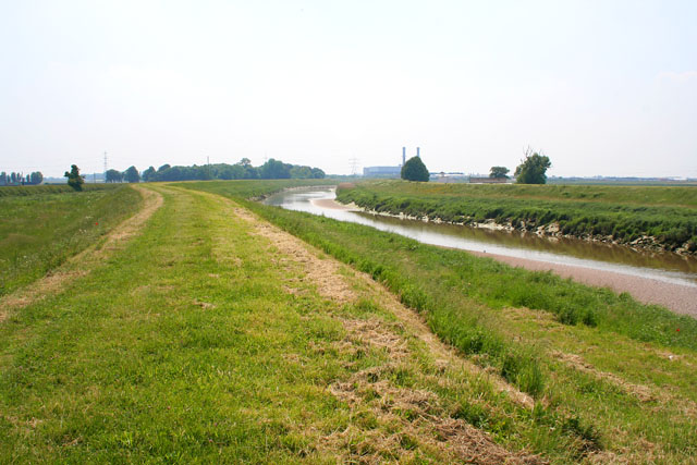
Covering an extensive area, Hill Marsh is primarily made up of salt marshes and mudflats. These habitats are formed by the deposition of sediment carried by tides and rivers, creating an environment that supports a wide range of plant and animal species. The marsh is also influenced by the nearby sea, with the ebb and flow of tides shaping its landscape.

The plant life in Hill Marsh is adapted to the saline conditions, with species such as sea lavender, glasswort, and samphire dominating the marshland. These plants not only provide a beautiful display of colors but also play a crucial role in stabilizing the sediment and preventing erosion.

The marsh is home to numerous bird species, making it a popular destination for birdwatchers. Migratory birds, such as Brent geese and waders, visit the marsh during the winter months, while resident species like lapwings and redshanks can be observed year-round. The mudflats and saltmarshes also attract a variety of invertebrates, including worms, crabs, and mollusks, which form an essential part of the coastal food chain.

Hill Marsh is not only a haven for wildlife but also a place of natural beauty. Its vast expanse of marshland, framed by the sea and sky, offers visitors a serene and tranquil experience. The marsh is accessible via footpaths and observation platforms, allowing people to explore and appreciate the unique ecosystem it encompasses.

If you have any feedback on the listing, please let us know in the comments section below.
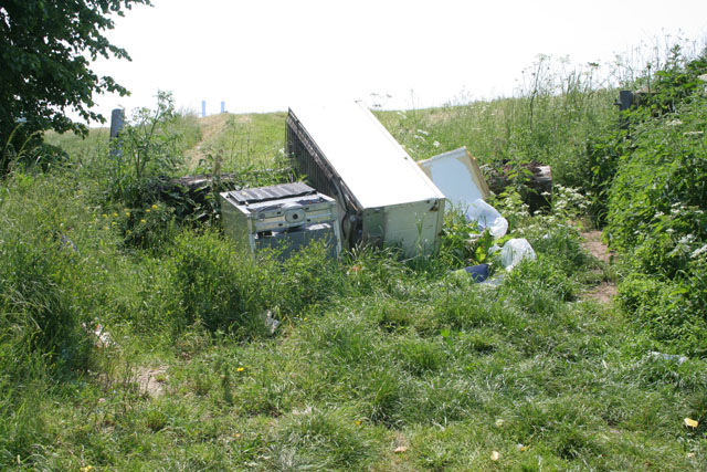
Hill Marsh Images

Images are sourced within 2km of 52.836649/-0.11762393 or Grid Reference TF2628. Thanks to Geograph Open Source API. All images are credited.

Surfleet bank Also known as sea bank.
Surfleet bank
Also known as sea bank.
River Glen at Surfleet Seas End Looking south west, upstream, at the non-tidal stretch of the River Glen. The photograph is taken from the sluice gate, downstream of which the river is tidal, and joins the large tidal River Welland - see <a href="https://www.geograph.org.uk/photo/73435">TF2829 : Tidal River Glen at Surfleet Seas End</a>.
River Glen at Surfleet Seas End
Looking south west, upstream, at the non-tidal stretch of the River Glen. The photograph is taken from the sluice gate, downstream of which the river is tidal, and joins the large tidal River Welland - see TF2829 : Tidal River Glen at Surfleet Seas End.
Tidal River Glen at Surfleet Seas End Looking north-east along the short, tidal stretch of the River Glen to where it joins the River Welland. Compare this with the upstream photograph of the non-tidal River Glen <a href="https://www.geograph.org.uk/photo/73423">TF2729 : River Glen at Surfleet Seas End</a> taken from the same position (above the sluice gate separating the tidal and non-tidal sections).
Tidal River Glen at Surfleet Seas End
Looking north-east along the short, tidal stretch of the River Glen to where it joins the River Welland. Compare this with the upstream photograph of the non-tidal River Glen TF2729 : River Glen at Surfleet Seas End taken from the same position (above the sluice gate separating the tidal and non-tidal sections).
Church of St. Laurence, Surfleet The top of the tower is 6 feet off perpendicular; a result of subsidence common on the soft ground of the Fenlands.
Church of St. Laurence, Surfleet
The top of the tower is 6 feet off perpendicular; a result of subsidence common on the soft ground of the Fenlands.
St.Laurence's church, Surfleet, Lincs.
Bridge over the River Glen, Surfleet, Lincs An iron girder bridge, built in 1884, with the riverside Mermaid Inn on the right. <span class="nowrap"><a title="http://www.sholland.gov.uk/council/democratic/parishes/surfleet/History+of+Surfleet.htm" rel="nofollow ugc noopener" href="http://www.sholland.gov.uk/council/democratic/parishes/surfleet/History+of+Surfleet.htm">Link</a><img style="margin-left:2px;" alt="External link" title="External link - shift click to open in new window" src="https://s1.geograph.org.uk/img/external.png" width="10" height="10"/></span>
Bridge over the River Glen, Surfleet, Lincs
An iron girder bridge, built in 1884, with the riverside Mermaid Inn on the right. LinkExternal link
Council Houses, Surfleet, Lincs located on Scoldhall Lane, north east of the village.
Council Houses, Surfleet, Lincs
located on Scoldhall Lane, north east of the village.
Sewage works, Surfleet, Lincs on Bendike Lane, adjacent to the A152 road.
Sewage works, Surfleet, Lincs
on Bendike Lane, adjacent to the A152 road.
River Welland at low tide The Welland is tidal up to Fulney Lock in Spalding, approximately 20 km (12.5 miles) from the sea. "Beaches" of sand are exposed at low tide. View point from the eastern flood defence bank. (See <a href="https://www.geograph.org.uk/photo/28250">TF2523 : The River Welland</a> for a view of the river above the lock.)
River Welland at low tide
The Welland is tidal up to Fulney Lock in Spalding, approximately 20 km (12.5 miles) from the sea. "Beaches" of sand are exposed at low tide. View point from the eastern flood defence bank. (See TF2523 : The River Welland for a view of the river above the lock.)
Next stop: the Wash The tidal River Welland from the massive flood bank on the eastern side.
Next stop: the Wash
The tidal River Welland from the massive flood bank on the eastern side.
Fenland countryside Endless cabbages! Taken looking east from Marsh Road.
Fenland countryside
Endless cabbages! Taken looking east from Marsh Road.
Farmland near Spalding Barn surrounded by potatoes.
Farmland near Spalding
Barn surrounded by potatoes.
Farmland near Spalding And yet another field of cabbages! Taken from Marsh Road near Welland House Farm.
Farmland near Spalding
And yet another field of cabbages! Taken from Marsh Road near Welland House Farm.
Fly tipping by the River Welland flood bank
Fly tipping
by the River Welland flood bank
Wykeham Chapel Standing alone just south of Spalding Marsh, this was built in 1311 by Prior Clement Hatfield to be the private chapel of his country residence. The line of the rectangular moat survives, part of it still filled with water. Clement of Hatfield was Lord Prior of the Benedictine Priory in Spalding from 1292 to 1318. The ruin is tucked away behind Wykeham Farm. View from the field to the east of Marsh Road.
Wykeham Chapel
Standing alone just south of Spalding Marsh, this was built in 1311 by Prior Clement Hatfield to be the private chapel of his country residence. The line of the rectangular moat survives, part of it still filled with water. Clement of Hatfield was Lord Prior of the Benedictine Priory in Spalding from 1292 to 1318. The ruin is tucked away behind Wykeham Farm. View from the field to the east of Marsh Road.
The Chase, Wykeham near Spalding This lane is tree lined, an unusual sight in this part of Lincolnshire.
The Chase, Wykeham near Spalding
This lane is tree lined, an unusual sight in this part of Lincolnshire.
Marsh Road near Spalding Marsh House Farm to the right and Sunnyfield Nursery behind the trees straight ahead. The River Welland is just out of shot on the left.
Marsh Road near Spalding
Marsh House Farm to the right and Sunnyfield Nursery behind the trees straight ahead. The River Welland is just out of shot on the left.
Farmland near Spalding The trailers are covered wagons used during crop picking. They are dotted about all over the Fenland fields.
Farmland near Spalding
The trailers are covered wagons used during crop picking. They are dotted about all over the Fenland fields.
Show me another place!

Hill Marsh is located at Grid Ref: TF2628 (Lat: 52.836649, Lng: -0.11762393)

Administrative County: Lincolnshire

District: South Holland

Police Authority: Lincolnshire

What 3 Words

///departure.heartburn.agreement. Near Pinchbeck, Lincolnshire

Related Wikis

Surfleet railway station

Surfleet railway station was a station in Surfleet, Lincolnshire, England. It closed to passenger traffic on 11 September 1961. The rail line is now the...

Surfleet

Surfleet is a small village and civil parish in the South Holland district of Lincolnshire, England. It is situated on the B1356 road, 3 miles (4.8 km...

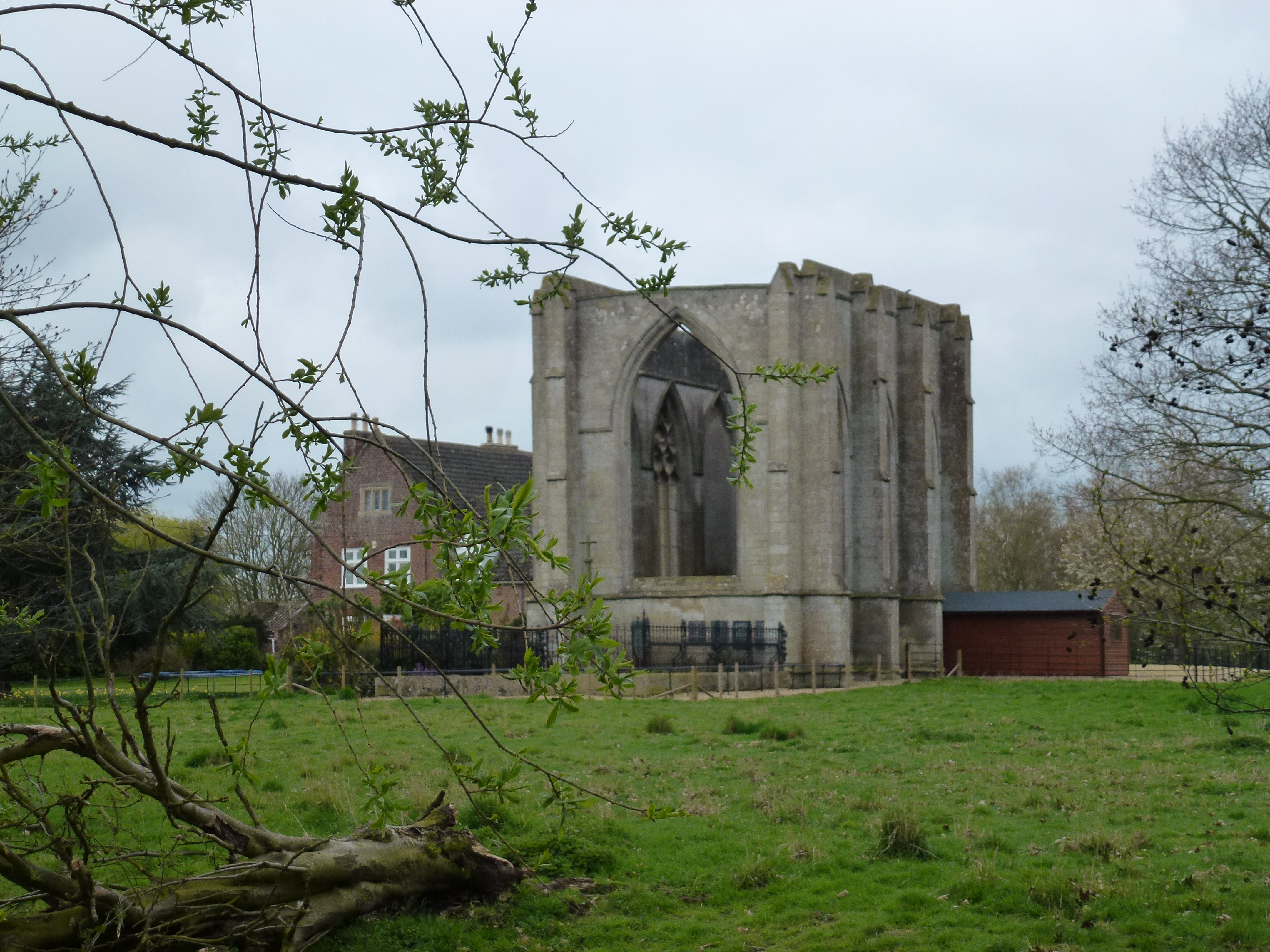
Wykeham, Weston, Lincolnshire

Wykeham /ˈwɪk.əm/ is a deserted medieval village in the civil parish of Weston in the South Holland district of Lincolnshire, England. Wykeham is the...

Belnie

Belnie is a hamlet in the civil parish of Gosberton, Lincolnshire, England. == References ==
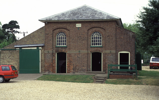
Pinchbeck Engine

The Pinchbeck Engine is a drainage engine, a rotative beam engine built in 1833 to drain Pinchbeck Marsh, to the north of Spalding, Lincolnshire, in England...

Gosberton

Gosberton is a village and civil parish in the South Holland district of Lincolnshire, England. It is situated 9 miles (14.5 km) south-west of Boston,...

Spalding Power Station

Spalding Power Station is a 860 MW gas-fired power station one mile north of Spalding on West Marsh Road close to the River Welland. The current site provides...

Pinchbeck, Lincolnshire

Pinchbeck is a village and civil parish in the South Holland district of Lincolnshire, England. The civil parish population was 5,153 at the 2001 census...

Nearby Amenities

Located within 500m of 52.836649,-0.11762393
Hill Marsh
Place: locality
Source: Bing
Lat/Long: 52.8365323/-0.1184259
Generator Method: photovoltaic
Generator Output Electricity: yes
Generator Source: solar
Generator Type: solar_photovoltaic_panel
Location: roof
Power: generator
Lat/Long: 52.840559/-0.1177852
Generator Method: photovoltaic
Generator Output Electricity: yes
Generator Source: solar
Generator Type: solar_photovoltaic_panel
Location: roof
Power: generator
Lat/Long: 52.8407599/-0.1159801
The data included in this document is from www.openstreetmap.org. The data is made available under ODbL.

Have you been to Hill Marsh?

Leave your review of Hill Marsh below (or comments, questions and feedback).