Whitton Scalp

Coastal Marsh, Saltings in Lincolnshire

England

Whitton Scalp

On path between Alkborough & Whitton & the upper reaches of the River Humber
On path between Alkborough & Whitton & the upper reaches of the River Humber Credit: Colin Park

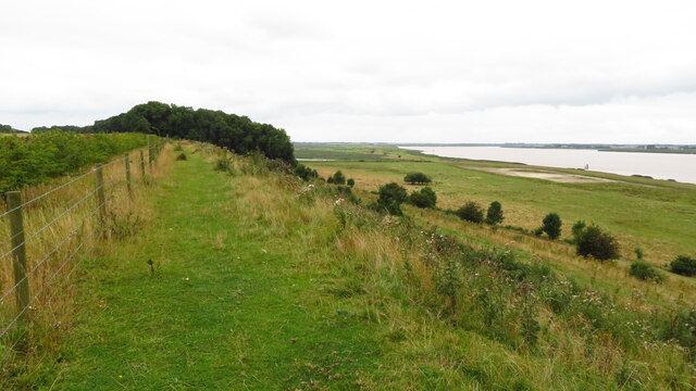
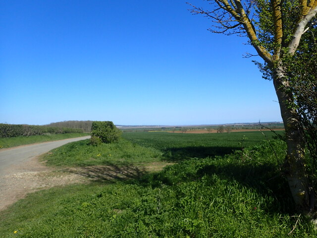
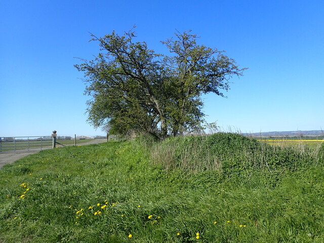
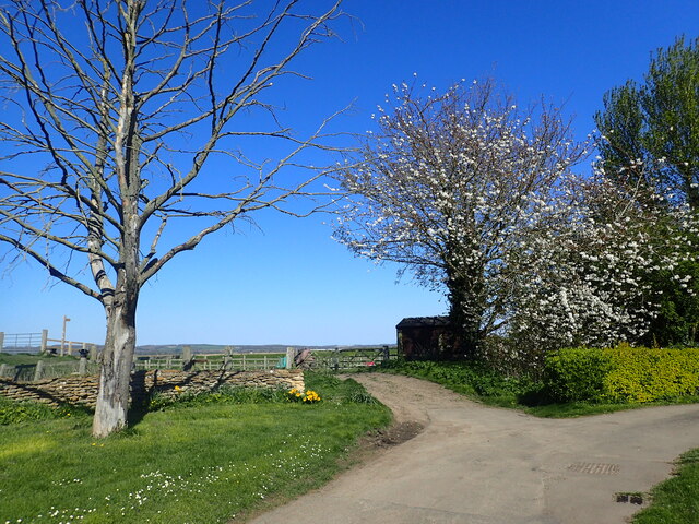
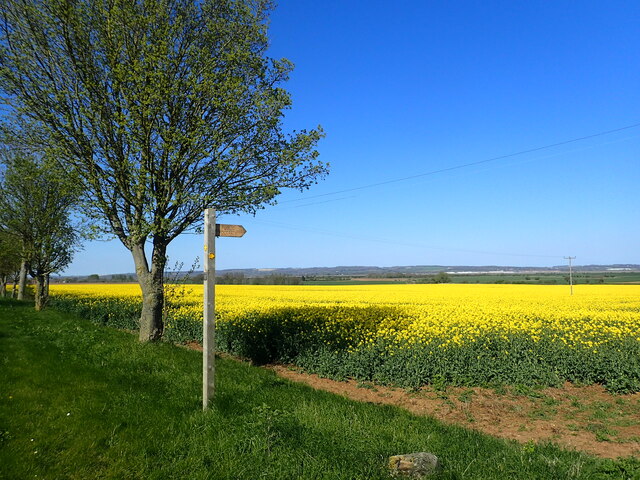
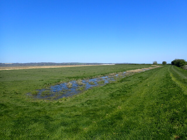
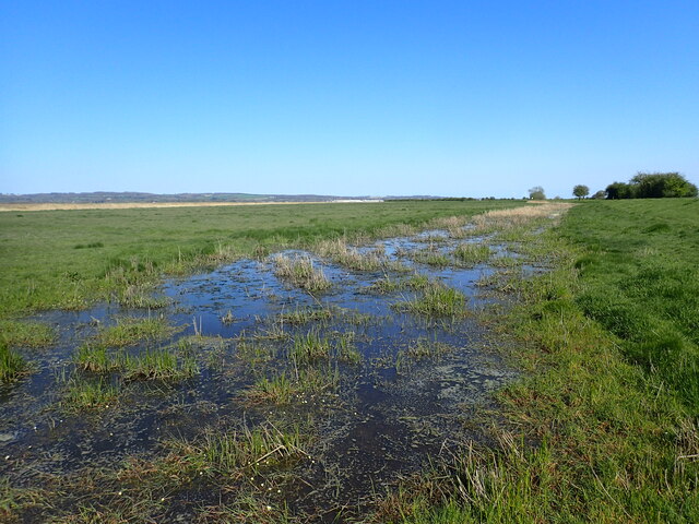
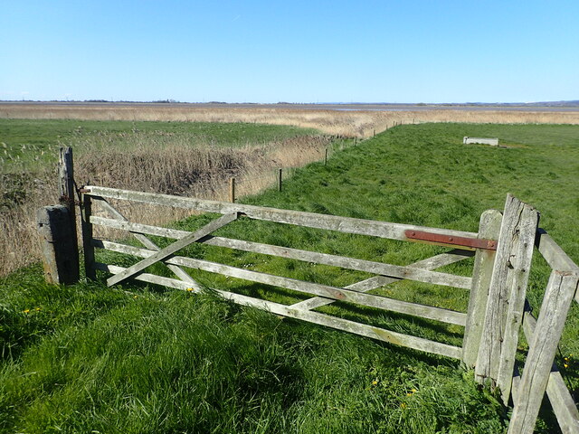
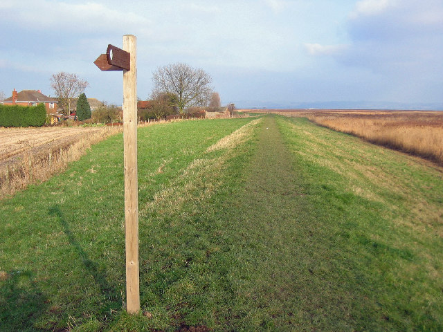
Whitton Scalp is a coastal marsh and saltings located in Lincolnshire, England. It is situated on the eastern coast of the country, overlooking the North Sea. The area is characterized by its vast expanse of salt marshes, mudflats, and sand dunes, making it an important habitat for various plant and animal species.

The marshland at Whitton Scalp is primarily composed of salt-tolerant vegetation such as samphire, sea lavender, and cordgrass. These plants play a crucial role in stabilizing the marshes and providing food and shelter for a diverse range of wildlife. The site is particularly renowned for its avian population, attracting numerous bird species throughout the year, including migratory birds that use the area as a stopover during their long journeys.

The marshes and mudflats of Whitton Scalp are also significant in terms of their ecological function. They act as natural buffers, protecting the coastline from erosion and storm surges. The constant ebb and flow of tides contribute to the formation of unique habitats and create a dynamic environment that supports a wide array of marine life.

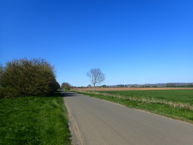
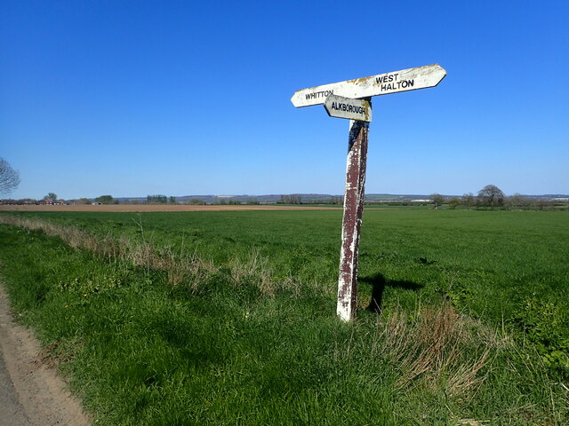
Whitton Scalp is a popular destination for nature enthusiasts and birdwatchers alike. Visitors can explore the area by following the designated footpaths and trails that provide access to the diverse habitats and scenic views. The site also offers opportunities for outdoor activities such as hiking, photography, and wildlife observation.

Overall, Whitton Scalp in Lincolnshire is a remarkable coastal marsh and saltings that showcases the beauty and importance of these unique ecosystems. It serves as a haven for numerous plant and animal species, while also providing valuable ecological services to the surrounding coastal environment.

If you have any feedback on the listing, please let us know in the comments section below.

Whitton Scalp Images

Images are sourced within 2km of 53.709089/-0.64308229 or Grid Reference SE8924. Thanks to Geograph Open Source API. All images are credited.

On path between Alkborough & Whitton & the upper reaches of the River Humber
Whitton Road This is north of Alkborough and heading towards the River Humber.
Whitton Road
This is north of Alkborough and heading towards the River Humber.
Ancient boundary This appears to be an ancient boundary feature and is in the form of a ditch and bank.
Ancient boundary
This appears to be an ancient boundary feature and is in the form of a ditch and bank.
Whitton Road This is north of Alkborough and heading towards the River Humber.
Whitton Road
This is north of Alkborough and heading towards the River Humber.
Looking along Whitton Road The Yorkshire Wolds are on the horizon, slightly left of centre.
Looking along Whitton Road
The Yorkshire Wolds are on the horizon, slightly left of centre.
Ancient boundary This appears to be an ancient boundary feature and is in the form of a ditch and bank. It continues on the opposite side of Whitton Road as seen at <a title="www.geograph.org.uk/photo/7468490" href="https://www.geograph.org.uk/photo/7468490">Link</a>
Ancient boundary
This appears to be an ancient boundary feature and is in the form of a ditch and bank. It continues on the opposite side of Whitton Road as seen at Link
Whitton - Church of St John the Baptist
Whitton Road The road from West Halton to Whitton is dead straight. Whitton can be seen in the distance.
Whitton Road
The road from West Halton to Whitton is dead straight. Whitton can be seen in the distance.
The entrance to Humber View Farm The farm is to the right and the view is from the bank on the far left.
The entrance to Humber View Farm
The farm is to the right and the view is from the bank on the far left.
View from Whitton Road The footpath leads past Bishopthorpe to Winteringham. The Yorkshire Wolds can be seen in the distance beyond the River Humber.
View from Whitton Road
The footpath leads past Bishopthorpe to Winteringham. The Yorkshire Wolds can be seen in the distance beyond the River Humber.
Signpost on Whitton Road The road from West Halton to Whitton is dead straight as seen at <a title="www.geograph.org.uk/photo/7468494" href="https://www.geograph.org.uk/photo/7468494">Link</a>  The Yorkshire Wolds can be seen in the far distance.
Signpost on Whitton Road
The road from West Halton to Whitton is dead straight as seen at Link The Yorkshire Wolds can be seen in the far distance.
The flood plain of the River Humber This is near Humber View Farm at Whitton. The Yorkshire Wolds can be seen on the left on the far side of the River Humber.
The flood plain of the River Humber
This is near Humber View Farm at Whitton. The Yorkshire Wolds can be seen on the left on the far side of the River Humber.
Looking towards the River Humber This is near Humber View Farm at Whitton.
Looking towards the River Humber
This is near Humber View Farm at Whitton.
St John's Church, Whitton St John's Church is well placed above the river Humber at the end of the road. It has a Norman west tower but the nave and chancel date from the 1890s.
St John's Church, Whitton
St John's Church is well placed above the river Humber at the end of the road. It has a Norman west tower but the nave and chancel date from the 1890s.
The interior of St John's Church, Whitton St John's Church is well placed above the river Humber at the end of the road. It has a Norman west tower but the nave and chancel date from the 1890s. For the view outside see <a title="www.geograph.org.uk/photo/7474998" href="https://www.geograph.org.uk/photo/7474998">Link</a>
The interior of St John's Church, Whitton
St John's Church is well placed above the river Humber at the end of the road. It has a Norman west tower but the nave and chancel date from the 1890s. For the view outside see Link
Show me another place!

Whitton Scalp is located at Grid Ref: SE8924 (Lat: 53.709089, Lng: -0.64308229)

Unitary Authority: North Lincolnshire

Police Authority: Humberside

What 3 Words

///adjuster.bets.splits. Near Whitton, Lincolnshire

Related Wikis

Whitton railway station (Lincolnshire)

Whitton railway station was a railway station, built by the North Lindsey Light Railway in Whitton, Lincolnshire. It was the northern terminus of the line...

Whitton, Lincolnshire

Whitton is a village and civil parish in North Lincolnshire, England. The 2011 census found 212 inhabitants, in 92 households. It is situated at the northern...

Whitton Island

Whitton Island is an island situated at the western end of the Humber Estuary in northern England. The almond-shaped island straddles the county boundary...
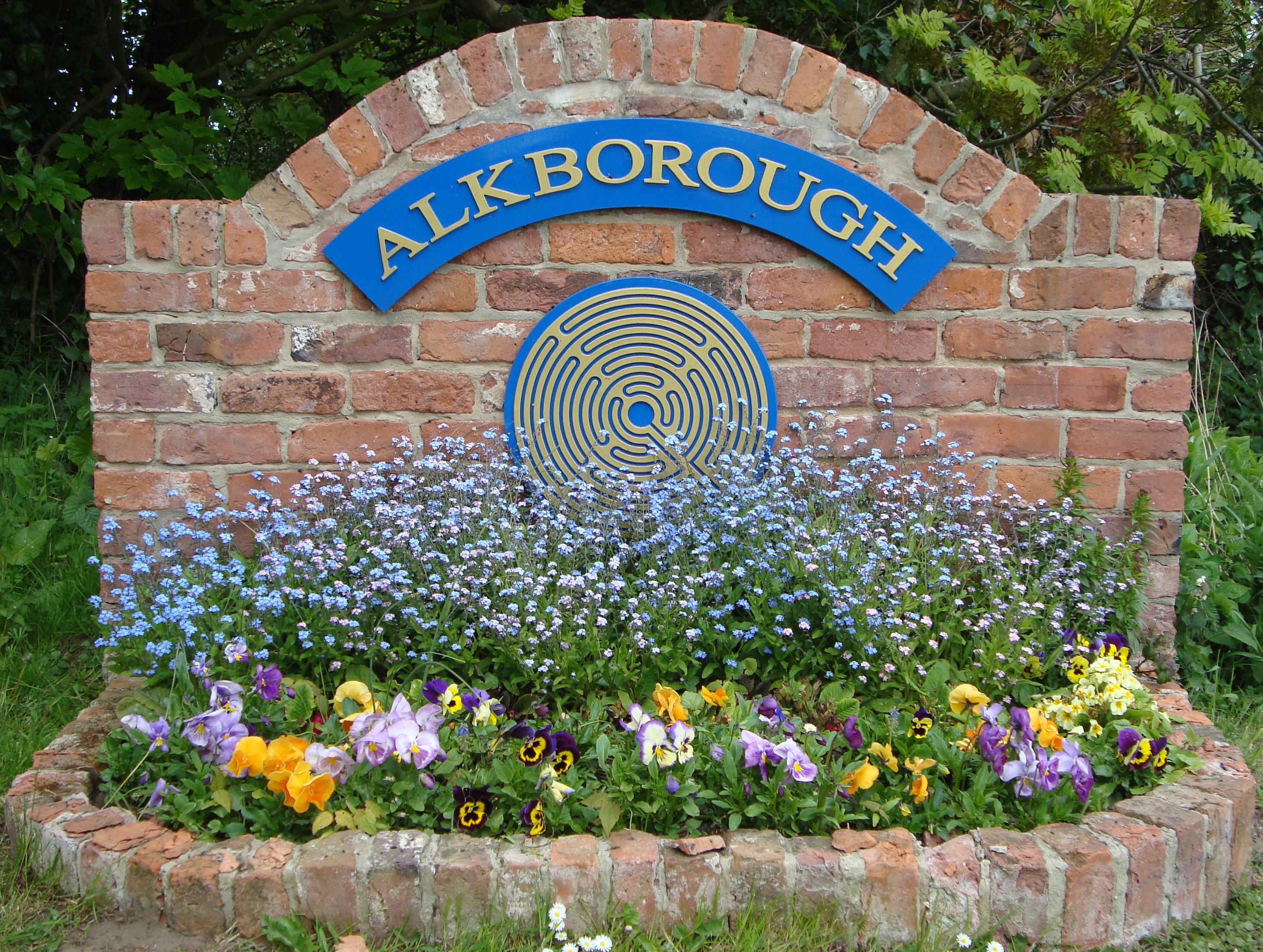
Alkborough

Alkborough is a parish of 471 people in 192 households (2021 census) in North Lincolnshire, England, located near the northern end of The Cliff range of...

Broomfleet

Broomfleet is a village and civil parish in the East Riding of Yorkshire, England. It is situated on the Humber Estuary approximately 4 miles (6 km) west...

Julian's Bower

Julian's Bower or Julian Bower is a name given to turf mazes in several different parts of England. Only one of this name still exists, at Alkborough in...
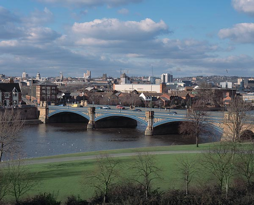
River Trent

The Trent is third in the list of longest rivers in the United Kingdom. Its source is in Staffordshire, on the southern edge of Biddulph Moor. It flows...

Faxfleet

Faxfleet is a hamlet and former civil parish, now in the parish of Blacktoft, in the East Riding of Yorkshire, England. It is situated approximately 6...

Nearby Amenities

Located within 500m of 53.709089,-0.64308229
Whitton
Historic Railway: station
Railway: site
Source: NPE
Wikidata: Q3198886
Wikipedia: en:Whitton railway station
Lat/Long: 53.7099214/-0.6360386
Hiking: yes
Information: guidepost
Tourism: information
Lat/Long: 53.708303/-0.6407475
Barrier: kissing_gate
Foot: yes
Lat/Long: 53.7073073/-0.6466861
Whitton Scalp
Place: locality
Source: Bing
Lat/Long: 53.7088483/-0.6435513
The data included in this document is from www.openstreetmap.org. The data is made available under ODbL.

Have you been to Whitton Scalp?

Leave your review of Whitton Scalp below (or comments, questions and feedback).