Ayre of Galtagarth

Coastal Marsh, Saltings in Shetland

Scotland

Ayre of Galtagarth

Fish farm on the Burn of Arisdale
Fish farm on the Burn of Arisdale Credit: Oliver Dixon

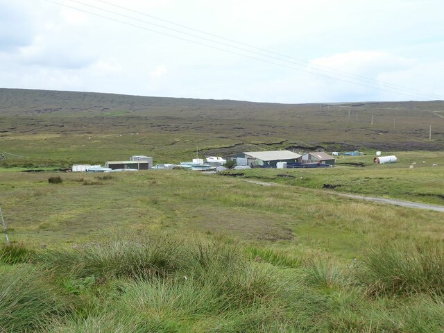
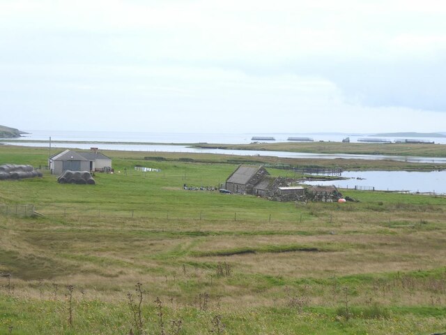
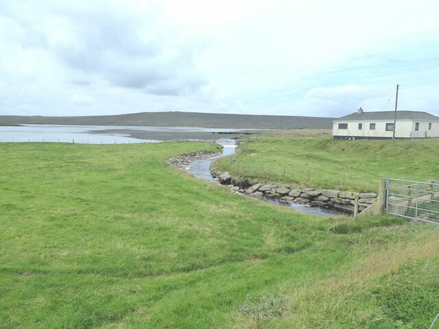
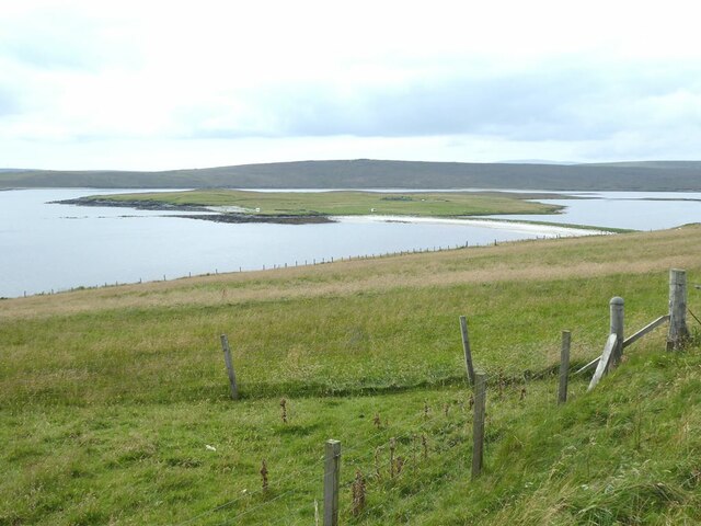
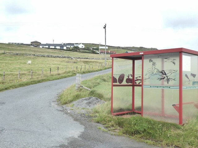
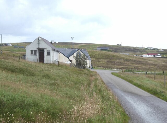
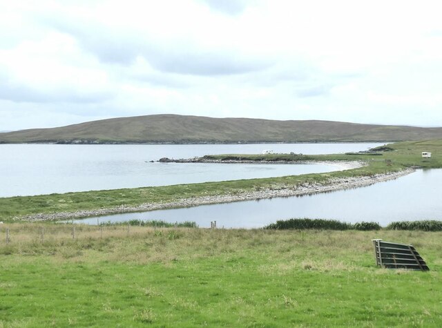
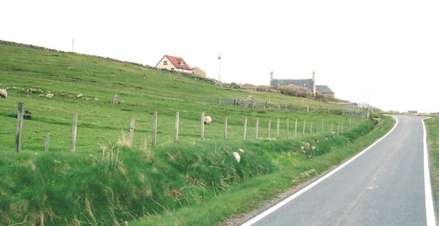
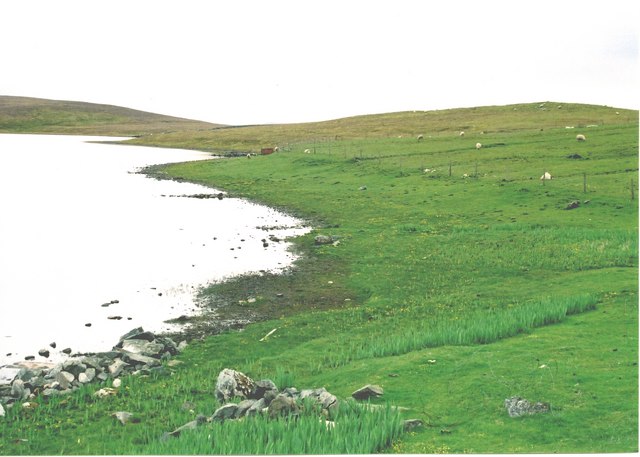
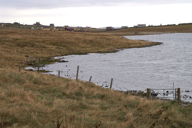
Ayre of Galtagarth is a coastal marsh located in Shetland, an archipelago in Scotland. It is situated near the village of Walls and is known for its unique landscape and ecological significance.

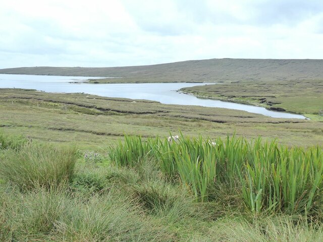
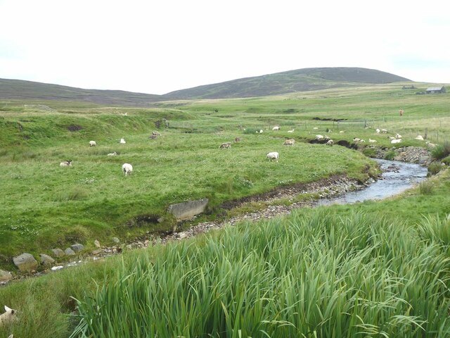
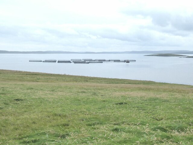
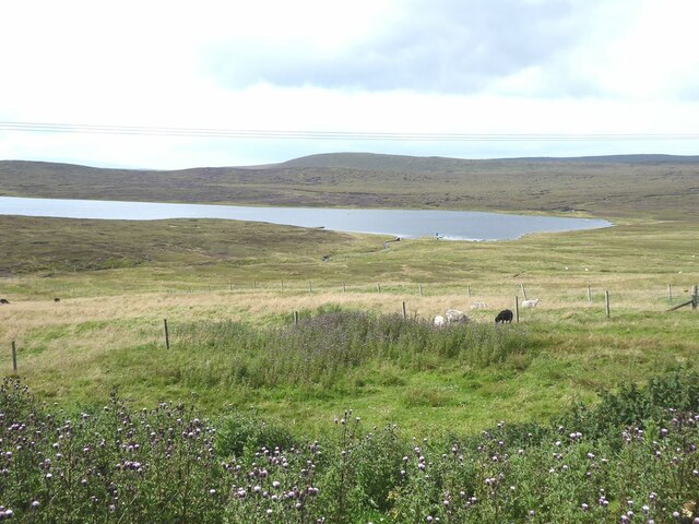
Covering an area of approximately 30 hectares, Ayre of Galtagarth is characterized by its salt marshes and saltings. The site is influenced by the tides and is located in close proximity to the coastline, resulting in a diverse range of habitats that support a variety of plant and animal species.

The salt marshes at Ayre of Galtagarth are composed of tall cord-grass and sea-blight, which thrive in the brackish water environment. These marshes provide important feeding and nesting grounds for numerous bird species, including red-throated divers, terns, and waders. The area is particularly known for its breeding populations of Arctic terns, which migrate here from the Arctic.

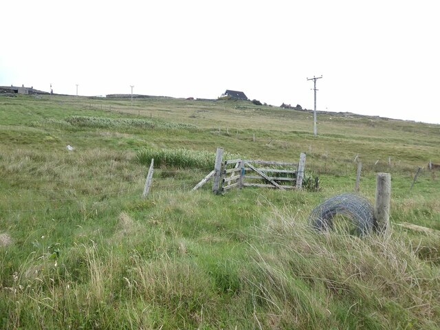
In addition to its avian biodiversity, Ayre of Galtagarth also supports a diverse range of plant species. The salt-tolerant vegetation includes sea aster, sea plantain, and sea pink, which add color and vibrancy to the marshes. These plants play a crucial role in stabilizing the soil and preventing erosion.

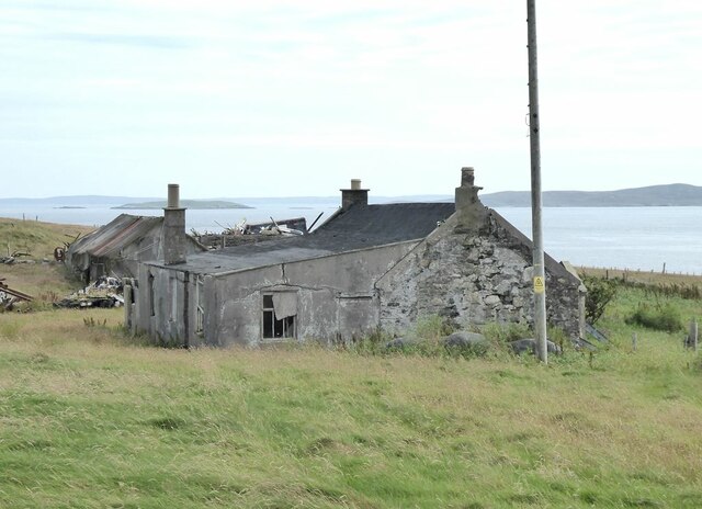
Due to its ecological importance, Ayre of Galtagarth has been designated as a Site of Special Scientific Interest (SSSI) and is protected under national conservation laws. Visitors to the site can enjoy the peaceful surroundings and observe the rich wildlife that thrives in this unique coastal environment.

If you have any feedback on the listing, please let us know in the comments section below.

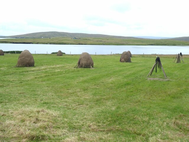
Ayre of Galtagarth Images

Images are sourced within 2km of 60.499264/-1.0937091 or Grid Reference HU4979. Thanks to Geograph Open Source API. All images are credited.

Fish farm on the Burn of Arisdale
Mouth of the Burn of Arisdale At high tide.
Mouth of the Burn of Arisdale
At high tide.
Loch of Galtagarth Arm of the sea cut off at low tide by tidal flats at this end, and by a causeway at the far end. Fish farms out in the bay.
Loch of Galtagarth
Arm of the sea cut off at low tide by tidal flats at this end, and by a causeway at the far end. Fish farms out in the bay.
Mouth of the Burn of Hamnavoe
Welcome to Burravoe! Scarecrow beside the road.
Welcome to Burravoe!
Scarecrow beside the road.
The Burn of Hamnavoe
Stooks of hay at Houlland Loch of Galtagarth and Ness of Galtagarth <a href="https://www.geograph.org.uk/gridref/HU4979">HU4979</a> beyond, with Ness of Copister <a href="https://www.geograph.org.uk/gridref/HU4978">HU4978</a> on the skyline.
Stooks of hay at Houlland
Loch of Galtagarth and Ness of Galtagarth HU4979 beyond, with Ness of Copister HU4978 on the skyline.
Pasture at Houlland The Ness of Galtagarth <a href="https://www.geograph.org.uk/gridref/HU4979">HU4979</a> in the middle distance, connected to the mainland by causeway. The enclosed water to the right is the Loch of Galtagarth.
Pasture at Houlland
The Ness of Galtagarth HU4979 in the middle distance, connected to the mainland by causeway. The enclosed water to the right is the Loch of Galtagarth.
Fish farm Off the south coast of the Isle of Yell. The island of Orfosay <a href="https://www.geograph.org.uk/gridref/HU4977">HU4977</a> to the right. Shetland Mainland in the distance.
Fish farm
Off the south coast of the Isle of Yell. The island of Orfosay HU4977 to the right. Shetland Mainland in the distance.
Decorated bus shelter for Houlland The Shetlanders make a great thing of their bus shelters.
Decorated bus shelter for Houlland
The Shetlanders make a great thing of their bus shelters.
Derelict farm buildings at Burraness
Hillside at Houlland
Houses at Kettlester
Loch of Kettlester
Loch of Kettlester
Galtagarth causeway Linking the Ness of Galtagarth to the mainland. The Loch of Galtagarth to the right. The Ness of Copister <a href="https://www.geograph.org.uk/gridref/HU4878">HU4878</a> beyond.
Galtagarth causeway
Linking the Ness of Galtagarth to the mainland. The Loch of Galtagarth to the right. The Ness of Copister HU4878 beyond.
Kettlester Scattered houses beside the B9081
Kettlester
Scattered houses beside the B9081
Houlland Sheep graze by the shore of the Loch of Littlester
Houlland
Sheep graze by the shore of the Loch of Littlester
Loch of Littlester The houses of Burravoe are on the horizon.
Loch of Littlester
The houses of Burravoe are on the horizon.
Show me another place!

Ayre of Galtagarth is located at Grid Ref: HU4979 (Lat: 60.499264, Lng: -1.0937091)

Unitary Authority: Shetland Islands

Police Authority: Highlands and Islands

What 3 Words

///hindered.wriggle.truckload. Near Ulsta, Shetland Islands

Related Wikis

Copister

Copister is a village in Yell. It is a former centre for haaf fishing, and has a shingle beach. == References == Blackadder, Jill Slee (2003). Shetland...

Old Haa Museum

The Old Haa of Brough in located in Burravoe, Yell, Shetland, Scotland. Built for Robert Tyrie, a merchant, in 1672, houses the local museum for Burravoe...

Burravoe

Burravoe is a community on the north shore of Burra Voe, in the south-east part of the island of Yell in the Shetland Islands, Scotland. The name Burravoe...

Orfasay

Orfasay (Old Norse: Orfyrisey, meaning "tidal island") is one of the Shetland Islands. == Geography == Orfasay is a tidal island in Yell Sound, connected...

Nearby Amenities

Located within 500m of 60.499264,-1.0937091
Passing Place
Lat/Long: 60.5030914/-1.0983786
Power: pole
Lat/Long: 60.4988335/-1.0848079
Power: pole
Lat/Long: 60.4992244/-1.0859022
Passing Place
Lat/Long: 60.5014952/-1.0867567
Power: pole
Lat/Long: 60.5032555/-1.0973159
Power: pole
Lat/Long: 60.5028659/-1.0962001
Power: pole
Lat/Long: 60.5025357/-1.0952881
Power: pole
Lat/Long: 60.4996725/-1.0871932
Passing Place
Lat/Long: 60.4996416/-1.0879946
Power: pole
Lat/Long: 60.5000704/-1.0883076
Power: pole
Lat/Long: 60.5003953/-1.0892223
Power: pole
Lat/Long: 60.500711/-1.0901101
Power: pole
Lat/Long: 60.5010187/-1.0910006
Power: pole
Lat/Long: 60.5014506/-1.0922263
Power: pole
Lat/Long: 60.5018785/-1.0934306
Power: pole
Lat/Long: 60.5016149/-1.0935435
Power: pole
Lat/Long: 60.5022151/-1.0943831
Power: pole
Lat/Long: 60.5026146/-1.0931446
Power: pole
Lat/Long: 60.5017772/-1.0872553
Power: pole
Lat/Long: 60.5014834/-1.0880476
Power: pole
Lat/Long: 60.5011266/-1.0890054
Power: pole
Lat/Long: 60.503355/-1.0928892
Power: pole
Lat/Long: 60.5012476/-1.093689
The data included in this document is from www.openstreetmap.org. The data is made available under ODbL.

Have you been to Ayre of Galtagarth?

Leave your review of Ayre of Galtagarth below (or comments, questions and feedback).