Linwood Bog

Coastal Marsh, Saltings in Hampshire New Forest

England

Linwood Bog

Track past Forest View Farm
Track past Forest View Farm Credit: David Martin

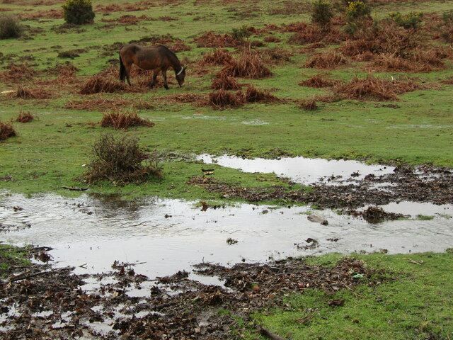
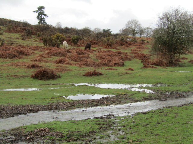
Linwood Bog, located in Hampshire, is a coastal marshland known for its unique ecosystem and diverse plant and animal species. Situated along the Hampshire coast, it is a designated Site of Special Scientific Interest (SSSI) due to its ecological significance.

The bog is characterized by its wet and marshy conditions, which are created by a combination of tidal action and freshwater runoff from surrounding areas. This creates a highly fertile environment, supporting a rich variety of plant life. Linwood Bog is particularly famous for its extensive salt marshes and saltings, which are home to several rare and protected plant species.

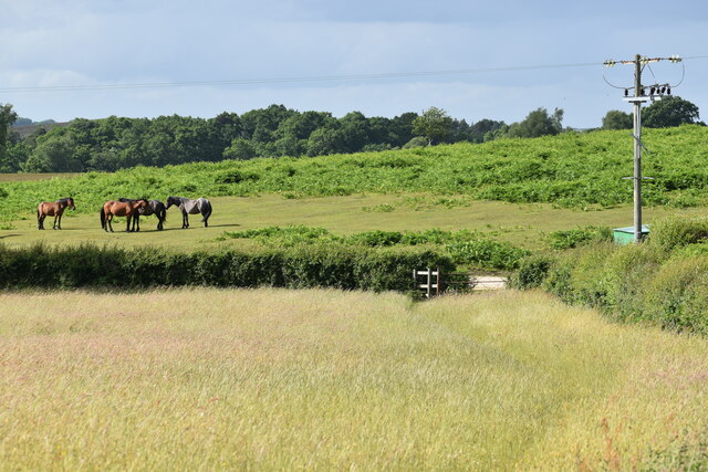
The bog's vegetation includes a range of salt-tolerant plants such as samphire, sea lavender, and glasswort, which thrive in the saline conditions. These plants provide vital habitat and food sources for a diverse array of bird species, making Linwood Bog a popular spot for birdwatching enthusiasts. Common sightings include wading birds like curlews, redshanks, and oystercatchers.

In addition to its botanical and avian importance, Linwood Bog also supports various small mammals and reptiles. It is home to several species of amphibians, including the rare natterjack toad, which is a protected species in the UK.

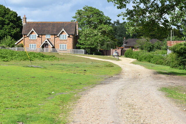
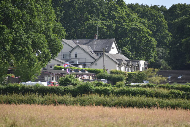
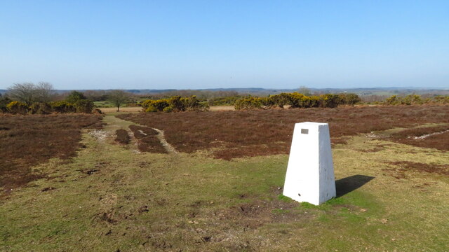
Visitors to Linwood Bog can explore its well-maintained footpaths and enjoy the tranquil surroundings. The site offers picturesque views of the coastal marshes, providing an excellent opportunity to appreciate the beauty of this unique and ecologically significant area.

If you have any feedback on the listing, please let us know in the comments section below.

Linwood Bog Images

Images are sourced within 2km of 50.888822/-1.7453678 or Grid Reference SU1809. Thanks to Geograph Open Source API. All images are credited.

Track past Forest View Farm
The Red Shoot pub and campsite
Field edge at Linwood The ponies are grazing on an area of access land known as Black Heath.
Field edge at Linwood
The ponies are grazing on an area of access land known as Black Heath.
Trig Point at Whitefield Plantation, Mockbeggar
Appleslade Bottom New Forest ponies grazing on a valley floor by Linwood.
<span class="nowrap"><a title="www.newforestnpa.gov.uk" rel="nofollow ugc noopener" href="http://www.newforestnpa.gov.uk">Link</a><img style="margin-left:2px;" alt="External link" title="External link - shift click to open in new window" src="https://s1.geograph.org.uk/img/external.png" width="10" height="10"/></span>
Appleslade Bottom
New Forest ponies grazing on a valley floor by Linwood. LinkExternal link
Appleslade Bottom New Forest ponies on a boggy valley bottom by Linwood.
<span class="nowrap"><a title="www.newforestnpa.gov.uk" rel="nofollow ugc noopener" href="http://www.newforestnpa.gov.uk">Link</a><img style="margin-left:2px;" alt="External link" title="External link - shift click to open in new window" src="https://s1.geograph.org.uk/img/external.png" width="10" height="10"/></span>
Appleslade Bottom
New Forest ponies on a boggy valley bottom by Linwood. LinkExternal link
Flooding Ibsley
Flooding Ibsley
Discovering RAF Ibsley: Communal site No. 1 (1) Located in the hamlet of Ibsley itself, this appears to have been the largest of the two communal sites, although compared to the other at South Gorley, little of it remains today apart from the platforms of several different buildings seen here in this view, together with several blast shelters for personnel. The site plan lists a tailors, barbers, and a shoemakers shop, a grocery and local produce store, a gymnasium, an airmens dining room, accommodation and ablutions, sergeants and officers messes and their ablutions, medical centre, and many other facilities too numerous to mention. 

Google Earth view:
<span class="nowrap"><a title="https://www.google.co.uk/maps/@50.8871481,-1.7703613,199m/data=!3m1!1e3" rel="nofollow ugc noopener" href="https://www.google.co.uk/maps/@50.8871481,-1.7703613,199m/data=!3m1!1e3">Link</a><img style="margin-left:2px;" alt="External link" title="External link - shift click to open in new window" src="https://s1.geograph.org.uk/img/external.png" width="10" height="10"/></span>

<a href="https://www.geograph.org.uk/photo/4704167">SU1609 : Discovering RAF Ibsley: Communal site No. 1 (2)</a>
Discovering RAF Ibsley: Communal site No. 1 (1)
Located in the hamlet of Ibsley itself, this appears to have been the largest of the two communal sites, although compared to the other at South Gorley, little of it remains today apart from the platforms of several different buildings seen here in this view, together with several blast shelters for personnel. The site plan lists a tailors, barbers, and a shoemakers shop, a grocery and local produce store, a gymnasium, an airmens dining room, accommodation and ablutions, sergeants and officers messes and their ablutions, medical centre, and many other facilities too numerous to mention. Google Earth view: LinkExternal link SU1609 : Discovering RAF Ibsley: Communal site No. 1 (2)
Discovering RAF Ibsley: Communal site No. 1 (2) The entrance to one of three blast shelters located around the site, these are not enclosed but are simply rectangular brick built structures within which are a series of doglegged walls with earth banked up around them.

<a href="https://www.geograph.org.uk/photo/4704176">SU1609 : Discovering RAF Ibsley: Communal site No. 1 (3)</a>
Discovering RAF Ibsley: Communal site No. 1 (2)
The entrance to one of three blast shelters located around the site, these are not enclosed but are simply rectangular brick built structures within which are a series of doglegged walls with earth banked up around them. SU1609 : Discovering RAF Ibsley: Communal site No. 1 (3)
Discovering RAF Ibsley: Communal site No. 1 (3) A view inside one of the blast shelters looking down into the interior showing the doglegged construction of the walls.

<a href="https://www.geograph.org.uk/photo/4704181">SU1609 : Discovering RAF Ibsley: Communal site No. 1 (4)</a>
Discovering RAF Ibsley: Communal site No. 1 (3)
A view inside one of the blast shelters looking down into the interior showing the doglegged construction of the walls. SU1609 : Discovering RAF Ibsley: Communal site No. 1 (4)
Discovering RAF Ibsley: Communal site No. 1 (4) The brick built platform of an unknown small building.

<a href="https://www.geograph.org.uk/photo/4704242">SU1610 : Discovering RAF Ibsley: Communal site No. 2 (1)</a>
Discovering RAF Ibsley: Communal site No. 1 (4)
The brick built platform of an unknown small building. SU1610 : Discovering RAF Ibsley: Communal site No. 2 (1)
Discovering RAF Ibsley: Quarters site No. 10 This was a remote site on Summerlug Hill, with little visible beyond the barbed wire apart from this Stanton air raid shelter. It was a defence site probably providing accommodation for air defence personnel, with barrack huts, a latrine, drying room, and a small arms ammunition store.

<a href="https://www.geograph.org.uk/photo/4704344">SU1609 : Discovering RAF Ibsley: Crossley Towers</a>
Discovering RAF Ibsley: Quarters site No. 10
This was a remote site on Summerlug Hill, with little visible beyond the barbed wire apart from this Stanton air raid shelter. It was a defence site probably providing accommodation for air defence personnel, with barrack huts, a latrine, drying room, and a small arms ammunition store. SU1609 : Discovering RAF Ibsley: Crossley Towers
Discovering RAF Ibsley: Crossley Towers Crossley Towers, formerly called Mockbeggar Slade lies below Summerlug Hill. It was one of a number of requisitioned houses, and became an officers mess, and later, WAAF accommodation. It was renamed Crossley Towers after 32 Squadron CO Sqdn Ldr Michael N Crossley, DSO, DFC., and the name which it is still known by today.

<a href="https://www.geograph.org.uk/photo/4704351">SU1609 : Discovering RAF Ibsley: Crossley Towers, Nissen hut</a>
Discovering RAF Ibsley: Crossley Towers
Crossley Towers, formerly called Mockbeggar Slade lies below Summerlug Hill. It was one of a number of requisitioned houses, and became an officers mess, and later, WAAF accommodation. It was renamed Crossley Towers after 32 Squadron CO Sqdn Ldr Michael N Crossley, DSO, DFC., and the name which it is still known by today. SU1609 : Discovering RAF Ibsley: Crossley Towers, Nissen hut
Discovering RAF Ibsley: Crossley Towers, Nissen hut The foundations of a Nissen hut close to Crossley Towers, purpose unknown.

<a href="https://www.geograph.org.uk/photo/4704366">SU1608 : Discovering RAF Ibsley: Quarters site - Newlands Plantation</a>
Discovering RAF Ibsley: Crossley Towers, Nissen hut
The foundations of a Nissen hut close to Crossley Towers, purpose unknown. SU1608 : Discovering RAF Ibsley: Quarters site - Newlands Plantation
Discovering RAF Ibsley: Battle Command Headquarters (1) -
Airfield Battle Headquarters: DoB ID: S0007964

Most WWII airfields had these, a Battle Command Headquarters, a protected bunker from where operations could be coordinated in the event that the airfield was under attack and overrun by ground forces. RAF Ibsley's BCHQ is located on a hill in woodland in Newlands Plantation that during the war would have been denuded of trees, giving a clear view of the airfield and surrounding countryside. 

This mostly subterranean structure was built of brick and reinforced concrete, the twin observation cupolas being the only part of it above ground. Below are several interlinking rooms leading off from the entrance passageway, the main room being for the Defence Officer, another a telephone exchange or PBX, a room for messengers and runners, and a closet with a chemical toilet (Elsan). Steps lead up to each observation cupola where a restricted view of the outside world could be obtained through the slit openings; these openings are lined with corrugated metal designed to deflect shrapnel. This Battle HQ is most unusual as it has not one but two observation cupolas, the interior of the one nearest the entrance being much narrower than normal, whilst the one furthest away is of a standard size with an emergency escape hatch. 

RAF Ibsley Battle HQ Layout: <span class="nowrap"><a title="https://media.geograph.org.uk/files/7eabe3a1649ffa2b3ff8c02ebfd5659f/BHQIbsley-original.jpg" rel="nofollow ugc noopener" href="https://media.geograph.org.uk/files/7eabe3a1649ffa2b3ff8c02ebfd5659f/BHQIbsley-original.jpg">Link</a><img style="margin-left:2px;" alt="External link" title="External link - shift click to open in new window" src="https://s1.geograph.org.uk/img/external.png" width="10" height="10"/></span>

<a href="https://www.geograph.org.uk/photo/4704754">SU1608 : Discovering RAF Ibsley: Battle Command Headquarters (2)</a>
Discovering RAF Ibsley: Battle Command Headquarters (1)
- Airfield Battle Headquarters: DoB ID: S0007964 Most WWII airfields had these, a Battle Command Headquarters, a protected bunker from where operations could be coordinated in the event that the airfield was under attack and overrun by ground forces. RAF Ibsley's BCHQ is located on a hill in woodland in Newlands Plantation that during the war would have been denuded of trees, giving a clear view of the airfield and surrounding countryside. This mostly subterranean structure was built of brick and reinforced concrete, the twin observation cupolas being the only part of it above ground. Below are several interlinking rooms leading off from the entrance passageway, the main room being for the Defence Officer, another a telephone exchange or PBX, a room for messengers and runners, and a closet with a chemical toilet (Elsan). Steps lead up to each observation cupola where a restricted view of the outside world could be obtained through the slit openings; these openings are lined with corrugated metal designed to deflect shrapnel. This Battle HQ is most unusual as it has not one but two observation cupolas, the interior of the one nearest the entrance being much narrower than normal, whilst the one furthest away is of a standard size with an emergency escape hatch. RAF Ibsley Battle HQ Layout: LinkExternal link SU1608 : Discovering RAF Ibsley: Battle Command Headquarters (2)
Discovering RAF Ibsley: Battle Command Headquarters (2) -
Airfield Battle Headquarters: DoB ID: S0007964

The entrance.

<a href="https://www.geograph.org.uk/photo/4704763">SU1608 : Discovering RAF Ibsley: Battle Command Headquarters (3)</a>
Discovering RAF Ibsley: Battle Command Headquarters (2)
- Airfield Battle Headquarters: DoB ID: S0007964 The entrance. SU1608 : Discovering RAF Ibsley: Battle Command Headquarters (3)
Discovering RAF Ibsley: Battle Command Headquarters (3) -
Airfield Battle Headquarters: DoB ID: S0007964

The emergency escape hatch for the bunker is located next to this cupola.

<a href="https://www.geograph.org.uk/photo/4704793">SU1608 : Discovering RAF Ibsley: Battle Command Headquarters (4)</a>
Discovering RAF Ibsley: Battle Command Headquarters (3)
- Airfield Battle Headquarters: DoB ID: S0007964 The emergency escape hatch for the bunker is located next to this cupola. SU1608 : Discovering RAF Ibsley: Battle Command Headquarters (4)
Discovering RAF Ibsley: Battle Command Headquarters (4) -
Airfield Battle Headquarters: DoB ID: S0007964

The east side cupola has observation slits on three sides only, whereas those of the west side cupola are on all four sides.

<a href="https://www.geograph.org.uk/photo/4704801">SU1608 : Discovering RAF Ibsley: Battle Command Headquarters (5)</a>
Discovering RAF Ibsley: Battle Command Headquarters (4)
- Airfield Battle Headquarters: DoB ID: S0007964 The east side cupola has observation slits on three sides only, whereas those of the west side cupola are on all four sides. SU1608 : Discovering RAF Ibsley: Battle Command Headquarters (5)
Show me another place!

Linwood Bog is located at Grid Ref: SU1809 (Lat: 50.888822, Lng: -1.7453678)

Administrative County: Hampshire

District: New Forest

Police Authority: Hampshire

What 3 Words

///pink.stung.shuttled. Near Fordingbridge, Hampshire

Related Wikis

Linwood, Hampshire

Linwood is a hamlet in the New Forest National Park of Hampshire, England. Its nearest town is Ringwood, which lies approximately 4.2 miles (5.9 km) south...

Ellingham, Harbridge and Ibsley

Ellingham, Harbridge and Ibsley is a civil parish in the west of the English county of Hampshire. The population of the civil parish at the 2011 Census...

Furze Hill

Furze Hill (or Furzehill) is a hamlet situated in the New Forest National Park of Hampshire, England. It is in the civil parish of Ellingham, Harbridge...

South Gorley

South Gorley is a hamlet in the New Forest National Park of Hampshire, England. It is in the civil parish of Ellingham, Harbridge and Ibsley. Its nearest...

Mockbeggar, Hampshire

Mockbeggar is a hamlet in the New Forest National Park of Hampshire, England. Its nearest town is Ringwood, which lies approximately 3 miles (5.6 km) south...

Gorley Lynch

Gorley Lynch is a hamlet in the civil parish of Gorley in the New Forest National Park of Hampshire, England. It is in the civil parish of Hyde. Its nearest...

Gorley Hill

Gorley Hill is the site of a former Iron Age promontory hillfort located in Hampshire in the United Kingdom. The fort once occupied the southwestern corner...

Ringwood and Fordingbridge Rural District

Ringwood and Fordingbridge was a rural district in Hampshire from 1932 to 1974.It was formed by the merger of part of the disbanded Christchurch Rural...

Nearby Amenities

Located within 500m of 50.888822,-1.7453678
Linwood Wildlife Reserve
Access: private
Leisure: nature_reserve
Operator: Hampshire & Isle of Wight Wildlife Trust
Source: OS OpenData StreetView
Lat/Long: 50.8851947/-1.7458382
Ford: yes
Lat/Long: 50.8875474/-1.7404614
Barrier: stile
Lat/Long: 50.8876992/-1.7405711
Barrier: stile
Lat/Long: 50.8857655/-1.7471373
Linwood Bog
Place: locality
Lat/Long: 50.8918929/-1.7404873
Great Bottom
Place: locality
Lat/Long: 50.8894871/-1.7487645
Barrier: stile
Lat/Long: 50.8851873/-1.7465831
The data included in this document is from www.openstreetmap.org. The data is made available under ODbL.

Have you been to Linwood Bog?

Leave your review of Linwood Bog below (or comments, questions and feedback).