Appleslade Bottom

Valley in Hampshire New Forest

England

Appleslade Bottom

Track past Forest View Farm
Track past Forest View Farm Credit: David Martin

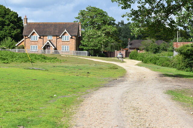
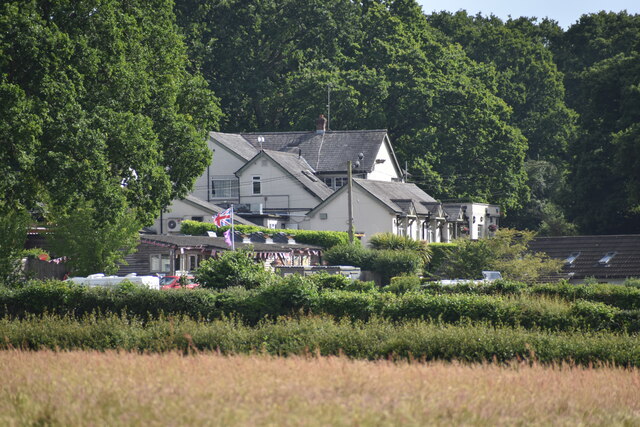
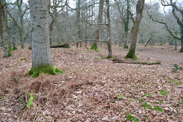
Appleslade Bottom, located in Hampshire, England, is a picturesque valley renowned for its natural beauty and tranquil atmosphere. Nestled in the heart of the South Downs National Park, this hidden gem offers visitors a unique and idyllic experience.

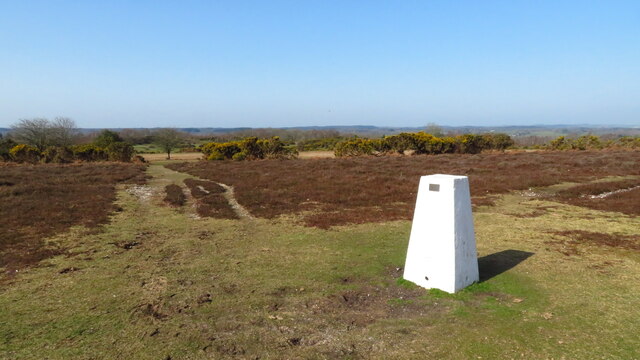
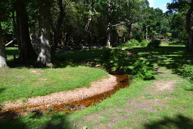
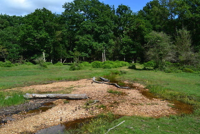
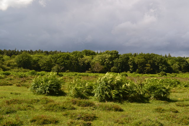
The valley is characterized by its rolling hills and meandering streams, which create a stunning landscape that changes with the seasons. Lush green meadows dotted with wildflowers dominate the area during the spring and summer months, while vibrant autumnal colors paint the valley in hues of gold and red during the fall. In winter, a blanket of snow often covers the valley, creating a postcard-worthy scene.

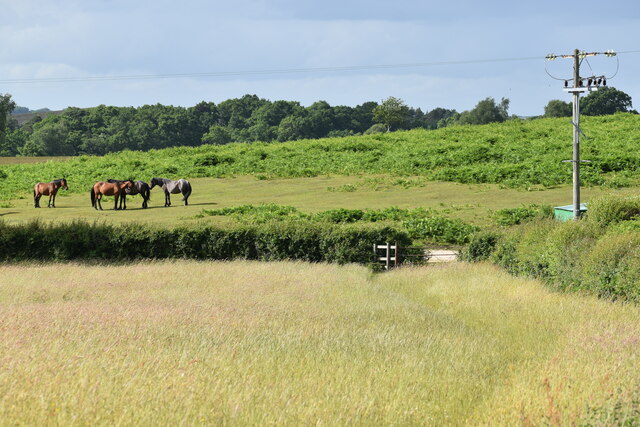
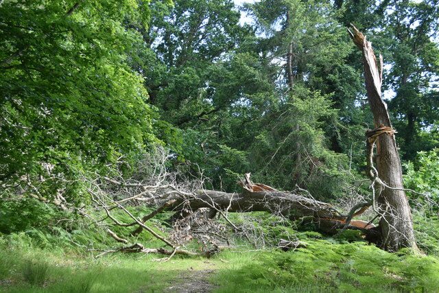
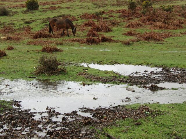
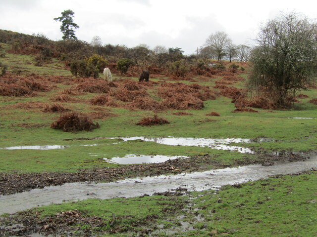
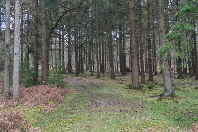
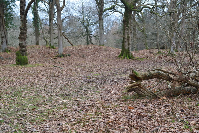
Appleslade Bottom is a haven for wildlife enthusiasts and nature lovers, with a rich diversity of flora and fauna to explore. The valley is home to an array of bird species, including skylarks, buzzards, and kestrels, which can be spotted soaring overhead. The surrounding woodlands teem with life, and visitors may encounter deer, badgers, and foxes during their explorations.

The valley offers several walking trails, allowing visitors to immerse themselves in the natural splendor. Along these paths, you can discover ancient woodlands, babbling brooks, and stunning panoramic views of the surrounding countryside. The tranquility of Appleslade Bottom makes it a popular spot for picnics and leisurely strolls.

With its unspoiled beauty and peaceful ambiance, Appleslade Bottom offers an escape from the hustle and bustle of everyday life. Whether you are an avid nature enthusiast, a photography enthusiast, or simply seeking a serene retreat, this Hampshire valley is a must-visit destination.

If you have any feedback on the listing, please let us know in the comments section below.

Appleslade Bottom Images

Images are sourced within 2km of 50.88301/-1.7401399 or Grid Reference SU1809. Thanks to Geograph Open Source API. All images are credited.

Track past Forest View Farm
The Red Shoot pub and campsite
Field edge at Linwood The ponies are grazing on an area of access land known as Black Heath.
Field edge at Linwood
The ponies are grazing on an area of access land known as Black Heath.
Fallen tree at Castle Piece This large fallen tree is within the embankment of the iron age hillfort at Castle Piece.
Fallen tree at Castle Piece
This large fallen tree is within the embankment of the iron age hillfort at Castle Piece.
Trig Point at Whitefield Plantation, Mockbeggar
Appleslade Bottom New Forest ponies grazing on a valley floor by Linwood.
<span class="nowrap"><a title="www.newforestnpa.gov.uk" rel="nofollow ugc noopener" href="http://www.newforestnpa.gov.uk">Link</a><img style="margin-left:2px;" alt="External link" title="External link - shift click to open in new window" src="https://s1.geograph.org.uk/img/external.png" width="10" height="10"/></span>
Appleslade Bottom
New Forest ponies grazing on a valley floor by Linwood. LinkExternal link
Appleslade Bottom New Forest ponies on a boggy valley bottom by Linwood.
<span class="nowrap"><a title="www.newforestnpa.gov.uk" rel="nofollow ugc noopener" href="http://www.newforestnpa.gov.uk">Link</a><img style="margin-left:2px;" alt="External link" title="External link - shift click to open in new window" src="https://s1.geograph.org.uk/img/external.png" width="10" height="10"/></span>
Appleslade Bottom
New Forest ponies on a boggy valley bottom by Linwood. LinkExternal link
Discovering RAF Ibsley: Quarters site No. 10 This was a remote site on Summerlug Hill, with little visible beyond the barbed wire apart from this Stanton air raid shelter. It was a defence site probably providing accommodation for air defence personnel, with barrack huts, a latrine, drying room, and a small arms ammunition store.

<a href="https://www.geograph.org.uk/photo/4704344">SU1609 : Discovering RAF Ibsley: Crossley Towers</a>
Discovering RAF Ibsley: Quarters site No. 10
This was a remote site on Summerlug Hill, with little visible beyond the barbed wire apart from this Stanton air raid shelter. It was a defence site probably providing accommodation for air defence personnel, with barrack huts, a latrine, drying room, and a small arms ammunition store. SU1609 : Discovering RAF Ibsley: Crossley Towers
Discovering RAF Ibsley: Crossley Towers Crossley Towers, formerly called Mockbeggar Slade lies below Summerlug Hill. It was one of a number of requisitioned houses, and became an officers mess, and later, WAAF accommodation. It was renamed Crossley Towers after 32 Squadron CO Sqdn Ldr Michael N Crossley, DSO, DFC., and the name which it is still known by today.

<a href="https://www.geograph.org.uk/photo/4704351">SU1609 : Discovering RAF Ibsley: Crossley Towers, Nissen hut</a>
Discovering RAF Ibsley: Crossley Towers
Crossley Towers, formerly called Mockbeggar Slade lies below Summerlug Hill. It was one of a number of requisitioned houses, and became an officers mess, and later, WAAF accommodation. It was renamed Crossley Towers after 32 Squadron CO Sqdn Ldr Michael N Crossley, DSO, DFC., and the name which it is still known by today. SU1609 : Discovering RAF Ibsley: Crossley Towers, Nissen hut
Discovering RAF Ibsley: Crossley Towers, Nissen hut The foundations of a Nissen hut close to Crossley Towers, purpose unknown.

<a href="https://www.geograph.org.uk/photo/4704366">SU1608 : Discovering RAF Ibsley: Quarters site - Newlands Plantation</a>
Discovering RAF Ibsley: Crossley Towers, Nissen hut
The foundations of a Nissen hut close to Crossley Towers, purpose unknown. SU1608 : Discovering RAF Ibsley: Quarters site - Newlands Plantation
South Gorley, right of way Private road with right of way, from Newtown Lane skirting common land (to the left).
South Gorley, right of way
Private road with right of way, from Newtown Lane skirting common land (to the left).
Bend in stream on edge of Pinnick Wood
Path fording stream in Linford Bottom
Stormy clouds from Linford Bottom
Road across Rockford Common
Grassy track in the forest, Roe Inclosure
Castle Piece hill fort, Roe Inclosure A fairly complete circular earth embankment, believed to be an iron age hill fort <span class="nowrap"><a title="http://www.megalithic.co.uk/article.php?sid=11605" rel="nofollow ugc noopener" href="http://www.megalithic.co.uk/article.php?sid=11605">Link</a><img style="margin-left:2px;" alt="External link" title="External link - shift click to open in new window" src="https://s1.geograph.org.uk/img/external.png" width="10" height="10"/></span>
Castle Piece hill fort, Roe Inclosure
A fairly complete circular earth embankment, believed to be an iron age hill fort LinkExternal link
Castle Piece hill fort, Roe Inclosure Here, standing on the earth embankment in the centre of <a href="https://www.geograph.org.uk/photo/5279273">SU1908 : Castle Piece hill fort, Roe Inclosure</a>, the outline is much harder to see than from a distance.
Castle Piece hill fort, Roe Inclosure
Here, standing on the earth embankment in the centre of SU1908 : Castle Piece hill fort, Roe Inclosure, the outline is much harder to see than from a distance.
Show me another place!

Appleslade Bottom is located at Grid Ref: SU1809 (Lat: 50.88301, Lng: -1.7401399)

Administrative County: Hampshire

District: New Forest

Police Authority: Hampshire

What 3 Words

///blunders.altitude.makeovers. Near Ringwood, Hampshire

Related Wikis

Linwood, Hampshire

Linwood is a hamlet in the New Forest National Park of Hampshire, England. Its nearest town is Ringwood, which lies approximately 4.2 miles (5.9 km) south...

Ellingham, Harbridge and Ibsley

Ellingham, Harbridge and Ibsley is a civil parish in the west of the English county of Hampshire. The population of the civil parish at the 2011 Census...

Highwood, Hampshire

Highwood is a hamlet in the New Forest National Park of Hampshire, England. According to the Post Office the population of the hamlet at the 2011 Census...

Furze Hill

Furze Hill (or Furzehill) is a hamlet situated in the New Forest National Park of Hampshire, England. It is in the civil parish of Ellingham, Harbridge...

South Gorley

South Gorley is a hamlet in the New Forest National Park of Hampshire, England. It is in the civil parish of Ellingham, Harbridge and Ibsley. Its nearest...

Mockbeggar, Hampshire

Mockbeggar is a hamlet in the New Forest National Park of Hampshire, England. Its nearest town is Ringwood, which lies approximately 3 miles (5.6 km) south...

Linford, Hampshire

Linford is a hamlet in the New Forest district of Hampshire, England, close to the market town of Ringwood. It is about 1.5 miles east of Ringwood. It...

Moyles Court School

Moyles Court School is a private school located in Rockford, Hampshire, for children aged 2 to 16 years. Its Headmaster is Richard Milner-Smith. ��2�...

Nearby Amenities

Located within 500m of 50.88301,-1.7401399
Lcn Ref: 45
Lat/Long: 50.883176/-1.7355492
Linwood
Is In: Hampshire, England, UK
Place: hamlet
Source: npe;local knowledge
Lat/Long: 50.8832936/-1.7350248
Telephone
Booth: KX100
Covered: booth
Phone: +44 1425 471310
Source: survey
Lat/Long: 50.8832079/-1.7375666
Post Box
Operator: Royal Mail
Operator Wikidata: Q638098
Post Box Type: lamp
Ref: BH24 33
Royal Cypher: EIIR
Royal Cypher Wikidata: Q33102113
Source: survey
Lat/Long: 50.8831698/-1.7354757
Linwood Wildlife Reserve
Access: private
Leisure: nature_reserve
Operator: Hampshire & Isle of Wight Wildlife Trust
Source: OS OpenData StreetView
Lat/Long: 50.8851947/-1.7458382
Barrier: stile
Lat/Long: 50.8844182/-1.7390166
Barrier: stile
Lat/Long: 50.8851268/-1.7367805
Ford: yes
Lat/Long: 50.8826982/-1.7392763
Ford: yes
Lat/Long: 50.8828604/-1.7394114
Barrier: cattle_grid
Lat/Long: 50.8838856/-1.7348665
Parish Council
Advertising: board
Lit: no
Support: poles
Lat/Long: 50.883207/-1.7374908
Barrier: cattle_grid
Lat/Long: 50.8836456/-1.7400235
Ele: 80
Natural: peak
Lat/Long: 50.8808092/-1.7421463
The data included in this document is from www.openstreetmap.org. The data is made available under ODbL.

Have you been to Appleslade Bottom?

Leave your review of Appleslade Bottom below (or comments, questions and feedback).