Ayre of Huxter

Coastal Marsh, Saltings in Shetland

Scotland

Ayre of Huxter

Sandness with Ronas Hill
Sandness with Ronas Hill Credit: Mike Pennington

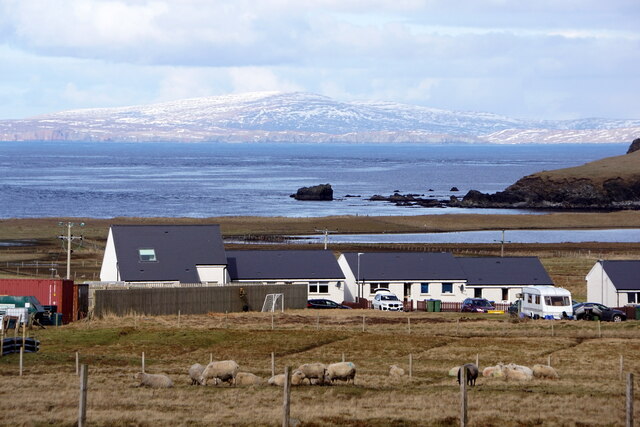
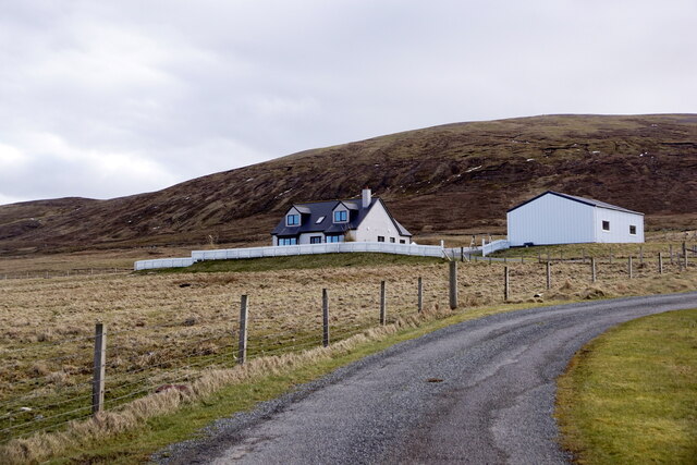
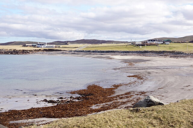
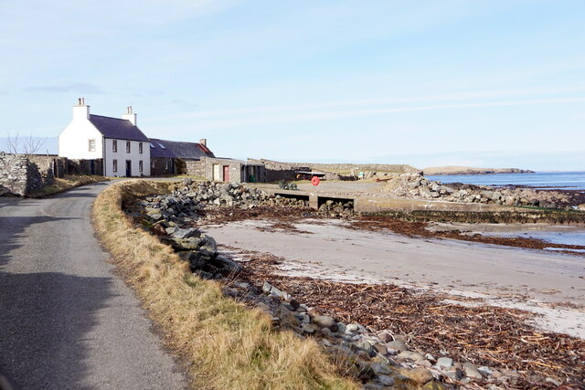
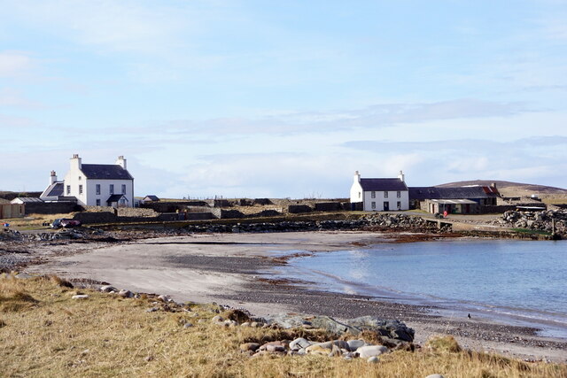
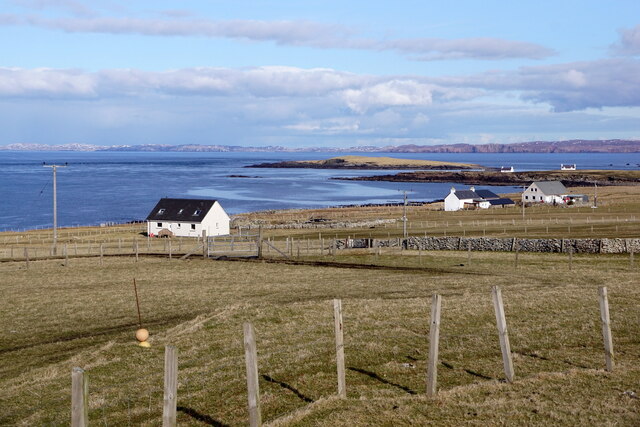
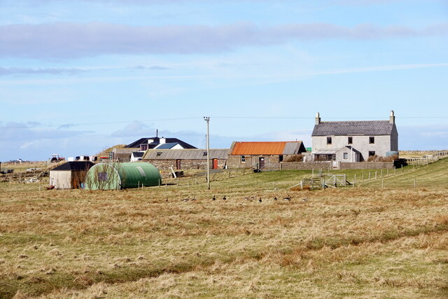
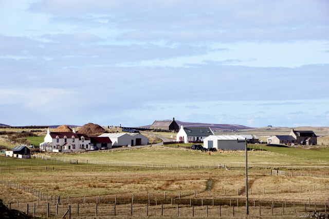
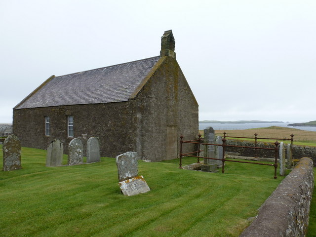
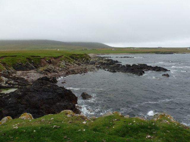
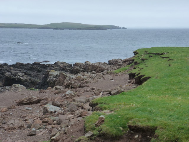
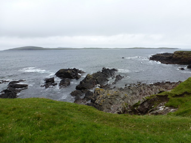
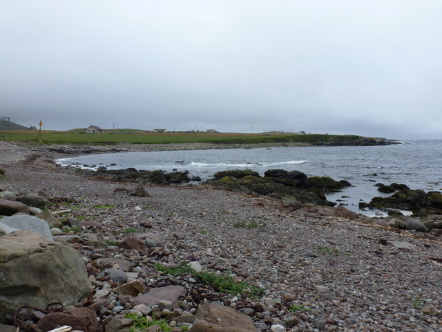
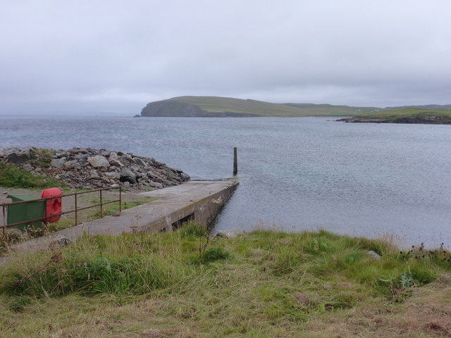
Ayre of Huxter is a picturesque coastal marsh located in the Shetland Islands, off the coast of Scotland. Nestled between the North Sea and the mainland, this area is characterized by its unique blend of marshland and saltings.

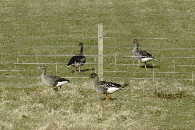
The marsh itself is a low-lying area that is often covered with water, especially during high tides. It is home to a diverse range of plant and animal species that have adapted to the constantly changing water levels and brackish conditions. Common plants found in the marsh include sea aster, sea lavender, and thrift, while bird species like redshanks, oystercatchers, and curlews can be spotted in the area.

Adjacent to the marsh is the saltings, a coastal habitat composed of muddy or sandy areas that are regularly flooded by seawater during high tides. This unique environment supports a variety of vegetation, such as glasswort, sea purslane, and sea wormwood. The saltings also provide a vital feeding ground for numerous wading birds, including dunlins, sanderlings, and ringed plovers.

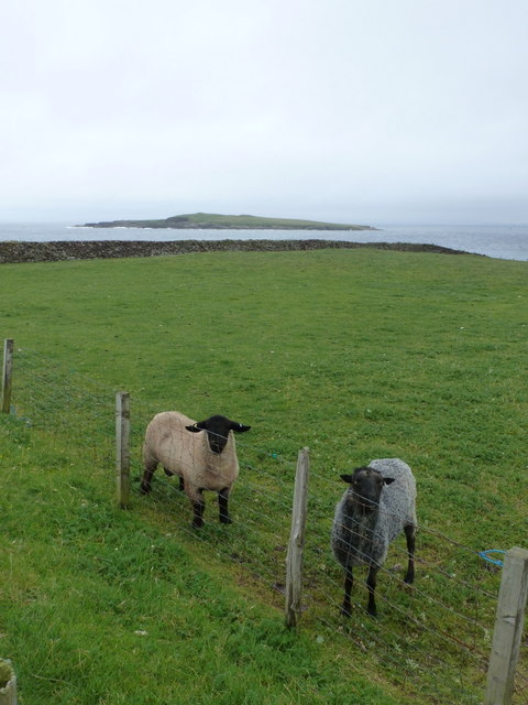
Ayre of Huxter is not only a haven for wildlife but also a place of natural beauty. The interplay between the marsh, saltings, and the surrounding sea creates a stunning landscape that changes with the ebb and flow of the tides. Visitors to Ayre of Huxter can enjoy peaceful walks along the marshland trails, observe the abundant birdlife, and take in the breathtaking panoramic views of the coastline.

If you have any feedback on the listing, please let us know in the comments section below.

Ayre of Huxter Images

Images are sourced within 2km of 60.299136/-1.6896295 or Grid Reference HU1757. Thanks to Geograph Open Source API. All images are credited.

Sandness with Ronas Hill
Sillerselka, Sandness
Ayre of Melby, Sandness
House by the pier, Melby, Sandness
Ayre of Melby, Sandness
Track at the end of the road, Huxter, Sandness
Papa Stour from Huxter, Sandness
Sandness from Huxter
Tusker, Sandness
Tusker, Sandness
Melby, Sandness
Melby, Sandness
Tundra Bean Goose (Anser serrirostris) with Greylag Geese (Anser anser), Melby
Sandness: disused church at Melby The telltale sign that this church is no longer in use is the fact that the only door is concreted up! The grounds are still in use as a cemetery, though.
Sandness: disused church at Melby
The telltale sign that this church is no longer in use is the fact that the only door is concreted up! The grounds are still in use as a cemetery, though.
Sandness: two sheep and Holm of Melby These two skittish sheep seemed rather surprised to see me - anyone - joining them on this drab, drizzly Saturday morning. Having just gone through their field and now on the seaward side of the fence, we can look back towards them with Holm of Melby, a small island in the Sound of Papa, in the background.
Sandness: two sheep and Holm of Melby
These two skittish sheep seemed rather surprised to see me - anyone - joining them on this drab, drizzly Saturday morning. Having just gone through their field and now on the seaward side of the fence, we can look back towards them with Holm of Melby, a small island in the Sound of Papa, in the background.
Sandness: rocky shore at Melby The Hill of Melby in the background is shrouded in mist this afternoon.
Sandness: rocky shore at Melby
The Hill of Melby in the background is shrouded in mist this afternoon.
Sandness: coastal erosion at Melby This low grass area alongside the shore has conspicuous evidence of ongoing erosion. The coastal path along here has been redirected inland a little. The eastern end of Papa Stour is in the background.
Sandness: coastal erosion at Melby
This low grass area alongside the shore has conspicuous evidence of ongoing erosion. The coastal path along here has been redirected inland a little. The eastern end of Papa Stour is in the background.
Sandness: view over Papa Stour from Melby Looking across the Sound of Papa from the coastline at Melby; the whole width of the island of Papa Stour pans out in the background.
Sandness: view over Papa Stour from Melby
Looking across the Sound of Papa from the coastline at Melby; the whole width of the island of Papa Stour pans out in the background.
Sandness: bay and pebbly beach A small bay around the western side of Melby, with a stony beach.
Sandness: bay and pebbly beach
A small bay around the western side of Melby, with a stony beach.
Sandness: Melby pier A small pier, more a glorified slipway really, at the end of the A971.
Sandness: Melby pier
A small pier, more a glorified slipway really, at the end of the A971.
Show me another place!

Ayre of Huxter is located at Grid Ref: HU1757 (Lat: 60.299136, Lng: -1.6896295)

Unitary Authority: Shetland Islands

Police Authority: Highlands and Islands

What 3 Words

///presumes.apricot.chapters. Near Walls, Shetland Islands

Related Wikis

Sandness

Sandness (the "d" is not pronounced locally) is a headland and district in the west of Shetland Mainland, Scotland. Sandness was a civil parish, which...

Papa Stour Airstrip

Papa Stour Airstrip is a small airstrip in the village of Biggings on the island of Papa Stour. Shetland, Scotland. == History == Papa Stour Airstrip opened...

Forewick Holm

Forewick Holm is a 1-hectare (2.5-acre) island in the Sound of Papa in the Shetland islands, Scotland. Located between Papa Stour and the Sandness peninsula...

Biggings

Biggings is a village on the island of Papa Stour, in Shetland, Scotland. Papa Stour's church is situated at the south of Biggings. A homestead of Duke...

Brei Holm

Brei Holm is a tiny tidal islet in the western Shetland Islands. It is due east of Papa Stour, to which it is connected at low tide, just outside Housa...

Maiden Stack

The Maiden Stack or Frau Stack is a tiny stack in the western Shetland Islands to the north of Brei Holm and east of Housa Voe in Papa Stour. It is so...

Papa Stour

Papa Stour (Scots: Papa Stour) is one of the Shetland Islands in Scotland, with a population of under fifteen people, some of whom immigrated after an...

Bousta

Bousta is a settlement on Mainland, in Shetland, Scotland. Bousta is situated in the parish of Walls and Sandness.Scott's Hawkweed is native to the pastures...

Nearby Amenities

Located within 500m of 60.299136,-1.6896295
Water Mills
Historic: archaeological_site
Lat/Long: 60.2982057/-1.6894441
Huxter
Place: hamlet
Wikidata: Q53996547
Lat/Long: 60.2980493/-1.685745
Ford: yes
Lat/Long: 60.2980567/-1.6893252
Power: pole
Lat/Long: 60.2983519/-1.6858329
Power: pole
Lat/Long: 60.2988214/-1.6847076
Power: pole
Lat/Long: 60.2993194/-1.6835314
Power: pole
Lat/Long: 60.2995575/-1.6820341
Power: pole
Lat/Long: 60.2997579/-1.6807794
The data included in this document is from www.openstreetmap.org. The data is made available under ODbL.

Have you been to Ayre of Huxter?

Leave your review of Ayre of Huxter below (or comments, questions and feedback).