Ballard Point

Coastal Marsh, Saltings in Dorset

England

Ballard Point

Fort Henry, Studland, near Swanage Fort Henry is an observation bunker overlooking Poole Bay.  It was built during the Second World War.  Although it is sometimes claimed it was built to assist in defending Britain's coastline against enemy invasion, that is not so.  The bunker was built to observe practice landings in preparation for D-Day.

This image was taken on a dull and murky day in August 2021, with poor visibility.
Fort Henry, Studland, near Swanage Credit: Malc McDonald

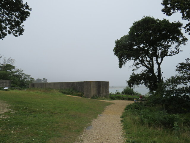
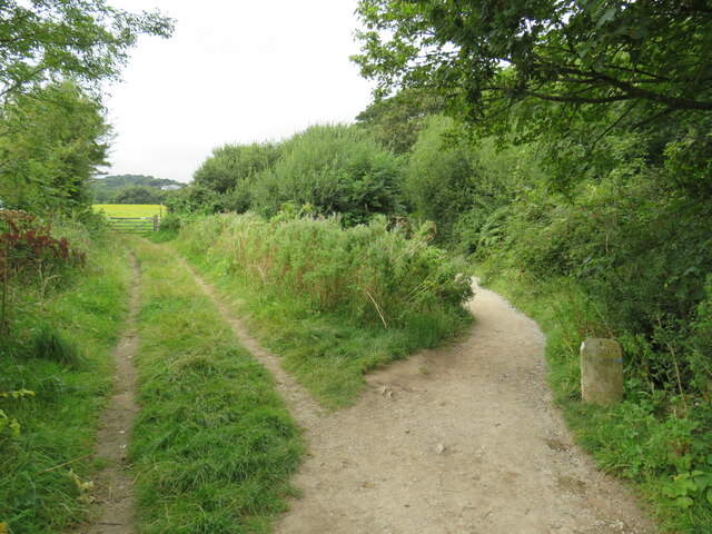
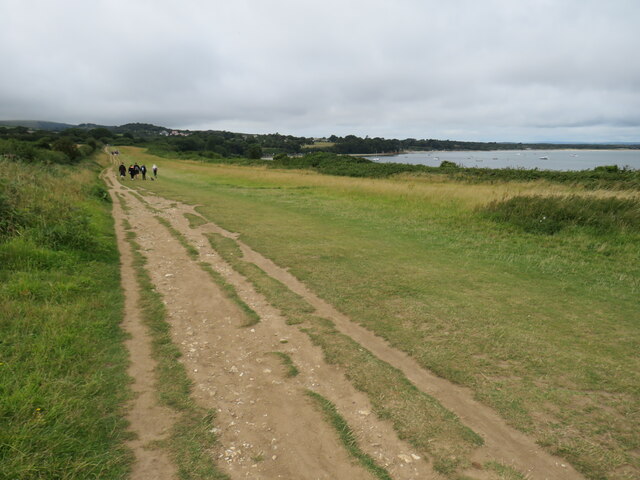
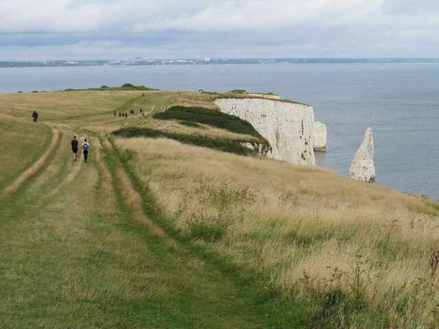
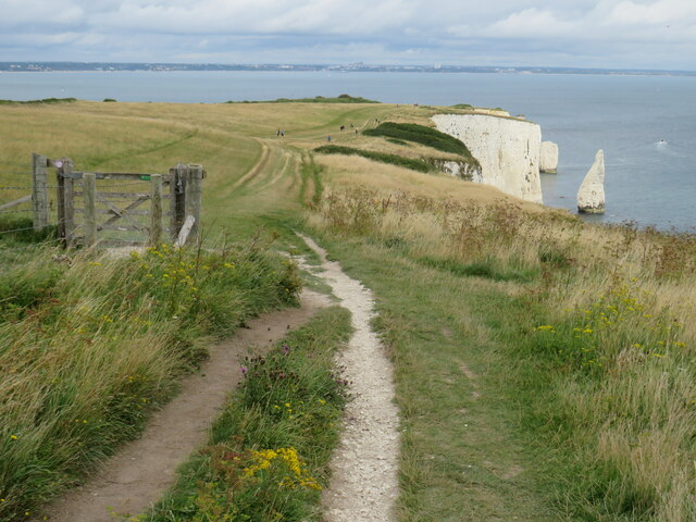
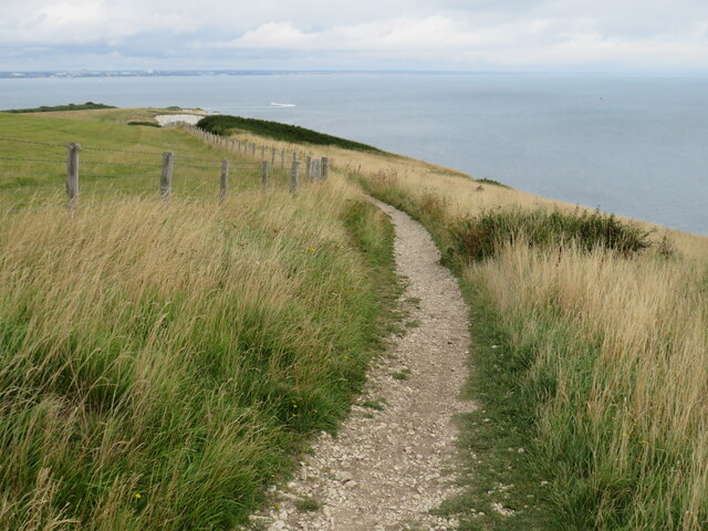
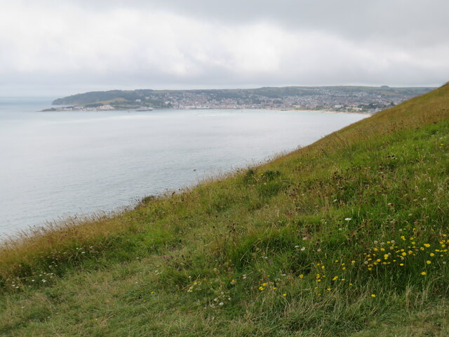
Ballard Point is a picturesque coastal marsh and saltings located in the county of Dorset, England. Situated between Studland Bay and Swanage Bay, this natural landform spans an area of approximately 500 hectares.

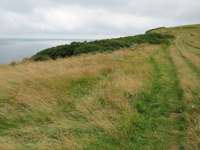
The landscape of Ballard Point is characterized by its diverse ecosystem, combining salt marshes, mudflats, and sand dunes. The area is known for its rich biodiversity and is designated as a Site of Special Scientific Interest (SSSI) and a Special Protection Area (SPA) due to its importance for bird species.

The salt marshes, which are flooded by tidal waters, provide a valuable habitat for a range of marine and bird life. The mudflats are home to a variety of wading birds, such as oystercatchers, curlews, and redshanks. The sand dunes, on the other hand, support a unique plant community, including sea holly and sea bindweed.

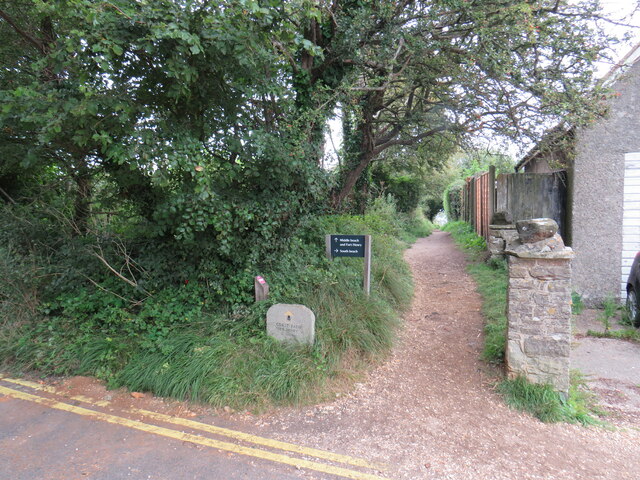
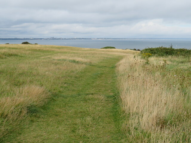
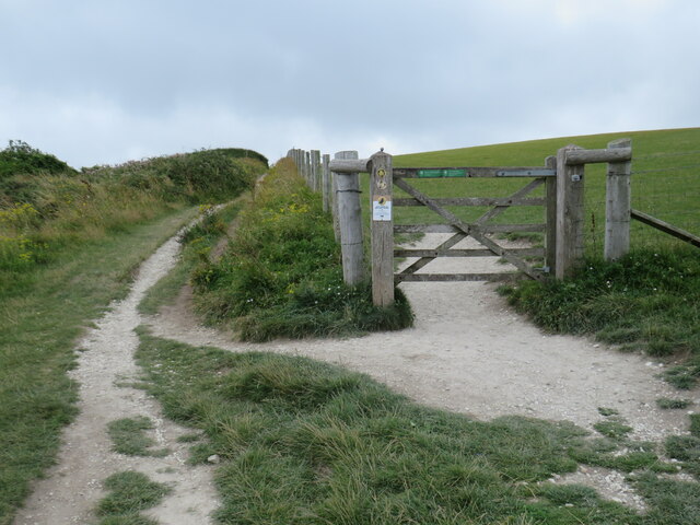
Visitors to Ballard Point can enjoy stunning coastal views and peaceful walks along the marshes. The area is also popular among birdwatchers, who come to observe the numerous species that inhabit the site. Throughout the year, the marshes are alive with the calls of birds, making it a haven for ornithologists and nature enthusiasts alike.

In addition to its natural beauty, Ballard Point holds historical significance, with evidence of human settlement dating back to the Mesolithic era. The remains of ancient field systems and a Bronze Age barrow can be found in the vicinity, adding to the area's cultural heritage.

Overall, Ballard Point in Dorset offers a unique and captivating coastal experience, showcasing the beauty of nature and the historical richness of the region.

If you have any feedback on the listing, please let us know in the comments section below.

Ballard Point Images

Images are sourced within 2km of 50.631378/-1.9329284 or Grid Reference SZ0481. Thanks to Geograph Open Source API. All images are credited.

Fort Henry, Studland, near Swanage Fort Henry is an observation bunker overlooking Poole Bay.  It was built during the Second World War.  Although it is sometimes claimed it was built to assist in defending Britain's coastline against enemy invasion, that is not so.  The bunker was built to observe practice landings in preparation for D-Day.

This image was taken on a dull and murky day in August 2021, with poor visibility.
Fort Henry, Studland, near Swanage
Fort Henry is an observation bunker overlooking Poole Bay. It was built during the Second World War. Although it is sometimes claimed it was built to assist in defending Britain's coastline against enemy invasion, that is not so. The bunker was built to observe practice landings in preparation for D-Day. This image was taken on a dull and murky day in August 2021, with poor visibility.
South West Coast Path at Studland This path in the village of Studland forms part of the South West Coast Path.
South West Coast Path at Studland
This path in the village of Studland forms part of the South West Coast Path.
Bankes Arms, Studland The Bankes Arms pub, in the village of Studland.  The pub is believed to date from the 16th Century.

The South West Coast Path follows the lane past the pub.
Bankes Arms, Studland
The Bankes Arms pub, in the village of Studland. The pub is believed to date from the 16th Century. The South West Coast Path follows the lane past the pub.
Manor Road, Studland Manor Road is a lane in the village of Studland, in Dorset.  It is on the route of the South West Coast Path.

The building to the left of the image is a public toilet.
Manor Road, Studland
Manor Road is a lane in the village of Studland, in Dorset. It is on the route of the South West Coast Path. The building to the left of the image is a public toilet.
South West Coast Path near Studland The South West Coast Path near the village of Studland, in Dorset.  A marker stone stands to the right of the path.
South West Coast Path near Studland
The South West Coast Path near the village of Studland, in Dorset. A marker stone stands to the right of the path.
South West Coast Path near Studland A view of the South West Coast Path, with Studland Bay visible to the right.
South West Coast Path near Studland
A view of the South West Coast Path, with Studland Bay visible to the right.
Old Harry Rocks, near Swanage Old Harry Rocks are sea stacks off Handfast Point (The Foreland), north of Swanage. They are formed of chalk and are classic features of coastal erosion. The rocks are under constant attack from the sea and Harry has already lost a "wife".
Old Harry Rocks, near Swanage
Old Harry Rocks are sea stacks off Handfast Point (The Foreland), north of Swanage. They are formed of chalk and are classic features of coastal erosion. The rocks are under constant attack from the sea and Harry has already lost a "wife".
Old Harry Rocks, near Swanage A National Trust sign at Old Harry Rocks, indicating that the National Trust owns and manages the land here.
Old Harry Rocks, near Swanage
A National Trust sign at Old Harry Rocks, indicating that the National Trust owns and manages the land here.
Old Harry Rocks, near Swanage A view of Old Harry Rocks and Poole Bay, taken on a dull and cloudy day in August 2021.
Old Harry Rocks, near Swanage
A view of Old Harry Rocks and Poole Bay, taken on a dull and cloudy day in August 2021.
Cliffs and stacks at The Foreland, near Swanage Cliffs and stacks on the Jurassic coastline close to Old Harry Rocks.
Cliffs and stacks at The Foreland, near Swanage
Cliffs and stacks on the Jurassic coastline close to Old Harry Rocks.
South West Coast Path at The Foreland, near Swanage A view of the South West Coast Path as it approaches Old Harry Rocks, on the Jurassic coastline near Swanage.
South West Coast Path at The Foreland, near Swanage
A view of the South West Coast Path as it approaches Old Harry Rocks, on the Jurassic coastline near Swanage.
South West Coast Path at The Foreland, near Swanage A view of the South West Coast Path on The Foreland, on the Isle of Purbeck.
South West Coast Path at The Foreland, near Swanage
A view of the South West Coast Path on The Foreland, on the Isle of Purbeck.
South West Coast Path near Swanage The South West Coast Path heading towards Old Harry Rocks, on the Isle of Purbeck.  Visible in this image are chalk cliffs and a sea stack, one of several here.  In the background is Poole Bay, looking towards Bournemouth.
South West Coast Path near Swanage
The South West Coast Path heading towards Old Harry Rocks, on the Isle of Purbeck. Visible in this image are chalk cliffs and a sea stack, one of several here. In the background is Poole Bay, looking towards Bournemouth.
South West Coast Path near Swanage The South West Coast Path, near Ballard Point on the Isle of Purbeck.  Another path branches off through the gate and across the field.
South West Coast Path near Swanage
The South West Coast Path, near Ballard Point on the Isle of Purbeck. Another path branches off through the gate and across the field.
South West Coast Path near Swanage A view of the South West Coast Path near Ballard Point, looking towards Old Harry Rocks and Poole Bay.  Visible to the right of the chalk cliffs are a couple of sea stacks.
South West Coast Path near Swanage
A view of the South West Coast Path near Ballard Point, looking towards Old Harry Rocks and Poole Bay. Visible to the right of the chalk cliffs are a couple of sea stacks.
South West Coast Path near Swanage A view of the South West Coast Path as it follows the clifftops near Ballard Point, on the Isle of Purbeck.
South West Coast Path near Swanage
A view of the South West Coast Path as it follows the clifftops near Ballard Point, on the Isle of Purbeck.
Clifftop at Ballard Point, near Swanage Grass on the clifftop at Ballard Point overlooking Swanage Bay and the town of Swanage.
Clifftop at Ballard Point, near Swanage
Grass on the clifftop at Ballard Point overlooking Swanage Bay and the town of Swanage.
Start of the Purbeck Way, near Ballard Point, Swanage The stone to the left of the image marks the start of the Purbeck Way footpath near Ballard Point, near Swanage.
Start of the Purbeck Way, near Ballard Point, Swanage
The stone to the left of the image marks the start of the Purbeck Way footpath near Ballard Point, near Swanage.
Show me another place!

Ballard Point is located at Grid Ref: SZ0481 (Lat: 50.631378, Lng: -1.9329284)

Unitary Authority: Dorset

Police Authority: Dorset

What 3 Words

///machine.mouths.hinders. Near Swanage, Dorset

Related Wikis

Ballard Cliff

Ballard Cliff is part of the Jurassic Coast near Swanage in the Isle of Purbeck in Dorset, England. The steeply dipping Cretaceous chalk that marks the...

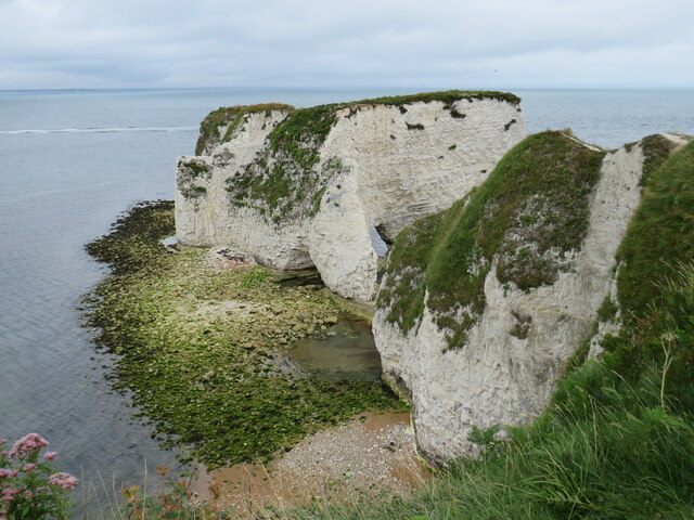
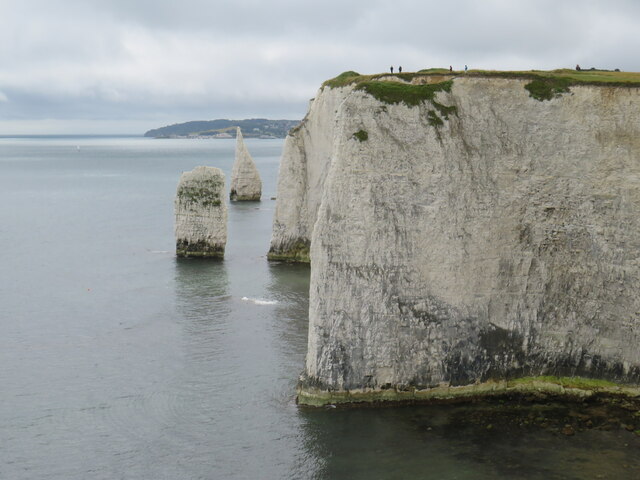
The Pinnacles (Dorset)

The Pinnacles are two chalk formations, including a stack and a stump, located near Handfast Point, on the Isle of Purbeck in Dorset, southern England...
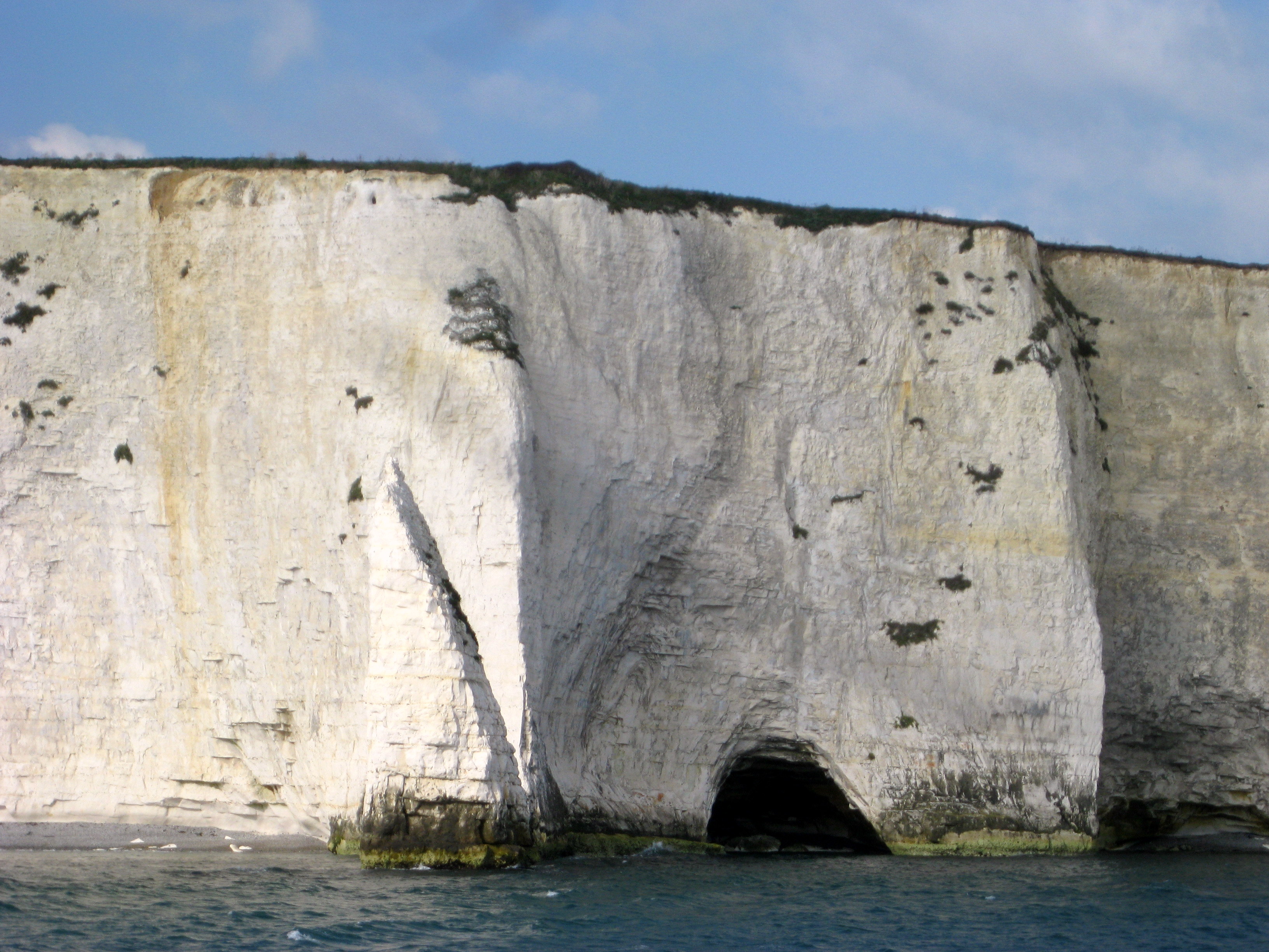
Parson's Barn

Parson's Barn is a large sea-level cavern below the Ballard Point cliffs, between Studland and Swanage bays in the English Channel. Ballard Point is the...
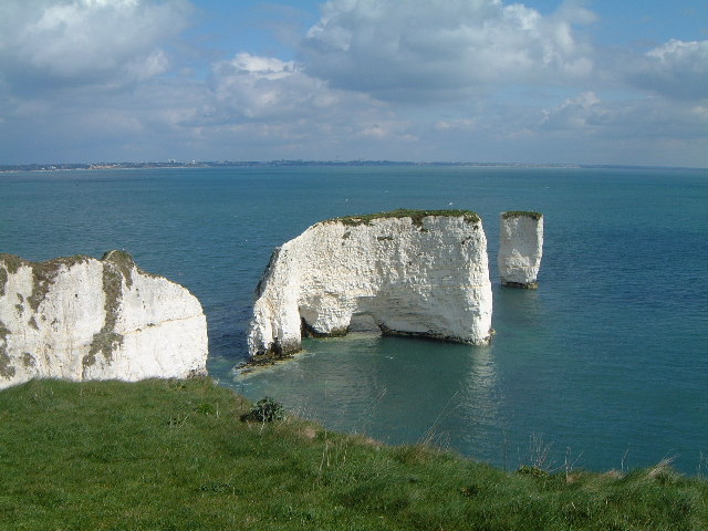
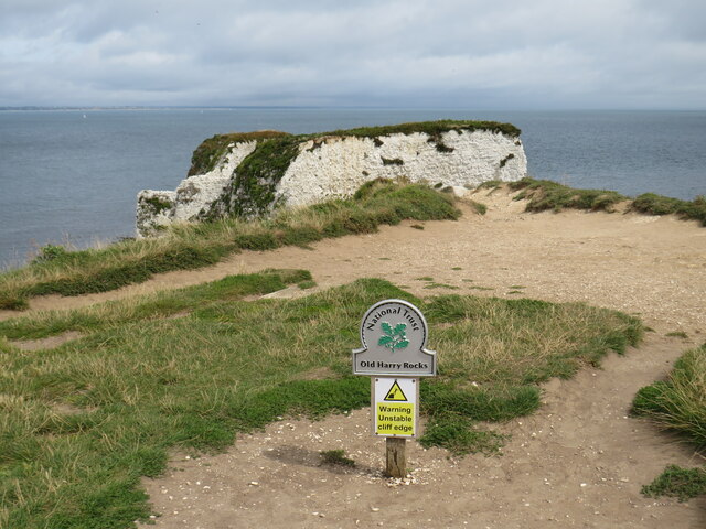
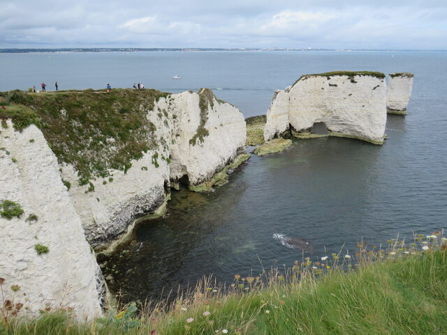
Old Harry Rocks

Old Harry Rocks are three chalk formations, including a stack and a stump, located at Handfast Point, on the Isle of Purbeck in Dorset, southern England...

Nearby Amenities

Located within 500m of 50.631378,-1.9329284
Source: PGS
Lat/Long: 50.6301449/-1.9385331
Source: PGS
Lat/Long: 50.6303293/-1.9378747
Source: PGS
Lat/Long: 50.6305282/-1.9370163
Source: PGS
Lat/Long: 50.6306311/-1.9362004
Source: PGS
Lat/Long: 50.6307373/-1.9353115
Source: PGS
Lat/Long: 50.6308496/-1.9341002
Source: PGS
Lat/Long: 50.6308925/-1.9334066
Source: PGS
Lat/Long: 50.6319853/-1.9326332
Source: PGS
Lat/Long: 50.6330229/-1.9317935
Source: PGS
Lat/Long: 50.6332719/-1.9317796
Source: PGS
Lat/Long: 50.6336159/-1.9314835
Source: PGS
Lat/Long: 50.633866/-1.9313065
Source: PGS
Lat/Long: 50.6340957/-1.9311638
Source: PGS
Lat/Long: 50.6345111/-1.9309041
Source: PGS
Lat/Long: 50.6347248/-1.9306896
Source: PGS
Lat/Long: 50.6351996/-1.930194
Man Made: survey_point
Lat/Long: 50.631694/-1.9389011
Ballard Point
Place: locality
Source: NLS - OS 1-inch 7th Series 1955-61
Wikidata: Q24656354
Lat/Long: 50.6312654/-1.9322958
Source: PGS
Lat/Long: 50.6321214/-1.9326753
The data included in this document is from www.openstreetmap.org. The data is made available under ODbL.

Have you been to Ballard Point?

Leave your review of Ballard Point below (or comments, questions and feedback).