Ballard Cliff

Cliff, Slope in Dorset

England

Ballard Cliff

Sandy path near Studland beach A sandy path passing beach huts overlooking Studland beach, photographed on a dull and murky day in August 2021.  This area is owned and managed by the National Trust.
Sandy path near Studland beach Credit: Malc McDonald

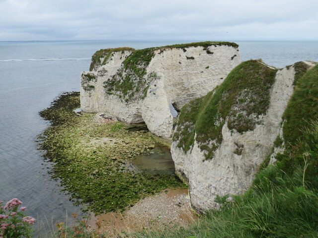
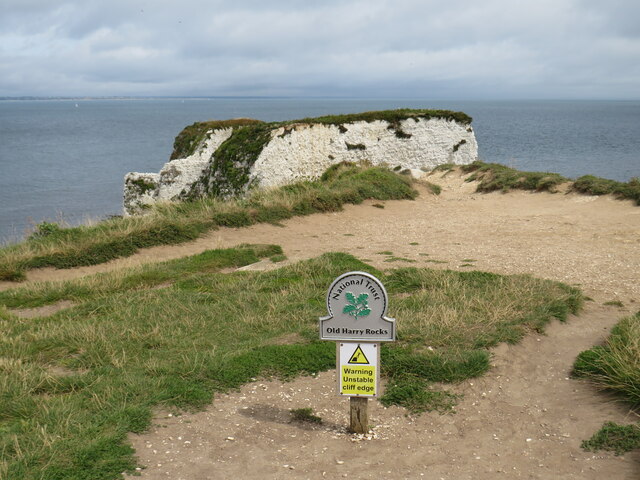
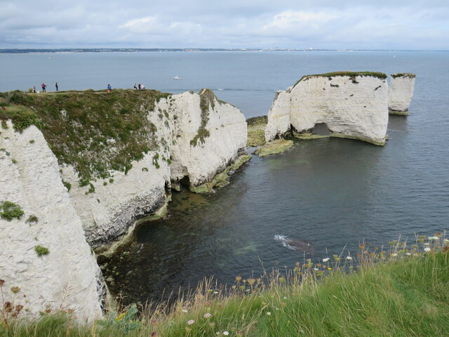
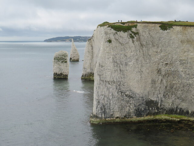
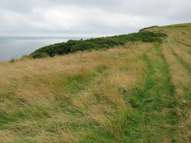
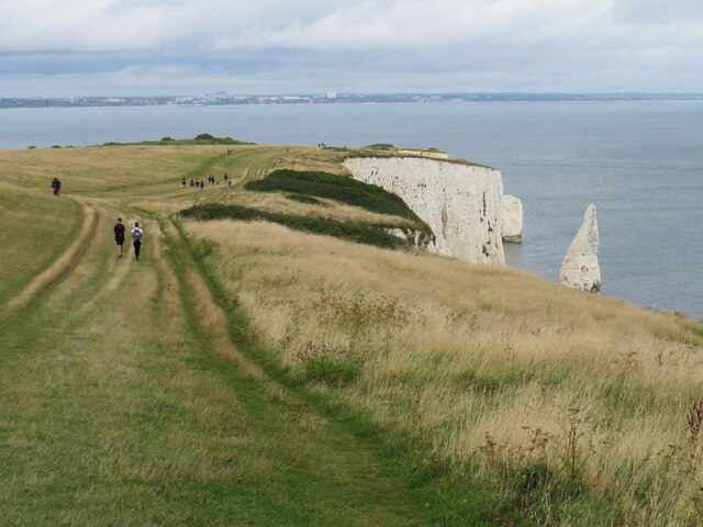
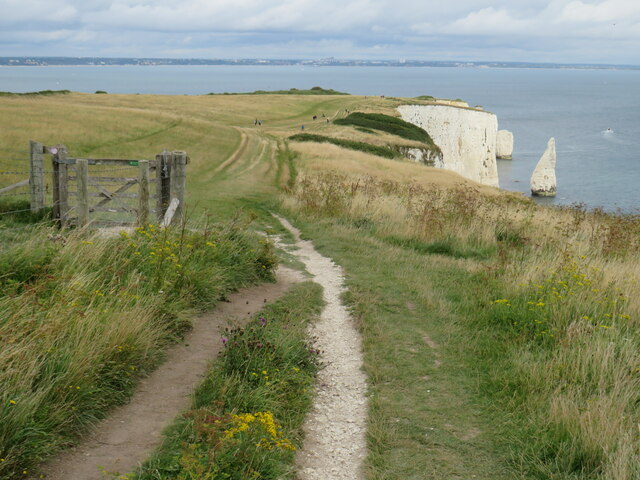
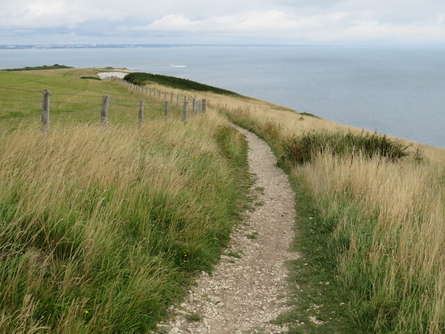
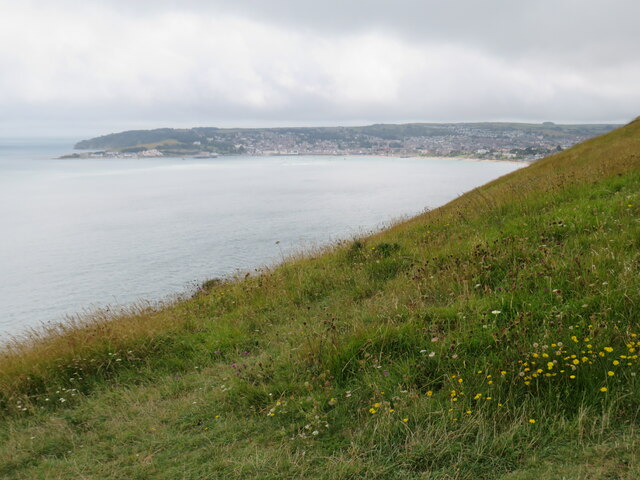
Ballard Cliff is a prominent geological feature located in Dorset, England. It is situated on the Isle of Purbeck, overlooking Swanage Bay and the English Channel. This cliff is known for its striking beauty, offering stunning panoramic views of the surrounding area.

Rising to a height of approximately 60 meters, Ballard Cliff is composed of layers of sedimentary rock, primarily consisting of limestone and shale. These rock formations date back millions of years and provide a glimpse into the geological history of the region.

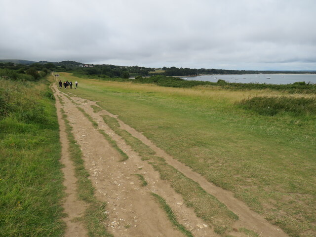
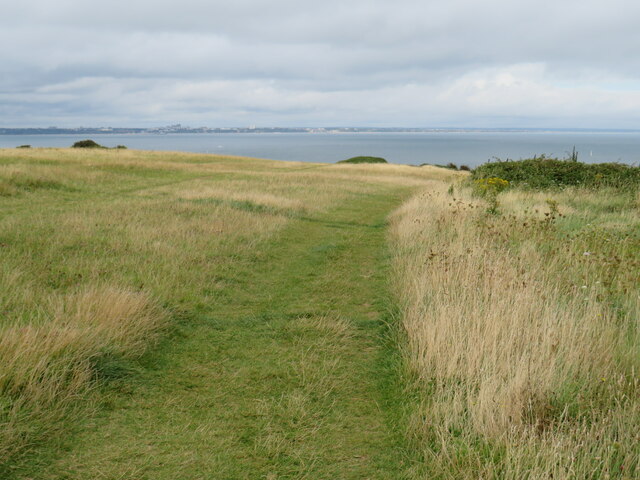
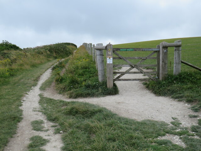
The cliff is characterized by its steep slopes and rugged terrain, which make it an ideal spot for hiking and exploring nature. Its exposed rock faces showcase unique patterns and textures, carved by the forces of erosion over time. Visitors can often spot fossils embedded within the rocks, offering a glimpse into the ancient marine life that once inhabited this area.

Ballard Cliff is also home to a diverse range of flora and fauna. The cliffside vegetation includes hardy grasses, wildflowers, and shrubs that have adapted to the challenging conditions of the exposed coastal environment. Birdwatchers can observe various seabirds soaring above the cliff, including gulls, cormorants, and puffins during the breeding season.

Due to its scenic beauty and geological significance, Ballard Cliff attracts tourists and nature enthusiasts from all over the world. It offers a unique opportunity to experience the stunning coastline of Dorset and immerse oneself in its rich natural heritage.

If you have any feedback on the listing, please let us know in the comments section below.

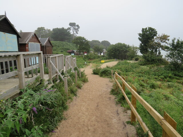
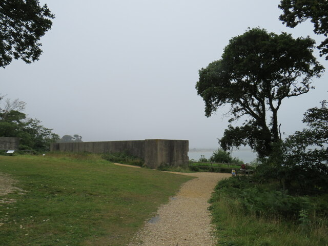
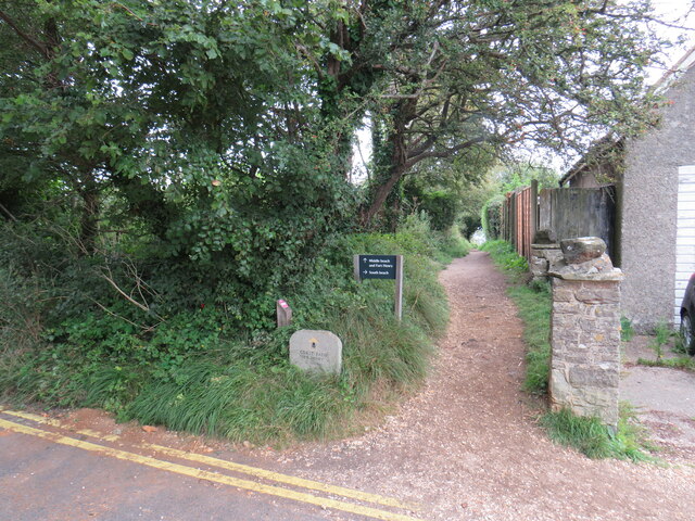
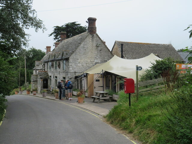
Ballard Cliff Images

Images are sourced within 2km of 50.630429/-1.9400274 or Grid Reference SZ0481. Thanks to Geograph Open Source API. All images are credited.

Sandy path near Studland beach A sandy path passing beach huts overlooking Studland beach, photographed on a dull and murky day in August 2021.  This area is owned and managed by the National Trust.
Sandy path near Studland beach
A sandy path passing beach huts overlooking Studland beach, photographed on a dull and murky day in August 2021. This area is owned and managed by the National Trust.
Fort Henry, Studland, near Swanage Fort Henry is an observation bunker overlooking Poole Bay.  It was built during the Second World War.  Although it is sometimes claimed it was built to assist in defending Britain's coastline against enemy invasion, that is not so.  The bunker was built to observe practice landings in preparation for D-Day.

This image was taken on a dull and murky day in August 2021, with poor visibility.
Fort Henry, Studland, near Swanage
Fort Henry is an observation bunker overlooking Poole Bay. It was built during the Second World War. Although it is sometimes claimed it was built to assist in defending Britain's coastline against enemy invasion, that is not so. The bunker was built to observe practice landings in preparation for D-Day. This image was taken on a dull and murky day in August 2021, with poor visibility.
South West Coast Path at Studland This path in the village of Studland forms part of the South West Coast Path.
South West Coast Path at Studland
This path in the village of Studland forms part of the South West Coast Path.
Bankes Arms, Studland The Bankes Arms pub, in the village of Studland.  The pub is believed to date from the 16th Century.

The South West Coast Path follows the lane past the pub.
Bankes Arms, Studland
The Bankes Arms pub, in the village of Studland. The pub is believed to date from the 16th Century. The South West Coast Path follows the lane past the pub.
Manor Road, Studland Manor Road is a lane in the village of Studland, in Dorset.  It is on the route of the South West Coast Path.

The building to the left of the image is a public toilet.
Manor Road, Studland
Manor Road is a lane in the village of Studland, in Dorset. It is on the route of the South West Coast Path. The building to the left of the image is a public toilet.
South West Coast Path near Studland The South West Coast Path near the village of Studland, in Dorset.  A marker stone stands to the right of the path.
South West Coast Path near Studland
The South West Coast Path near the village of Studland, in Dorset. A marker stone stands to the right of the path.
South West Coast Path near Studland A view of the South West Coast Path, with Studland Bay visible to the right.
South West Coast Path near Studland
A view of the South West Coast Path, with Studland Bay visible to the right.
Old Harry Rocks, near Swanage Old Harry Rocks are sea stacks off Handfast Point (The Foreland), north of Swanage. They are formed of chalk and are classic features of coastal erosion. The rocks are under constant attack from the sea and Harry has already lost a "wife".
Old Harry Rocks, near Swanage
Old Harry Rocks are sea stacks off Handfast Point (The Foreland), north of Swanage. They are formed of chalk and are classic features of coastal erosion. The rocks are under constant attack from the sea and Harry has already lost a "wife".
Old Harry Rocks, near Swanage A National Trust sign at Old Harry Rocks, indicating that the National Trust owns and manages the land here.
Old Harry Rocks, near Swanage
A National Trust sign at Old Harry Rocks, indicating that the National Trust owns and manages the land here.
Old Harry Rocks, near Swanage A view of Old Harry Rocks and Poole Bay, taken on a dull and cloudy day in August 2021.
Old Harry Rocks, near Swanage
A view of Old Harry Rocks and Poole Bay, taken on a dull and cloudy day in August 2021.
Cliffs and stacks at The Foreland, near Swanage Cliffs and stacks on the Jurassic coastline close to Old Harry Rocks.
Cliffs and stacks at The Foreland, near Swanage
Cliffs and stacks on the Jurassic coastline close to Old Harry Rocks.
South West Coast Path at The Foreland, near Swanage A view of the South West Coast Path as it approaches Old Harry Rocks, on the Jurassic coastline near Swanage.
South West Coast Path at The Foreland, near Swanage
A view of the South West Coast Path as it approaches Old Harry Rocks, on the Jurassic coastline near Swanage.
South West Coast Path at The Foreland, near Swanage A view of the South West Coast Path on The Foreland, on the Isle of Purbeck.
South West Coast Path at The Foreland, near Swanage
A view of the South West Coast Path on The Foreland, on the Isle of Purbeck.
South West Coast Path near Swanage The South West Coast Path heading towards Old Harry Rocks, on the Isle of Purbeck.  Visible in this image are chalk cliffs and a sea stack, one of several here.  In the background is Poole Bay, looking towards Bournemouth.
South West Coast Path near Swanage
The South West Coast Path heading towards Old Harry Rocks, on the Isle of Purbeck. Visible in this image are chalk cliffs and a sea stack, one of several here. In the background is Poole Bay, looking towards Bournemouth.
South West Coast Path near Swanage The South West Coast Path, near Ballard Point on the Isle of Purbeck.  Another path branches off through the gate and across the field.
South West Coast Path near Swanage
The South West Coast Path, near Ballard Point on the Isle of Purbeck. Another path branches off through the gate and across the field.
South West Coast Path near Swanage A view of the South West Coast Path near Ballard Point, looking towards Old Harry Rocks and Poole Bay.  Visible to the right of the chalk cliffs are a couple of sea stacks.
South West Coast Path near Swanage
A view of the South West Coast Path near Ballard Point, looking towards Old Harry Rocks and Poole Bay. Visible to the right of the chalk cliffs are a couple of sea stacks.
South West Coast Path near Swanage A view of the South West Coast Path as it follows the clifftops near Ballard Point, on the Isle of Purbeck.
South West Coast Path near Swanage
A view of the South West Coast Path as it follows the clifftops near Ballard Point, on the Isle of Purbeck.
Clifftop at Ballard Point, near Swanage Grass on the clifftop at Ballard Point overlooking Swanage Bay and the town of Swanage.
Clifftop at Ballard Point, near Swanage
Grass on the clifftop at Ballard Point overlooking Swanage Bay and the town of Swanage.
Show me another place!

Ballard Cliff is located at Grid Ref: SZ0481 (Lat: 50.630429, Lng: -1.9400274)

Unitary Authority: Dorset

Police Authority: Dorset

What 3 Words

///revisits.lions.shunted. Near Swanage, Dorset

Related Wikis

Ballard Cliff

Ballard Cliff is part of the Jurassic Coast near Swanage in the Isle of Purbeck in Dorset, England. The steeply dipping Cretaceous chalk that marks the...

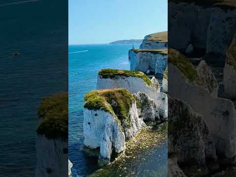
The Pinnacles (Dorset)

The Pinnacles are two chalk formations, including a stack and a stump, located near Handfast Point, on the Isle of Purbeck in Dorset, southern England...

St Nicholas' Church, Studland

The Church of Saint Nicholas is a Church of England parish church in Studland, Dorset, England. It was built in the early 12th century on the foundations...

Studland

Studland is a village and civil parish on the Isle of Purbeck in Dorset, England. The village is located about 2 miles (3.2 km) north of the town of Swanage...

Related Videos

Old Harry Rocks | Swanage | UK Hiking

Our next Hike around the Purbecks, taking in Old Harry Rocks and Swanage.

Hiking The South West Coast Path - Studland to Swanage

We take our sea safaris past all these sites so much but it's the first time I've ever walked it. It's shorter by water!

Nearby Amenities

Located within 500m of 50.630429,-1.9400274
Source: PGS
Lat/Long: 50.6285145/-1.9458118
Source: PGS
Lat/Long: 50.6288131/-1.945228
Source: PGS
Lat/Long: 50.6292397/-1.9444686
Source: PGS
Lat/Long: 50.629367/-1.9437787
Source: PGS
Lat/Long: 50.6295831/-1.9426645
Source: PGS
Lat/Long: 50.6297993/-1.9412175
Source: PGS
Lat/Long: 50.6299223/-1.9401706
Source: PGS
Lat/Long: 50.6301449/-1.9385331
Source: PGS
Lat/Long: 50.6303293/-1.9378747
Source: PGS
Lat/Long: 50.6305282/-1.9370163
Source: PGS
Lat/Long: 50.6306311/-1.9362004
Source: PGS
Lat/Long: 50.6307373/-1.9353115
Source: PGS
Lat/Long: 50.6308496/-1.9341002
Source: PGS
Lat/Long: 50.6308925/-1.9334066
Man Made: survey_point
Lat/Long: 50.631694/-1.9389011
Barrier: kissing_gate
Lat/Long: 50.6306202/-1.9451805
The data included in this document is from www.openstreetmap.org. The data is made available under ODbL.

Have you been to Ballard Cliff?

Leave your review of Ballard Cliff below (or comments, questions and feedback).