Buck's Cove Saltmarsh

Coastal Marsh, Saltings in Dorset

England

Buck's Cove Saltmarsh

Defending Dorset: Holton Heath: Light Anti-Aircraft Battery - Bofors gun tower no. 1 (17) -
LAA Battery: DoB ID: e27074

During WWII, in addition to the heavy anti-aircraft artillery protecting the Royal Naval Cordite Factory at Holton Heath, there were also a series of smaller anti-aircraft batteries providing close-in LAA defence against low flying enemy aircraft. The remains of two of these LAA sites survive in the form of concrete towers on which 40mm Bofors guns were mounted. This particular gun tower (no. 1) is on the heath to the south west of the former cordite factory, the other (no. 2) is on private land further west on the other side of the A351 road near Sandford House.

<a href="https://www.geograph.org.uk/photo/5287593">SY9390 : Defending Dorset: Holton Heath: Light Anti-Aircraft Battery - Bofors gun tower no. 1 (18)</a>
Defending Dorset: Holton Heath: Light Anti-Aircraft Battery - Bofors gun tower no. 1 (17) Credit: Mike Searle

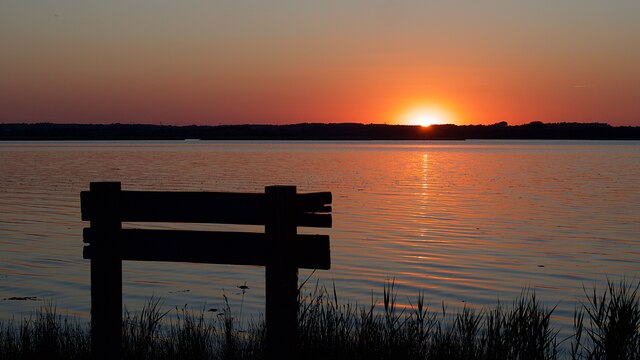
Buck's Cove Saltmarsh is a coastal marsh located in Dorset, England. It is a unique and important ecosystem that consists of a combination of mudflats, marshes, and salt marsh plants. The marsh is situated along the coast, where it is influenced by the tides of the English Channel.

The saltmarsh is home to a variety of plant and animal species that have adapted to the harsh saltwater environment. Common plant species found in the marsh include sea lavender, saltmarsh grasses, and samphire. These plants provide important habitat and food sources for a diverse range of wildlife, including birds, insects, and small mammals.

The marsh also plays a crucial role in protecting the coastline from erosion and absorbing excess nutrients and pollutants from the surrounding land. It acts as a natural buffer against storm surges and helps to maintain water quality in the area.

Visitors to Buck's Cove Saltmarsh can enjoy walking along the trails that wind through the marsh, observing the unique flora and fauna that call this ecosystem home. It is a peaceful and serene environment that offers a glimpse into the diverse and dynamic coastal ecosystems of Dorset.

If you have any feedback on the listing, please let us know in the comments section below.

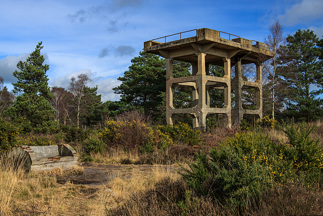
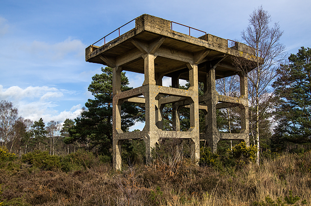
Buck's Cove Saltmarsh Images

Images are sourced within 2km of 50.69534/-2.0860865 or Grid Reference SY9488. Thanks to Geograph Open Source API. All images are credited.

Defending Dorset: Holton Heath: Light Anti-Aircraft Battery - Bofors gun tower no. 1 (17) -
LAA Battery: DoB ID: e27074

During WWII, in addition to the heavy anti-aircraft artillery protecting the Royal Naval Cordite Factory at Holton Heath, there were also a series of smaller anti-aircraft batteries providing close-in LAA defence against low flying enemy aircraft. The remains of two of these LAA sites survive in the form of concrete towers on which 40mm Bofors guns were mounted. This particular gun tower (no. 1) is on the heath to the south west of the former cordite factory, the other (no. 2) is on private land further west on the other side of the A351 road near Sandford House.

<a href="https://www.geograph.org.uk/photo/5287593">SY9390 : Defending Dorset: Holton Heath: Light Anti-Aircraft Battery - Bofors gun tower no. 1 (18)</a>
Defending Dorset: Holton Heath: Light Anti-Aircraft Battery - Bofors gun tower no. 1 (17)
- LAA Battery: DoB ID: e27074 During WWII, in addition to the heavy anti-aircraft artillery protecting the Royal Naval Cordite Factory at Holton Heath, there were also a series of smaller anti-aircraft batteries providing close-in LAA defence against low flying enemy aircraft. The remains of two of these LAA sites survive in the form of concrete towers on which 40mm Bofors guns were mounted. This particular gun tower (no. 1) is on the heath to the south west of the former cordite factory, the other (no. 2) is on private land further west on the other side of the A351 road near Sandford House. SY9390 : Defending Dorset: Holton Heath: Light Anti-Aircraft Battery - Bofors gun tower no. 1 (18)
Defending Dorset: Holton Heath: Light Anti-Aircraft Battery - Bofors gun tower no. 1 (18) -
LAA Battery: DoB ID: e27074

At first glance the tower seems to be a single structure, but in fact it was designed and constructed as two separate concrete towers each supporting separate upper platforms. One platform was equipped with the Bofors gun, the other housed an observation post. The separation between the two platforms is barely 30mm, but necessary in order to prevent the vibration of the Bofors gun adversely affecting the observers and their range and height finding equipment on the adjacent platform.

<a href="https://www.geograph.org.uk/photo/5287598">SY9390 : Defending Dorset: Holton Heath: Light Anti-Aircraft Battery - Bofors gun tower no. 1 (19)</a>
Defending Dorset: Holton Heath: Light Anti-Aircraft Battery - Bofors gun tower no. 1 (18)
- LAA Battery: DoB ID: e27074 At first glance the tower seems to be a single structure, but in fact it was designed and constructed as two separate concrete towers each supporting separate upper platforms. One platform was equipped with the Bofors gun, the other housed an observation post. The separation between the two platforms is barely 30mm, but necessary in order to prevent the vibration of the Bofors gun adversely affecting the observers and their range and height finding equipment on the adjacent platform. SY9390 : Defending Dorset: Holton Heath: Light Anti-Aircraft Battery - Bofors gun tower no. 1 (19)
Defending Dorset: Holton Heath: Light Anti-Aircraft Battery - Bofors gun tower no. 1 (19) -
LAA Battery: DoB ID: e27074

The gap between the two platforms, albeit slight, is apparent in this view between the towers looking up to the platforms above.

<a href="https://www.geograph.org.uk/photo/5287600">SY9390 : Defending Dorset: Holton Heath: Light Anti-Aircraft Battery - Bofors gun tower no. 1 (20)</a>
Defending Dorset: Holton Heath: Light Anti-Aircraft Battery - Bofors gun tower no. 1 (19)
- LAA Battery: DoB ID: e27074 The gap between the two platforms, albeit slight, is apparent in this view between the towers looking up to the platforms above. SY9390 : Defending Dorset: Holton Heath: Light Anti-Aircraft Battery - Bofors gun tower no. 1 (20)
Defending Dorset: Holton Heath: Light Anti-Aircraft Battery - Bofors gun tower no. 1 (20) -
LAA Battery: DoB ID: e27074

The platforms retain their concrete ready use ammunition lockers, and the iron railings around the perimeter.

The tower along with its companion further west are the only surviving examples of Bofors gun towers in Dorset, and among about ten in total that survive in England. Designated as 'Scheduled' by Historic England.

<a href="https://www.geograph.org.uk/photo/5296754">SY9390 : Defending Dorset: Holton Heath: Light Anti-Aircraft Battery - Bofors gun tower no. 2 (21)</a>
Defending Dorset: Holton Heath: Light Anti-Aircraft Battery - Bofors gun tower no. 1 (20)
- LAA Battery: DoB ID: e27074 The platforms retain their concrete ready use ammunition lockers, and the iron railings around the perimeter. The tower along with its companion further west are the only surviving examples of Bofors gun towers in Dorset, and among about ten in total that survive in England. Designated as 'Scheduled' by Historic England. SY9390 : Defending Dorset: Holton Heath: Light Anti-Aircraft Battery - Bofors gun tower no. 2 (21)
Sandford : Driveway A driveway off of Sandford Road.
Sandford : Driveway
A driveway off of Sandford Road.
Sandford : Sandford Road A351 Looking back along Sandford Road.
Sandford : Sandford Road A351
Looking back along Sandford Road.
Sandford : Woodlands Drive Along Woodlands Drive as it heads off from Sandford Road.
Sandford : Woodlands Drive
Along Woodlands Drive as it heads off from Sandford Road.
Old Milestone by the A351, north east of Wareham Carved stone post by the A351, in parish of WAREHAM ST MARTIN (PURBECK District), near roundabout by Sandford Middle School, on wide verge on northern exit from roundabout, on East side of road. Dorset 3 (Rounded top), erected by the Poole turnpike trust in the 19th century. 

Inscription reads:-
: Wareham / 2 : : Poole / 8 / Hyde / Park / Corner / 109 :
Carved benchmark bottom centre of front face.

Milestone Society National ID: DO_WAPO02.
Old Milestone by the A351, north east of Wareham
Carved stone post by the A351, in parish of WAREHAM ST MARTIN (PURBECK District), near roundabout by Sandford Middle School, on wide verge on northern exit from roundabout, on East side of road. Dorset 3 (Rounded top), erected by the Poole turnpike trust in the 19th century. Inscription reads:- : Wareham / 2 : : Poole / 8 / Hyde / Park / Corner / 109 : Carved benchmark bottom centre of front face. Milestone Society National ID: DO_WAPO02.
RNCF Holton Heath: vintage street light (1) -
The history of the former Royal Naval Cordite Factory at Holton Heath has been well documented, spanning both of the world wars of the 20th century. The facility opened in 1916, and was in continuous operation producing cordite for the Royal Navy until 1945, the site then being placed on a care and maintenance basis. Some parts continued to be used by the Admiralty, but these too eventually closed in 1997 when the whole site was developed thereafter as an industrial estate, with many of the old buildings retained.

The cast-iron lamp post in the photo is one of two at this location, being very early forms of industrial electric street lighting. Their manufacture was by the contractors Mann Egerton & Co. Ltd., and were made by Davey Paxman & Co. Ltd in 1916, the same year that the RNCF facility was opened.

<a href="https://www.geograph.org.uk/photo/5728596">SY9490 : RNCF Holton Heath: vintage street light (2)</a>
RNCF Holton Heath: vintage street light (1)
- The history of the former Royal Naval Cordite Factory at Holton Heath has been well documented, spanning both of the world wars of the 20th century. The facility opened in 1916, and was in continuous operation producing cordite for the Royal Navy until 1945, the site then being placed on a care and maintenance basis. Some parts continued to be used by the Admiralty, but these too eventually closed in 1997 when the whole site was developed thereafter as an industrial estate, with many of the old buildings retained. The cast-iron lamp post in the photo is one of two at this location, being very early forms of industrial electric street lighting. Their manufacture was by the contractors Mann Egerton & Co. Ltd., and were made by Davey Paxman & Co. Ltd in 1916, the same year that the RNCF facility was opened. SY9490 : RNCF Holton Heath: vintage street light (2)
RNCF Holton Heath: vintage street light (2) -
A close-up of the *base inscription that gives details of the contractors Mann Egerton of London, and the makers Davey Paxman & Co. Ltd of Colchester; both companies are still trading today. Mann Egerton are now a brand of car dealers across East Anglia, whilst Davey Paxman are more well known for their diesel generators under the Paxman brand, although due to various acquisitions, are now owned by the German company MAN SE.

* 'Mann Egerton & Co. Ltd Contractors London - Davey Paxman & Co. Ltd Makers Colchester 1916'.
RNCF Holton Heath: vintage street light (2)
- A close-up of the *base inscription that gives details of the contractors Mann Egerton of London, and the makers Davey Paxman & Co. Ltd of Colchester; both companies are still trading today. Mann Egerton are now a brand of car dealers across East Anglia, whilst Davey Paxman are more well known for their diesel generators under the Paxman brand, although due to various acquisitions, are now owned by the German company MAN SE. * 'Mann Egerton & Co. Ltd Contractors London - Davey Paxman & Co. Ltd Makers Colchester 1916'.
Old Boundary Marker by footpath at Holton Heath Station Estate Boundary Marker by the footpath, in parish of Wareham St Martin (Purbeck District), Station Road, 50m S gate no 2 overlooking ditch.

Surveyed

Milestone Society National ID: DO_SAND02em.
Old Boundary Marker by footpath at Holton Heath Station
Estate Boundary Marker by the footpath, in parish of Wareham St Martin (Purbeck District), Station Road, 50m S gate no 2 overlooking ditch. Surveyed Milestone Society National ID: DO_SAND02em.
Old Boundary Marker on Holton Heath, Wareham St Martin Parish Estate Boundary Marker by the footpath, in parish of Wareham St Martin (Purbeck District), Roman Road, in woodland almost in centre of path.

Surveyed

Milestone Society National ID: DO_SAND04em.
Old Boundary Marker on Holton Heath, Wareham St Martin Parish
Estate Boundary Marker by the footpath, in parish of Wareham St Martin (Purbeck District), Roman Road, in woodland almost in centre of path. Surveyed Milestone Society National ID: DO_SAND04em.
Old Boundary Marker on the Roman Road, Wareham St Martin Parish Estate Boundary Marker - Admiralty, by the footpath, in parish of Wareham St Martin (Purbeck District), Roman Road/footpath junction.

Surveyed

Milestone Society National ID: DO_ADWAM21em
Old Boundary Marker on the Roman Road, Wareham St Martin Parish
Estate Boundary Marker - Admiralty, by the footpath, in parish of Wareham St Martin (Purbeck District), Roman Road/footpath junction. Surveyed Milestone Society National ID: DO_ADWAM21em
Old Boundary Marker on Holton Heath, Wareham St Martin parish Estate Boundary Marker by the footpath, in parish of Wareham St Martin (Purbeck District), Roman Road, footpath junction.

Inscription reads:-
H K
1925

Surveyed

Milestone Society National ID: DO_SAND03em
Old Boundary Marker on Holton Heath, Wareham St Martin parish
Estate Boundary Marker by the footpath, in parish of Wareham St Martin (Purbeck District), Roman Road, footpath junction. Inscription reads:- H K 1925 Surveyed Milestone Society National ID: DO_SAND03em
Church of St Martin, Wareham (1) The most complete example of an Anglo-Saxon church in Dorset, a Grade I listed building, and a Scheduled Ancient Monument. [Wikipedia]

<a href="https://www.geograph.org.uk/photo/722210">SY9287 : Church of St Martin, Wareham (2)</a>
Church of St Martin, Wareham (1)
The most complete example of an Anglo-Saxon church in Dorset, a Grade I listed building, and a Scheduled Ancient Monument. [Wikipedia] SY9287 : Church of St Martin, Wareham (2)
Church of St Martin, Wareham - T E Lawrence effigy (3) The effigy of T. E. Lawrence (Lawrence of Arabia). Sculpted by his friend Eric Kennington, it was reputedly rejected by Westminster Abbey, St Paul's and Salisbury Cathedrals as being too controversial. Lawrence was killed in a motorcycle accident near his home at Cloud's Hill in 1935, and lies buried in the separate graveyard of St Nicholas Church at Moreton.

<a href="https://www.geograph.org.uk/photo/722196">SY9287 : Church of St Martin, Wareham - T E Lawrence effigy (4)</a>
Church of St Martin, Wareham - T E Lawrence effigy (3)
The effigy of T. E. Lawrence (Lawrence of Arabia). Sculpted by his friend Eric Kennington, it was reputedly rejected by Westminster Abbey, St Paul's and Salisbury Cathedrals as being too controversial. Lawrence was killed in a motorcycle accident near his home at Cloud's Hill in 1935, and lies buried in the separate graveyard of St Nicholas Church at Moreton. SY9287 : Church of St Martin, Wareham - T E Lawrence effigy (4)
Sunset over Wareham Channel Seen from Hydes Heath on the RSPB National Nature Reserve
Sunset over Wareham Channel
Seen from Hydes Heath on the RSPB National Nature Reserve
Sunset over Wareham Channel
Show me another place!

Buck's Cove Saltmarsh is located at Grid Ref: SY9488 (Lat: 50.69534, Lng: -2.0860865)

Unitary Authority: Dorset

Police Authority: Dorset

What 3 Words

///lamp.repaid.practical. Near Wareham, Dorset

Related Wikis

River Piddle

The River Piddle or Trent or North River is a small rural Dorset river which rises in the Dorset Downs and flows into Poole Harbour near Wareham. ��2...

Gigger's Island

Gigger's Island is an island in Poole Harbour in the English county of Dorset. The island is situated near to the Frome and Piddle rivers, near to the...

Mid Dorset and North Poole (UK Parliament constituency)

Mid Dorset and North Poole is a constituency represented in the House of Commons of the UK Parliament since 2015 by Michael Tomlinson, a Conservative....

Sandford, Dorset

Sandford is a village in the English county of Dorset, on the A351 road some two miles from Wareham and seven miles from Poole. Sandford forms the only...

Nearby Amenities

Located within 500m of 50.69534,-2.0860865
Source: PGS
Lat/Long: 50.6943597/-2.0793086
Source: PGS
Lat/Long: 50.6938199/-2.0806548
Source: PGS
Lat/Long: 50.6936853/-2.0810652
Source: PGS
Lat/Long: 50.6931994/-2.0821432
Source: PGS
Lat/Long: 50.6950218/-2.0815872
Source: PGS
Lat/Long: 50.6952248/-2.0811039
Source: PGS
Lat/Long: 50.6954819/-2.08081
Source: PGS
Lat/Long: 50.6957612/-2.0807928
Source: PGS
Lat/Long: 50.6961816/-2.0801738
Source: PGS
Lat/Long: 50.6960572/-2.0793909
Source: PGS
Lat/Long: 50.6957565/-2.079363
The data included in this document is from www.openstreetmap.org. The data is made available under ODbL.

Have you been to Buck's Cove Saltmarsh?

Leave your review of Buck's Cove Saltmarsh below (or comments, questions and feedback).